Advertisement
Published: June 20th 2011
‘We’re here’, proclaimed the taxi driver, pulling over to the side of the road.
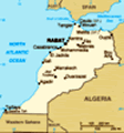
‘Here, really?‘ In our reckoning we must still be about five kilometres short of Imlill, the epicentre of trekking in Morocco’s High Altas mountains. Under the shade of a walnut grove, our guide, cook/muleteer and mule are patiently waiting. After quick introductions our backpacks are strapped onto the mule, along with the food and cooking equipment for the next three days, and with the mule’s cross sectional area almost tripled, our small party sets off.
We’re new to trekking, but what we had arranged to do is a three day hike from here (somewhere outside of Imlill) to a small village called Seti Fatma, two valleys away.
So with excitement and a little apprehension we head off, following a small track from the roadside down to the creek, across a simple bridge before climbing up into a small Berber village on the opposite bank. The green vegetation which carpets the valley floor disappears almost as soon as we climb out of the upper edge of the village and in its place the mountainside has changed to being an inclined plane of dry stony earth, punctuated
by the odd tuft of grass and a few small shrubs.
The track zigs and zags its way up the hillside and as we gain height the views out across the valley behind us get better and better. To our right we can see the looming snow capped peak of Jebel Toubkal, north Africa’s highest mountain. Magic stuff!
Eventually we reach the top of the pass (2100m) and, after a short break to take in the view, grab our breath and some photos, we start the descent.
To our guide’s relief our progress downhill is much faster than that ascending and after about half an hour we reach the terraced fields and orchards at the base of the valley. We head for the creek which, fed by melting snow off the nearby peaks, is flowing clear and fast. The opportunities to cross are limited but we follow our guide across a series of conveniently located rocks to arrive dryly on the opposite bank.
With our little adventure over we climb up into the nearby village following an irrigation channel. We pass plenty of chickens and children (who greet us in French) and towards the top of
the village we’re ushered through an archway into the yard of one of the local homes. Under the shade of a tree there’re some bench seats and a table laid out for us, and upstairs, Ali, our cook/muleteer, is preparing lunch. While we wait, we enjoy some hot sweet mint tea and chat with our guide Lassan. When it arrives, lunch is a huge spread of salad, sardines, Moroccan round bread, and a tagine of meatballs. Yum!
After lunch we bid farewell to our hosts and leave the village, following the trail further up the valley. The contrast in the landscape as we potter along is amazing. The valley floor, where water is abundant, is full of almond, peach, apple and cherry trees, vegetable patches and small terraces of wheat. The mountainsides however are dry and stony with few plants. For us these dramatically contrasting landscapes are one of the reasons why we came back to Morocco, and the reason we’re hiking now. They are simply amazing.
We pass through a few more small villages (including a small stop at a friend of our guide’s for tea- what an experience!) and at around 4:00pm we make it to
our accommodation for the night. We’re staying at a gite in a village called Ouaneskra. To be honest we’re not too sure what the definition of a gite is, but the place we’re staying in, in tune with the surrounding village homes, is very simple.
We go for a walk around the village to explore a little while Ali unpacks his cooking equipment. When we get back he has prepared a huge meal starting with spicy Moroccan soup with flatbread, followed by chicken and vegetables. An amazing meal, especially as all the ingredients and cooking equipment have been brought here on the back of the mule. It is also just what we need before our big second day of hiking.
On Tuesday morning we’re up at 6:00am, packed up and finished breakfast by 7:00am, and by half past we’re following Lassan out of the gite on to the mountainside. The sun hasn’t made it high enough to light the valley and in the shade the morning air has a crisp chill. From Ouaneskra we follow a dirt track for about two kilometres uphill to the last village in the valley (greeting children on their way to school as
we go), which we pass through on route to Tizi n’Tacheddirt, the second mountain pass of our trek.
Half an hour later we cross a sealed road and the serious ascent starts. The track is stony and in an almost counter intuitive way the higher we climb the more vegetated the mountainside becomes. We’re passed in the opposite direction by two local women who have been out gathering grass for their livestock, and a bit further on, while we are having a rest, we’re caught up by a blind man following his donkey. Lassan explains that every day he follows the donkey to the top of the pass to sell drinks and chocolate bars to passing hikers. At the end of the day, he follows the donkey back home again.
So he joins us, and our party of five continue on our way.
We’ve never been active at altitude like this before and its effects sneak up on us. The hillside doesn’t feel that steep but we’re finding it really hard going. We have to stop frequently to catch our breath, and by the time we become surrounded by snow we are really struggling as the altitude,
muddy path and nearly kilometre of ascent which we’ve already completed, starts taking a toll. But we press on... slowly. Twenty steps then a break. Twenty steps then a break.
Eventually we climb around a cluster of rocks and out in front of us we can see the last short section of track leading to the top of the pass.
Woohoo, we’ve made it!
3200 metres!
More than twice the height of Britain’s tallest mountain and a kilometre taller than Kosciuszko (no doubt easy for seasoned experts, but certainly the highest we’ve been before).
After catching our breath we buy soft drinks from our new companion and grab a seat on some rocks to take in the surroundings. The mountains on either side of us go up still and everything is covered in snow. Quite a visual contrast to things earlier.
As we’re looking around marvelling at what we’re seeing, Lassan leans over and announces ‘now 1300m descent’.
‘Over the next two days?’ we query.
‘No, after Fanta’
And with that we finish our drinks, pull our day packs back on, and follow him into the very beginnings of the Ourika Valley.
As we descend,
the snow quickly disappears and in its place the mountainside becomes dry and stony once again. We follow the track, rolling occasionally on the stones, as it zigs and zags its way ever downward. By far the best thing is how remote we now are. An hour since leaving the top of the pass we’ve only passed two other people trekking the other way. There are no power lines, no mobile phone towers, no roads, no houses, no livestock, no fields in sight.
As we continue, the mountainside changes again. From the grey brown it was earlier, it has now turned into a plane of dark red earth. The only vegetation of note are lone weathered juniper trees and some small shrubs.
A further hour or so on we pass a herd of goats and their minders (shepherds), before the trail takes us down a sharp descent. As we get close to the bottom we look over to see a mule next to a stream which looks remarkably like... it is, it’s Ali’s mule!
Next to the fast, clear running stream, under the shade of a huge boulder, Ali has laid out a couple of cane blankets
and has the gas cooker fired up. What an awesome place to stop for lunch!
We gladly take a seat on the blanket and as we shake the hiking boots from our aching feet, Ali brings over a round of piping hot sweet mint tea. With the best picnic view (ever) we enjoy another huge lunch of bread, salad, and chick pea tagine, before we get ourselves ready for the last part of the descent.
Staying high on the mountainside as the stream drops into a steep gorge beneath us, we press on, following Lassan along the rocky trail. Half an hour after our lunch break, we round a bend in amongst some huge boulders and below us is Labassene, the first village we’ve seen since crossing the pass. Set onto the hillside it is stunningly beautiful, surrounded by terraced fields of wheat and canola.
We climb down from the ridge and as we pass through the village we greet the local children in Arabic, ‘es salaam alaykum’. Some of the time we receive responses in Arabic, occasionally we receive a response in French, but sometimes we just receive just a blank look. After two days we’re
now convinced that we should learn a few words of Berber - at least hello might be good.
From Labassene the track is wider and clearly used more often, but it is ever so rocky and it is still quite steep. The village soon disappears from view and we follow the valley, high above the river, for another half an hour or so to Timichi. Quite conveniently, our gite for the night is on the outskirts of town and for us, not a metre too soon. It’s just gone 4:00pm when we arrive, and we are absolutely knackered.
We’re shown to our room where with great delight we dump our bags, and swap our hiking boots for flip flops. With our feet thanking us we head back down stairs where we enjoy some more fantastic sweet mint tea (you can see a trend here) and watch the procession of other hikers turn up. In a boost to our pride they all look just as tired as us (so we’re not so bad at this after all).
Ali cooks us up a huge lamb tagine for dinner and afterwards we pass the time by chatting with some of
the other trekkers - a pair of young French teachers. Hailing from northern France they are bubbly people with a real passion for cider, travel, and much to Ariana’s interest, education.
On Wednesday, Lassan has us heading off at a leisurely 8:30am. From Timichi we’re happy to be following a newly graded dirt road, at a very slight decline, as we make our way yet further down the valley. Ali’s mule has been sent back to Imlill today with one of the other muleteers at the gite so toady he’s walking with us.
He’s a short man, much shorter than Ariana, but gee he sets a mean pace. Mule pace, we reckon. Ali notices that we’re struggling and he slows down for us so that the our small party can proceed along steadily together as we alternate between following the road and taking detours through the small Berber villages which we pass. After a while the road climbs the hillside as the riverbed below enters into a steep gorge.
Now elevated, we proceed along the mountainside and the views around us get even better. The wind swept, largely treeless mountainsides are loosely vegetated with hardy looking little
bushes and some grass. There is even the odd dilapidated stock fence. On the mountainside on the opposite side of the river we can see goat track trails zig zagging their way in all sorts of directions.
A further half hour or so along we reach a high point on the ridge. The river beneath us has splayed out of its gorge and once again the valley floor is a vast green plane dotted with brown-red villages on either side. ‘Villages of Seti Fatma’, Ali tells us with a big smile. The view is one of the best of our hike - the valley floor is in stark contrast to the mountainsides and the bright white snow which caps the peaks. Clear blue skies complete the vista. Magic.
The way down in front of us is fairly obvious so Ali and Lassan let us know they’ll see us at the bottom as they ‘man from snowy river’ style, go straight down. We take our time and follow the road. With such amazing surroundings we’re in no hurry.
At the bottom, we meet up with our guides and follow irrigation channels and garden paths to arrive at a
local store/cafe, right on the edge of the river. Ali pops inside to prepare our final lunch of the trip and while we wait Lassan tells us the technique required to make the perfect cup of Moroccan mint tea.
After enjoying another fantastic lunch (and Ali lets Ariana wash up as a small gesture of gratitude) we sling on our backpacks, which had been bought from Timichi by anther muleteer, and head across the river to start our trip back to Marrakech.
There are some waterfalls near by, and quite clearly they are popular because once across the river the village (Seti Fatma proper) is rammed with tourists, cafes, and cars.
Looking around at the Marrakech day trippers in their fresh pressed linens, we can’t help but feel extremely lucky and grateful for the experience that we’ve had. We’ve been alone on mountainsides, climbed to 3200m with a blind man and his donkey, walked through villages so out of the way they have no roads in or out and no electricity.
There’s no doubt about it, the experience of hiking thirty odd kilometres across the rooftop of north Africa will stay with us forever.
Advertisement
Tot: 0.133s; Tpl: 0.014s; cc: 20; qc: 85; dbt: 0.0795s; 1; m:domysql w:travelblog (10.17.0.13); sld: 1;
; mem: 1.4mb