Cook Islander Geography, Cook Islands Geography
Advertisement
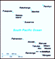
Location: Oceania, group of islands in the South Pacific Ocean, about one-half of the way from Hawaii to New Zealand
Geographic coordinates: 21 14 S, 159 46 W
Map references: Oceania
Area: Total: 240 sq km land: 240 sq km water: 0 sq km
Area - comparative: 1.3 times the size of Washington, DC
Land boundaries: 0 km
Coastline: 120 km
Maritime claims: Territorial sea: 12 nm exclusive economic zone: 200 nm continental shelf: 200 nm or to the edge of the continental margin
Climate: Tropical; moderated by trade winds
Terrain: Low coral atolls in north; volcanic, hilly islands in south
Elevation extremes: Lowest point: Pacific Ocean 0 m highest point: Te Manga 652 m
Natural resources: NEGL
Land use: Arable land: 17.39% permanent crops: 13.04% other: 69.57% (2001)
Irrigated land: NA
Natural hazards: Typhoons (November to March)
Environment - current issues: NA
Environment - international agreements: Party to: Biodiversity, Climate Change, Climate Change-Kyoto Protocol, Desertification, Law of the Sea signed, but not ratified: none of the selected agreements
Geography - note: The northern Cook Islands are seven low-lying, sparsely populated, coral atolls; the southern Cook Islands consist of eight elevated, fertile, volcanic isles where most of the populace lives
Advertisement
The information here has been derived from Public Domain Sources such as the CIA World Factbook. No liability can be taken for any inaccuracies.
Tot: 0.02s; Tpl: 0.007s; cc: 3; qc: 2; dbt: 0.0025s; 1; m:domysql w:travelblog (10.17.0.13); sld: 1;
; mem: 1mb
 Named after Captain COOK, who sighted them in 1770, the islands became a British protectorate in 1888. By 1900, administrative control was transferred to New Zealand; in 1965 residents chose self-government in free association with New Zealand. The e...