Advertisement
Published: March 8th 2020
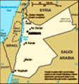
Our first full day in Jordan with Talal, our leader, and Oust, our junior leader (he is training to be a leader), and our driver, Mamoud. During our Jordan trip we have the same bus, same driver, wifi on the bus, and filtered water. Yeah - I love it. And they are not so aggressive here about paying for a toilet - at least not yet. I heard there is panic buying of toilet paper in California (because of Coronavirus), and my friend Brian jokingly asked me "If they let you back in the country, bring us some toilet paper". Is it really that bad?
This morning we visited Jerash. The drive there is beautiful: rolling hills, agriculture, lots of vegetable and fruit stands near the road. There are tons of pomegranates around here and I had fresh pomegranate juice at Jerash.
Jerash is the site of the ruins of the Greco-Roman city of
Gerasa, also referred to as
Antioch on the Golden River.
Ancient Greek inscriptions from the city support that the city was founded by
Alexander the Great and his general
Perdiccas, who allegedly settled aged
Macedonian soldiers there during the spring of 331 BC,
when he left Egypt and crossed Syria en route to Mesopotamia. However, other sources, namely the city's former name of "Antioch on the Chrysorrhoas, point to a founding by
Seleucid King
Antioch IV, while still others attribute the founding to
Ptolemy II of
Egypt.
After the Roman conquest in 63 BC, Jerash and the land surrounding it were annexed to the
Roman province of
Syria, and later joined the
Decapolis league of cities. The historian
Josephus mentions the city as being principally inhabited by Syrians, and also having a small Jewish community.
In AD 106, Jerash was absorbed into the Roman province of
Arabia, which included the city of Philadelphia (modern day
Amman). The Romans ensured security and peace in this area, which enabled its people to devote their efforts and time to economic development and encouraged civic building activity.
Jerash is considered one of the largest and most well-preserved sites of Roman architecture in the world outside Italy.
And is sometimes misleadingly referred to as the "
Pompeii of the Middle East" or of Asia, referring to its size, extent of excavation and level of preservation.
Jerash was the birthplace of the
 Jerash
South Gate - Hadrian'smathematician
Nicomachus of Gerasa (
Greek: Νικόμαχος) (c. 60 – c. 120 AD).
In the second half of the 1st century AD, the city of Jerash achieved great prosperity. In AD 106, the Emperor
Trajan constructed roads throughout the province, and more trade came to Jerash. The Emperor
Hadrian visited Jerash in AD 129–130. The triumphal arch (or
Arch of Hadrian) was built to celebrate his visit.
Jerash flourished during the Greco and Roman periods until the mid-eighth century CE, when the
749 Galilee earthquake destroyed large parts of it, while subsequent earthquakes contributed to additional destruction. However, in the year 1120,
Zahir ad-Din Toghtekin, atabeg of Damascus ordered a garrison of forty men stationed in Jerash to convert the
Temple of Artemis into a fortress. It was captured in 1121 by
Baldwin II,
King of Jerusalem, and utterly destroyed.
Then, the Crusaders immediately abandoned Jerash and withdrew to
Sakib (Seecip); the eastern border of the settlement.
Jerash was then deserted until it reappeared by the beginning of the Ottoman rule in the early 16th century. In the census of 1596, it had a population of 12
Muslim households.
However, the archaeologists have found a small
Mamluk hamlet in the Northwest Quarter<sup
Jerash
Me at South Gate id="cite_ref-8" class="reference">
which indicates that Jerash was resettled before the Ottoman era. The excavations conducted since 2011 have shed light on the Middle Islamic period as recent discoveries have uncovered a large concentration of Middle Islamic/Mamluk structures and pottery.
The ancient city has been gradually revealed through a series of excavations which commenced in 1925, and continue to this day.
Remains in the Greco-Roman Jerash include:
• Numerous
Corinthiancolumns
• The
Tetrapylon of Jerash •
Hadrian's Arch
• The circus/
hippodrome • The two large temples (dedicated to
Zeus and
Artemis)
• The nearly unique oval
Forum, which is surrounded by a fine colonnade,
• The long colonnaded street or
cardo • Two theatres (the Large South Theatre and smaller North Theatre)
• Two
communal baths, and a scattering of small temples
• A large
Nymphaeum fed by an
aqueduct • An almost complete circuit of
city walls • A water powered
saw millfor cutting stone
• Two large bridges across the nearby river.
The Dead SeaI've been looking forward to this - floating in the Dead Sea. They recommend that you don't get the water in your eyes or mouth. I accidently got some in my mouth and it tastes dreadful. You really can just lie back and
float. We all got a mud bath too. You smear the mud on and let it dry, then scrub if off. My skin felt great afterwards.
The
Dead Sea (
Hebrew: יָם הַמֶּלַח
 Yam ha-Melah
 lit.
Sea of Salt;
Arabic: البحر الميت
Al-Bahr al-Mayyit or
Buhayrat,
Bahret or
Birket Lut,
lit. "Lake/Sea of Lot") is a
salt lake bordered by
Jordan to the east and
Israel and the
West Bank to the west. It lies in the
Jordan Rift Valley, and its main
tributary is the
Jordan River.
Its surface and shores are 430.5 metres (1,412 ft) below
sea level,
Earth's
lowest elevation on land. It is 304 m (997 ft) deep, the deepest
hypersaline lake in the world. With a
salinity of 342 g/kg, or 34.2%!((MISSING)in 2011), it is one of the
world's saltiest bodies of water – 9.6 times as
salty as the ocean – and has a
density of 1.24 kg/litre, which makes swimming similar to
floating.
This salinity makes for a harsh environment in which plants and animals cannot flourish, hence its name. The Dead Sea's main, northern basin is 50 kilometres (31 mi) long and 15 kilometres (9 mi) wide at its widest
Jerash
The Cardo, the main street point.
The Dead Sea is an
endorheic lake located in the
Jordan Rift Valley, a geographic feature formed by the
Dead Sea Transform (DST). This left lateral-moving
transform fault lies along the
tectonic plate boundary between the
African Plate and the
Arabian Plate. It runs between the
East Anatolian Fault zone in
Turkey and the northern end of the
Red Sea Rift offshore of the southern tip of
Sinai. It is here that the Upper Jordan River/Sea of Galilee/Lower Jordan River water system comes to an end.
Formation theories
There are two contending hypotheses about the origin of the low elevation of the Dead Sea. The older hypothesis is that the Dead Sea lies in a true rift zone, an extension of the
Red Sea Rift, or even of the
Great Rift Valley of
eastern Africa. A more recent hypothesis is that the Dead Sea basin is a consequence of a "step-over" discontinuity along the Dead Sea Transform, creating an extension of the crust with consequent subsidence.
Sedom Lagoon
During the late
Pliocene-early
Pleistocene, around 3.7 million years ago, what is now the valley of the Jordan River, Dead Sea, and the northern
Wadi Arabah was repeatedly inundated by waters from the
Mediterranean Sea.
The waters formed
2Jerash
Temple of Zeus in a narrow, crooked bay that is called by geologists the Sedom Lagoon, which was connected to the sea through what is now the
Jezreel Valley. The floods of the valley came and went depending on long-scale changes in the tectonic and
climatic conditions.
The Sedom Lagoon extended at its maximum from the
Sea of Galilee in the north to somewhere around 50 km (30 mi) south of the current southern end of the Dead Sea, and the subsequent lakes never surpassed this expanse. The
Hula Depression was never part of any of these water bodies due to its higher elevation and the high threshold of the
Korazim block separating it from the Sea of Galilee basin.
Salt deposits
The Sedom Lagoon deposited
evaporites mainly consisting of
rock salt, which eventually reached a thickness of 2.3 km (1.43 mi) on the old basin floor in the area of today's
Mount Sedom.
Lake formation
Approximately two million years ago, the land between the
Rift Valley and the Mediterranean Sea rose to such an extent that the ocean could no longer flood the area. Thus, the long lagoon became a landlocked lake.<sup
id="cite_ref-Kafri2010_20-1" class="reference">
The first prehistoric lake to follow the Sedom Lagoon is named
Lake Amora (which possibly appeared in the early Pleistocene; its sediments developed into the Amora (Samra) Formation, dated to over 200-80
kyr BP), followed by
Lake Lisan (c. 70-14 kyr) and finally by the Dead Sea.
Lake salinity
The water levels and salinity of the successive lakes (Amora, Lisan, Dead Sea) have either risen or fallen as an effect of the tectonic dropping of the valley bottom, and due to climate variation. As the climate became more arid, Lake Lisan finally shrank and became saltier, leaving the Dead Sea as its last remainder.
From 70,000 to 12,000 years ago, Lake Lisan's level was 100 m (330 ft) to 250 m (820 ft) higher than its current level. Its level fluctuated dramatically, rising to its highest level around 26,000 years ago, indicating a very wet climate in the
Near East.
Around 10,000 years ago, the lake's level dropped dramatically, probably even lower than today. During the last several thousand years, the lake has fluctuated approximately 400 m (1,300 ft), with some significant drops and rises. Current theories as to
Jerash
Marketplace the cause of this dramatic drop in levels rule out
volcanic activity; therefore, it may have been a seismic event.
With 34.2%!<(MISSING)a href="https://en.wikipedia.org/wiki/Salinity">salinity (in 2011), it is one of the
world's saltiest bodies of water. The mineral content of the Dead Sea is very different from that of ocean water. The exact composition of the Dead Sea water varies mainly with season, depth and temperature. In the early 1980s, the concentration of ionic species (in g/kg) of Dead Sea surface water was Cl
− (181.4), Br
− (4.2), SO4
2− (0.4), HCO3
− (0.2), Ca
2+ (14.1), Na
+ (32.5), K
+ (6.2) and Mg
2+ (35.2). The total salinity was 276 g/kg.
These results show that the composition of the salt, as anhydrous chlorides on a weight percentage basis, was
calcium chloride (CaCl2) 14.4%!,(MISSING)
potassium chloride (KCl) 4.4%!,(MISSING)
magnesium chloride (MgCl2) 50.8%!a(MISSING)nd
sodium chloride (NaCl) 30.4%! (MISSING)In comparison, the salt in the water of most
oceans and
seas is approximately 85%!<(MISSING)a href="https://en.wikipedia.org/wiki/Sodium_chloride">sodium chloride. The concentration of
sulfate ions (SO4
2−) is very low, and the concentration of
bromide ions (Br
−) is the highest of all waters on Earth.
Since 1930, when its surface was 1,050 km
2 (410 sq mi) and its level was 390 m (1,280 ft) below sea level, the Dead Sea
has been monitored continuously.
In recent decades, the Dead Sea has been rapidly shrinking because of diversion of incoming water from the Jordan River to the north. The southern end is fed by a canal maintained by the Dead Sea Works, a company that converts the sea's raw materials. From a water surface of 395 m (1,296 ft) below sea level in 1970
it fell 22 m (72 ft) to 418 m (1,371 ft) below sea level in 2006, reaching a drop rate of 1 m (3 ft) per year. As the water level decreases, the characteristics of the Sea and surrounding region may substantially change.
The Dead Sea level drop has been followed by a
groundwater level drop, causing brines that used to occupy underground layers near the shoreline to be flushed out by freshwater. This is believed to be the cause of the recent appearance of large
sinkholes along the western shore—incoming freshwater dissolves salt layers, rapidly creating subsurface cavities that subsequently collapse to form these sinkholes.
Advertisement
Tot: 0.134s; Tpl: 0.019s; cc: 9; qc: 24; dbt: 0.0405s; 1; m:domysql w:travelblog (10.17.0.13); sld: 1;
; mem: 1.2mb


 Maroon


