Advertisement
Published: March 26th 2016
Thursday 3rd March, 2016. Ponta Delgada, São Miguel, Azores
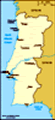
The Azores are located in the North Atlantic Ocean approximately 1815 km from the Portuguese mainland, 1200 km from Madeira and 2625 km from Newfoundland in Canada. The archipelago comprises 9 islands and several islets and is part of the biogeographic region of Macronesia, along with the archipelagos of Madeira, Canary Islands and Cape Verde. The archipelago is located at the junction of the north American, Eurasian and African lithospheric plates on a large area of the Atlantic with depths below 2000 metres, with an approximate triangular shape, known as the Azores Plateau. In general terms, the Mid Atlantic Ridge divides the American plate from the African and Eurasian plates while the Gloria Fault and the Azores Block (or microplate) forms the frontier between the Eurasian and the African Plates.
The Azores islands are all of volcanic origin and are oceanic islands that emerged from the surrounding sea floor, as a result of continuous pilling up of volcanic materials. The islands are not the same age. Santa Maria is the oldest at approximately 8 million years and Pico is the youngest at only 300,000 years old.
There are 27 volcanic systems in the archipelago, including large central volcanoes with a summit collapse caldera (such as the Caldeirão volcano in Corvo Island) and fissural zones of basaltic volcanism, such as São Jorge Island.
Having been here last year, we had already decided that we wanted to explore the east and north of the island of São Miguel. We docked as usual in the Cruise Terminal at Ponta Delgada. After disembarking we waited for Brendan and June who were going to accompany us today. We went to the same car hire place as last year and hired a car. We set off towards the Furnas Valley. We had been there last year but we thought Brendan (being a Geographer) would enjoy it - also it was raining last year. We pulled into the car park at Furnas Lake and paid the 50 cents each entrance fee. This area is full of fumeroles and boiling mud (but isn't too stinky). There is a lovely boardwalk which takes you round all the bubbling activity without getting your feet wet or burned. Some of the fumeroles are used by local restaurants to cook a local delicacy (can't remember
the name of it) of a pot of meat and vegetables which is buried in the earth and slow cooked for around 7 hours. After walking the boardwalk we went to take a look at the lake (which is also hot). We decided that the ducks must have asbestos feathers and legs! We went to purchase some fruit from a local vendor and found that the said ducks were also hanging around with a group of cats! Puts a new take on the cat amongst the pigeons! However both animals completely ignored each other.
We returned to the car and continued on to the town of Furnas itself where we knew we would find yet more thermal activity. They have many fumeroles or caldeiras here. We strolled past the Caldeira de Pêro Botelho and the Caldira do Esguicho among others and then stopped at the Agua Miguel Henrique & Agua da Prata Springs for a photograph. We strolled among the other caldeiras and then along the river before returining to the car.
We drove south towards the town of Povoação where we found a parking space in the harbour. We strolled around this pretty
coastal town until we found the square. Here we found a good value restaurant for a menu of the day each. After lunch we returned to the car and continued along the coast road towards Faial da Terra. This was a part of the island that we had never visited before so now it was all a new experience. On the road we stopped to take some photos of the view down to Povoação with Ribeira Quente in the distance (we went there last year). We reached the Miradouro da Pta da Madrugada which is a lookout point where the road turns north. This affords beautiful views to the north and south. The lookout is also equipped with picnic tables and BBQ facilities. We imagine that in the summer this would be a very popular stop for lunch. We continued driving along the magnificent coast until we came to the town of Vila de Nordeste (which literally means town of the north east). From here we took the motorway along the north coast of the island until we reached the exit for Ribeira Grande. Instead of heading towards the town we headed inland.
We were aiming for
the Caldeira Velha Natural Monument which we had found by accident last year. This is a place where there is yet more thermal activity with pools where you can swim in the hot water. Last year we didn't have our swimming gear - but this time we were prepared! We paid our entrance fee and then strolled along the manicured path through the forest until we reached the first pool. There were plenty of people taking a dip but the temperature had seemed to drop as we walked along the path so we decided that it might not be too comfortable once you emerged from the hot water - so decided to give the taking a dip bit a miss (shame as that is what we had really come back here for). We went into the small museum where we learned that the island of São Miguel had grown through different stages, a process that started approximately 4 million years ago in Nordeste. The island of São Miguel includes 4 large volcanoes with a summit caldera (Povoação, Furnas, Sete Cidades and Fogo - the Povoação volcano being extinct) and two areas of volcanism predominatley basaltic: the extinct volcanic zone of
Nordeste-Agua Retorta and the Picos area. The last area extends roughly from Capelas to Santana/Rabo dePeixe on the north coast, and from Relva to Lagoa on the south coast where there are approximately 235 volcanic cones, many of them younger than 10,000 years old. In the active central volcanoes of Furnas and Fogo there are important fumarolic fields where we had seen many thermal power stations on the way here. We walked back along to the path to the car and took a photo of the view down to Ribeira Grande before heading off towards the Lagoa do Fogo (Lake of Fire).
Along the road we stopped at the Miradouro da Bela Vista which had fantastic views to the south coast and Ribeira Grande on the north coast. We continued on to the Miradouro da Lagoa do Fogo where we had a fantastic view of the Fire Lake. This volcano is still active, the last eruptions being in June and July 1563. We drove on to another viewpoint called Miradouro Candelária. From here we had two fantastic views - one down to the south coast and the other down to the Lagoa Das Sete Cidades. There was
a huge derelict hotel at this viewpoint. It would have had fantastic views but obviously was not profitable. Now it is a huge hulk of a building that is home only to local flora and fauna.
We continued on towards Sete Cidades until we came to the Miradouro do Cerrado das Freiras. This is another viewpoint that looks out over the Lagoa Das Sete Cidades. The lake is crossed by a causeway which divides it into two. The resulting two lakes are called the Green Lake and Blue Lake respectively due to the colour of their waters. We continued down to the causeway and crossed into the town. We found a parking place next to the beautiful church of St Nicholas (Igreja de S. Nicolau). We took some photos of the church before heading into a local bar for some refreshment. We headed back towards Ponta Delgada, stopping one last time at another viewpoint called the Miradouro da Lagoa de Santiago where we had lovely views over Lake Santiago.
Once back in town we delivered the car. June and Brendan went to find a supermarket and M found a cafe to get
online. After dinner we went to the Stars in Their Eyes show. This was won by the new singer, Emma, as Bette Midler. We followed this with a trip to the disco with Danny. An excellent day that was enjoyed by all 4 of us.
Advertisement
Tot: 0.083s; Tpl: 0.014s; cc: 9; qc: 31; dbt: 0.0521s; 1; m:domysql w:travelblog (10.17.0.13); sld: 1;
; mem: 1.1mb