Advertisement
Published: June 22nd 2014
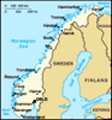
Andalsnes to Molde to Kristiansund (along Atlantic Road) to Trondheim 16 & 17 June 2014
After the exhilaration of the Troll Ladder in the morning, we ventured onto Molde following the Romsdals Fjord. The road included one car ferry crossing and a couple of bridges, certainly 2 features that we have become acostomed to whilst driving through Norway. Again, it was beautiful scenery, craggy mountains mixed with farming. The day remained dry with cloud cover.
We arrived in Molde, the "City of Roses". We found the Rose Garden on the roof of the Town Hall but it was the season for only a few flowers.
We found a park on the waters-edge and saw the Molde cathedral, which was consecrated in 1957. It has a double-nave long church in the Gothic style. A 50 metre high freestanding bell tower culminates in a copper-clad pyramid. The church was locked so we couldn't see inside. It is the third church to be built on the site. The two first ones burned down, but an old wooden cross and Axel Ender’s famous “Easter Morning” altarpiece were rescued from the flames.
Rosepiken - The Rose Maiden and the Town Hall. At
the Town Hall Square in the “Town of Roses” stands the bronze statue “Rosepiken”, surrounded by a dancing fountain. The Rose Maiden is young and beautiful, and has her arms full of roses.
Aker Stadium. One of Norway’s most modern football stadiums, seating 11 200. The stadium is situated on the waterfront to the west of the town centre and is designed by the Molde architect Kjell Kosberg. It has a granite and glass frontage.
Molde Cruise Ship Harbour. Molde has long been a port of call for cruise ships, and the town was one of the main attractions when the first cruise ship with paying passengers visited Norway in 1882. Every summer, 40-50 cruise ships call at Molde Harbour.
Jazzgutten - The Jazz Boy. On the lower market place, with the fjord and the mountains as a backdrop, is the bronze statue “Jazzgutten”, a young jazz player with his saxophone. Every July the main street in Molde closes for the Jazz entertainment.
We then found a large picnic area almost on the edge of town, next to the water and parked for the night. We watched 4 blokes fly their drone....which went way out over
the water...and fell. The guy with the remote control convinced a boat to take him out to the site he thought the drone went down. We don't think he found it.
By the time we went to bed at about 11.45pm it was still light and 4 other motor homes had pulled up next to us.
The next morning (Tuesday 17 June) the weather was dry but cloudy. We got to know the Dutch couple who parked next to us, got some advice on the Atlantic Road where we were heading and left by about 9.00am. We headed towards Bud.
Bud and the Atlantic Road. Within an hours driving from Molde, we visited the idylic fishing village of Bud and the famous Atlantic Road, voted the worlds nicest road by ”The Guardian”. We stopped at the Bud Tourist Centre which was next to 2 WW11 German bunkers. We got info on the sites along the Atlantic Road . The Road is 8.3 km long, build on several small islands, and with 8 bridges and several landfills. With its open-sea-view, this spectacular road soon became a very popular tourist attraction.
We found the road zigzags
across bridges and rock-fills from island to island right out at the ocean’s edge. It was easy to park our motor home in one of the many parking bays and walk a few metres to the smooth coastal rocks and some excellent fishing spots (so the fishermen told us). The busiest parking bay was at the famous Bridge where there was literally a traffic jam of motor homes and cars.
A stone’s throw or two to the west, the shipping lane crosses the notorious waters of the Hustadvika bay, concealing innumerable wrecks. Many people take a trip out here when the autumn storms start to rage. Apparently it is quite a sight when the big waves break beside (and sometimes across) the road! The road workers experienced 12 hurricanes during the construction of the Atlantic Road before it was opened in 1989. Around 1900 as many as 120 people lived on these windswept islands. In 2006 the Atlantic Road was voted Norwegian Structure of the Century.
We then drove onto Kristiansund where we had lunch. The town has about 17,000 people.
We found this town to be yet another pretty town. It was bombed in 1940 so
was rebuilt in multi coloured buildings which made a wonderful surround for the imposing church we could see on the opposite side of the sheltered harbour. There was a big cruise ship in the harbour and we could pick out the tourist as we walked around the town. The day remained overcast but dry. We could feel a real nip in the air increase as we moved further north.
From here we headed for Trondheim. We took the coastal road which included one ferry crossing and many bridges between the islands on the E39.
Advertisement
Tot: 0.062s; Tpl: 0.014s; cc: 9; qc: 31; dbt: 0.0383s; 1; m:domysql w:travelblog (10.17.0.13); sld: 1;
; mem: 1.1mb


")
")

")
")
")
")
")

")
")
")
")
")
")
")