Rwandan Geography, Rwanda Geography
Advertisement
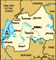
Location: Central Africa, east of Democratic Republic of the Congo
Geographic coordinates: 2 00 S, 30 00 E
Map references: Africa
Area: Total: 26,338 sq km land: 24,948 sq km water: 1,390 sq km
Area - comparative: Slightly smaller than Maryland
Land boundaries: Total: 893 km border countries: Burundi 290 km, Democratic Republic of the Congo 217 km, Tanzania 217 km, Uganda 169 km
Coastline: 0 km (landlocked)
Maritime claims: None (landlocked)
Climate: Temperate; two rainy seasons (February to April, November to January); mild in mountains with frost and snow possible
Terrain: Mostly grassy uplands and hills; relief is mountainous with altitude declining from west to east
Elevation extremes: Lowest point: Rusizi River 950 m highest point: Volcan Karisimbi 4,519 m
Natural resources: Gold, cassiterite (tin ore), wolframite (tungsten ore), methane, hydropower, arable land
Land use: Arable land: 40.54% permanent crops: 12.16% other: 47.3% (2001)
Irrigated land: 40 sq km (1998 est.)
Natural hazards: Periodic droughts; the volcanic Virunga mountains are in the northwest along the border with Democratic Republic of the Congo
Environment - current issues: Deforestation results from uncontrolled cutting of trees for fuel; overgrazing; soil exhaustion; soil erosion; widespread poaching
Environment - international agreements: Party to: Biodiversity, Climate Change, Climate Change-Kyoto Protocol, Desertification, Endangered Species, Hazardous Wastes, Ozone Layer Protection signed, but not ratified: Law of the Sea
Geography - note: Landlocked; most of the country is savanna grassland with the population predominantly rural
Advertisement
The information here has been derived from Public Domain Sources such as the CIA World Factbook. No liability can be taken for any inaccuracies.
Tot: 0.019s; Tpl: 0.007s; cc: 3; qc: 2; dbt: 0.0025s; 1; m:domysql w:travelblog (10.17.0.13); sld: 1;
; mem: 1.1mb
 In 1959, three years before independence from Belgium, the majority ethnic group, the Hutus, overthrew the ruling Tutsi king. Over the next several years, thousands of Tutsis were killed, and some 150,000 driven into exile in neighboring countries. T...