Advertisement
Published: August 3rd 2015
Distance driven today: 310 miles/499 km
Cumulative distance driven: 12,064 miles / 19,415 km (4,000 miles to go)
Today’s trip: Puno, Peru to Ururo, Bolivia
Broder crossings: 1
Finding the steepest street in La Paz with an impossible grade: yes
We got up early today in order to make it to the Bolivian border in time. The temperature in the morning had dropped to sub-freezing and we were reminded of the fact that we are at a high altitude on the South American Altiplano. For the first two hours we rode along the western shores of Lake Titicaca and drove through many smaller indigenous towns. By 11am we were at the border at the rather disorganized town of Desaguardero. Peruvian immigration took all of 1 minute to stamp our passports, while the Peruvian customs took 2 minutes to clear our motorcycle for exiting the country. Include a 2 minute bathroom stop and by 11:05am we had already exited Peru! Zoe and I couldn’t believe how quickly this first half of the border crossing went, and naturally we got our hopes up regarding the time schedule for the day. For those of you who have followed our
adventure for a while, and have read about some of our Central American border crossing blog posts, you can probably guess what happened next.
The line to the passport control on the Bolivian side extended for about a block or so outside the immigration building. Once it was our turn to get our passports stamped for entry into Bolivia, I couldn’t help but notice that the immigration officer had difficulty reading her computer screen that she was inputting our information into. When I quickly glanced at her screen I noticed a dust layer that was so thick that it made it almost impossible to read the screen. No wonder the passport line moved so slowly. Next we went to the customs office next door, to get a temporary vehicle import permit. The office was empty and after several minutes of asking around, a friendly Bolivian border policeman informed us that the customs officer had gone for lunch (wtf). “Is there perhaps another customs officer that can help us?” Zoe and I asked. “No, he is the
only customs officer at this border station” was the policeman’s reply. “So when is he coming back from his lunch break?” we asked.
“Momentito, take it easy, he should be back in 10-15 minutes” came back the reply. Zoe and I decided to go and have lunch on our own, while we were waiting for the one and only customs officer to come back from his lunch break.
Since it was Sunday, all shops we closed at the Bolivian side. We therefore walked across the border to Peru and had lunch there. Just like that, we walked across the border back and forth, without anybody really checking us. When we returned to the Bolivian customs there was a smaller line already formed, and everybody in it was commenting on the same subject. How on earth could the only customs officer in the entire border take a lunch break? Waiting were the three Brazilians that were riding their motorcycles around South America, the Colombian who had taken his car to Chile, and the Argentinian who was driving his car from Argentina to Peru and back. The good thing was that we got a ton of information from these other people, while we were waiting for the customs officer to return, regarding the road conditions, places to visit, places to definitely avoid etc. 2
hours later (!?!) the customs officer finally returned from his lunch break, seeming totally oblivious of the frustration that the people in the line were expressing against his lunch habits as a civil servant.
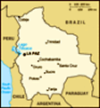
By the time we got to the Bolivian capital of LaPaz, Zoe and I decided to continue driving southbound towards the city of Oruro. However, the route I had in the GPS unit was programmed to take us to the city center of LaPaz. By the time we got to the heart of LaPaz, we had followed a long winding road along the steep canyon in which LaPaz is built in. As we were driving down the steep valley road it become apparent that the geography of La Paz reflects society. While the lower areas at the center have high rise condos and offices, the surrounding hills are full with makeshift brick houses of the poor. When I selected the GPS route for the next driving leg, from LaPaz to the city or Oruro, the GPS unit decided to take the shortest route. Instead of taking us all the way back through the surrounding hills of the city, it took the shortest route, which meant
pretty much straight up the steep hillsides.
In less than 10 minutes we found ourselves driving on streets that become ever steeper, nearing impossible grades. After a few truly scary red lights, having to stop and start uphill with a heavy bike and a mind-defying steep street, we concluded that it would be impossible to take the suggested route. Instead, we needed to first backtrack to the city center, and then to retrace our initial route into the city, in order to get out of LaPaz. After being lost in LaPaz for half an hour, and taking another half hour to get out of the city we were finally ready to start riding towards our final destination today, which is Oruro. In total, we lost over an hour in LaPaz, but as Zoe would comment later in the evening, we at least got to see the genuine parts of LaPaz which most likely very few tourists ever get to experience.
On our way out of LaPaz, we stopped at a street market and bought a Bolivia flag for under $1, which we put on the rear duffel bag of the bike.
Advertisement
Tot: 0.099s; Tpl: 0.01s; cc: 10; qc: 47; dbt: 0.0595s; 1; m:domysql w:travelblog (10.17.0.13); sld: 1;
; mem: 1.1mb