Fijian Geography, Fiji Geography
Advertisement
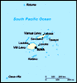
Location: Oceania, island group in the South Pacific Ocean, about two-thirds of the way from Hawaii to New Zealand
Geographic coordinates: 18 00 S, 175 00 E
Map references: Oceania
Area: Total: 18,270 sq km land: 18,270 sq km water: 0 sq km
Area - comparative: Slightly smaller than New Jersey
Land boundaries: 0 km
Coastline: 1,129 km
Maritime claims: Measured from claimed archipelagic straight baselines territorial sea: 12 nm exclusive economic zone: 200 nm continental shelf: 200-m depth or to the depth of exploitation; rectilinear shelf claim added
Climate: Tropical marine; only slight seasonal temperature variation
Terrain: Mostly mountains of volcanic origin
Elevation extremes: Lowest point: Pacific Ocean 0 m highest point: Tomanivi 1,324 m
Natural resources: Timber, fish, gold, copper, offshore oil potential, hydropower
Land use: Arable land: 10.95% permanent crops: 4.65% other: 84.4% (2001)
Irrigated land: 30 sq km (1998 est.)
Natural hazards: Cyclonic storms can occur from November to January
Environment - current issues: Deforestation; soil erosion
Environment - international agreements: Party to: Biodiversity, Climate Change, Climate Change-Kyoto Protocol, Desertification, Endangered Species, Law of the Sea, Marine Life Conservation, Ozone Layer Protection, Tropical Timber 83, Tropical Timber 94 signed, but not ratified: none of the selected agreements
Geography - note: Includes 332 islands of which approximately 110 are inhabited
Advertisement
The information here has been derived from Public Domain Sources such as the CIA World Factbook. No liability can be taken for any inaccuracies.
Tot: 0.068s; Tpl: 0.007s; cc: 6; qc: 6; dbt: 0.0077s; 1; m:domysql w:travelblog (10.17.0.13); sld: 1;
; mem: 1.1mb
 Fiji became independent in 1970, after nearly a century as a British colony. Democratic rule was interrupted by two military coups in 1987, caused by concern over a government perceived as dominated by the Indian community (descendants of contract la...