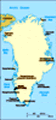
Greenlandic Geography, Greenland Geography
Advertisement
Location: Northern North America, island between the Arctic Ocean and the North Atlantic Ocean, northeast of Canada
Geographic coordinates: 72 00 N, 40 00 W
Map references: Arctic Region
Area: Total: 2,166,086 sq km land: 2,166,086 sq km (410,449 sq km ice-free, 1,755,637 sq km ice-covered) (2000 est.)
Area - comparative: Slightly more than three times the size of Texas
Land boundaries: 0 km
Coastline: 44,087 km
Maritime claims: Territorial sea: 3 nm continental shelf: 200 nm or agreed boundaries or median line exclusive fishing zone: 200 nm or agreed boundaries or median line
Climate: Arctic to subarctic; cool summers, cold winters
Terrain: Flat to gradually sloping icecap covers all but a narrow, mountainous, barren, rocky coast
Elevation extremes: Lowest point: Atlantic Ocean 0 m highest point: Gunnbjorn 3,700 m
Natural resources: Coal, iron ore, lead, zinc, molybdenum, gold, platinum, uranium, fish, seals, whales, hydropower, possible oil and gas
Land use: Arable land: 0% permanent crops: 0% other: 100% (2001)
Irrigated land: NA sq km
Natural hazards: Continuous permafrost over northern two-thirds of the island
Environment - current issues: Protection of the arctic environment; preservation of the Inuit traditional way of life, including whaling and seal hunting
Environment - international agreements:
Geography - note: Dominates North Atlantic Ocean between North America and Europe; sparse population confined to small settlements along coast, but close to one-quarter of the population lives in the capital, Nuuk; world's second largest ice cap
Advertisement
The information here has been derived from Public Domain Sources such as the CIA World Factbook. No liability can be taken for any inaccuracies.
Tot: 0.035s; Tpl: 0.007s; cc: 5; qc: 8; dbt: 0.0086s; 1; m:domysql w:travelblog (10.17.0.13); sld: 1;
; mem: 1mb
 The world's largest island, Greenland is about 81% ice-capped. Vikings reached the island in the 10th century from Iceland; Danish colonization began in the 18th century and Greenland was made an integral part of Denmark in 1953. It joined the Europe...