Advertisement
Published: February 10th 2020
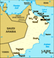
Squint hard at a map of the Arabian Peninsula and you’ll see, towards its eastern end, a triangular spike of land that appears to be trying to prod Iran. A good political map of the area will show that the very tip of this spike, guarding the Straits of Hormuz, is a different colour from the rest. This is the Omani exclave of the Musandam Peninsula, entirely surrounded on the land side by the United Arab Emirates. Here the Hajar Mountains, the spectacular backdrop to Muscat and the cities of the Batinah plain along Oman’s northeastern coast, finally win the day, crashing dramatically into the ocean, allowing man only the occasional narrow valley for his habitation. Flying over the Peninsula, I was staggered that anyone has even bothered trying to fashion a living here in these nearly bare and crumbling mountains.
And yet they have, the strategic importance of the land governing the entrance to the Persian Gulf being a greater consideration than its habitability for invaders such as the Assyrians, Babylonians and Persians. Most visibly, the Portuguese dotted the Musandam coastline with their forts, just as they did elsewhere around the Arabian Peninsula. Interested only in protecting their trade
routes, they didn’t venture further inland. Perhaps unexpectedly, as part of the oil-funded “renaissance” of Oman from the outset of his reign in 1970, Sultan Qaboos made conservation of the forts one of his priorities, an impressive commitment to the country’s heritage.
The Khasab Fort has sadly lost its dramatic vista over the bay thanks to a major land reclamation project that now provides an outlook over the garish lights of the LuLu Hypermarket and its accompanying acreage of car park, but the Fort is nevertheless worth a visit – albeit, as I discovered, expecting it to have a dramatic cliff-top location, it takes some finding if you start off in the wrong direction. The central fort-within-a-fort now contains an exhibition showing many facets of life here, geological, environmental, historical and cultural. In the courtyard are replicas of different types of boats and habitations. Historically, Peninsula people moved between the mountains and the coast on a seasonal basis. At the coast, they lived in airy reed-based dwellings on stilts. Meantime, their mountain homes were constructed for maximum security in their absence. Partly underground, the house would be filled with furniture and vast grain jars before the roof was put
on. With roofs constructed of slabs of stone requiring six to eight men to move, and walls built so as to leave only tiny doorways, these “lock houses” (bait al qafl) would then be challenging for anyone to burgle.
But the real draw of the Musandam is its khors, or fjords. The appearance of northern and eastern sides of the Peninsula suggests the gods ran out of building materials, the coasts ragged with a network of deep inlets as if still waiting for someone to fill in the gaps. Khasab, the area’s capital, is in the lee of the straggly near-island of the northernmost part of the Peninsula, itself barely attached to the mainland by an isthmus that is as little as 550m (600 yards) wide in places, so a day’s trip into the khors is not likely to test the sea legs unduly, particularly in the spaciousness of a dhow. There weren’t even ten guests aboard on the day that I went, so we luxuriated, Arabian Nights-style, on two levels of carpet- and fake grass (yes, really)-covered decks, relaxing back against colourful cushions, with a delicious lunch of freshly-grilled kebabs, rice, salad and fruit
to fuel the second part of the day.
Imagine Norway without the vegetation. Harshly beautiful bare mountainsides tumbling into the ocean, occasionally allowing enough of a sandy ledge before the waves to squeeze in tiny settlements that can only be accessed and serviced by sea (including the provision of fresh water and waste disposal). With the weekend’s unexpected rains having washed the sky clean of dust, we were treated to glorious blues above and turquoise waters around us. The mountains provided a salutary reminder of our insignificance: rock striations ripple and dip, as if giants have casually flicked the surface of the land, and the strata’s surprisingly varied colours of the layers made me wish I knew just a little more about geology and plate tectonics. The mountainsides themselves looked worryingly fragile, everywhere scree and cracks hardly inviting of exploration on foot.
I was to discover that this fragility is a very real issue: my attempt to explore the Peninsula’s mountainous and winding single inland road the next day was frustrated by a landslide caused by the weekend’s rain. Not a rare event, I was told – though I could have guessed – and my guide consoled me
with detours to his favourite corners of the locale, including a glorious view back to Khasab that may one day be a selling point for the hotel whose construction is currently stalled for lack of funds.
As part of the dhow cruise, we stopped at Telegraph Island. In the middle of the Khor Ash Sham, this small, low-lying lump of rock played home to a British repeater station, part of the London to Karachi telegraphic cable, for a few years in the mid-nineteenth century. Apart from its spectacular 360-degree views, the island would have had limited appeal as a posting – activities on offer being swimming, sleeping and, err, counting cormorants, never mind further small considerations such as the long summer heat and the locals’ unfriendliness – so it’s no surprise that the Island allegedly spawned the phrase “going (or being driven) round the bend”. Operators sent here would have been increasingly desperate to return to civilisation, something that would have necessitated a voyage “around the bend” in the Strait of Hormuz back to India. We had no such problems, our dhow waiting patiently while, for a couple of hours, we explored the island on foot and snorkelled the
reefs at its base.
Earlier we’d been treated to the wildlife highlight of the day – six or seven Indo-Pacific humpbacked dolphins, including a calf, playing between us and a neighbouring dhow in the bay opposite Sham, the first of the khor’s stone fishing villages. After a while, the pod seemed to decide that they’d had enough of that game, and, as one, dived down and out of sight. On our way back out of the khor later in the day the captain found us a shark lurking in the shallows, but, as it was barely four foot in length, none of us could really get worked up about it, though I gestured a thumbs-up at the captain, trying for a level of positivity commensurate with his efforts.
I didn’t get to the very far north, home to the Kumzari people, their dialect living evidence of the wide range of peoples who have traded through the Straits over the millennia. One estimate suggests it is a combination of 45 different languages. However, I’d read that the speedboat trip from Khasab to Kumzar isn’t exactly comfortable – there being a lack of seats – though apparently life jackets are
now provided, I’m assured. And it’s not cheap, even by the standards of Oman’s high prices, with a round trip estimated to be over £400 (US$520). I’m afraid I wimped out.
In the meantime, having had such an adventure to reach the Peninsula, I took my time to enjoy it. I hired a car through the delightfully-named Al Rehab rental company to drive back towards the Ras Al Khaimah border one morning so that I could see the last stretch of Thursday night’s road in daylight. Although the western coast of the Peninsula is far smoother than the north and east, the mountains still fall straight into the sea, and gluing a road onto its edge has been and remains an impressive feat. A few kilometres into my trip, I encountered roadworks, but here the work was taking place above me. The inside lane of what was a very pock-marked stretch of road was currently closed to give abseilers space to work, fixing heavy-duty metal mesh onto the cliff-face. Not a job for the faint-hearted.
Later that day, I attempted to complete my tour of every last metre of tarred road on the Peninsula (not an immensely challenging
target), and headed inland to drive the length of the Sal Al A'la, the east/west-running valley behind Khasab. Again, my lack of knowledge frustrated me. “How come the valley is so flat, but the mountainsides so rugged and crumbly?” I wondered aloud. This didn’t fit with what I remembered of my very basic junior high school physical geography. Later, in the comfort of the Telegraph Island Restaurant – much more luxurious and well-provisioned than its namesake – the internet came to the rescue. This land is truly ancient. What I had been driving through would have been the seabed of the Tethys Sea, a body of water that once joined the Atlantic and Pacific Oceans, and one that would have lapped at the shores of Gondwanaland. The Tethys was subsequently broken up – the Mediterranean is what remains of its western arm – as tectonic plates shifted and our modern-day continents developed. For the cognoscenti, this makes the Musandam an excitingly rich and unusual area to study, but, for yours humbly and ignorantly truly, its majesty was no less stunning. With the gathering of the storm clouds that would later that evening drop an unseasonal quantity of rain, I had
a spectacular mini road-trip.
Six days after my eventful trip to get to Khasab, I tore myself away, electing the easier and faster option of flying back to Muscat. This time I’d be flying straight on to see friends in Delhi for the weekend, but I’d be back in Oman the next week. On the basis of my first few days in Muscat and a wonderful near-week in the Musandam, I couldn’t wait to explore the country further. Thesiger’s Empty Quarter awaited.
Advertisement
Tot: 0.125s; Tpl: 0.019s; cc: 11; qc: 28; dbt: 0.0733s; 1; m:domysql w:travelblog (10.17.0.13); sld: 1;
; mem: 1.1mb