Advertisement
So my birthday-trip-blog-entry took longer than expected to finish, and I apologize for that. But the explanation is very simple.
Just kidding.
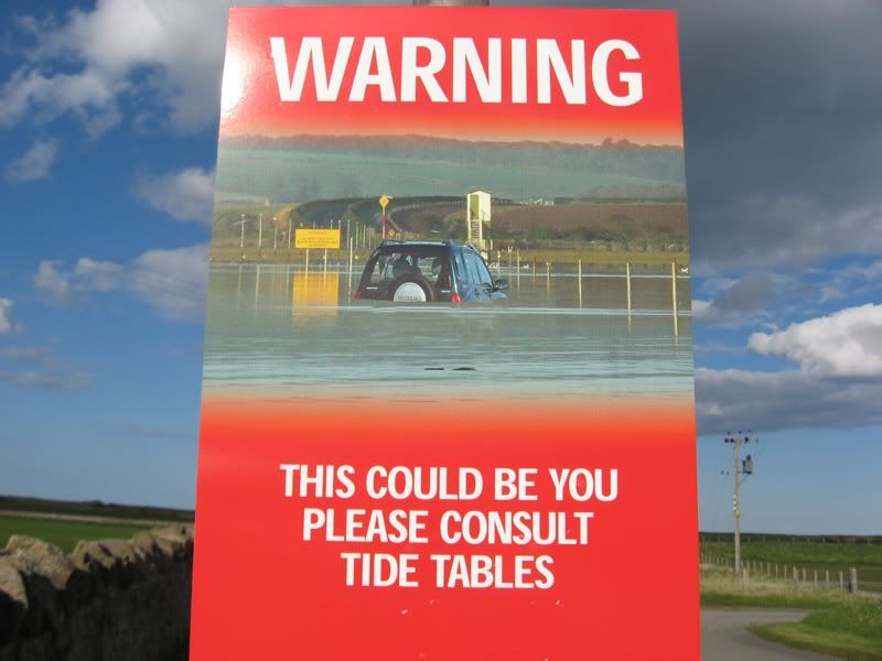
No this didn't happen to me (no car, out-of-country driver's license). What happened to me for real was (is) the end of the semester clinic/case reports/exams/essays/working out Student Loans for next year/realizing I analyzed an assessment wrong and had to do it again, twice... etc.
The fact that I'm typing coherently is actually pretty good, all things considered. Anyway.
Last week I had the pleasure of turning one year older, and in honor of that I took a trip over the weekend, to a little island (or a TINY island, depending on the tides) called Lindisfarne, or Holy Island. It is just off the northeast coast, slightly south of Berwick upon Tweed. A man called St. Cuthbert founded it some 1400 years ago, in an attempt to establish a place of solitude.
Going to an Island that you can only physically get to for two 6-hour periods each day was a pretty good start. Even now, the "causeway" - a road crossing the sands between the coast and the island - is only passable at low tide. Hence the sign above. Although there are "tide tables" posted all over the place (in the real world and online), apparently tourists get stuck on it every year when they underestimate the power of the ocean and/or overestimate their ability to drive quickly over wet sand.
The island is small and quiet and lovely. Despite some farms and sheep fields, it's main area of income is obviously tourism. It has:
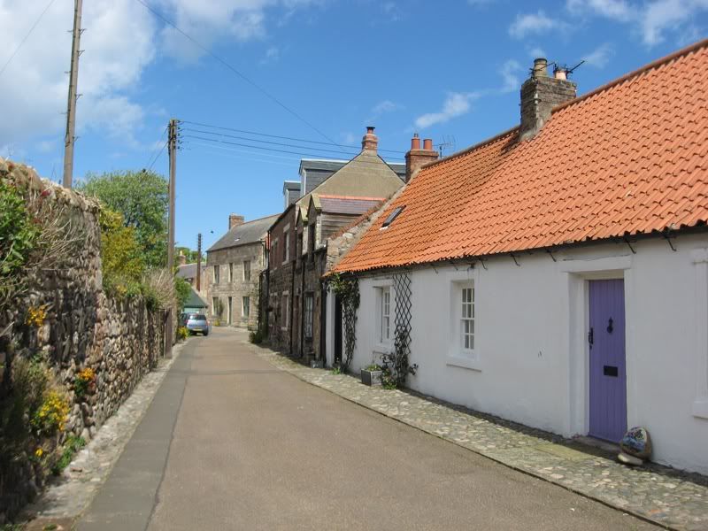
a tiny village, with more than a few souvenir shops, B&Bs, pubs (sometimes B&Bs that ARE pubs...gotta love Britain) and... well that's pretty much it,
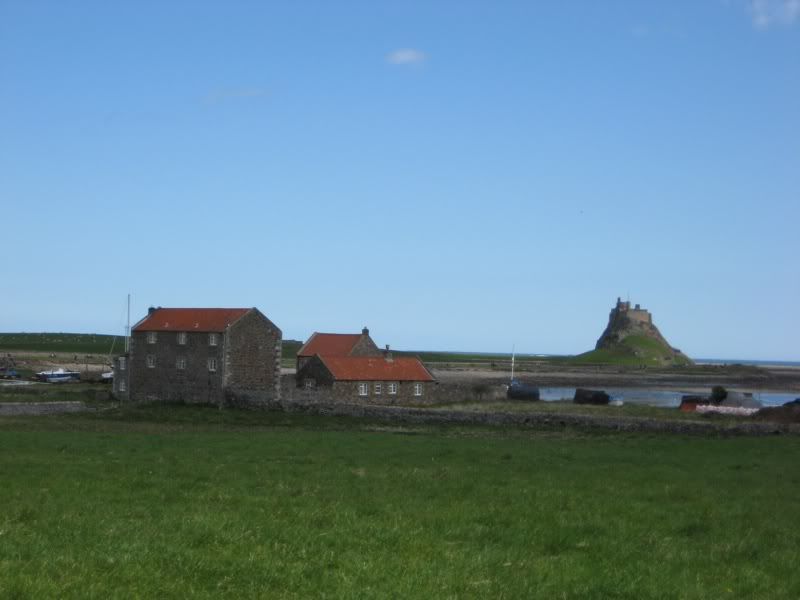
a tiny harbor, a castle,
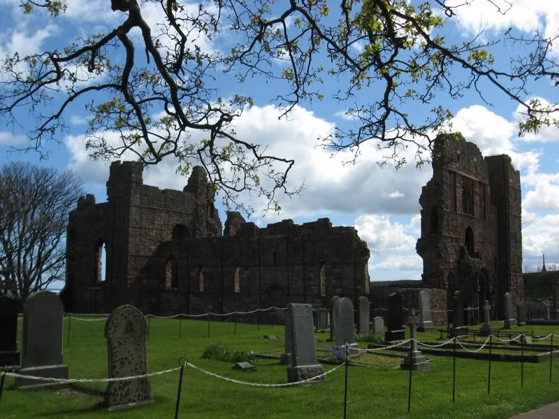
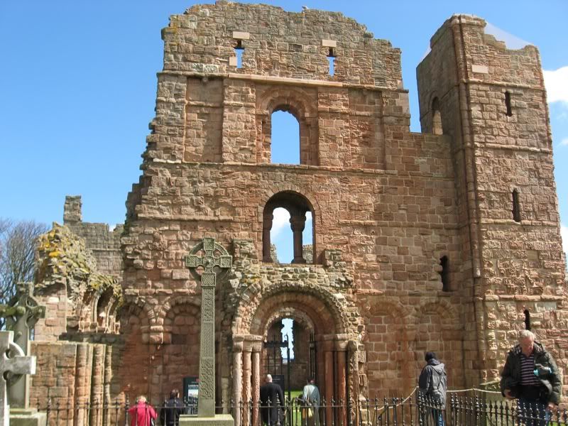
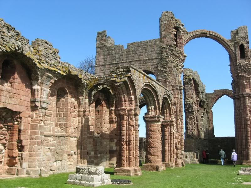
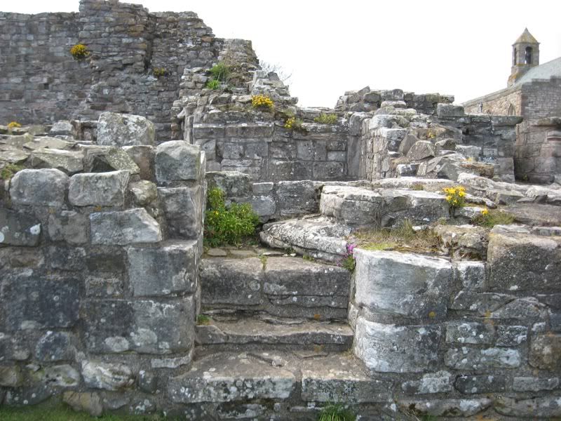
and the ruins of an ancient priory, which was built on the site of the original church established by St. Cuthbert.
I was very, very lucky with the weather. It was gorgeous all day, which rarely happens over here. I started by wandering around the site of the priory, which is just at the edge of the village.
It fell into ruin during a time called the "disillusionment" in... the 16th century if I remember the plaque right?
I love when the ruins are intact enough that you can see its resemblence to the cathedrals that are still in use today. It makes it fun to picture what it must have looked like at its prime.
I love this. I wonder where they were going?
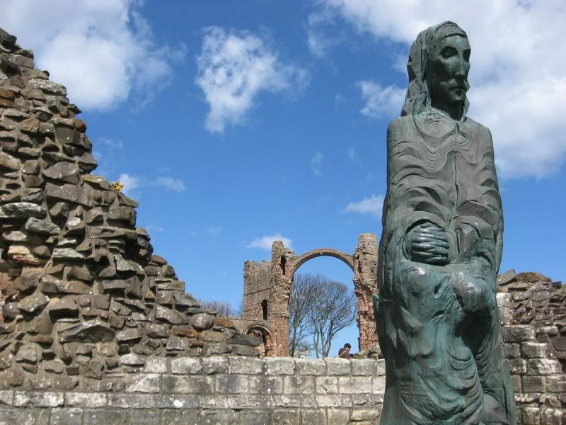
A statue of the man himself.
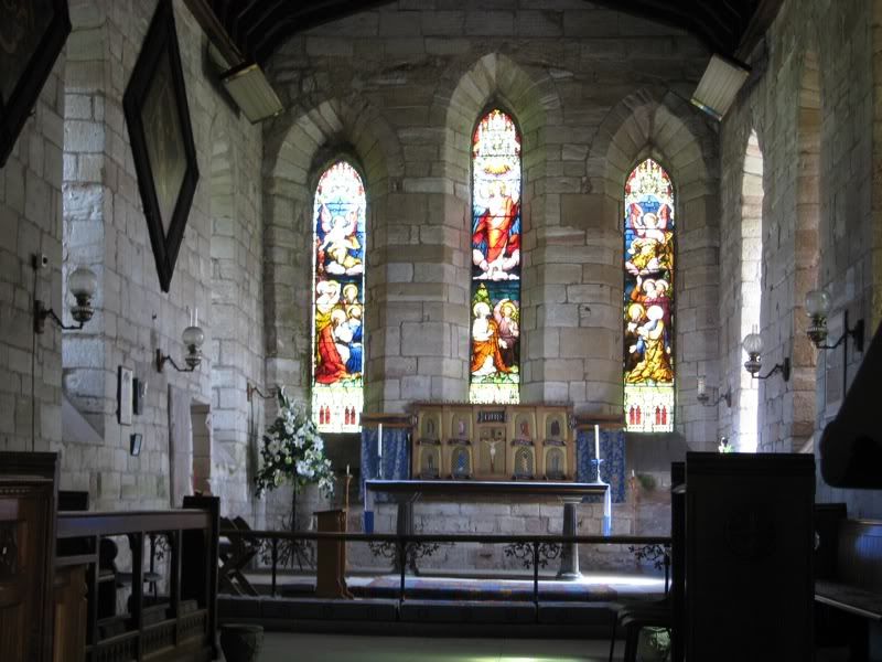
St. Mary's, a church next to the priory and just as old.
My "Best Walks in Northumberland" book traced a 3 mile walk around the edges of the island, starting from the village.
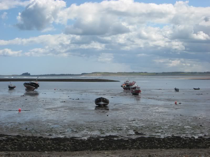
Passing the harbor on the southern part of the island. Which apparently, in contrast to the causeway, can only be used at HIGH tide. I don't know this for a fact. Just inference.
That silhouette way in the background there is another castle. It is completely intact, well-known in the Northeast and yet another
touristy English Heritage site. It's called Bamburgh. I have every intention of visiting Bamburgh at some point, probably with a few coursemates who have also said they wanted to go.
The island with the posts on it was another refuge of St. Cuthbert's. He used to go there when life on Holy Island wasn't solitary enough for him.
Not much of a people-person, I'm gathering.
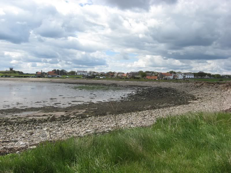
A vew of the village from the pathway leading to...
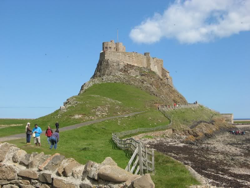
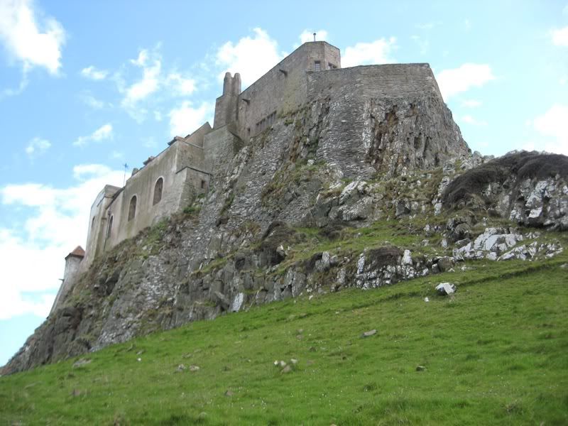
Lindisfarne castle. Around the time of the disillusionment, the island became a military stronghold, and you can see why. That convenient rocky hill is, as far as I know, not man-made.
My guidebook says the inside of Lindisfarne castle isn't as good as the view of the outside, so I didn't bother with it, instead following the path around the base.
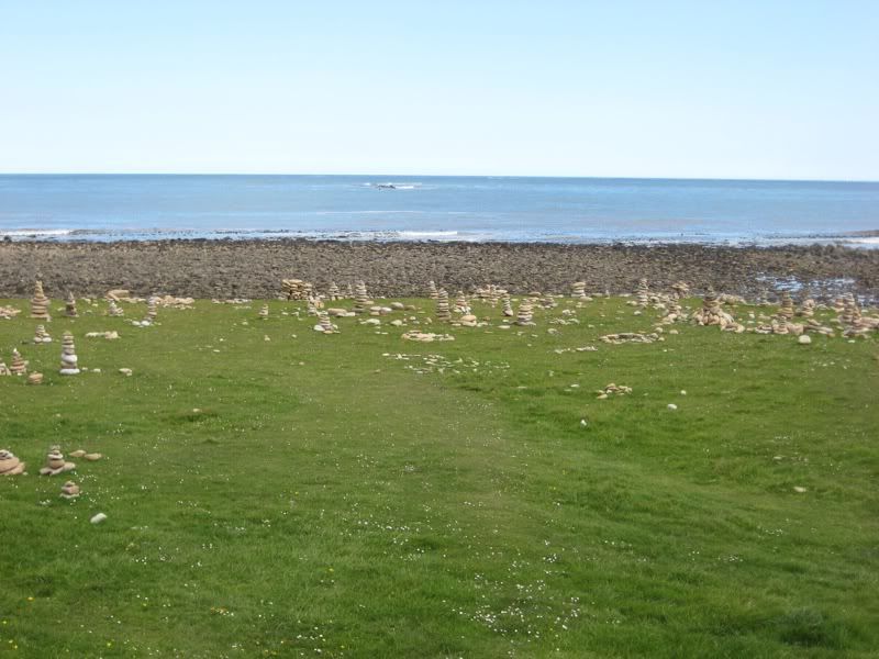
These were in the field behind Lindisfarne Castle. I don't know the story behind them, but I do know that rock piles are a symbol in Buddhism (see my entries in South Korea). If that's what they were meant for here, then it makes me happy that "Holy Island" is able to symbolize more than one major religion.
But maybe tourists just did this because they felt like it. Or farmers did it, to mess with the tourists. I honestly don't know.
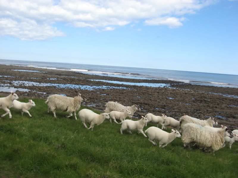
The eastern shore of the island. Sheep are so funny. They stand in a flock like this in the middle of the path. As you walk at them, they just stare at you - apparently completely calm - until they suddenly decide that you are AHH TOO CLOSE and take off at a run.
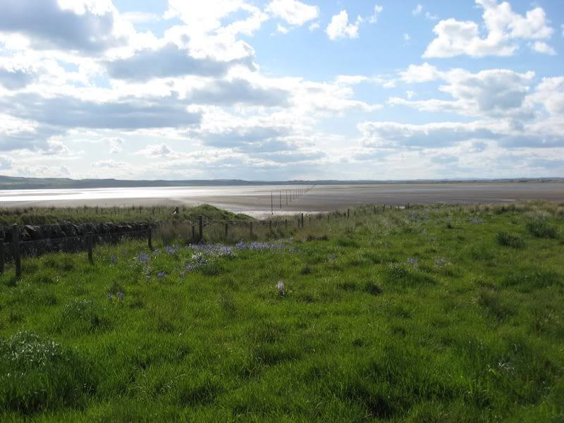
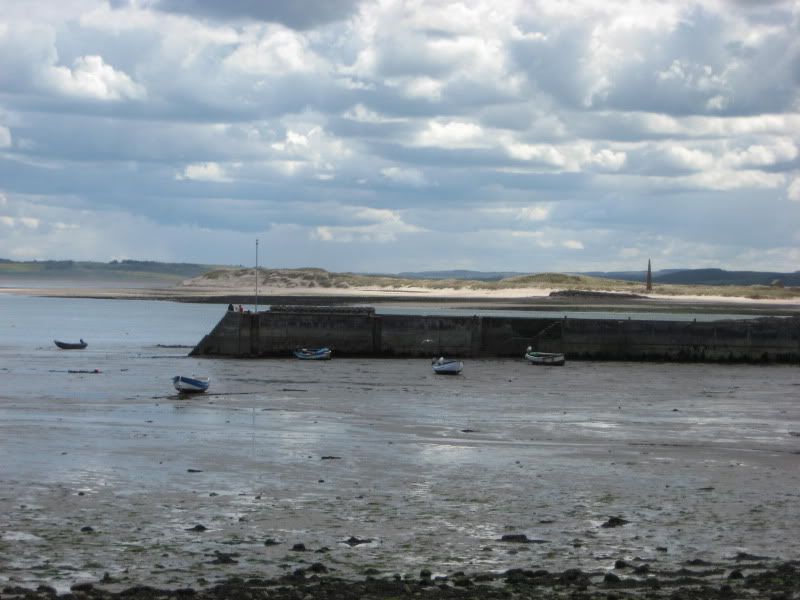
This is the western shore of the island. That trail of posts is the Pilgrim's Pathway or something like that - used before the causeway was built. Everything I've read about it is supplemented by "WE DO NOT RECOMMEND YOU TRY THIS ESPECIALLY NOT WITHOUT A PROFESSIONAL," so I'm guessing it's not as safe as it may seem at low tide. The causeway is more to the right, outside the frame of the picture.
Professional what, exactly?
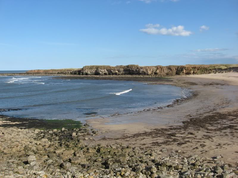
On the northern shore of the island. This section was covered in sand dunes and had a few of these outcroppings and cliffs. After I finished the walking tour, I came out here and explored a while.
As much as I complained about how early it gets dark in the winter, the amount of daylight we're getting now more than makes up for it. It doesn't hold a candle to places like Alaska (where I was able to stay outside drawing until almost 11pm in August), but it's still incredible. And it's nice to be able to sit down for dinner (pub in the village, people very friendly), and realize you've still got hours left to walk around.
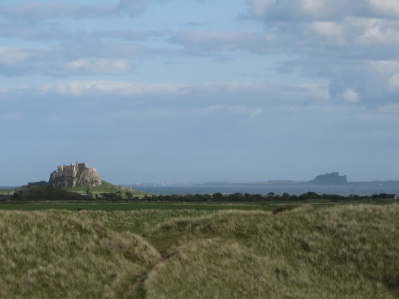
Lindisfarne Castle and Bamburgh, seen from the sand dunes on the opposite side of the island. (The village would be just to the right of the picture.)
And the mainland. These patches of yellow are all over the place in England right now. I've seen quite a few of them from train rides and the like. I'm not sure what the flower is, but it's very pretty.
That massive stretch of sand between the dunes and the mainland is called..."the sands." Apparently the tide comes in deceptively fast, which leads many a stray tourist to get stuck in the middle if s/he tries to cross at the wrong time. There was a card in a shop with a cartoon of a man and a woman sitting on top of a car not unlike the one in the sign. The man is saying "I didn't think that applied to TOURISTS." Ha.
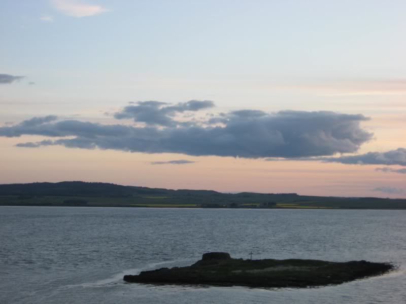
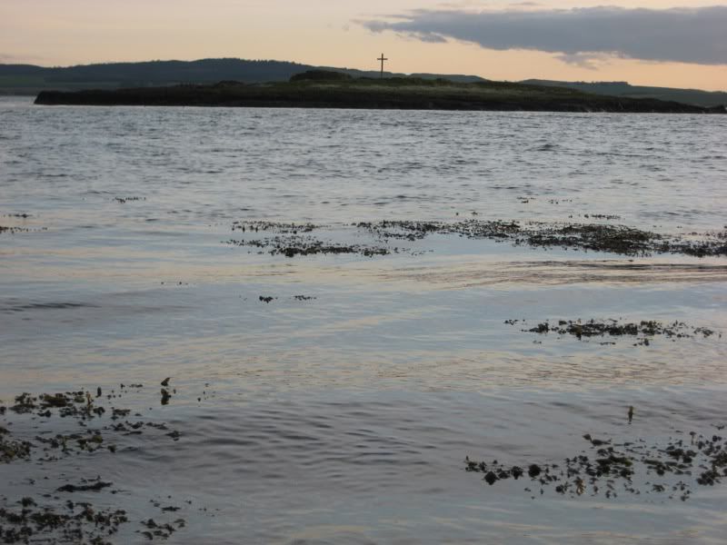
Sunset/high tide from a hill by the village and the priory. I know that the cross on the tiny island is significant to St. Cuthbert's life in some way, but I can't remember how. Maybe when the other tiny island became too crowded (those pesky birds...) he came and hid over here?
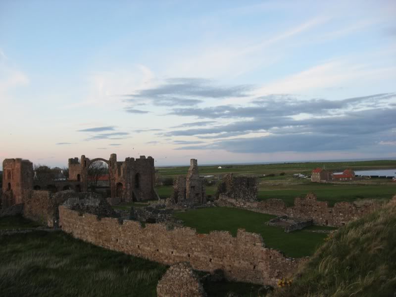
The priory at sunset.
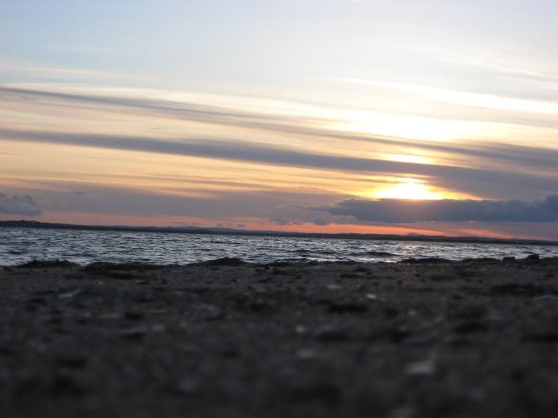
And the beach.
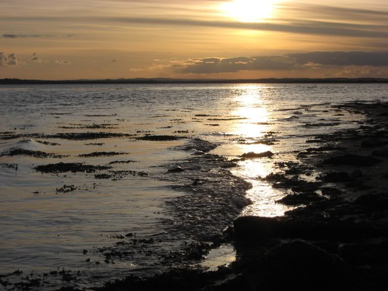
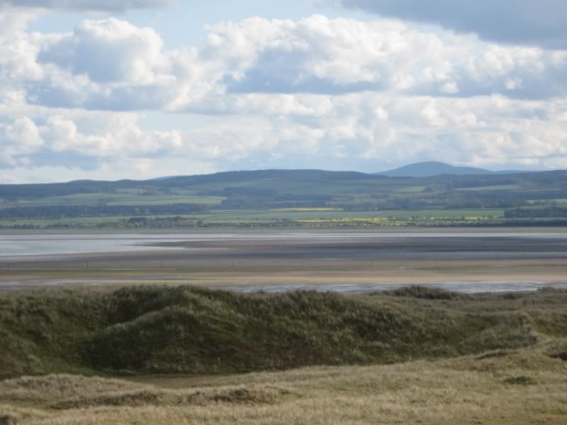
It's hard to imagine how much of this area is dry sand during low tides.
And this was just funny. No I didn't do it.
Last week of classes now, then we plunge head-first into exam period and in two week, emerge. Some of us will have 1-2 weeks off. Others will start summer block placement straight away. We don't know who will have what until probably 1-2 days beforehand.
BUT we are planning a trip to the Lake District (amazing National Park in the Northwest) for the second weekend in June, so there will definitely be a blog entry forthcoming about that. We've booked a cabin (cheaper than a hostel if you get enough people, which we have) and everything.
See you then.
Advertisement
Tot: 0.102s; Tpl: 0.009s; cc: 13; qc: 51; dbt: 0.0418s; 1; m:domysql w:travelblog (10.17.0.13); sld: 1;
; mem: 1.2mb


Mom
non-member comment
An amazing place and beautiful pictures! Thanks for sharing. Good luck with finals; fingers crossed here for a good summer placement for you.