Advertisement
Published: September 30th 2012
According to history books The Haute Route was first completed in 1861 when some English members of the Alpine Club trodded their way from Chamonix in France to Zermatt in Switzerland. Since then The Haute Route has become an institution and is now regarded as one of the classic long distance treks in Europe.
The Walkers Haute Route is slightly different than the Winter Haute Route and avoids any technical or glacial terrain. It does not really require any mountaineering skillls or experience other than a good stamina and legs which can cope with some long ascents and descents. The 30 metre vertical iron ladder taking you up the final rock face to Pas de Chevres can be a bit scary though . . .
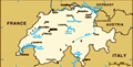
From the foot of Mont Blanc to the foot of Matterhorn the Haute Route stretches 180 km, crosses 11 high mountain passes ranging between 2200 m. - 2965 m, takes you into some wonderful scenic deep narrow valleys and lets you enjoy some of the finest and most spectacular terrain in the French and Swiss Alps.
Despite being warned that there was still quite a lot of snow left in the mountains
from winter this year making the walking potentially difficult in places, I decided to give it a try and just take one day at the time and see where this would leave me. Also knowing that some of the Huts along the route had not opened for the season yet was another issue I had to take into consideration before setting out. I did not really wanted to get stranded up in the mountains somewhere without having a place to stay.
A guidebook and a map was crucial. The Kevin Reynolds 'Chamonix to Zermatt'- Cicerone Guide proved to be invaluable on many occasions when I lost my direction or got confused on the myriad of trails crisscrossing the terrain.
The painted waymarks were not always easy to spot especially on some of the higher parts on the route either hidden in the snow or simply washed away from last season. I remember drifting away from the main-trail a few times on the way especially up to the Meidpass, Col de Sorebois and up/down Augstbordpass. Nothing serious, but enough to take me on quite a few 5 minute detour-adventures. That did not bother me much though
" A fine
landscape is like a piece of music; it must be taken at the right tempo"
Stage 1 : Chamonix 1037m - Col de la Forclaz 1526 m. 7h45m Chamonix is becoming one of my favourite destinations. Situated in the Haute-Savoie departement in south-eastern France between the impressive Aiguille Rouge and the snow capped Mont Blanc massif, this place holds some rich traditions when it comes to outdoor-and mountaineering activities. In 1924 it hosted the first ever Winter Olympics.
After having spent yesterday enjoying the nice warm weather in Chamonix and preparing and putting my final bits & pieces together for my long walk across the Alps to Zermatt, the day had finally come. Stepping out of my hotel I could see Mont Blanc taking advantage of the early sunrise shining brightly and beautifully up there standing like a crown overlooking the Chamonix Valley.
My backpack felt a bit heavier on my shoulders than I had expected but as soon as I had left Chamonix behind me it did not really bother me. The first couple of hours took me up to Argentiere at 1251 m. after what can be best described as a very
quiet stroll up the valley floor. On the nicely laid out trails I was only accompanied by some ibex, squirrels and some early morning enthusiasts swinging their clubs on the golf-course just outside Plan Praz.
Argentiere is another popular ski and mountaineering village sitting 7 km north-east of Chamonix. Maybe not as busy as its counterpart down the valley but still a charming and relaxing place at the base of Les Grandes Montets.
The 'Supermarchet U'supermarket ( 8am-12.30 & 2.30pm-7 pm ) in the middle of the village is a convenient place to stock up on some food and drinks before taking on the long climb to the Swiss-French border at Col de Balme. I was already well stocked up from Chamonix, but could not resist spending some Euros on some cold softdrinks.
Coming out of Argentiere a sign pointed left to Le Tour taking me up the steepest track so far since Chamonix. As soon as the trail started to level out I had to be quick on my feet to step out of the way when a local farmer suddenly appeared with his cattle charging after him trying to get a taste of what was
in the farmers bait-bucket.
Moments later Le Tour 1462 m. appeared on a green meadow through the trees. The village is one of the 16 villages in the commune of Chamonix-Mont-Blanc located 4 km up-valley from Argentiere. The last descent into Le Tour was easy and I arrived there at 9.55 am about 3 hours after leaving Chamonix.
A ski lift was running between Le Tour and Charamillion and can definately save you some time and energy, but I never felt tempted and was determined to use my feet and ignore all the "easy options" as much as I could along the way.
With the spectacular Le Tour Glacier to my right and the gondolas moving continuesly up and down over my head I continued up the steep terrain only sharing the trail with some mountain bikers coming down. It took me 45 minutes to reach Charamillion and for the first time this day I had my first real break since this morning.
At Le Chalet Charamillion 1850 m. , just next to the gondola-station, the terrace offers brilliant panorama views of the Mont Blanc massif and the Chamonix Valley and is a great place to
stop for lunch. With a good selection of food and drinks this was an ideal stop before the final push up to Col de Balme.
It took me another one hour to reach the Swiss-French border at Col de Balme 2204 m. The border was marked by a small granite stone next to Refuge Col de Balme, which was still closed for the season. I had been informed that it would open a few weeks later.
The Col offers some great views of the Mont Blanc range and Aiguilles Rouge on the French side and the Trient Valley & beyond on the Switzerland-side of the border.
My ambition this day was to reach Col de da Forclaz further down the valley and to get there I had at least three options. Last year, when doing the Tour du Mont Blanc, I went for the more direct, but not so scenic route via Le Peuty so this year I was determined to make a different approach doing the high level route via Refuge Les Grand.
A signpost " Le Grands 1h10 min " at Col de Balme pointed slightly to the right and put on the right
trail straight away. Within a minute I was walking on a huge snowfield coming down from the steep slopes and for the first time this day my feet was getting wet. More snowfields followed and made the walking a bit awkard in places especially with a big backpack and a pair of shoes which definately had lost its best grip a long time ago. A German guy coming in the opposite direction was struggling a bit as well to keep his footing right in the soft elements but we were both encouraged by each others news that the dry end of the trail was "just" around the corner :-)
It took me almost 30 minutes to get across the white slushy areas and then continued on to a dry narrow trail that would eventually take me to Le Grands. As I came closer the views only got better and better. Soon I could point out Fenètre d'Arpette among the world of granite ahead of me at the far high end of the Trient Valley and right next to it the magnificient Glacier du Trient making the northern flank of the Mont Blanc massif.
Arrived at Refuge Les Grand
2113 m. at 1.15 pm. The place seemed very quiet and the only person I could see around was the gardienne sitting in the sunshine outside the hut smoking his tobacco pipe enjoying the nice,warm weather and superb views. Had this been a place offering meals I definately would have spent the night here, but I was not prepared for self-catering this day. Next time I will:-)
The descent from Les Grands was a bit steep, but with the nice and dry conditons this day it did not cause any trouble. Though the trail was a bit overgrown in places route-finding was easy. Reached Chalet de Glacier 1853 m. at 2.05 pm where a lot of people were sitting outside under the umbrellas enjoying their meal and drinks on this fine summer day. The rest of the walk out to Col de la Forclaz was the easiest I had done since coming out of Chamonix earlier this morning walking on a flat,nicely laid out path that eventually took me to the world of exhaust gas and roaring sound of motorbikes and cars topping out on Col de la Forclaz at 1526 m.
A single room at Hotel Col
de la Forclaz with shared bathroom including dinner cost 60 Euro. Across the street was a small shop selling souvenirs and a decent selection of refreshments.
I spent the afternoon sitting outside relaxing, chatting and watching vehicles and cyclists passing by trying to decide wether I should continue over a snow bound Fenetre d'Arpette or go for the low level snow-free option via Alp Bovine tomorrow.
Stage 2 : Col de la Forclaz 1526m - Le Chable 821 m. 7h55m I woke up to yet another beautiful day of nice, clear and sunny weather. Outside it was all very calm and quiet and I wondered for a while where all the motorbikes had gone.
I was done debating which route I would take today. Though Fenetre d'Arpette did not have any snow on the western-side of the pass there were still plenty of snow on the other side according to people I had talked to over the last two days making my descent potentially tricky and dangerous. I did not really want to put me in a situation like that getting stuck or even slip badly on a steep snowfield. I only brought with me a
semi-light version of crampons, but I did not trust them in this particular case. Moreover, I had already done Fenetre d'Arpette last year on Tour du Mont Blanc which also fuelled my arguments to try something new and different this time. I therefore decided to go with the slightly longer low-level variant via Alp Bovine.
Just across the street from the hotel I entered the trail which quickly continued into the woods ascending gradually on the hillside. There was not a lot to see until I reached the open area of La Giete 1884 m. with a lonely farmers house standing on the green meadow and with views up Les Combes. About 15 minutes later Martigny appeared down to my left. The small town sits on the east edge of the Rhone Valley surrounded by vineyards, orchards and some fine alpine terrain. It takes about 90 minutes from Martigny to reach Chamonix on The Mont Blanc Express train.
Shortly after, I reached the highest point on the trail today at 2040 m. and from here I had super views down towards the nice, open green pastures of Alp Bovine and the magnificient Grand Combin forming a fine background.
As I descended from my highpoint I was overtaken by a strong runner who seemed to be one those crazy-kind-of- people who would compete in the Ultra-Trail du Mont Blanc, a 168 km long annual race around the whole Mont Blanc massif.
When I passed the lovely Alpage de Bovine 1987 m. at 8 am a few minutes later the place was already open, selling refreshment in a nice open environment. There were already a few people sitting around the outdoor tables enjoying the nice morning sunshine overlooking the whole valley below, the town of Martigny and the nice mountain of Dents du Midi -"The teeth of the South"- with its seven distinct summits slightly behind to the left. Its highest point is La Cime de l'Est at 3178 m.
A sign outside the Bovine farm building said " Champex 2h40min " as I continued down bending right along the green hillside, crossing a small waterfall a little bit further down before heading into the woods negotiating some steep terrain at times. Coming down to a second river containing a lot more water and force, I had to be a little bit more careful on my crossing. This
also meant that my feet had to be in for its first foot bath today :o).
Soon I emerged on to a gravel road which took me down to some farm buildings at Plan L'Eau 1330 m. and walked straight into the biggest crowd of people so far this day. I went inside to check out what was going on and I could see people drinking beer, laughing and having a good time. When I stepped out on the outdoor terrace I suddenly heard rifle shots . . . . . .
On my way out I could see people carrying their weapons and I imagined this had to be a gathering of some sorts with perhaps a shooting range nearby. This was not really my-kind-of-place to hang out so I left quickly as I came and continued my walk towards Champex.
Champex 1466 m. was only a 20 minute walk away and I arrived in the traditional mountain village at 10.05 am. The place was bathing in warm sunshine this morning centered around the idyllic Champe-Lac Lake reflecting all its beautiful quiet surroundings. I decided to stop here for lunch.
The village had a good
selection of accomodation, a supermarket, a few shops and restaurants.
" Two roads diverged in a yellow wood, And sorry I could not travel both . . . " Champex is where the great Haute Route and the fabulous Tour du Mont Blanc Route melts and splits.
" . . . I took the one less traveled by . . . " While the latter is probably a bit more recognized and famous and attracting more people The Haute Route feels perhaps a bit more off-the-beaten-track and not so much trodden. I was now putting my feet into a brand new territory.
Left Champex at 11.15 am. Equipped with a brand new pair of light crampons, hopefully better than the once I already had, in my backpack for later use, I moved downhill along the eastern side of La Catogne ( 2597 m. ) into Val d'Entremont heading for Sembrancher and then my final destination this day, Le Chable.
My guidebook was very useful on this particular stage. On a number of occasions on my way down I had to check and re-check Kevin Reynold's descriptions to make sure I was on the right trail. The signposts
and trailjunctions was a bit confusing at times.
Reached Sembrancher 717 m. at 1.20 pm. This is a small village with some narrow and picturesque streets and houses in the district of Entremont in the canton of Valais. Apparently this place has a population of 700 people, but when I walked through the main centre I kept wondering where they all had gone. A handful of people was all I could see.
It took me only about an hour to reach Le Chable from Sembrancher walking on paved roads, gravel roads and forrest trails. When I finally reached the small scenic Le Chable 821 m. at 2.40 pm at the foot of Verbier the only thing I could think of was getting something to drink and cool down my feet which was literally burning after walking in 30++ degrees for hours.
Hotel La Poste in Le Chable was apparently still closed for the season and to get accomodation I had to cross the Drance de Bagnes River and stay in the neighbouring village of Villette, just a few minutes away. Hotel du Gietroz was one of only a few options I had and paid 90 chf for
a single room including breakfast.
In the afternoon I made a phone call to the gardienne at Cabane de Louvie to check out if it would be possible to go there tomorrow and then cross the Grand Desert for a very long walk to Cabane des Dix the day after. I knew that Cabane Mont Fort and Cabane de Prafleuri was still closed for the season and that my options were limited, so it would be either this or something else.
I was not at all surprised to hear from the lady at the Louvie hut that the conditions on the mountain was not safe and suitable at the moment. With all the late snow still sitting firmly on strategic places any crossings up there could be potentially hazardous without the right tools and equipment. This basically meant I would have to dig out a Plan B on how to get to my next destination tomorrow. Right now I was not sure.
Stage 3 : Le Chable 821 m. - Sion 482 m. by train Looking thoroughly on my maps and with a little bit of assistance from the helpful local Tourist Information Center down at
the Le Chable train station, I eventually managed to find a good solution that would put me back on the Haute Route again without having to cross the snow-bound Col Termin, the Grand Desert and Col Prafleuri. So, today I would take the train as far as Sion, spend the night there and next morning take a local bus up the Heremence Valley as far as it would go and then walk from there. That would hopefully put me within walking distance of Lac de Dix and eventually Cabanes de Dix.
The train cost me 20 Chf and left Le Chable at 9.19 am. Arrived in Martigny 25 minutes later, changed on to another train that eventually took me to Sion in less than 30 minutes.
Sion is the capital of canton Valais and is located in the middle of one of the most important wine-growing regions of Switzerland. It is also known as the most sun-blessed town in Switzerland and this morning it certainly lived up to its good reputation.
Stayed at Hotel Elite in the middle of the city paying 80 Chf for a single room. Spent the rest of the day exploring the streets
and castles of this ancient town and was particualarly impressed with the Basilique de Valere sitting on a hilltop with superb views overlooking the area.
Stage 4 : Mache Village 1310 m - Cabane des Dix 2928 m. 6h20m I was at the Sion gare bus-terminal, just down the road from my hotel in good time ahead of my departure at 7.15 am. Again walking conditions looked outstanding with sunshine and blue skies for a third consecutive day. Hopefully this would last all the way up to my destination this day Cabane des Dix at the far end of Val des Dix.
The bus ticket cost 9,20 Chf and we left precisely on time. Once out of Sion the bus climbed immediately into the Heremence Valley making short stops at Vex, Heremence, Prolin before arriving in Mache Village 1310 m. at 7.50 am. This was as close as I could get up the valley on public transport and from this point and onwards it was all walking.
A sip of water and I was on my way. I followed the paved main road which sliced its way up through the Heremence valley climbing gently and moderately.
It did not take long until I got my first glimpse of the huge grey wall of Barrage de la Grande Dixence at the far end of the valley, but to get there I still had a long time to go. Reached the tiny village of Pralong 1608 m. at 8.50 am which was the last settlement before the big dam. I decided to take a break and sit down in the shade for a while and make a phone call to Cabane des Dix to let them know I was coming in later today. I was a bit concerned about the conditions higher up, but the gardienne told me that the trail was ok despite still some snow lying around.
A few cars and a cyclist coming up the valley was the only company I had as I continued on the hard sunny surface feeling a bit stiff in my legs from my first two days of trekking. It took me a lot of effort to come up the last series of steep bends which never seemed to have an end until I walked through a completely dark tunnel and suddenly stood face to face with the massive
243 metre high structure of Barrage de la Grande Dixence, the tallest gravity dam in the world.
At the bottom of this monumental construction was Hotel du Barrage Grande Dixence ( which had not opened for the season yet except its restaurant ) , a small shop selling refreshments/souvenirs ( open ) and a pavillon d'exposition. The place offered some fine views down the Heremence Valley and was a good place to sit down for a while after a sweaty finish up the endless road. Having reached this far in a little bit more than 2 hours from Mache Village I felt comfortable that I would not be late today and reach my destination in reasonable time.
I was not really tempted to take the much easier aerial cablecar/telepherique to the top of the dam and spent instead 20 stiff minutes to reach the 2365 metre point. I was now standing at the northern tip of the 4 km long Lac des Dix which is ,apparently, the the largest lake in the Alps above 2000 metres. Looking a long way ahead of me at the end of Val des Dix, I could see the pyramidal-like Mont Blanc de
Cheilon 3870 m. flanked by beautiful glaciers and somehwere well below there was Cabane des Dix. A signpost said it would take 3h40min to get there !
The several dark, dripping tunnels I had to pass through initaly after coming up to the edge of the lake surprised me a bit, but when I saw the number of debris and rocks covering the ground from landslides outside it felt safer to be walking in these cold, somewhat unpleasant corridors instead.
Coming out into more open territory the walk was easy, scenic and enjoyable. At 11.20 I passed below Refuge de La Barma situated at 2458 m. and was now officially back on the main Haute Route trail after my detour via Sion. Hopefully this would be the last and only bypass I had to do until Zermatt, but at this moment I did not really know what obstacles the next valleys and mountain passes would bring.
Strolling along the wide track to the southern end of the lake I was accompanied by marmots and some grand views of Pointes de Tsena Refien 3307 m, Mont Blanc de Cheilon, Glacier de Cheilon and La Serpentine at the head
of Val des Dix.
At 12.30 pm I reached Pas de Chevres 2371 m. at the end of the lake with signposts "
Les Dix 1h50m , Col de Riedmatten 1h50, Arolla 3h35m ". From here the trail climbed steeply and for the first time since the big dam I ran into a group of french speaking people heading up the same way as me.
After 40 minutes of hard uphill walking I reached another signpost where the trail split into two. One going left to Col de Riedmatten and the other straight up to Cabane des Dix. To be honest I could have picked both but the first was perhaps a little bit longer, did not have so much snow but would involve some glacier crossing on the final approach to the hut. The latter appealed more to me, though it would take me up through some large snowfield areas on the last section towards the Cabane.
The red & white waymarks were large, frequent and easy to spot up the rocky moraine but once a red painted arrow guided me to the right I was in a territory of wet slushy snow with only old
footmarks to follow. Coming up the not so firm ground was quite energy draining and I wondered if the long Grand Desert traverse would have been equally consuming.
Coming up the last slope to the eastern ridge of Tete Noire the Cabane des Dix appeared down below and within 10 minutes I arrived at the popular hut situated on top of a small hill at 2928 m. at 2.10 pm.
I paid 72 Chf for a room with half-board. As there were no more than 25 guests here this afternoon I had a big dormitory room all to myself. The dinner of soup, meat & risotto and pudding for desert was rich and tasty. On top of that the excellent hosts even shared some whitewine with all its guests just to round off a fine day of trekking in a little bit of style.
Outside drizzling rain was coming and going and so were the views. I had a good feeling though it would be dry and nice by tomorrow.
Stage 5 : Cabane de Dix 2928 m - Les Hauderes 1452 m. 6h00m The wind was howling on the walls throughout the night but
by the time I got up conditions outside looked pretty good despite some grey overcast weather hanging in the valley.
Todays walk would take me into the narrow Val d'Arolla a side-branch to Val d'Herens which I would walk as far down as Les Hauderes village about 11 km north of Arolla.
Some bread, oat porridge, juice and tea for breakfast was enough to set me up for one of the easier legs on the Haute Route. By 7.20 am I was already on my way down the steep scree slope from the Cabane.
In a matter of minutes I was walking on snow again, or more specifically, I was actually stepping on to the lower parts of Glacier de Cheilon which would take me across to the other side near the infamous iron ladders. It felt kind of intimidating to be walking on a glacier without any safety equipment but I had read and been told that this particular traverse was completely safe if I did stick to the established " Safe Route ". Except from some small rivers with some scary looking cracks in them the crossing was much easier than the steep tricky scramble
on snow, scree and boulders on the last part taking me up to the bottom of the vertical ladders to Pas des Chevres.
Standing and preparing myself mentally and physically for the exhilarating climb up the 90 iron rungs I had some superb views across the snow covered Val des Dix and the lofty Cabane des Dix at the far end. I could not see a single person around here this morning which was a big relief especially in this particular setting. I did not really fancy being stuck on the ladders in a traffic jam with a big backpack over my shoulders and with no extra security to hold on to.
Checking, re-checking and checking again. Shoelaces ok, backpack securely locked, tight and firm, my gloves off, my sleeves up and a deep breath. I was ready !
Though ladders are not among my favourite tools they can sometimes be very practical. Painting my grandfather and grandmothers house earlier this year using a ladder now felt like a nice, smooth and comfortable walk in the park compared to some of this. This was by far the longest and most exposed piece of iron I had ever
put my body and soul on to even beating a similar scaring-looking ladder I had to climb to get out of the deep Tiger Leaping Gorge in China a few years ago.
I had the slowest possible pace up the vertical rock-face holding tightly and firmly on to the cold iron treating every single step with my highest honour and respect. I never looked down. My eyes and senses did not like the ide.
It took more than 10 minutes to finish the 30 metre long bolted ladders which also involved stepping on to a second but much shorter ladder near the top. Once I finally stepped on to normal solid ground at Pas de Chevres 2855 m. ( 8.20 am ) my hands and arms were completely numb and exhausted. What an effort !
Views from the rocky narrow Pas de Chevres were excellent. Looking west I could see the whole length of Val des Dix framed by mountains covered in clouds and in the eastern direction another mountain spectacle was unfolding showing Petit Mont Rouge 2928 m. , Petit de Genevois, the spiky Aiguille de La Tsa 3668 m. also known as the Matterhorn of
Arolla, just to mention a few in between the clouds.
The descent to Arolla was easy. A few pockets of snow initally but nothing difficult. A signpost 10 minutes below the Pas only confirmed the right trail and soon I was finding myself walking into a green narrow valley with the village of Arolla sitting somewhere down at the bottom between the trees.
I arrived in Arolla 2006 m. at 9.55 am. This is a small village in the municipality of Evolene and is the last settlement at the end of Val d'Arolla. The place has accomodation, a small grocery store, an outdoor shop, a tourism office and buses connecting with the lower regions. With its good facilities and nice location at the foot of Mont Collon 3637 m. this really seemed to be a fine place to stay.
I bought myself some cheese and bread, sat down and enjoyed my lunch on the bench outside the grocery store. The north face of Mont Collon was covered up in dark clouds on the upper part and I had a slight feeling that they might carry some rain that would eventually hit the valley at some point pretty
soon.
Before leaving Arolla I had to check out what conditions I could expect on tomorrows crossing of Col du Tsate. The friendly lady working at the local outdoor shop was very knowledgable about the area and told me that the Col still had quite some snow left on the other side of the valley suggesting that I should be a little bit careful on descent. She also talked warmly about going up the high trail to Lac Bleu and checked my shoes to see if they were suitable for the potentially slippy and somewhat narrow and exposed trail leading up to the lake. I think we both agreed that my footwear had left its better days behind already . . .
Left Arolla at 10.45 am. Shortly after entering the woods the trail split into two and I continued up on the high trail. In the distance I could hear thunder and soon it started raining as well. The lady was absolutely right about the trail. It was narrow and exposed in places and even had handrails to support on certain awkward spots. There were nobody else to see along the way and when I reached the
windy Lac Bleu 2009 m. at 11.55 am the place looked completely empty as well.
From Lac Bleu it was all downhill. When I reached Pension du Lac Bleu in La Gouille 1844 m. 25 minutes later the rain had already ceased and the last hour or from there to Les Hauderes 1452 m. was dry and comfortable.
Les Hauderes has a pretty good selection of accomodation to chooses from but when I was there in medio June only a few of them seemed to be open. Stayed at the friendly Hotel Melezes next to the main road near the supermarket. I paid 75 Chf for a single room with breakfast. As with all my accomodation places so far on the Haute Route there were almost no people staying here this night.
Stage 6 : Les Hauderes 1452 m - Cabane de Moiry 2825 m. 6h55m My legs felt great, the weather was great and yet another great day of walking in the Alps. Today I was going over the moutnain passage of Col du Tsate and into the beautiful Val de Moiry, the western side-branch of Val d'Annniviers. I would end up sleeping next to
a giant glacier !
I had already booked a bed at Cabanae de Moiry yesterday just to make sure I did not go all the way up there empty handed in case the place was busy for some reason.
Left Les Hauderes at 7.20 am. With a perfect clear view of Pigne d'Arolla and La Serpentine behind me on the way up the hillside this promised to be an excellent day of hiking that would definately keep my camera button busy.
Reached the small settlement of La Sage 1667 m. at 7.55 am and without checking with my guidebook I just continued on the paved road up to Villa 1714 m. Confronting Kev Reynolds route description again I realized that I had missed my trail a bit which basically meant I had to return down to La Sage and pick up my path again from there. This added an extra 30 minutes to my total walking time, but it did not really matter. I had plenty of time this day.
Connecting with the right trail again I moved up through the woods and reached Mayens de Motau 1920 m. at 9.05 am which had a signpost
saying " Col du Tsate 2h35min ". The snow clad Pigne d'Arolla 3796 m. looked even more impressive behind me a little bit further up as I continued gaining altitude walking up a green open meadow littered with colourful alpine flowers.
From the small tarn just above some Remointse du Tsate 2480 m. views were outstanding and the mountain reflections in the water made it even more interesting to capture some fine shots. A long way up there I could see the rim of Col Du Tsate and that was still "only" 1 hour away !
Compared to some of the other passes on the Haute Route I found coming up the last slopes to the Tsate pass fairly easy and comfortabel, except for the last few hundred metres up some steep rocky terrain to the summit saddle. Arrived at a completely windstill Col du Tsate 2868 m. at 11.15 am. Looking southwest Pigne d'Arolla, La Serpentine, Blance de Perroc, La Luette and all the others were now almost completely wrapped up in clouds and looking on the other side into Val de Moiry, Aiguilles de la Le 3179 m. was the only notable mountain visible. The famous
Weisshorn and Zinalrothorn were hidden just behind there somewhere . . .
I decided to put on my newly bought light crampons and walking poles for support down the somewhat steep snow covered slopes from the Col but it did not take long until I was walking on a dry surface again with the massive Glacier de Moiry unveiling itself in spectacular fashion at the far south end of the Moiry Valley. Slightly to the left to the mass of ice I could see Cabane de Moiry as a small dott sitting just below Pigne de la Le 3392 m.
It took a little bit less than 1 hour to reach the parking lot which sits at the end of the road at the bottom of the valley and for the first time this day I ran into people. Most of them doing short walks in the area or simply just sitting around appreciating the fine weather and wonderful views. The small buvette next to the glacier lake was closed when I arrived but I had my own lunch with me from this morning and decided to sit down and spend some quality time here enjoying the atmosphere
of high glaciated peaks and wild spectacular terrain.
From where I was sitting right now I still had about 450 altitude metres to cover to get up to Cabane de Moiry which I reckoned would take me a minimum of 1 hour or more.
Left my comfortable lunch-stop at 1 pm moving up fairly slowly coming on to a knife-edge looking trail on the left side of the lateral moraine. It was all very easy walking until I reached a tarn which marked the beginning of a long steep section that would eventually take me up to my destination. It did not look easy or comfortable from where I was standing trying to figure out how to best cope with this steep slushy snow segment of the trail which looked a bit scary and ugly from below. Coming a bit closer I noticed that this particular section had been equipped with some assisting ropes to give some well needed extra support on this exposed part. Without them this definately could have been an unpleasant experience, but with those ropes attached this passage now felt much less intimidating. I wondered what it would be like to go down this
way tomorrow . . .
After a strenous 40 minute climb I arrived at Cabane de Moiry 2825 m. at 2.15 pm. The hut is run by the Swiss Alpine Club and has 96 beds. A relatively new addition to the old building has been built here offering modern fancy facilities and some phenomenal close-up views of Glacier de Moiry from inside the huge dining hall and from its fine outdoor terrace. I counted between 20-30 guests here this afternoon, most of them doing glacier walks in the area.
Half-board at the Cabane de Moiry cost 83 Chf. A bottle of Coca Cola 6 Chf. Dinner was rich and tasty but what impressed me most about this striking place was its spectacular setting among ice, glaciated peaks and mountains
Stage 7 : Cabane de Moiry 2825 m - Zinal 1675 m. 5h50m The last people were about to leave when I sat down to have my breakfast in the fancy dining room picking my food and drinks from a small buffet . Looking out the huge windows the sun had already hit the upper part of the Moiry Glacier and again I was blessed with
clear blue skies and amazing views.
I was a bit anxious what the conditions would be like on steep descent from the Cabane. A night of rain and cold weather was not a very good combination in my mind and when I stepped out at 6.50 am to start my fifth day on the Haute Route my worries were justified. The trail had been covered in a thin layer of ice and the pockets of snow were glaciated and harder than rocks. What would normally be a fairly easy 20 minute downhill walk had become a challenging task that would take me almost an hour of scrambling, twisting and turning to get to the bottom of the slope. How I managed to get all the way down in one piece with only a minor scratch on my camera I do not know !
Backtracking yesterdays trail for a few minutes took me to a signpost pointing to " Sorebois 3h40m, Zinal 5h25m " which guided me up on the high trail meandering north along a grassy hillside well above the paved road. Walking was easy and it did not take long until I had a fine overview of
Lac de Moiry below which is located at 2249 m.
Some grassy loops and another signpost " Sorebois 1h30m , Zinal 3 h " at 9.30 am marked the end of the leisurely walk and the beginning of a bit more demanding climb to Col de Sorebois. A wall of clouds were sitting in the valley just to the left of where I was coming up on a slightly indistinct trail. Some Chamois were running and playing on the meadows providing great morning entertainment in the Swiss Alps, much better than the bambi-on-the-ice display I had put on just a few hours ago.
A final push up a naked, barren slope eventually took me to my highest point of my trip today, Col de Sorebois 2847 m. at 10.25 am. Around me clouds and mist was now coming and going in all directions and the incredible panorama of high peaks, like Weisshorn and Dent Blanche, Kevin Reynolds raves about in his guidebook were all completely wrapped up and gone.
Thinking that perhaps the views would open up a bit more on descent I slowly started the long walk down to Zinal located at the bottom of Anniviers'
Valley. The walking terrain was not the most interesting with ski lifts and jeep roads all around me, but at least I did not have snow obstacles to negotiate like on some of my previous days. As more mist was drifting in loosing my track a bit did not bother me. Down below me the sound of music and construction work was the best "natural" GPS to guide me nicely and safely down to the ski lift -and restaurant area of Sorebois 2438 m. at 11.05 am.
Decided to sit down for a while and have a cheese sandwich ( 5 Chf ) inside the Bergrestaurant Sorebois before my last knee-crunching descent to Zinal. In addition to its spacious indoor eating facilities the place had a huge outdoor terrrace with some amazing views of the " Kaiserkrone " formed by Weisshorn 4505, Zinalrothorn 4221, Obergabelhorn 4063, Matterhorn 4477 and Dent Blanche 4358. Today however, all I could see was the tip of my nose and some fragmentet views of Zinal far down below.
Having restored some energy again I started descending at 11.45. An indistinct trail with good red & white markings underneath the cable car and chair
lift, took me down the naked ski slopes which are probably much more busy in winter than in the summer months. Except from the few people having a beer at Sorebois restaurant sun-terrace there was nobody else around here this morning doing walks.
My knees were aching a bit as I continued my slog into a slippery forested area about 30 minutes down from the restaurant. The somewhat unreliable surface and a pair of worn out shoes with nothing left to offer in terms of grip capacity, caused me some unsteady moments at times on the steep tracks. Even a ballett dancer would have had trouble finding a good balancing rythm under these circumstances :-)
At last I reached my end destination this day, Zinal 1675 m. at 12.40 pm. The village is a popular ski resort sitting at the end of the Anniviers' Valley surrounded by many 4000 metre peaks. A good selection of accomodation, a big supermarket, various shops, a tourism office and its great location among high peaks and great alpine terrain make this an ideal stop-over place on the Haute Route.
I got a discount at Hotel Europe and paid 80 Chf for
a big room which also included breakfast. Spent the rest of the day enjoying the nice warm sunshine, eating ice-cream and soaking up the views of Mount Besso 3667 m. sitting nicely at the very end of the valley next to Zinalrothorn and Blanc de Moming. Apparently 'Besso ' is a local dialect meaning 'double or twins '.
Stage 8 : Zinal 1675 m - Cabane Bella Tolla 2346 m. 5h25m When I was having my breakfast I realized I was the only guest at the hotel here this day, which again was just another confirmation that this was still very early in the season. Having spent almost a week in the mountians I was kind of getting used to empty trails and tables and I did not expect that to change until I reached a 'touristified' Zermatt in a few days from now.
Picked up some cheese and sandwiches at the well-stocked supermaket just a few yards from the hotel and at 8.45 am I was underway on at what would become yet another great day of excellent hiking and outstanding scenery. Weather was top-notch !
The Kevin Reynolds guidebook helped me with directions
out of Zinal and put me on the right trail climbing steadily up through woodland on the western side of Val d'Anniviers. After coming through a gate at 9.20 am, I reached the open green pastures at Lirec offering fine views back on Zinal and the valley below.
Coming up higher to the edge of the tree line views only got better and better and behind me the majestic line up of Mount Besso 3668 m, Obergabelhorn 4063 m, Matterhorn 4476 m and Dent Blanche 4357 m looked terrific.
The well trodden trail I was walking on is apparently part of the famous Sierre - Zinal Marathon. Running 31 km between the two villages and with 2200 m. of ascent and 800 m. of descent it has been rated as one of the greatest mountain races in the world. Somebody described it as "It is to mountain running what the New York Marathon is to Marathons". I must admit is hard not to agree with those grand statements though I did prefer to enjoy the superb scenery at a much slower pace rather than just running through it.
A mountain-biker was coming in the opposite direction as
I reached the farm buildings of Barneuza Alpage 2211 m. at 10.20 am. Decided to sit down for a few minutes, dig in to my lunchbox and absorb the inspiring mountain views around me. What a beautiful day !
A signpost next to where I was sitting informed me that it would still take 1hour40minutes to reach Hotel Weisshorn which apparently is a very popular stop-over-place on the Haute Route. Getting there was easy. The well trodden undulating trail along the scenic green mountain-side did not require much effort or balancing skills. Passed the lonely wooden building of Alpe Nava 2340 m. at 11.10 am ( with a signpost Hotel Weisshorn 1h ) before arriving at the legendary hotel at 12.20 pm. Perched high above Val d'Anniviers and the village of St Luc at an altitude of 2337 m. , the place offers some superb mountain views.
There were quite a number of people sitting around on the open terrace eating food and having something to drink in a wonderful panorama-style-environment. With its epic views and spectacular location it is understandable why this place has gained such huge popularity. Staying here overnight was not cheap though !
Looking north I could see Cabane Bella Tola on the slopes above the St Luc - Tignousa cable car line and to the east between Pigne de Combavert 2871 m and and Meidspitz 2935 m was Meidpass 2790 m. which I would cross tomorrow.
It took me only 50 minutes to reach the Cabane from Hotel Weisshorn on a somewhat confusing set of tracks and trails. When I finally arrived at the superbly located Cabane Bella Tola at 2.10 pm I just crashed into one of the sun-chairs thinking 'what a good decision to come up here .
Through my sunglasses I had an epic line up of peaks and mountains with Matterhorn, Point de Zinal and the queen of the Alps - Dent Blanche queing up in front of me. Overlooking this superb panorama memories of Annapurna, Dhaulagiri, Manaslu, Ama Dablam, Kangtega, Himalchuli of Nepal came drifting back into my mind.
The stone refuge of Cabane de Bella Tolla was built in 1962 and renovated in 2000. It can accomodate for 92 people and is a very good alternative to the more expensive Hotel Weisshorn just a 1 hour walk away. Views are probably better as
well. I paid 60 Chf for a dormitory bed, dinner and breakfast. Beds were comfortable, food was good and the staff very helpful and attentive. All in all a very good experience !
Stage 9 : Cabane Bella Tola 2346 m - St Niklaus 1127 m. 9h00m This would be by far my longest and perhaps hardest day on the Haute Route taking me over two Cols, into two valleys and from french speaking territory to the german speaking part of Switzerland. Weather forecast for tomorrow did not look very promising, so instead of just going over to Gruben, my ambition this day was to make it all the way to St.Niklaus over the Augstbordpass. Climbing Schwarzhorn along the way would only be a bonus !
The staff at the Cabane knew from yesterday I was leaving early and had already prepared my breakfast in a huge box containing juice, milk, jam, cheese, bread and porridge in plentiful amounts and enough to keep me going for many hours.
Weather was fabulous, but a bit cold when I left the quiet refuge at 6.50 am.
A well marked trail behind the Cabane took me up below
the slopes of Arete des Ombrintses where I reached a signpost at Le Marais de Roua 2484 m. at 7.20 am. About 10 minutes later I arrived at the small snow-and ice covered Lac de Bella Tolla 2579 m. and for a while I was a bit confused where the trail continued from here. Pockets of snow and an indistinct path made it difficult to navigate properly and I managed to loose the main trail on a number of occasions. I thought for a while I had picked myself up again when I passed the semi-frozen tarn of Lac De L'Armina 2562 m. at 7.55 am, but soon afterwards I found myself scrambling helplessly over a huge boulder field which never seemed to have an end to it. After negotiating the big rocks for what felt like an eternity I literally just landed on the last zig-zag trail that would eventually take me to the saddle which separates the french from the german in Switzerland. Reached Meidpass 2790 m. at 8.30 am waving "Au revoir" to the west and greeting "Guten Tag" to the east.
Views from Meipass were breathtaking. Surrounded by an almost complete circle of icy peaks
and high mountains this instantly became one of my favourite spots on the whole route. With Nadelhorn 4327 m. , Dom 4545 m. the second highest mountain in Switzerland, Stellihorn 3436 m. , Brunegghorn 3833 m. , Bishorn 4153 m., Weisshorn 4506 m., Grand Combin and many more standing all around me this felt like being in a wonderful garden of the finest heights in the himalaya of Switzerland. Wunderbar !
Still with some long hours of walking ahead of me I started my descent into the Turtmanntal Valley. A very steep, scary snow slope attached to the summit saddle required full attention and some fine balancing skills to overcome. Luckily the sun had softened the snow enough to make the short traverse doable without putting my life at risk.
The rest of the downhill walk was a pleasure. Bishorn and Weisshorn looked particularly impressive from where I was coming down.
In less than 1 hour I reached some alpenhutten at Meide Mittlere Stafel 2273 m. offering perfect views across the valley to Augstbordpass and Scwarzhorn and the Turtmann glacier to my right. Arrived in the small, quiet village of Gruben 1822 m. at 10.05 am. This
place is apparently only inhabited in summer and is as far up the valley the postbus goes.
There were not many options around here so I decided to sit down and have a short lunch break on the sunny outdoor terrace at Hotel Schwarzhorn before embracing the historic Augstbordpass. A tasty cheese sandwich and a soft drink cost 8,60 Chf.
At 10.40 am I was back on my feet ready to take on my last and final pass on the Haute Route. Going through a gate at the hotel garden put me on the trail immediately rising quite steeply into woodland. In about 30 minutes I reached a signpost
"Augsborbordpass2h10m,Jungen4h50,St.Niklaus6h10m" which reminded me that I still had some distance to cover this day before arriving at my final destination.
Coming above the treeline I had some wonderful views back across to the Meidpass-range and the small settlement of Meide Mittlere and after gaining a little bit more height I caught my first glimpse of the Augstbordpass saddle sitting at the far end of a wide open area.
On the last hour or so to the pass the trail and waymarks were a bit indistinct and with
pockets of snow around I lost my track a few times ending up in a large boulder area ( again ! ) on the final approach before stepping on to more solid ground on the last few metres to the pass. Arrived at Augstbordpass 2894 m. at 12.40 pm.
Augstbordpass sits between Schwarzhorn 3201 m. to the north and Steitalhorn 3164 m. to the south. It also links Turtmanntal valley with Mattertal valley and in the middle ages it used to be an important part of the trading route between the Rhone Valley and Italy. Views were brilliant !
I felt I had enough energy in my legs to do a side-trip and climb the nearby Schwarzhorn, but with snow still scattered around my temptation eased to the extent it was better not making an attempt.
With the 14.000 foot long Mischabel mountain range ahead of me crowned with several 4000m+ peaks like Taschhorn, Lenzspitze and the massive Dom, I started descending down towards St.Niklaus and the Mattertal Valley. This eastern side of the Augstbordpass still had lots of snow left from winter and I ended up coming down on a soft slushy surface following old footsteps.
After reaching a signpost about 30 minutes below the pass pointing right to St.Niklaus I was getting into more drier land but still there were areas of snow to negotate on frequent intervals.
A group of dayhikers enjoying their lunch in the nice sunshine were the first people I walked into since Gruben, and after coming down to a spectacular shoulder and then entering a narrow exposed section taking me across to the Twara viewpoint overlooking the length of the Mattertal valley and the majestic Dom 4545 m. ,there were a few others as well taking advantage of the almost perfect conditions this day. I think we were all very much impressed by the grand views !
This was definately a place one could just hang out for hours and simply enjoy the splendid panorama before setting out on the long descent to the bottom of the valley. My water bottles were empty and feeling slightly dehydrated I did not spend a lot of time here before heading down to St.Niklaus. Passed through Jungen 1955 m. at 3 pm before finally arriving in the small village of St.Niklaus 1170 m. 50 minutes later.
Checked in at Pension
Walliskelter located on a narrow cobbled street in the center of the village. A private room with shower and shared toilets cost 50 Chf including breakfast.
Stage 10 : St Niklaus 1127 m. - Taschalp 2214 m. 6h40m My decision to do a very long day yesterday had paid off. Looking outside my window it was all grey and raining making it the wettest day so far since Chamonix.
I had not really made up my mind until this morning on which route I would follow down the Mattertal valley towards Zermatt . My first choice would be to walk the spectacular 31 km long Europaweg stretching from Grachen to Zermatt, but in weather conditons like this I did not reckon that to be a very safe or rewarding experience. I knew the Europahutte had not opened for the season yet as well and with no other sleeping options before the closed landslide area just after the hut I would nevertheless have to go all the way down again to the bottom of the valley to get accomodation. My second option was to walk down the valley floor instead as far as Randa or Tasch and from there
make a long ascent to the Kinhutte to the "safe" side of the landslide a little bit further on from the Europahutte. If weather was better by tomorrow I would then still get a "piece" of the Europaweg before arriving in Zermatt.
After having my breakfast I went to the nearby tourist information office to check out if they could confirm if Kinhutte was open or not. The lady at the desk tried to make a phone call directly to the owners but there were nobody answering. She was still pretty sure though that it would be open by now. I was not very convinced by her answer. . . .
With all my raingear firmly on I left St Niklaus at 9.25 am hoping that the loose end on what would be my final destination this day could be solved by visiting the tourist office in Tasch further down the valley instead. Maybe they knew better . . .
The walk was itself was not very thrilling. I followed the main road as far as Mattsand 1227 m. ( 10.00 am ) before switching on to the much quieter old road reaching Herbriggen 1263 m. at
10.20 am and Randa 1439 m. at 11.10 am. When I reached the "big" village ( by Haute Route standards ) of Tasch 1438 m. about one hour later, the rain had ceased and a little bit of sunshine was starting to push through.
The tourist office had closed 10 minutes prior to my arrival for the mid-day-break but would open again later. I spent the time having some lunch at the train station cafeteria/shop ( which had a good selection of items to choose from ) and sitting outside drying my wet gear on what had turned out to be quite a pleasant sunny day after some miserable first few hours of walking.
Getting a second opinion was a good decision. When the tourist office finally opened its doors I was told by the helpful staff that Kinhutte was still closed for the season and if I wanted to do part of the Europaweg my best choice would be to make a 2 hour walk up to Taschalp/Ottavan 2214 m. and spend the night at the Europaweghutte, before setting out to Zermatt the next day. A great option in my opinion !
After some light shopping
at the Coop Supermarket next door I was on my way from Tasch at 2.25 am. At the far east end of the village by the Taschbach river a signpost
"Taschalp 2h" pointed up into the woods putting me on a nice, solid trail taking up the long Taschalp valley. Soon I had some fine views overlooking the Tasch Village before arriving on to an open grassland area which had crucifix at 3.10 am with another signpost
"Zum Europaweg 1h,Taschalp". About 25 minutes later I walked on to a tarmac road and behind me I had an absolutely amazing view of Matterhorn standing tall and majestically above everyone one else only visited by a few clouds. I was already starting to get very thrilled about getting an even better and more extensive look at this iconic pyramid-like-beauty on my upcoming days but for now I guess this was only a teaser.
The paved road continued upwards and after passing a few hamlets I walked into the settlement of Taschalp/Ottavan 2187 m. at 4.05 pm. Except from the Europaweg hutte this place had about 20 hamlets, a chapel, fine views of Weisshorn in the east, good views of Taschhutte
2709 m. and the glacier ( Mellich Glacier ? ) coming down from Rimpfsixhhorn 4199 m. in the south-east and it probably also had more cattle than inhabitants. The bells seemed to chime all over the place .-)
I was the only guest at the Europaweghutte this day. A bed + dinner + breakfast cost 55 Chf and facilities were good. When the owner left in the afternoon I was instructed in where I should put the key before leaving the next morning.
Stage 11 : Taschalp 2214 m. - Zermatt 1606 m. 3h45m I did not really expect the luxury of having a whole hut completely at my own disposal with not even the gardienne present, but I knew very well when I left the white painted building in the early morning hours this quiet atmosphere would not last for much longer. Today, on my last day on the Haute Route, I was heading towards the big crowds.
Weather was not bad or perfect but something in between. Clouds were sitting low enough to hide all the upper mountain views, but it looked as if I would have a fair chance of getting a glimpse
or two of Matterhorn along the way before descending into Zermatt.
A signpost a little bit up from Europaweghutte
"Tufteren 1h40 , Sunnegga 2h15, Zermatt 3h" indicated this would probably be my shortest and easiest stage so far since leaving Chamonix 10 days ago.
Just a few steps into my walk the Mattertal introduced itself in the most atmospheric and colourful way with a beautiful rainbow decorating the valley among soft flowing mist and ray of light. The few drops of rain which came along did not bother me.
It did not take long until Zermatt was visible nestled down at the far end of the valley. The well trodden trail skirted along the grassy slopes of Rimpfischorn 4195, Strahlhorn 4190 and Adlerhorn 3988 and was easy to follow. Passing through the hamlets of Tufteren 2215 m. at 9.55 am a group of japanese tourists were already up here doing strolls, taking pictures and like me, perhaps, waiting and hoping for weather to clear to see Matterhorn. At this moment the odds seemed to be against us !
As I continued towards the ski lifts at Sunnegga I bumped into more people suggesting that Zermatt was
closer than ever before. When I reached the popular Sunnegga 2288 m. at 10.20 am I granted myself a break and something to eat inside the nice solid ( prices were very solid ) restaurant which can be reached from Zermatt in only 3 minutes with the underground funicular railway linking the two places. This area is apparently called Zermatt's 'Sunny Corner'but on this particular morning there was absolutely nothing reminding me of sunshine up here. Matterhorn, Zinalrothorn, Weisshorn and all its nearby peaks were still nicely wrapped up and gone !
All the major trails in and around Zermatt has its own name and according to one of the brochures I had picked up I would follow the'Gourmetweg' from Sunnegga down to my end point.
The descent was not as interesting as I had hoped for but I guess it would have been much more rewarding if weather conditions had been a little bit more favourable. About 10 minutes after leaving Buffet Bar Sunnegga I passed through the tiny settlement of Findeln 2051 m. before descending into woodland emerging at Winkelmatten 1672 m. the upper suburb of Zermatt. A few minutes later I found myself walking among
thousands of tourists on the bustling main street of Zermatt in a myriad of souvenir shops, gear shops,hotels, guesthouses, restaurants. Even McDonalds had reached the foot of Matterhorn !
It had taken 10 days to complete The Haute Route ! Total walking time including breaks 65 hours 35 minutes.
Top 8 list : 1. Best views : This route is lined up with spectacular views every day.
2. Best lodge : All lodges were superb !
3. Best food : Not McDonalds in Zermatt
4. Toughest ascent : Walking 1618 altitude metres from Mache Village to Cabane de Dix. From paved road via gravel road and then on to snow
5. Toughest descent : Col de Sorebois to Zinal. My knees were screaming. The icy descent from Cabane de Moiry putting all my bones in my body at risk
6. Biggest disappointment : Not being able to walk the stage between Le Chable via Grand Desert to Lac des Dix
7. Biggest surprise : The empty trails, tables and lodges.
8. Tour du Mont Blanc vs The Haute Route : Both
Advertisement
Tot: 0.226s; Tpl: 0.03s; cc: 16; qc: 78; dbt: 0.0789s; 1; m:domysql w:travelblog (10.17.0.13); sld: 1;
; mem: 1.7mb