Slovak Geography, Slovakia Geography
Advertisement
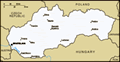
Location: Central Europe, south of Poland
Geographic coordinates: 48 40 N, 19 30 E
Map references: Europe
Area: Total: 48,845 sq km land: 48,800 sq km water: 45 sq km
Area - comparative: About twice the size of New Hampshire
Land boundaries: Total: 1,524 km border countries: Austria 91 km, Czech Republic 215 km, Hungary 677 km, Poland 444 km, Ukraine 97 km
Coastline: 0 km (landlocked)
Maritime claims: None (landlocked)
Climate: Temperate; cool summers; cold, cloudy, humid winters
Terrain: Rugged mountains in the central and northern part and lowlands in the south
Elevation extremes: Lowest point: Bodrok River 94 m highest point: Gerlachovsky Stit 2,655 m
Natural resources: Brown coal and lignite; small amounts of iron ore, copper and manganese ore; salt; arable land
Land use: Arable land: 30.16% permanent crops: 2.62% other: 67.22% (2001)
Irrigated land: 1,740 sq km (1998 est.)
Natural hazards: NA
Environment - current issues: Air pollution from metallurgical plants presents human health risks; acid rain damaging forests
Environment - international agreements: Party to: Air Pollution, Air Pollution-Nitrogen Oxides, Air Pollution-Persistent Organic Pollutants, Air Pollution-Sulfur 85, Air Pollution-Sulfur 94, Air Pollution-Volatile Organic Compounds, Antarctic Treaty, Biodiversity, Climate Change, Climate Change-Kyoto Protocol, Desertification, Endangered Species, Environmental Modification, Hazardous Wastes, Law of the Sea, Ozone Layer Protection, Ship Pollution, Wetlands signed, but not ratified: none of the selected agreements
Geography - note: Landlocked; most of the country is rugged and mountainous; the Tatra Mountains in the north are interspersed with many scenic lakes and valleys
Advertisement
The information here has been derived from Public Domain Sources such as the CIA World Factbook. No liability can be taken for any inaccuracies.
Tot: 0.077s; Tpl: 0.008s; cc: 6; qc: 6; dbt: 0.0102s; 1; m:domysql w:travelblog (10.17.0.13); sld: 1;
; mem: 1.1mb
 In 1918 the Slovaks joined the closely related Czechs to form Czechoslovakia. Following the chaos of World War II, Czechoslovakia became a Communist nation within Soviet-ruled Eastern Europe. Soviet influence collapsed in 1989 and Czechoslovakia once...