Advertisement
Published: December 2nd 2010
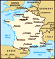
Zuid Frankrijk 28 april t/m 6 mei 2009.
28 april dinsdag.
Ik werk ’s morgens nog even thuis en om iets na half elf vertrekken we naar Brussel Charleroi Airport.
Een drama file op de weg naar Antwerpen kost ons bijna 45 minuten.
Een bijna ongeluk onder Brussel, een auto raakt de vangrail of een andere auto en komt stuiterend achterste voren op de snelweg terecht. We kunnen er net om heen.
Op tijd op de luchthaven. Wilma moet haar tas nog in een vorm duwen om de tas mee te mogen nemen als handbagage in het vliegtuig van Ryan Air. De vloeistoffen nog sealen en instappen.
Met een hoop wind landen we 1 ½ uur later op Carcasonne.
We halen de auto op, een VW Polo, en gaan naar het hotel vlak bij de airport.
Een aardige dame helpt ons en geeft uitleg over de stad. Het is een kleine kamer, maar voldoende.
We gaan met de auto naar de supermarkt; kopen fruit en drinken en wat broodjes.
Weetjes over CARCASSONNE:
Carcassonne (Occitaans: Carcassona) is een stad in Frankrijk. Het is de prefectuur (hoofdstad) van het departement Aude. Carcassonne ligt in de regio Languedoc-Roussillon op 90 kilometer
ten zuidoosten vanToulouse, globaal tussen de Pyreneeën en de Montagne Noire. De stad ligt aan weerszijden van de rivier de Audeen wordt doorsneden door het Canal du Midi. De stad heeft door zijn centrale ligging een belangrijke regionale marktfunctie; belangrijkste werkgevers zijn de overheid, dienstensector, detailhandel en toerisme. In 1999 bedroeg het aantal inwoners 43.950.
De stad staat op de werelderfgoedlijst van UNESCO en trekt jaarlijks 3 miljoen toeristen. De bekendste bezienswaardigheid is de volledig gerestaureerde citadel, La Cité genaamd. De citadel staat bekend als mooiste voorbeeld van een middeleeuwse stad in Europa, die bijna volledig bewaard is. Het is ook de grootste burcht van deKatharen (zie ook: burchten van de Katharen).
De eigenlijke binnenstad, waar ook het stadhuis ligt, is de Ville Basse (Benedenstad) of Bastide St. Louis. Dit centrum is in de 13e eeuw gebouwd als toevluchtsoord voor bewoners uit de voorsteden. Een stenen brug over deAude verbindt de oude Cité en de nieuwe stad met elkaar.
Op naar La Cité. Een mooie oude burcht met veel oude straatjes en een Kathedraal nabij de oude stad van Carcassonne.
Hierna nog even lopen naar het echte oude centrum, naar het stationstation en Canal du Midi.
Ik ga de wedstrijd
Barcelona – Chelsea op de kamer kijken met een biertje/chips en Wilma gaat slapen.
29 april woensdag.
We staan om 8 uur op, nemen het ontbijt buffet en gaan op pad richting Toulouse.
Weetjes over TOULOUSE:
Toulouse (Italiaans en Occitaans: Tolosa) is een stad in het zuiden van Frankrijk, prefectuur van het departement Haute-Garonne en hoofdstad van de regio Midi-Pyrénées. Ze is gelegen aan de rivier Garonne. Toulouse heeft sinds de dertiende eeuw een universiteit, de eerste in Frankrijk buiten Parijs.
Het regent vaak en het is somber weer; We zoeken het plaatsje Villesy. Hier hadden we een mooi huis op internet gezien. Helaas niet gevonden, daarna via Saissac, Revel naar Toulouse.
Toulouse hebben we wat in het oude centrum gelopen over de brug van de Garonne.
Het was even droog. Hierna op weg naar Lisle-sur-Tarn. Een mooi oud centrum net als Mirepoix.
Ook hier is het weer even droog. Hierna naar Albi, een leuke stad met de Tarn als rivier.
Weetjes over ALBI:
Albi is een stad in het zuiden van Frankrijk. Het is de hoofdstad van het Franse departement Tarn. Door Albi stroomt de rivier Tarn. Er wonen ca. 50.000 mensen in Albi, die Albigeois
worden genoemd.
Toen zijn we naar Laguepie gegaan waar een leuk huis te koop stond, maar dat stadje was niet veel. Het was erg slecht weer, en de rivier de Aveyron stond heeel erg hoog. Toen door naar Najac een mooi oud bergdorp op een heuvelrug met kasteel.
Weetjes over NAJAC:
Najac is een gemeente in het Franse departement Aveyron (regio Midi-Pyrénées) en telt 744 inwoners (1999). De plaats maakt deel uit van het arrondissementVillefranche-de-Rouergue.
Hier loopt de rivier de Aveyron doorheen. Het was weer even droog voor een wandeling.
Op weg naar Cahors komen we de Aldi tegen, kopen daar wat crackers en kaas en bier en water.
Daarna 40 km door bossen en vele heuvellandschappen met soms kleine plaatsjes.
We eten wat frietjes en drinken een cappi bij de Mcdonalds en zoeken op het internet een slaapplaats in Cahors. We vinden niet veel.
Weetjes over CAHORS:
Cahors (Occitaans: Caors) is een Franse gemeente en de hoofdstad (préfecture) van het departement Lot.
De stad ligt in een meander van de rivier de Lot en is bijna volledig omgeven door water. De ligging is uniek: op een gelijke afstand van de Atlantische Oceaan, deMiddellandse Zee en de Pyreneeën.
De inwoners van de stad heten Cadurciens (vroeger: Cahorsins).
Vandaag is de stad vooral bekend als het centrum van de broemde AOC wijn en als toeristische trekpleister.
In Cahors nemen we direct een simpel hotel met veel kamers net buiten het centrum, niet te duur. We lopen naar het centrum, naar de oude brug met het duiveltje Pont Valentré over de LOT rvier. Deze brug is een schoolvoorbeeld van een middeleeuwse vestingbrug. De torens moesten de toegang tot de stad verdedigen. Het bouwen van de brug heeft 70 jaar geduurd, daar is ook de mythe van de duivel ontstaan. De bouwmeester van de brug zou zijn ziel aan de duivel verkocht hebben, maar met een list daar vanaf hebben proberen te komen. Als represaille brak de duivel elke nacht af wat er de dag ervoor aan de centrale toren toegevoegd was. Bij de restauratie in de 19e eeuw is daarom een duivel in de toren toegevoegd. Een van de mooiste middeleeuwse bruggen van Europa.
Hierna door de oude straatjes gelopen, we eten een broodje en drinken een wijntje en bier bij een groot sportscherm in een kroeg. Vanavond Arsenal – Manchester die ga ik ook nog kijken. De avond
eindigde met 1-0 voor Manchster.
Het is donderdag 30 april om 9.30 uur, 12 graden. Best fris.
We ontbijten met (natuurlijk)een wit stokbrood en conflakes. Het plan is naar Brive te gaan via een omweg door het binnenland. (departement Lot). Cahors is een leuke stad met veel historie, zoals het duivels verhaal. De middelste toren heet nu Tour du Diable. We rijden Cahors door het centrum uit en nemen afscheid van de leuke stad.
Weetjes over ROCAMADOUR:
Rocamadour is een stad in Frankrijk, in het Centraal Massief, departement Lot. De stad is na Lourdes de meest bezochte bedevaartsplaats van Frankrijk. Rocamadour is bereikbaar vanaf Sarlat en Souillac via de D673. De stad is gebouwd op een rots midden in de Causse de Gramat, een uitgestrekt leisteenplateau en onderdeel van de Causses du Quercy. Boven op de rots ligt eenburcht. Via een slingerend pad (of een lift voor de mindervaliden) kan men het heiligdom bereiken, een reeks van kapellen met fresco's en een kerk. Via een trap, waarin vele fossielen van mariene herkomst zichtbaar zijn, komt men onderaan de berg. Daar ligt het zeer toeristische stadje met zijn nauwe straatjes. De naam van deze heilige plaats is van het Occitaanse
'roc amator'; de rots van Amadour. Deze rots is in de vroege middeleeuwen uitgekozen door een Sint Amadourals woonplaats. Sint Amadour leidde een kluizenaarsbestaan en wordt in een legende geïdentificeerd met Zacheüs, een leerling van Jezus. Hij is ook de man van Sint Veronica, met wie hij samen vanuit het Heilige Land hier naartoe vluchtte.
In de 12e eeuw werd het lichaam van Sint Amadour nog geheel intact en onaangetast aangetroffen in een tombe in de bergwand. Het lichaam werd in de kapel gelegd waar men vervolgens op zijn wederopstanding wachtte, die echter niet kwam. Later is het lichaam door de protestanten tijdens een van de vele godsdienstoorlogen verbrand.
Rocamadour werd een zeer populaire bedevaartsplaats op de weg van Noord-Europa naar Santiago de Compostella. Veel bekende mensen kwamen naar Rocamadour op pelgrimstocht, waaronder koning Lodewijk de Heilige en Hendrik III van Engeland die in Rocamadour op wonderbaarlijke wijze genezen zou zijn van een ziekte.
Naast de tombe van St. Amadour is de Zwarte Madonna van Rocamadour een belangrijke reden voor een pelgrimsbezoek.
Tussen de stad en de burcht in liggen zeven heiligdommen aan de Parvis des Églises, te bereiken door een trap met 223 treden, of een lift.
We rijden binnendoor naar Rocamadour langs de wijn velden, bossen en kronkelwegen. Tegen 11.00 uur zien we stad hoog tegen de berg aan liggen. Prachtig. De auto moeten we beneden laten staan en via een lange klim komen we in het dorp terecht. De huizen zijn mooi onderhouden en de winkelstraat is gezellig. Nu nog de brede trap beklimmen die ons naar de heiligdommen van de stad brengt. De pelgrims beklommen de trap al biddend op hun knieën. Wij hebben de trap lopend beklommen. We bezoeken de Chapelle Notre-Dame waar de zwarte Madonna met kind staat. We branden een kaas voor onze ouders. Op deze plaats is ook het lichaam gevonden van St. Amadour. Verder zijn er nog een Chapelle en een kasteel. We dalen de trap weer af en gaan op weg naar Roland en Angelique in Brive. Onderweg stoppen we in Martel. Leuke Middeleeuwse stad met stoomtrein. (helaas geen dienst vandaag) Wel is het inmiddels 20 graden.
Weetjes over BRIVE:
Brive-la-Gaillarde of kortweg 'Brive' is een gemeente in het Franse departement Corrèze (regio Limousin) en telt 49.141 inwoners (1999). De plaats maakt deel uit van het arrondissement Brive-la-Gaillarde.
Om precies te zijn wonen Roland en Angelique niet
in Brive maar in La Chapelle aux Brocs. We worden hartelijk ontvangen met lekkere koffie. Het is 5 jaar gelden dat wij hier waren en er is veel opgeknapt en bijgebouwd. Het is mooi landgoed geworden. Nu met wat geiten, schapen met 1 lam kippen en een konijn.
We blijven een uurtje of 2 en gaan ons hotel opzoeken na eerst door het centrum van Brive te lopen. Het is een aardige stad maar meer ook niet. We willen naar een meer rijden, maar keren weer om, het ligt toch te ver weg Weer zitten we in het industrie gebied. Het hotel is oke. We rijden naar de Carrefour en eten bij La Patater. Geen patat maar gepofte aardappelen. Daarna naar hotel en wat tv de route voor morgen en dit tikken. Morgen naar Bordeaux.
1 mei vrijdag, dag van de arbeid.
Het zonnetje schijnt en we gaan op weg naar alles wat we onderweg tegenkomen. Onze 1e stop vandaag in Perigueux.
Weetjes over PERIGUEUX:
Périgueux is een stad in het departement Dordogne in het midden van Frankrijk. Het ligt in een gebied dat Périgord Blanc genoemd wordt; het departement Dordogne omvat het gebied van de voormalige
provincie Périgord. De stad heeft 32.294 inwoners (2005), heeft een oppervlakte van 982 ha. en is de hoofdstad van het departement.
Een uurtje brengen we hierdoor. We lopen door oude smalle, steile straatjes met grote kerken. Het is vandaag de dag van de arbeid en alle winkels zijn dicht behalve restaurants, bars en de markt. Op iedere hoek staan mensen om lelietjes van dalen te verkopen.
Onze 2e stop is Mussidan. Hier hadden we een leuk huis gezien op internet. Het dorp is niet echt leuk dus we zoeken ook niet erg hard naar het huis. We besluiten nu over de grote weg, de A89, te rijden naar Bordeaux.
Weetjes over BORDEAUX:
Bordeaux (229.900 inwoners (2005), agglomeratie 753.931 (1999)) is een stad in het zuidwesten van Frankrijk, de hoofdstad van het departement Gironde en de regio Aquitanië. De agglomeratie is georganiseerd in een verband van gemeentes, de Communauté Urbaine de Bordeaux. De stad is over de hele wereld bekend om de wijnen die uit de omgeving komen. Het is de historische hoofdstad van de regio Gascogne. De naam van de stad wordt verschillende herkomsten toegedicht. Kwade tongen beweren dat Bordeaux het meervoud is van het Oud-Franse bordel, wat
puinhoop of bordeel betekent. De meest geaccepteerde oorsprong is oever van de wateren, bord des eaux wat in het Oud-Frans Bordeaux geeft. Bijnamen: 1) Port de la lune, de "maanhaven", verwijzend naar de vorm van de rivier deGaronne die door de stad loopt. Deze verwijzing komt terug in het logo van de stad in de vorm van drie halve manen. 2) La belle endormie, de 'schone slaapster', verwijzend naar de weelderige architectuur te danken aan het rijke verleden, maar het rustige leven in de stad en gebrek aan economische dynamiek vandaag de dag.
In Bordeaux is het erg druk en op het laatste moment vinden we een parkeerplaats langs de Garonne. We hadden het bijna opgegeven. We rijden over de lange mooi brug over de Garonne het centrum in. Je ziet mooie koopmanshuizen langs de rivier. Er is een demonstratie tegen de privatisering en tegen de president. Er is veel herrie, spandoeken en er zijn veel mensen die meelopen. Verder is Bordeaux een aardige stad. We verdwalen en kunnen de auto niet terug vinden. Even vragen dan maar. De auto is gevonden en we gaan weer verder.
Het landschap is groen, vlakker met veel wijngaarden en kastelen. We zijn
onderweg, inmiddels is het 14.30 uur, naar Bergerac.
Weetjes over BERGERAC:
Bergerac is een gemeente in het Franse departement Dordogne (regio Aquitanië) en telt 26.053 inwoners (1999). De plaats maakt deel uit van het arrondissementBergerac.
Bergerac ligt voor het grootste deel aan de noordzijde Dordogne rivier, en de streek wordt gedomineerd door de wijnbouw. Ten oosten van Bergerac ligt de Pécharmant, een wijngebied waar stevige rode wijn vandaan komt, terwijl ten zuiden van de Dordoge de Monbazillac witte zoete wijnen produceert. Daarnaast wordt in Bergerac op belangrijke schaal tabak verhandeld. In het westen grenst het wijngebied van Bergerac aan die van de Saint-Émilion.
Bergerac is een hele leuke stad en spreekt ons erg aan. De Dordogne stroomt door Bergerac. Ook hier is het water woest en staat het hoog. Ondanks dat alle winkels dicht zijn is het gezellig en er zijn veel terrasjes open. Bij de makelaars zijn veel leuke en betaalbare huizen in de aanbieding.
Onze volgende stop is Lalinde.
( Lalinde is een Franse gemeente in het departement Dordogne, in de regio Aquitanië. De gemeente heeft 3042 inwoners op een oppervlakte van 27,70 km² (110 inw. per km²). Een kleine maar leuke plaats waar we een
terrasje pikken. Ook hier stroomt de Dordogne. Dit plaatsje en omgeving komt in aanmerking om te wonen. Er loopt ook een smalle rivier of kanaal langs de Dordogne waarlangs me hardloopt of fietst.
Het is redelijk vlak en soms net als een hollands kanaal.
10 kilometer voor Sarlat rijden we alweer een mooi dorpje in. Er staat een kasteel hoog op een berg het plaatsje heet Beynac
(Beynac is een gemeente in het Franse departement Haute-Vienne (regio Limousin) en telt 478 inwoners (1999). De plaats maakt deel uit van het arrondissementLimoges. Het kasteel van Beynac ligt in de gemeente Beynac-et-Cazenac in het departement Dordogne.) en we lopen buitenadem de berg op tot aan het kasteel. En alweer een prachtig uitzicht over de rivier en de groene bossen. De Dordogne stroomt nog steeds met ons mee. Eindelijk zijn we in Sarlat.
Weetjes over SARLAT:
Sarlat-la-Canéda is een plaats in het departement Dordogne in de regio Aquitanië in Frankrijk. De plaats ligt in de Périgord Noir.
Sarlat heeft 10.423 inwoners en een oppervlakte van 4713 ha. Het behoort tot het arrondissement Sarlat-la-Canéda en het kanton Sarlat-la-Canéda. De plaats is bereikbaar via de D704.
In het oude stadsgedeelte bevinden zich
diverse middeleeuwse huizen. De markt die iedere zaterdag op de Place du Marché-aux-Obies wordt gehouden biedt typischestreekproducten. Het oude Sarlat bestaat uit twee delen gescheiden door de Travese of Rue de la République. In de 13de en 14de eeuw beleefde de stad een welvarende periode als handelsplaats.Het dorp la Canéda werd op 1 maart 1965 samengevoegd met Sarlat. Het is ontstaan in de 8ste eeuw rond een abdij.
En ook dit is een leuk en mooi dorp met oude huizen en straten. We slapen midden in het centrum bij Les Glaciers. We hebben een schitterende kamer met een groot bed en een balkon met uitzicht op het plein. Voor de toilet en douche moet je zeker twintig meter lopen om er te komen. Dit alles is onze kamer. We drinken nog een biertje en wijntje en dat is het voor vandaag.
2 mei zaterdag.
Vanaf ons balkon hebben we een prachtig uitzicht over de markt onder ons. Er is brood, worst, kaas en fruit. De kooplui zitten om 8.00 uur al aan de wijn. Het zonnetje komt flauw door maar het wordt vast een mooie dag. Na 12 km stoppen we in Domme.
(Domme is een gemeente in
het Franse departement Dordogne. Het is een oud stadje met een ommuurde vesting, boven op een berg langs de rivier de Dordogne. Het ligt in de streek Périgord Noir in Frankrijk, aan de grens met departement Lot.
Het werd in 1281 door Filips de Stoute gebouwd. Het heeft circa 1025 inwoners. De postcode is 24250. Het heeft nu nog twee stadspoorten.)
Een Middeleeuws gezellig dorp. Lekker even wandelen en weer verder. Naar Condezaygues. Hier hebben we een huis gezien. 11.30 uur rijden we departement Dordogne uit en Lot-en-Garonne in. We stoppen in Fumel. Redelijk grote plaats maar ziet er somber uit, niet echt gezellig. Het huis vinden we ook niet ook al is het een dorp van 10 huizen. De streek vinden ook iets minder aantrekkelijk. Opeens staan er een stuk 5 bambi-hertjes in een weiland. De volgende stop is Villeneuve-sur-Lot.
(Villeneuve-sur-Lot is een gemeente in het Franse departement Lot-et-Garonne (regio Aquitanië) en telt 22.782 inwoners (1999). De plaats maakt deel uit van het arrondissement Villeneuve-sur-Lot.) Leuk stadje met gezellig plein en goedkope lekkere koffie. Wel veel buitenlanders. Bij de makelaar hangen veel leuke huizen. Om 14.00 uur rijden we weer verder. Bij Agen (De stad ligt
in het zuiden van Frankrijk en in het zuidwesten van het département Lot-et-Garonne. Het centrum is gesitueerd tussen de rechterkant van de rivierGaronne en het Canal latéral à la Garonne. Ongeveer halfweg tussen Bordeaux (132km) en Toulouse (107km) en dicht aan de A26 autoroute.) lopen we langs het kanaal bij de Garonne naar de sluis er is veel hoogte verschil. Er fietsen veel mensen of lopen te joggen. Het zonnertje brandt er aardig op los. We lopen een half uurtje rond. In Auch (Auch is een gemeente en stad in het Franse departement Gers (regio Midi-Pyrénées) en telt 21.838 inwoners (1999), die Auscitains worden genoemd. De oppervlakte bedraagt 72,5 km², de bevolkingsdichtheid is 301,2 inwoners per km². Het is de prefectuur van het departement.) ook nog even de auto uit. Ook een leuke stad met een grote kerk met 2 torens.
Om 16.45 uur zijn we eindelijk opweg naar Tarbes. (Tarbes is een gemeente in het Franse departement Hautes-Pyrénées (regio Midi-Pyrénées) en telt 46.275 inwoners (1999). De plaats maakt deel uit van het arrondissement Tarbes.) Om 18.00 uur zijn we er echt en om 18.15 uur rijden we weer weg. Aan Tarbes is niks aan. Dan maar door naar
Pau.
Weetjes over PAU:
Pau is een stad in Frankrijk. Met 82 500 (216 830 in de agglomeratie) inwoners is het de grootste stad en tevens prefectuur van het departement Pyrénées-Atlantiques. Het ligt in de regio Aquitanië.
Van 1950 tot 1990 was Pau afhankelijk van de productie van gas en sulfaat dioxide. Momenteel zijn de belangrijkste economische activiteiten de olieindustrie, de luchtvaartindustrie, toerisme en landbouw. In Pau is Elf Aquitaine opgericht. Dit bedrijf is tegenwoordig een onderdeel van Total.
Pau is het derde economische en universitaire centrum van het Zuid-Westen van Frankrijk na Bordeaux en Toulouse.
Bijna ieder jaar is Pau opgenomen in de Ronde van Frankrijk.
Onderweg naar Pau zien we de besneeuwde toppen van de Pyreneeën. We parkeren de auto in het centrum. In de buurt van het kasteel. (Het Château de Pau is een kasteel uit 1370 in het centrum van Pau de hoofdstad van de Pyrénées-Atlantiques en Béarn. Koning Hendrik IV van Frankrijk en Navarra is hier geboren op 13 december 1553. Ook de burggraven van Béarn woonden hier. Ook Napoleon verbleef hier in de zomer. Er zijn verschillende kunstwerken in het kasteel.)
We zoeken een hotel uit het boek van Wilma, maar kunnen
het niet vinden Zien wel een paar nieuwe gebouwen en winkelcentra. De laatste keer waren we hier toen Jan zo gevallen was 5jr geleden en Wilma’s moeder een ataque kreeg en we via Pau naar huis moesten vliegen.
Het wordt Hotel Regina voor 48 euro. We gaan weer wat wandelen, drinken en een biertje. Bij het kasteel lopen we naar de rivier en eten later een salade en een pizza met ¾ ltr wijn.
We zien nog een deel van de 2e helft van de wedstrijd rel tegen Barcelona (2-6) dus Barca wordt nu kampioen. Nog een rondje en dan naar bed.
3 mei zondag.
We staan op met dichte mist rijden richting Pau in erg dichte mist.
Vanuit Pau vertrokken naar Angeles-Angzost (hier schijnt de zon) en rond gelopen en koffiegedronken in hetzelfde cafe als 5 jaar geleden.
De bergen zien er fantastisch uit met hun sneeuw laag. We besluiten naar Gavarnie (Gavarnie is een gemeente in het Franse departement Hautes-Pyrénées (regio Midi-Pyrénées) en telt 154 inwoners (2004). De plaats maakt deel uit van het arrondissement Argelès-Gazost. De plaats is werelderfgoed vanwege de aanwezigheid van een cirque, de Cirque de Gavarnie.) te rijden een km
of 40 verder richting bergen en dat was een goed plan.
We wandelen 2 uur waarvan zeker 1 uur door de sneeuw. Geen goede schoenen aan dus natte voeten maar het was het dubbel en dwars waard. Ik ben zelfs verbrand tijdens het wandelen. Nu over de tolweg naar Béziers. (De Pyreneeën (Frans: Pyrénées, Spaans: Pirineos, Catalaans: Pirineus, Baskisch: Pirinioak) zijn een gebergte, gelegen op de grens van Spanje en Frankrijk. Het gebergte strekt zich uit over ongeveer 430 kilometer, tussen de Atlantische Oceaan en de Middellandse Zee.
Het dwergstaatje Andorra ligt volledig in het gebergte.
De hoogste berg is de Aneto (3404 meter), gelegen in het uiterste noordoosten van het Spaanse Aragón.
Het gebergte is ontstaan door de botsing van het Iberisch schiereiland met het Europese continent, gedurende de Alpiene orogenese, vanaf circa 50 miljoen jaar geleden tot heden.
Er zijn drie nationale parken onder andere Nationaal park Ordesa y Monte Perdido en Nationaal park Aigüestortes i Estany de Sant Maurici.)
De Pyreneeën verdwijnen langzaam en we stoppen voor koffie en bij Carcassonne om een foto van La Cité te maken vanaf de grote weg. Dan scheuren we door naar Montpellier.
Weetjes over Montpellier:
Montpellier is een Zuid-Franse
stad, prefectuur van het departement Hérault en van de regio Languedoc-Roussillon. De stad heeft circa 244.000 inwoners waarvan 80.000 studenten.
De stad ligt op korte afstand van de kust tussen Nîmes en Narbonne. Over de weg is de stad via de A9 te bereiken, die Orange met de Spaanse grens nabij Perpignanverbindt. Montpellier is tevens aangesloten op het TGV netwerk met treinen naar Perpignan, Lyon en Parijs.
Montpellier heeft een historisch stadscentrum met vele smalle straatjes met winkeltjes en veel bezienswaardigheden. Het centrum van Montpellier heet Place de la Comédie. Hier zijn een aantal maal per week straatartiesten en muzikanten te vinden. In het midden ligt de Place de l'Oeuf, een ovaal pleintje op het eigenlijke plein. In het midden van dit ovale plein staat de fontein Trois Grâces, oftewel drie gratiën. Aan de Place de la Comédie ligt ook de Opéra Comédie
Het is erg druk op de péage zeker de andere kant staat lang in de file. Men komt terug van een weekend vrij. Montpellier een zeer leuke stad. Met een modern en oud centrum. We eten een heerlijke salade, om 21.30 uur we lijken Fransen, en moeten om 22.30 uur nog een hotel zoeken.
We
vinden een leuk modern hotel in een oud pand. We krijgen een luxe kamer voor een standaard prijs. Na een biertje en wijntje in de tuin gaan we slapen.
4 mei maandag.
We verlaten de leuke stad Montpellier, maken nog een paar foto’s en rijden met mooi weer (korte broek aan vandaag) door de binnenlanden naar Anduze. Hier staan ook veel huizen te koop dus willen we het gebied zien. Onderweg zien we veel wijn ranken een echt wijngebied dus. Maar………………erg in Nowhere.
Een plus punt is een stoomtrein het stadje op zich is wel aardig. Dit gaat het dus niet worden. Na een bakje koffie gaan we naar Nimes.
(Nîmes is een stad in de regio Languedoc-Roussillon (Frankrijk) met 133.424 inwoners (telling 1999). Dit is de prefectuur van het departement Gard. Postcode 30000 tot 30900.
Nîmes ligt niet ver van Avignon, Montpellier en Marseille, en is bereikbaar via de autoroute A9 en A54 en de TGV. Het Maison Carrée, dat wordt beschouwd als de best bewaarde Romeinse tempel, was gewijd aan de "Prinsen van de Jeugd" (de kleinzonen van de keizer).
De Arena van Nîmes, werd gebouwd tussen 50-100 na Chr. en geïnspireerd
op het Colosseum in Rome. Het is - ook hier weer - de best bewaarde van de Romeinse tijden. Het is 113 bij 101 m. groot. De vloer is 70 bij 38 m. Langs buiten zijn 2 niveaus van 60 bogen elk te onderscheiden. Binnen bood deze arena plaats aan 24.000 toeschouwers verdeeld over 34 tribunes, die konden plaatsnemen in 4 zones die samenhingen met het sociaal statuut van de kijkers. De arena is ontworpen voorgladiatorengevechten. In de Middeleeuwen werd het verbouwd tot een versterkt dorp en had tot 1812 twee kerken, een klein kasteeltje en circa 220 huizen. Tegenwoordig worden er stierengevechten en concerten en voorstellingen in de arena gegeven.)
Oude centrum bekeken met mooie kerken en grote oude arena. Het duurde even voordat we de auto teruggevonden hadden na twee maal vragen moesten we een eind lopen. Maar…..we hebben de Polo weer. Op aanraden van Inge (onze buurman) gaan we naar La Grande Motte (La Grande-Motte is een gemeente in het Franse departement Hérault (regio Languedoc-Roussillon) en telt 6458 inwoners (1999). De plaats maakt deel uit van het arrondissement Montpellier. Het is een vrij moderne en ruim opgezette badplaats met veel flats. De flats zijn echter apart van
vorm en er is veel groen aanwezig.) aan de kust. Ook wel petite Camarque genoemd en we zien inderdaad de paardjes lopen ook zien we vlak voor La Grande Motte flamingo’s in het water staan. Prachtig gezicht.
Het weer betrekt en het wordt een kort bezoekje aan het strand.
Verder naar Sète, (Sète is een gemeente in het Franse departement Hérault (regio Languedoc-Roussillon) en telt 39 542 inwoners (1999). De oppervlakte bedraagt 24,2 km², de bevolkingsdichtheid is 1634 inwoners per km².
Sète ligt aan het Étang de Thau, een lagunemeer van de Middellandse Zee. Het is een karakteristiek havenstadje.
Het Canal du Midi komt hier uit in de Middellandse Zee.
De stad is genoemd naar een walvis, evenals Ceuta. De huidige naam is in 1927 vastgesteld, voordien kwam Cette het meest voor.) langs de kustweg. Deze plaats valt tegen, het is een havenplaats waar grote cruiseschepen aanleggen en veel industrie. We dachten hier te blijven maar besluiten door te rijden naar Bézier maar………………oef de afslag gemist en we kunnen pas na 20 km omdraaien dan maar naar Narbonne. (Narbonne (Narbona in het Occitaans) (bevolking van 50.000) is een stad in het zuiden van Frankrijk, in het departement
Aude. De stad ligt aan de kust van deMiddellandse Zee en de rivier Aude.
We vinden een leuk oud hotel Hotel La France. Weer het oud centrum in maar ook deze stad staalt niet veel uit. Het is zelfs moeilijk om een restaurant te vinden en een bar voor een drankje is ook dicht. Dan maar vroeg (21.30 uur) naar het hotel, nog wat lezen, dagboekje tikken, tv kijken en internetten.
Het blijft flink waaien.
5 mei dinsdag.
Na de Hallen nog bezocht te hebben vlak bij ons hotel, we dronken daar nog een lekkere koffie, gaan we op weg naar Perpignan.
Weetjes over PERIGNAN:
Perpignan (Catalaans: Perpinyà) is de hoofdstad van het Franse departement Pyrénées-Orientales, in de regio Languedoc-Roussillon. Vlakbij ligt de Middellandse Zee. Perpignan ligt in het Franse deel van Catalonië en is in 2008 uitgeroepen tot officiële Catalaanse cultuurhoofdstad. Nabij de stad bevindt zich de voor Catalanen heilige berg Pic du Canigou. Perpignan ligt op 850 km van Parijs en op 180 km van Barcelona.
De stad ligt aan de A9 die Montpellier en Narbonne met Barcelona verbindt. Perpignan heeft ook een internationale luchthaven: luchthaven van Perpignan. Verder is Perpignan voorlopig het eindpunt van
de TGV vanuit het noorden. Op dit moment wordt gewerkt aan een HSL tussen Perpignan en Barcelona.
De stad Perpignan heeft circa 116.700 inwoners (2004). In de agglomeratie Perpignan wonen in totaal meer dan 300.000 mensen en dit aantal groeit nog steeds.
Verder beschikt Perpignan over een eigen universiteit genaamd Université de Perpignan Via Domitia (UPVD). De naam Via Domitia verwijst naar de de eerste heirbaan die aangelegd werd in Gallië.
Perpignan heeft een typisch mediterraan klimaat. De winters zijn er zacht en de zomers zijn er warm en droog. De stad telt circa 300 zonnedagen per jaar. De stad behoort dan ook tot de warmste steden van Frankrijk.
In en rond Perpignan wordt behalve Frans ook wel Catalaans gesproken. Dit blijkt ook uit vermeldingen in beide talen op straatborden.
Via de péage. Onder weg nemen we de kust weg bij La Franqui tot bij Le Barcarès Hier stoppen we en gaan het strand op. Het waait heeeeel erg hard dat het zand op de benen zeer doet. Het is wel een mooi gezicht de bergen aan de ene kant en de zee aan de andere kant. Er zijn veel nieuwe hotels en appartementen. Ook een groot schip,
restaurant en casino ligt op de boulevard aan het strand.
Het is nog niet erg druk De zon blijft schijnen.
Hierna richting Limoux (Limoux is een gemeente in het Franse departement Aude (regio Languedoc-Roussillon) en telt 9411 inwoners (1999). De plaats maakt deel uit van het arrondissementLimoux.) via de D 117. Een mooie route door vele wijngebieden. Bij St Paul de Fenouillet (Saint-Paul-de-Fenouillet (Occitaans: Sant Pau de Fenolhet) is een Franse plaats gelegen in het departement Pyrénées-Orientales in de regio Languedoc-Roussillon. De inwoners worden Saint-Paulais genoemd.
Het hoort bij het arrondissement Perpignan en het kanton Saint-Paul-de-Fenouillet. Het ligt op de linkeroever van de rivier de Agly in de streek Agly.
Er bevindt zich een overblijfsel van een kasteel van de Katharen, Château Fenouillet) gaan we de Gorges de Galamus bekijken. (Gorges de Galamus is een kloof in de departementen Aude en Pyrénées-Orientales in het Zuiden van Frankrijk.
Bereikbaar via D10. Er loopt een prachtige weg langs. Vlakbij de plaatsen Cubières en Saint-Paul-de-Fenouillet.
Er kan gekano'd worden in de kloof.
Aan het einde van de Gorges in het Zuiden in het departement Pyrénées-Orientales is een prachtig uitzicht op de Pic du Canigou , 2784 meter hoge berg.)
Een
mooie rivier tussen de rotsen/kloof en een heel smalle weg om er te komen. Er waren ook 2 kappelen in grotten. Hierna verder naar Limoux. Hier drinken we een koffie op het plein en bellen naar Ad en Inge of het vanavond uitkomt om elkaar te treffen.
We treffen elkaar om 19:00 in het Mercure hotel, eerst checken we weer in ons oude Hotel Balladin in.
Na een glas bubbelwijn gaan we naar La Cité en eten daar in een chique restaurant.
Veel vlees ( Rauw) en typisch franse gerechten.
Na afscheid bij Mercure rijden we weer naar ons Hotel.
6 mei woensdag.
Vandaag laatste dag, We gaan nu richting Béziers via de D610. We rijden dichtbij rivier de Aude en Canal du Midi.
Weetjes over CANAL DU MIDI:
Het Canal du Midi is een 250 km lang kanaal tussen de Atlantische Oceaan en de Middellandse Zee. Het Canal du Midi loopt door de Franse regio's Languedoc-Roussillon en Midi-Pyrénées. Het kanaal begint in de gekanaliseerde Garonne bij Toulouse en mondt uit in de Middellandse Zee bij de vissersplaats Sète. Deze verbinding werd al bedacht door de Romeinen en Leonardo Da Vinci, maar altijd rees hetzelfde probleem op;
het overwinnen van de heuvelrug in het drogeLanguedoc. Pas in de 17e eeuw won het kanaal aan belang, om de 2000 km lange omweg rond het vijandige Spanje te vermijden. Hierover deed men indertijd 1 maand. Het kanaal werd uiteindelijk ontworpen door Pierre Paul Riquet en de Italiaan Francois Andreossy in de periode 1667-1680.
Het werd in het Languedocgebied gevoed door een 30 km lang voedingskanaal. Ook liet hij het Bassin Saint-Ferreol aanleggen, het grootste bassin van zijn tijd. Er staan nog vele andere kunstwerken op het kanaal, zoals trapsluizen, aquaducten, een tunnel etc. Daarom werd het in 1996 toegevoegd aan de werelderfgoedlijst vanUNESCO. Beroemd is het aquaduct of "pont-canal" bij Béziers, dat de Orb overspant.
We zien Canal du Midi vaak door de plaatsjes stromen. In Capestang lopen we in het oude centrum en over het marktje. In elke stad zie je wel een plek waar oude schildering is aangebracht. Hierna komen we nog langs een olijfoliefabriekje/molen, We kunnen niets meenenemen, dus op naar Beziers.
Hier rijden we naar de oude stad, lopen een rondje, maken foto’s hierna naar het Canal du Midi met de 9 sluisjes.
Hier lopen we wat drinken koffie en maken weer fotos.
Het
weer is erg mooi en warm, we rijden via de péage terug naar Carcassonne en tikken dit strukje bij Mcdonald met Wifi.
Om 1600 uur moeten we op het vliegveld zijn, we vertrekken om 17:30.
21.30 uur stappen we thuis naar binnen. Morgen weer werken.
Het was een leerzame en fijne week.
South of France 28 April t / m 6 May 2009.
Tuesday April 28.
I work in the morning and at home a little bit after half past ten we go to Brussels Charleroi Airport.
File a drama on the way to Antwerp will cost us almost 45 minutes.
A near-accident in Brussels, a car hits the guardrail or another car and comes bouncing backwards on the highway right. We can just round it.
On time at the airport. Wilma is still in her bag to form a push to take the bag as hand luggage on the plane from Ryan Air. The liquids are sealing and boarding.
With a lot of wind, we landed a half hour later Carcassonne.
We get the car, a VW Polo, and go to the hotel near the airport.
A nice lady helping us and will explain the city.
It's a small room, but sufficient.
We go by car to the supermarket, buy some fruit and drinks and sandwiches.
Facts about Carcassonne:
Carcassonne (Occitan: Carcassona) is a city in France. It is the prefecture (capital) of the Aude department. Carcassonne is located in the Languedoc-Roussillon region at 90 km southeast vanToulouse, roughly between the Pyrenees and the Montagne Noire. The city lies on either side of the river Auden is intersected by the Canal du Midi. The city's central location is an important regional market position, major employers are government, services, retail and tourism. In 1999 the population 43,950.
The city is on the UNESCO World Heritage Site and attracts 3 million tourists. The most famous attraction is the fully restored citadel, called La Cité. The citadel is known as the finest example of a medieval town in Europe, which is almost completely preserved. It is also the largest castle in deKatharen (see also: castles of the Cathars).
The actual city, where the town hall lies the Basse Ville (Lower Town) or Bastide Saint Louis. This center is in the 13th century as a refuge for residents from the suburbs. A stone bridge connects the old deAude Cité and
the new city together.
On to La Cité. A beautiful old castle with many old streets and a cathedral near the ancient city of Carcassonne.
After a little walk to the real old town, the train station and Canal du Midi.
I go the match Barcelona - Chelsea in the room watching with a beer / chips and Wilma goes to sleep.
Wednesday April 29.
We are at 8 am, take breakfast buffet and go on the road to Toulouse.
Facts about TOULOUSE:
Toulouse (Italian and Occitan: Tolosa) is a city in southern France, prefecture of the Haute-Garonne and capital of the Midi-Pyrénées. It is located on the river Garonne. Toulouse is a university since the thirteenth century, the first in France outside Paris.
It rains often and it's gloomy weather, we find the town Villesy. Here we had a nice house seen on the Internet. Not found, then use Saissac, Revel Toulouse.
Toulouse we have some in the old town walked across the bridge of the Garonne.
It was just dry. After heading to Lisle-sur-Tarn. A beautiful old town just like Mirepoix.
Again the weather is dry. Below to Albi, a charming town with a river
Tarn.
Facts about ALBI:
Albi is a city in southern France. It is the capital of the French department of Tarn. Albi by the river Tarn. Here live some 50,000 people in Albi, which are called Albigeois.
Then we went to Laguépie where a nice house was for sale, but that town was not much. It was very bad weather, and the river Aveyron was veeery very high. Najac then on to a beautiful old mountain village on a hill with its castle.
Facts about NAJAC:
Najac is a commune in the French department of Aveyron (Midi-Pyrénées) and has 744 inhabitants (1999). The site is part of the district of Villefranche-de-Rouergue.
Here the river Aveyron through. It was as dry for a walk.
On the road to Cahors, we at Aldi, buy it some crackers and cheese and beer and water.
Then 40 km through forests and hills with many small towns sometimes.
We eat some fries and a drink at the Mcdonalds cappi and search the Internet a place to sleep in Cahors. We find not much.
Facts about CAHORS:
Cahors (Occitan: Caors) is a French municipality and the capital (prefecture) of the Lot.
The town lies
in a meander of the river Lot and is almost completely surrounded by water. The location is unique: at an equal distance from the Atlantic Ocean, deMiddellandse Sea and the Pyrenees. The inhabitants of the city called Cadurciens (formerly Cahorsins).
Today, the city known as the center of the broemde AOC wine and as a tourist attraction.
In Cahors, we immediately a simple hotel with many rooms just outside the center, not too expensive. We walk to the center, the old bridge with the devil on the Pont Valentré rvier LOT. This bridge is an example of a medieval fortified bridge. The towers had access to defend the city. Building the bridge has lasted 70 years, there has also created the myth of the devil. The architect of the bridge would have sold soul to the devil, but a ruse to get rid of are trying to get. If retaliation broke the devil every night wondering what the day before the central tower was added. The restoration in the 19th century is therefore a devil in the tower added. One of the finest medieval bridges in Europe.
After walking through the old streets, we eat a sandwich and drink
a glass of wine and beer at a large screen in a sports bar. Tonight Arsenal - Manchester which I'm still looking. The evening ended with 1-0 for Manchster.
It's Thursday, April 30 at 9:30 am, 12 degrees. Best fresh.
We have breakfast with (of course) a white bread and conflakes. The plan is to go to Brive a detour through the interior. (Lot). Cahors is a nice town with great history, like the devil story. The middle tower is now called Tour du Diable. We drive through the center of Cahors and say goodbye to the nice city.
Facts about ROCAMADOUR:
Rocamadour is a city in France, in the Massif Central, Lot. The city is the most visited pilgrimage site after Lourdes in France. Rocamadour is accessible from Sarlat and Souillac via the D673. The city is built on a rock in the middle of the Causse de Rocamadour, a vast slate plateau and part of the Causses du Quercy. Eenburcht lies above the cliff. Via a winding path (or a lift for the disabled) can reach the sanctuary, a series of chapels with frescoes and a church. A staircase, where many fossils of marine origin are visible,
one comes down the mountain. That is very tourist town with its narrow streets. The name of this holy place from the Occitan "roc amator ', the rock Amadour. This rock is in the early Middle Ages, selected by a St. Amadourals residence. St. Amadour lived a recluse and is identified with a legend Zacchaeus, a disciple of Jesus. He is also the husband of St. Veronica, with whom he collaborated from the Holy Land here fled.
In the 12th century, the body of Saint Amadour still completely intact and untouched found in a tomb in the mountainside. The body was placed in the chapel where it then awaiting his resurrection, but did not. Later the body by the Protestants during the religious wars of the many burned.
Rocamadour was a very popular place of pilgrimage on the way from Northern Europe to Santiago de Compostela. Many famous people came on pilgrimage to Rocamadour, including King Saint Louis and Henry III of England in Rocamadour miraculously would recover from an illness.
Besides the tomb of St. Amadour the Black Madonna of Rocamadour an important reason for visiting pilgrims.
Between the city and the castle are seven sanctuaries on the
Parvis des Eglises, accessible by a stairway with 223 steps or a lift.
We drive along to Rocamadour in through the vineyards, forests and winding roads. At 11.00 hours we see city high against the mountain lie. Beautiful. The car we have downstairs and leave through a long climb, we visit the village. The houses are well kept and the shopping is fun. Now we ascend the broad staircase that leads us to the shrines of the city. The pilgrims climb the stairs on their knees praying. We climbed the stairs running. We visit the Chapelle Notre-Dame, where the black Madonna and child is. We burn a cheese for our parents. At this point it is also found the body of St. Amadour. There are also a Chapel and a castle. We descend the stairs and head for Roland and Angelique in Brive. We stop at Martel. Delightful medieval town with steam train. (Unfortunately no service today) Well it is now 20 degrees.
Facts about BRIVE:
Brive-la-Gaillarde or simply "Brive is a commune in the French department Corrèze (Limousin region) and has 49,141 inhabitants (1999). The site is part of the district of Brive-la-Gaillarde.
To be precise, Roland
and Angelique live but not in Brive La Chapelle aux Broc. We are greeted with coffee. It's 5 years ago we were here and there is much refurbished and built. It has become a beautiful estate. Now with some goats, sheep, chickens with a lamb and a rabbit.
We stay an hour or two and go find our hotel after the first run downtown Brive. It's a nice city but nothing more. We want to drive more, but once again, it is still too far away again we are in the industrial area. The hotel is okay. We drive to the Carrefour and eat at La Patater. No fries, but baked potatoes. Hotel and then to television what the route for tomorrow and it ticks. Bordeaux tomorrow.
Friday May 1, Labour Day.
The sun is shining and we head for everything we encounter on the road. Our first stop today in Perigueux.
Facts about PERIGUEUX:
Perigueux is a town in the Dordogne in the middle of France. It is located in an area called Perigord Blanc, Dordogne department, the area of the former province of Perigord. The city has 32,294 inhabitants (2005), covers an area of 982
hectares. and is the capital of the department.
One hour we bring this. We walk through ancient narrow, steep streets with large churches. Today is the day of work and all shops are closed except for restaurants, bars and market. On every corner people are selling lily of the valley.
Our second stop is Mussidan. Here we had a nice house seen on the Internet. The village is really nice so we do not look very hard at the house. We decide now on the road, the A89, driving to Bordeaux.
Facts about Bordeaux:
Bordeaux (229,900 inhabitants (2005), agglomeration 753,931 (1999)) is a city in southwestern France, capital of the Gironde and the Aquitaine region. The agglomeration is organized in an association of municipalities, the Communauté Urbaine de Bordeaux. The city is known worldwide for its wines from the surrounding area. It is the historical capital of Gascony region. The name of the city is different origins attributed. Evil tongues say that Bordeaux is the plural of Old French brothel, which means mess or brothel. The most widely accepted origin of the river waters, des eaux board which in Old French gives Bordeaux. Nicknames: 1) Port de la
lune, "the Mon port", referring to the shape of the river that runs through the city deGaronne. This reference is reflected in the logo of the city in the form of three crescents. 2) La belle endormie, the 'sleeping beauty', referring to the opulent architecture due to its rich past, but the quiet life in the city and lack of economic dynamism today.
Bordeaux is very busy and at the last minute we find a parking space along the Garonne. We had almost given up. We drive along the beautiful long bridge over the Garonne in the center. You see beautiful merchant houses along the riverside. There is a demonstration against privatization and against the president. There is much noise, banners, and there are many people who walk along. Furthermore, Bordeaux is a nice city. We get lost and can not find the car. Just ask then. The car was found and we move on.
The landscape is green, with much flatter vineyards and castles. We are moving, it is now 14.30 hours, to Bergerac.
Facts about BERGERAC:
Bergerac is a town in the French Dordogne (Aquitaine region) and has 26,053 inhabitants (1999). The site is part of the
district bergerac.
Bergerac lies largely in the north Dordogne River, and the region is dominated by viticulture. Bergerac is situated east of the Pécharmant, a hearty red wine region where wine comes from, while south of the Dordoge Monbazillac sweet white wines. In addition, Bergerac major scale tobacco trade. In the west, bordering the vineyards of Bergerac to that of the Saint-Emilion.
Bergerac is a very nice town and speaks to us. The Dordogne flows through Bergerac. Again the water is wild and it is high. Despite all the shops are closed, it is nice and there are many open terraces. When brokers are nice and affordable homes for sale.
Our next stop is Lalinde.
(Lalinde is a French commune in the Dordogne in the Aquitaine region. The municipality has 3042 inhabitants in an area of 27.70 km ² (110 inh. Per square km). A small but nice place where we pick a terrace. Again flows the Dordogne. This town and surrounding area is eligible to attend. There is a narrow channel along the Dordogne river or along my running or cycling.
It is relatively flat and sometimes like a Dutch canal.
Sarlat 10 km drive to
another beautiful village. There is a castle high on a mountain the place called Beynac
(Beynac is a commune in the French department of Haute-Vienne (Limousin region) and has 478 inhabitants (1999). The site is part of the arrondissementLimoges. Beynac Castle is located in the town of Beynac-et-Cazenac in the Dordogne .) and we run out of breath on the hill to the castle. And again a splendid view over the river and the green woods. The Dordogne flows are still with us. At last we are Sarlat.
Facts about SARLAT:
Sarlat-la-Caneda is one place in the Dordogne region of Aquitaine in France. The place is situated in the Perigord Noir.
Sarlat has 10,423 inhabitants and an area of 4713 hectares. It belongs to the district in Sarlat-la-Caneda, and the Canton of Sarlat-la-Caneda. The site is accessible via the D704.
In the old town there are several medieval houses. The market every Saturday in the Place du Marche-aux-held Obies offers typical regional products. The old Sarlat has two parts separated by Traves or Rue de la Republique. In the 13th and 14th centuries the city experienced a prosperous period handelsplaats.Het village la Caneda was March 1, 1965 merged
with Sarlat. It originated in the 8th century around an abbey.
And this is a nice and beautiful village with ancient houses and streets. We sleep in the center of Les Glaciers. We have a beautiful room with a large bed and a balcony overlooking the square. For the toilet and shower, be sure twenty meters walk to get there. All of this is our room. We drink more beer and wine and that's it for today.
Saturday May 2.
From our balcony we have a beautiful view of the market among us. There is bread, sausage, cheese and fruit. The merchants are already at 8.00 am on the wine. The sun is passing through but it is a pretty solid day. After 12 km we stop at Domme.
(Stupid is a commune in the French department of Dordogne. It is an old town with a walled fortress atop a hill along the river Dordogne. Located in the Perigord Noir region of France, on the border with Lot.
It was built in 1281 by Philip the Bold. It has about 1025 inhabitants. The zip code is 24250. It now has two gates.)
A nice medieval village. Nice
for a walk and again. To Condezaygues. Here we have seen a house. 11.30 hours we drive Dordogne and Lot and Garonne. We stop in Fumel. Fairly large place but it looks bleak, not really nice. The house we are not even a village of 10 houses. The region also are somewhat less attractive. Suddenly there are a lot 5-bambi deer in a meadow. The next stop is Villeneuve-sur-Lot.
(Villeneuve-sur-Lot, a commune in the French department of Lot-et-Garonne (Aquitaine region) and has 22,782 inhabitants (1999). The site is part of the district of Villeneuve-sur-Lot.) Nice town with a charming courtyard and cheap coffee. However, many foreigners. When the broker hanging many nice houses. At 14.00 hours we drive again. At Agen (The city is located in the south of France and in the southwest of the Lot-et-Garonne. The center is located between the right side of the river Garonne and the Canal Lateral a la Garonne. About halfway between Bordeaux (132km) and Toulouse (107km) and close to the A26 autoroute.) we walk along the canal to the Garonne to the lock there is much difference in height. Many bikes or walking to jogging. Zonnertje it burns well on
loose. We walk around half an hour. Auch (Auch is a town and commune in the French department of Gers (Midi-Pyrénées) and has 21,838 inhabitants (1999), which are called Auscitains. The surface area of 72.5 km ², population density is 301.2 inhabitants per km ² . It is the prefecture of the department.) also stopped the car. Also a nice city with a large church with two towers.
At 16.45 hours we are finally on our way to Tarbes. (Tarbes is a French commune in the Hautes-Pyrénées (Midi-Pyrénées) and has 46,275 inhabitants (1999). The site is part of the district of Tarbes.) At 18.00 hours we are real and at 18.15 we drive again. At Tarbes nothing. But then to Pau.
Facts about PAU:
Pau is a town in France. With 82,500 (216,830 in the metropolitan area) residents is the largest city and prefecture of the department of Pyrénées-Atlantiques. Situated in the Aquitaine region.
From 1950 to 1990 Pau was dependent on the production of gas and sulfur dioxide. Currently, the main economic activities of the oil industry, the aviation industry, tourism and agriculture. Pau, Elf Aquitaine founded. This company is now part of Total.
Pau is the
third business and academic center of the South West of France from Bordeaux and Toulouse.
Almost every year, Pau included in the Tour de France.
On the way to Pau we see the snowy peaks of the Pyrenees. We park the car in the center. Near the castle. (Château de Pau is a castle from 1370 in the heart of Pau, the capital of the Pyrénées-Atlantiques and Béarn. King Henry IV of France and Navarre was born here on December 13, 1553. The Viscounts of Béarn lived here. Even Napoleon stayed here in the summer. There are several works in the castle.)
We find a hotel from the book by Wilma, but can not find or see a few new buildings and shopping centers. The last time we were here so when January had fallen 5JR ago and Wilma's mother was an ataque and we had to fly home from Pau.
The Hotel Regina is for 48 euros. We go for a walk, drink a beer. At the castle we walk to the river and later a dinner salad and pizza with a ¾ l wine.
We see a portion of the second half of the race riot against
Barcelona (2-6) Barca is now champion. Another round and then to bed.
Sunday May 3.
We are about to drive to Pau in thick fog dense fog.
From left to Pau Angeles Angzost (here the sun shines) and walked around and drank coffee in the same cafe as five years ago.
The mountains look great with their snow. We decide to Gavarnie (Gavarnie is a commune in the French department of Hautes-Pyrénées (Midi-Pyrénées) and has 154 inhabitants (2004). The site is part of the district Argeles-Gazost. The place is world because of the presence of a cirque, the Cirque de Gavarnie.) or 40 to drive one kilometer on towards mountains and that was a good plan.
We walk two hours of which at least one hour through the snow. No good shoes so your feet wet but it was well worth it. I even burned while walking. Now on the toll road to Béziers. (The Pyrenees (French: Pyrénées, Spanish: Pirineos, Catalan: Pirineus, Basque: Pirinioak) are a mountain range, located on the border of Spain and France. The mountain range stretches for about 430 km between the Atlantic and the Mediterranean Sea.
The tiny principality of
Andorra lies entirely in the mountains.
The highest mountain is the Aneto (3404 meters), located in the extreme northeast of the Spanish Aragon.
The mountain was created by the collision of the Iberian Peninsula with continental Europe during the Alpine orogeny, from about 50 million years ago until now.
There are three national parks include National Park Ordesa y Monte Perdido National Park and Estany de Sant Maurici i Aiguestortes.)
The Pyrenees will disappear slowly and stop for coffee and take a picture of Carcassonne La Cite make from the main road. Then we race on to Montpellier.
Facts about Montpellier:
Montpellier is a city in southern France, prefecture of the department of Herault and the Languedoc-Roussillon. The city has approximately 244,000 inhabitants of which 80,000 students.
The town is a short distance from the coast between Nimes and Narbonne. By road, the city via the A9 to reach the Orange to the Spanish border near Perpignan Connect. Montpellier is also connected to the TGV network with trains to Perpignan, Lyon and Paris.
Montpellier is a historic town with many narrow streets with shops and sights. The center of Montpellier is called Place de la Comedie. Here are a
few times a week, street performers and musicians to find. In the middle lies the Place de l'Oeuf, an oval square on the actual square. In the middle of the oval plaza, the fountain Trois Graces, or three graces. At the Place de la Comedie is the Opéra Comédie
It is certainly very busy at the toll the other hand, long in the file. People come back from a weekend off. Montpellier is a very nice city. With a modern and old town. We eat a delicious salad, at 21.30 hours we seem French, and at 22.30 to find another hotel.
We find a nice modern hotel in an old building. We get a deluxe room for a standard price. After a beer and wine in the garden we go to sleep.
Monday 4 May.
We leave the lovely city of Montpellier, make a few photos and driving in good weather (shorts today) through the interior to Anduze. There are too many houses for sale so we want to see the area. We see a lot of vines is a real wine country. But ... ... ... ... ... ... very much in Nowhere.
One
plus point is a steam train the town itself is nice. It is therefore not to be. After a cup of coffee, we go to Nimes.
(Nimes is a town in the Languedoc-Roussillon (France), with 133,424 inhabitants (census 1999). This is the prefecture of the Gard. Zip code 30000 to 30900.
Nimes is not far from Avignon, Montpellier and Marseille, and accessible from the motorway A9 and A54 and the TGV. The Maison Carree, which is considered the best preserved Roman temple was dedicated to the "Princes of the Youth" (the grandsons of the emperor).
The Arena of Nimes, was built between AD 50-100. and inspired by the Colosseum in Rome. It's - here again - the best preserved of the Roman times. It is 113 to 101 m wide. The floor is 70 by 38 m. On the outside are two levels of 60 arches each distinct. Offered within the arena of 24,000 spectators across 34 grandstands, which could take place in four areas that were associated with the social status of the viewers. The arena is designed for gladiatorial combat. In the Middle Ages it was converted into a fortified village and had the 1812 two
churches, a small castle and around 220 houses. Today there are bullfights, concerts and performances given in the arena.)
Old Town viewed with beautiful churches and grand old arena. It took a while before we had recovered the car after asking twice we had a long walk. But ... .. we have the Polo again. On the advice of Inge (our neighbor) we go to La Grande Motte (La Grande-Motte is a town in the French department of Herault (Languedoc-Roussillon) and has 6458 inhabitants (1999). The site is part of the district of Montpellier . It's quite modern and spacious resort with many flats. The flats are individually shaped and a lot of green there.) on the coast. Sometimes called petite Camargue and we do see the horses are also seen in front of La Grande Motte flamingos in the water. Beautiful sight.
The weather and it involves a brief visit to the beach.
Further Sète, (Sète, a commune in the French department of Herault (Languedoc-Roussillon) and has 39 542 inhabitants (1999). The surface area of 24.2 km ², a population of 1634 inhabitants per km ².
Sète is situated on the Etang de Thau, a lagoon more of
the Mediterranean. It is a typical port town.
The Canal du Midi is here in the Mediterranean Sea.
The town is named after a whale, and Ceuta. The present name was adopted in 1927, there came Cette most common.) Along the coastal road. This place is disappointing, it is a port where cruise ships dock and many large industries. We thought staying here but decide to drive to Bézier but ... ... ... ... ... ... phew missed the exit and we can only turn over only 20 km from Narbonne. (Narbonne (Narbona in Occitan) (population 50,000) is a city in southern France in the Aude department. The town lies on the shores of the River Aude and deMiddellandse Sea.
We find a nice old hotel La France. Again the old center in this town steels but not much. It's even hard to find a restaurant and a bar for a drink is also close. So I asked (21:30) to the hotel, some reading, typing diary, watch TV and internet.
It remains quite windy.
Tuesday May 5.
After having visited the Halls are close to our hotel, where we drank a delicious coffee, we go
to Perpignan.
Facts about Perignan:
Perpignan (Catalan: Perpinya) is the capital of the French department of Pyrenees-Orientales in the Languedoc-Roussillon region. Nearby is the Mediterranean. Perpignan is in the French part of Catalonia and in 2008 proclaimed the official capital of Catalan culture. Near the city is the holy mountain of Pic du Canigou Catalans. Perpignan is 850 km from Paris and 180 km from Barcelona.
The town lies on the A9 to Montpellier and Narbonne with Barcelona. Perpignan has an international airport: Perpignan airport. Furthermore, the endpoint of the preliminary Perpignan TGV from the north. We are currently working on an HSL between Perpignan and Barcelona.
The city has about 116,700 inhabitants Perpignan (2004). Perpignan in the metropolitan area live in more than 300,000 people and this number is still growing.
In addition, a private university named Perpignan Université de Perpignan Via Domitia (UPVD). The name refers to the Via Domitia the first military road that was built in Gaul.
Perpignan has a typical Mediterranean climate. The winters are mild and summers are warm and dry. The city has about 300 sunny days per year. The city belongs to the warmest towns in France.
In and around Perpignan,
but French is also spoken Catalan. This is confirmed by entries in either language on street signs.
Through the toll. On the way we take the coast road at La Franqui up to Barcarès We stop here and go to the beach. The wind blows the sand tad very hard on the legs hurt. It is a beautiful sight of the mountains on one side and sea on the other side. There are many new hotels and apartments. A large ship, restaurant and casino located on the boulevard at the beach.
It's not crowded, the Sun keeps shining.
After the direction of Limoux (Limoux is a commune in the French department of Aude (Languedoc-Roussillon) and has 9411 inhabitants (1999). The site is part of the arrondissementLimoux.) Via the D 117. A beautiful route through many vineyards. At St Paul de Fenouillet (Saint-Paul-de-Fenouillet (Occitan: Sant Pau Fenolhet) is a French town located in the Pyrénées-Orientales in the Languedoc-Roussillon. The inhabitants are called Saint Paulais.
It belongs to the district of Perpignan and the canton of Saint-Paul-de-Fenouillet. It lies on the left bank of the river in the region Agly Agly.
There is a remnant of a castle of
the Cathars, Château Fenouillet) we see the Gorges de Galamus. (Gorges de Galamus is a gap in the departments of Aude and Pyrénées-Orientales in the South of France.
Accessible via D10. There is a wonderful way along. Nearby places Cubières and Saint-Paul-de-Fenouillet.
There can be gekano'd in the gap.
At the end of the Gorges in the South in the Pyrénées-Orientales is a beautiful view of the Pic du Canigou , 2784 meters high mountain.)
A beautiful river between the rocks / gap and a very narrow path to get there. There were two Chapels in caves. After further Limoux. Here we drink a coffee on the square and call ad and Inge tonight or suits to take apart.
We meet at 19:00 at the Mercure hotel, first we check back at our old hotel in Balladin.
After a glass of sparkling wine we go to La Cite and eat it in a fancy restaurant.
Many meat (raw) and typical French dishes.
After saying at Mercure we drive to our hotel.
Wednesday May 6.
Today last day, we are now using the D610 towards Béziers. We drive close to the River Aude and Canal du Midi.
Facts about CANAL DU MIDI:
The Canal du Midi is a 250 km long canal between the Atlantic and the Mediterranean. The Canal du Midi passes through the French regions of Languedoc-Roussillon and Midi-Pyrenees. The canal begins in the Garonne at Toulouse, and channeled flows into the Mediterranean at the fishing town of Sète. This compound has been invented by the Romans and Leonardo Da Vinci, but always the same problem arose, overcoming the dry hills in the Languedoc. Only in the 17th century gained importance in the channel, the 2000 km long detour around Spain to avoid the enemy. At the time this was done 1 month. The canal was eventually designed by Pierre Paul Riquet and Italian in the period 1667-1680 Andreossy Francois.
It was in the Languedoc region fed by a 30 km long power channel. He also Bassin Saint-Ferreol construction, the largest tank in his time. There are many other works on the channel, such as staircase locks, aqueducts, tunnels, etc. Therefore, in 1996 added to World Heritage vanUNESCO. Famous is the aqueduct or "pont-canal" at Beziers, which spans the river Orb.
We often see the Canal du Midi flows towns. Capestang we walk in the
old town and the market place. In every city you see a place where old painting is applied. After we come through an olive oil factory / mill, we can not think to take, so on to Beziers.
Here we drive to the old town, walk around, take pictures below to the Canal du Midi in the 9 locks.
Here we walk back drinking coffee and making pictures.
The weather is very nice and warm, we drive through the toll and tapping it back to Carcassonne strukje at Mcdonald with WiFi.
At 1600 hours we were at the airport, we leave at 17:30.
21.30 hours we get home inside. Tomorrow back to work.
It was instructive and a great week
wilma
Advertisement
Tot: 0.127s; Tpl: 0.03s; cc: 27; qc: 26; dbt: 0.0277s; 1; m:domysql w:travelblog (10.17.0.13); sld: 1;
; mem: 1.5mb

![DSCN0327 [1280x768]](http://photos.travelblog.net/173312/550523/t/5886914-dscn0327_-1280x768-0.jpg "DSCN0327 [1280x768]")
![DSCN0327 [1280x768]](/pix/shim.gif "DSCN0327 [1280x768]")


![zfr09b 125 [1280x768]](http://photos.travelblog.net/173312/550523/t/5886970-zfr09b_125_-1280x768-0.jpg "zfr09b 125 [1280x768]")
![zfr09b 126 [1280x768]](http://photos.travelblog.net/173312/550523/t/5886971-zfr09b_126_-1280x768-0.jpg "zfr09b 126 [1280x768]")
![eendx2 [1280x768]](http://photos.travelblog.net/173312/550523/t/5886972-eendx2_-1280x768-0.jpg "eendx2 [1280x768]")
![zfr09b 127 [1280x768]](http://photos.travelblog.net/173312/550523/t/5886973-zfr09b_127_-1280x768-0.jpg "zfr09b 127 [1280x768]")
![zfr09b 089 [1280x768]](http://photos.travelblog.net/173312/550523/t/5886974-zfr09b_089_-1280x768-0.jpg "zfr09b 089 [1280x768]")
![gavernie [1280x768]](http://photos.travelblog.net/173312/550523/t/5886975-gavernie_-1280x768-0.jpg "gavernie [1280x768]")
![zfr09b 130 [1280x768]](http://photos.travelblog.net/173312/550523/t/5886976-zfr09b_130_-1280x768-0.jpg "zfr09b 130 [1280x768]")