Advertisement
Published: July 11th 2013
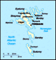
Suðuroy
Setting out early in the morning when the rain was pouring down and the winds were close to 20 m/s to sit in a ferry heading out on the Atlantic ocean didn't seem that good an idea at the time, but luckily our faith in the Norwegian weather site yr.no paid off. The ferry ride was a bit bumpy, but when we arrived to Suðuroy at nine the rain stopped and after maybe one hour we had the sunshine promised.
We didn't really have a clear plan of what to do once at Suðuroy, the southermost of the Fareo islands, so once there we walked to Tvøroyri. Tvøroyri is the second biggest town on Suðuroy, and close to the ferry. It proved to be a quite outstretched town, maybe 5 houses wide between coast and mountains, but several kilometers long. Once there we asked for directions from an older gentleman, and got two different hiking trails pointed out to us, one to Hvannhagi and one to the end of the peninsula. Apparently it was also possible to combine the two, so we decided to continue towards the end of the penisula and then possible walk from there to
Hvannhagi.
The roads took us to Froðba, the neighbour town to Tvøroyri, where we found a peaceful monument of a local poet and sat for some time resting our legs in the sun. We also found a sign pointing us in the direction of the hiking trail, an unexpected luxury. The Faroe Islands doesn't have very much signs or instructions on where to go, you will always need to either bring along some instructions on your own or ask for advice on site.
The hiking trail was taking us to the top of the hill northeast of Tvøroyri. As mentioned before it was a windy day, and we quickly realized this made climbing the hill much easier. With the wind in our back we could just spread our arms and be pushed uphill by the air. So we let ourselves get pushed past grass making waves in the wind, waterfalls unable to decide whichway to fall and an occational sheep.
At the top we took a small break, and after some recognition decided to go for the safer alternative and walk back down the same way we came up. The wind on the top of the mountain
was really strong, and we felt that it might become difficult to move around if the wind would start to blow even a little more. So we headed down again, went back to the city of Tvøroyri and found a nice pub that also served some food where we then sat for a few hours recovering from the sun and the wind before returning to Torshavn on a much smoother ferry ride. Once back there our hostess had made panncakes, so we finished the day with some tea and panncakes before
Eysturoy
Our plan was to go to Mykines this morning, but the ferry to Mykines was not running third day in a row due to weather conditions. We quickly made up a plan B, we decided to go to Gjógv, a village in the north end of Eysturoy several persons had recommended to visit. When we got on the first bus the bus driver however told us that the bus from Oyrarbakki to Gjógv didn't run on Sundays. He suggested to hitchhike the last part of the trip, so we decided to be adventurous and took the bus to Oyrarbakki anyways.
When arriving to Oyrarbakki, a
small village whose main attraction was a big bus station from where several buslines to the northern parts of the islands starts, we started to walk north towards the town of Eiði. Eiði was on our way to Gjógv, and was also mentioned in our guidebook as worth while seeing. By mistake we took a not that busy road that went through the villages along the coast instead of the road running up in the mountain and had to walk for 3 kilometers without any cars coming our way. After three kilometers the two roads joined, and within a few minutes we had a ride with a lady in hurry for church in Eiði, and arrived there ten minutes later.
We quickly looked at what Eiði had to offer and decided to move forward towards Gjógv. The distance from Eiði to Gjógv is roughly 13 km and goes between the highest mountains on the islands, so the first kilometer was a steep uphill walk. After that we were passed by a minibus with a Danish family who were going to the same place as we and gave us a ride there.
Gjógv was truely a idyllic little village.
A small stream was running through the it, the houses were cute and the cliffs along the sea stunning. We had our lunch on the basalt rocks by the sea and then headed for a walk on the hills above the city. As we still needed to get back to Torshavn we kept the walk short and then hit the road with our thumbs in the air.
After only half a kilometer we got lucky, a mother with her son going to Oyrarbakki. She ended up driving us half the way from Oyrarbakki to Torshavn as she was going to pick up her daughter, and after that we managed to get a ride almost all the way to our B&B with a guy going through Torshavn to Sandoy. I have to say that it proved surprisingly easy to hitchhike, everyone at the Faroe islands are really helpful. Also it might help that there aren't really that many other hitchhikers, so people are interested to hear what it is all about. 😊
Advertisement
Tot: 0.117s; Tpl: 0.013s; cc: 18; qc: 90; dbt: 0.0735s; 1; m:domysql w:travelblog (10.17.0.13); sld: 1;
; mem: 1.3mb