Advertisement
Published: August 6th 2007
After our day trip mission on the Bajas, Jeremy and I were very keen to do some harder-core riding and Trace wanted to do a rock climbing course in Vang Vieng, so we split along gender lines (ie left Trace by herself) and went on a week mission into some very remote areas in southern Laos.
I know our blog has consisted mainly of motorbike stories lately, but this Man Mission is the last one, and by far the best.
From Vang Vieng I could not hire a Baja, so I hopped on the back of Jeremy’s bike and we headed to the capital Vientiane and I paid in advance for a Baja for 4 days. Then Jeremy went to the guy he had hired his bike from so that his clutch cable and a couple of other things could be fixed. The guy (Fuark) is a Vietnamese motocross rider, and had a great selection of bikes. The bikes were so good that I sheepishly took the Baja I had just hired back to the place I had hired it from 30 minutes prior (the clutch was slipping a little), got a refund, and hired an awesome 2002 Baja
 Leaving Vang Vieng on the Man Mission
Our second rolled truck. Isn't it ironic that he has taken out the "winding road" sign?from Fuark for the same price. A good decision considering some of the roads we were about to tackle. Jeremy ended up taking another 2004 Baja rather than waiting for his to be fixed.
We then rode the three hours back to Vang Vieng to pick up our gear. This was a bit of a pain, because we had left our gear in Vang Vieng intending to head out on a road east of Vang Vieng, but after talking with two expats in Vientiane that have been riding in Laos for years we found out that there had been quite a bit of conflict between tribal bandits/rebels/insurgents/gangsters and the government. It is impossible to get to grips with exactly who or what is involved with these reports of “banditry”, but the guys I talked to were not prone to over-exaggeration. They quite calmly told us that we could get shot if we traveled the roads we had planned to take. As usual I tried to ask their opinion on who was causing the trouble, or if it was propaganda etc. One guy’s answer was “If you get shot it doesn’t matter who fired the bullet” (over the past 10
days one Lao person working for an NGO had been killed, and a bus had been held up), the other guy said that recently a number of Hmong had been repatriated from Thailand, and they had set up some sort of gangster outfit in central Laos. Who knows, but it did seem foolish to do the trip we had planned so we decided to head south and check out some remote areas on the Ho Chi Minh Trail.
So, because of these changed plans we needed to ride up to Vang Vieng because Trace was expecting us back, and we had our gear there, then the next day for the third time in 24 hours ride the three hours to Vientiane. Here we stopped to visit the Beerlao factory (a kind of Mecca for us), which was probably the most technologically advanced place I had seen in Laos, then headed south.
The main road south of Vientiane stretches all the way to Cambodia and is very straight and very boring. At one stage however, I was watching Jeremy wondering why he was following a truck closely without passing it, and then when I looked up I just about
fell off my bike because there were two fully grown elephants standing on the back of it reaching out their trunks to smell us. Surreal. You don’t see that in Wanganui.
That night we stayed in Pakxan the provincial capital of Bolikhamxai province, then headed east the next day towards “Kong Lor” cave that we had heard was worth a look. We were expecting a small dirt road from the main road to Kong Lor cave, but a new road is being built that will be sealed next year, so the 40km was fast apart from the 30m detours around the unfinished fords. Then we arrived at the cave and there were about six thousand Lao people?! Apparently it was the 5-year anniversary of the opening of the cave and there was a three-day festival to celebrate it. There was lots of beerlao going down, loud music, food stalls, and only five other westerners (one of which was Emily, the American girl we met at the Gibbon Experience). There were also quite a few stands with a Lao game where you hurtle darts at a wall of balloons from point blank range to win prizes. Sounds easy, but the
darts are as blunt as a spoon and fly like drunken butterflies. You may as well be throwing potato chips. The Lao teenagers love it though.
So we were expecting a ride on a 4x4 track to a little visited cave, but got a smooth dirt highway and more people than Bangkok.
Despite this, the cave was worth a visit. We hired a small boat for US$10 and entered the cave. After traveling for 7.5km, yes, 7.5km, you emerge from the other side. Amazing. World class.
Kong Lor cave is in the province of Khammoune, which I realized was the only province I had not been to during my 2003, 2005, and 2007 trips. For me it is the most beautiful. It is half covered by protected jungle, has mind-blowingly stunning limestone karst scenery, and many caves such as that at Kong Lor.
The day after visiting Kong Lor we headed west towards Vietnam on a fantastic windy tarmac road, with black karst and jungle surrounding us. Before reaching Vietnam we turned off the main road and traveled south on a winding dust/rock road. This road is near a huge dam being built in the area
(Laos has an ambition to be the “battery of Southeast Asia”). This meant that we were well dusted by trucks traveling the road, and Jeremy was just about taken out by the trailer unit of one as it cut a corner.
Before lunch I got a puncture, which Jeremy mocked me for relentlessly as during our trip in 2005 I got 4 punctures in 6 days, while he got none. The problem with this one was that the tyre irons from my Minsk tool kit were not grunty enough for the Baja. So I pushed the bike 3km to a small town and got it fixed. I only got 4km before it was flat again, this time I checked inside the tire and found the metal splinter which had caused both punctures. So after two hours delay we pushed on, not certain how tricky the roads were before our distant destination of Phin.
We felt we were making very good time because the dirt roads became hard and flat after my puncture. But then all of a sudden the road stopped and three small dirt tracks headed left, right, and straight ahead. We headed right, which was south,
and at every junction after headed in a southern direction as long as the track was bigger than a footpath. We turned back once but got to the river we were trying to find after an hour or so. We were not sure how hard the river would be to cross so checked out one spot for a while as it seemed possible and the locals were encouraging us to cross there. But the banks were pretty hectic so we decided to move on and check the rest of the river out. A couple of kms down the road we found a lovely little bridge and within 10mins were on the main dirt road heading towards Phin. However, rather than getting to Phin we arrived in Xepon (east of Phin), but that was great because we had planned to head there anyway to try the road closer to the Vietnamese border.
The next morning we left Xepon at 6.30am and took a small detour to check out the old Xepon that was bombed heavily during the second Indochina war. All that is left of the town is half a wall of the old Wat and the brick bank vault.
From there we got back on the main road and headed east towards Vietnam before turning south at “Dong”. South from Dong was fast packed gravel/dirt. After about half an hour on this road we came across a couple of km of an old rock road that had been fenced off. After half a second of wondering what on earth was going on I realized it must be a section of the Ho Chi Minh Trail that was being protected.
Because our ride on this day must have been almost all on the HCM trail, and because we saw so much evidence of the US attempts to stop it, here’s a bit of background info on the trail courtesy of a USAF website, Wikipedia, and others:
The Ho Chi Minh Trail is a road system winding along the Truong Son Range that facilitated movement of soldiers and war supplies from North Vietnam to battlefields in South Vietnam. The Trail played a key role in the Communist victory over South Vietnam. The system developed into an intricate maze of 18-foot wide dirt roads (paved with gravel and corduroyed in some areas), foot and bicycle paths, and truck parks. There were numerous supply bunkers, storage areas, barracks, hospitals, and command and control facilities. All of this was concealed from aerial observation by an intricate system of natural and man-made camouflage that was constantly expanded and replaced. By 1973, trucks could drive the entire length of the Trail without emerging from the canopy except to ford streams or cross them on crude bridges built beneath the surface of the water.
As an example of the importance of the Trail, in 1967 the People’s Army of Vietnam (PAVN) used the Trail to transport and store more than 81,000 tons of supplies to be utilized during the infamous “Tet offensive” of 1968. To prepare for it, 200,000 PAVN troops, including seven infantry regiments and twenty independent battalions made the trip south on the Trail. At any given time, approximately 100,000 people were employed along the trail as drivers, mechanics, engineers, and porters and in ground security and anti-aircraft units.
The first bombing of the Trail occurred on April 3, 1965, with two B-57 light bombers, supported by a C-130 dropping flares for illumination, flew the first “Steel Tiger” mission against the Trail. Combat aircraft of all kinds would soon
join in the attack. The rain of ordnance that fell upon the Trail peaked in 1969, when 433,000 tons fell on Laos. This was made possible by the close-out of Operation Rolling Thunder (the bombing of north Vietnam) and the subsequent availability of huge amounts of airpower for the interdiction of the Trail through Operation “Commando Hunt”. One river crossing near the border of Vietnam and Laos is credited as being the most heavily bombed spot in the history of warfare. Much, much, much more than Khe Sanh for example, which had the equivalent of five Hiroshima nukes dropped on it.
The process by which supplies were moved southward by the PAVN was extremely complicated, requiring coordination between various transportation elements and numerous transfers of cargo in and out of vehicles and wayside storage areas. Almost all movement was conducted at night in a series of short shuttles, rather than by long-distance hauling. Drivers drove their trucks over the same routes night after night, becoming thoroughly familiar with their assigned segments. Periods of high-moon illumination, which allowed travel without headlights, and low cloud cover, were exploited to avoid detection from overhead aircraft. Truck movement began shortly after nightfall and
normally trailed off about 3:00 a.m. to allow time for the unloading, dispersal, and concealment of supplies and vehicles before daylight. Although the North Vietnamese later made limited use of waterways and pipelines, their road network and trucks remained throughout the war as the heart of their logistic system. Intelligence estimates put the North Vietnamese truck inventory in Laos alone at 2,500 to 3,000 during the 1970 and 1971 dry seasons with from 500 to 1,000 moving per night, each carrying about four tons of supplies. Replacement trucks were drawn from large inventories maintained within the sanctuary of North Vietnam in the vicinity of Hanoi and Haiphong.
By 1970 the entire trail was protected by anti-aircraft guns, some equipped with radar. The PAVN’s employment of “hunter-killer” teams and tribal scouts also protected the trail against enemy incursions. By the end of the war, according to the North Vietnamese, nearly 2000 miles of the 12,000-mile trail had been camouflaged. The PAVN’s use of underwater bridges not detectable from the air, and the employment of deception tactics such as strewing gasoline-soaked rags along the trail to trick pilots into believing they had struck real targets, served to make the trail even
One of the many bombs that we passed along the way
You have to see the countryside to get a feel for how bombed the south of Laos was. Especially when you consider that there have been 35 years of scrap collecting of the bombs going on. more elusive to US air power.
The elusive nature of targets along the Ho Chi Minh Trail prompted the US to explore the application of new technology to the interdiction problem. The “Igloo White” program was the most effective, consisting of a network of sensors and remote surveillance systems (mainly dropped by planes). During the lifetime of the program, which ran from 1966 to 1971, the United States spent approximately $1.7 billion to create a network of 20,000 battery-powered sensors along the trail in Laos. The Igloo White system was vast. In the words of one Air Force officer, “we wired the Ho Chi Minh trail like a drugstore pinball machine and we plugged it in every night.”
In addition to the Igloo White program some of the more exotic ideas developed by the US for slowing movement on the Trail included dropping Budweiser beer on the Trail, developing chemicals to turn the dirt into mud, rain seeding to prolong the monsoon rains, monitoring Trail movement by developing sensors that resembled dog excrement (it was cancelled after it was learned that there were no dogs on the Ho Chi Minh Trail), and training pigeons to carry munitions, land
Yes, that is a bomb crater Jeremy is standing in
It seems that either the Yanks were indiscriminant about where they bombed, or they were taking out locals "supporting" the NVA (because I am sure if they wanted to these minority tribespeople could stop the North Vietnamese Army rolling past). on North Vietnamese trucks, and explode on touchdown (among other difficulties, the pigeons couldn’t tell a communist truck from a non-communist one).
So following in the footsteps on many Vietnamese before us, we made good time down from Dong and got to a town “Nong” at 8am. We checked out a Russian armoured vehicle of some sort and a Russian antiaircraft gun and figured we might make it to “Ta Oi” for a late breakfast. As it was we got to Ta Oi at 4pm.
Our first obstacle was a dirty great river south of Nong that was not on the map. There were no boats so we went about trying to figure out how to get across. The locals pointed us west but we could not find a crossing within 10km of Nong. So we headed east and there was an easy crossing over a river that must have been a tributary of the larger one.
From here we continued on a small but reasonable dirt road surrounded by bomb craters and pieces of UXO. There must have been a huge amount of UXO in the area just after the war, because there was a lot
left after 35 years of people collecting it for scrap.
We arrived in a small village where the topography was dominated by 500-pound bomb craters bigger than the houses. Instead of timber, cluster bomb canisters were used as piles for the houses. We could not find a road out of the village so we asked for “Ta Oi”. Funnily enough there was an old guy who said in English “No have road Ta Oi” and directed us back the way we had come. I think there might have been a road but he seemed adamant that it was no good. With a nice simple diagram he drew us a map. We had to turn right somewhere down the road we had come, then “La Beng, La Hap, Ta Oi”. They were the best directions of the day.
By asking for La Beng we found the turn off, and soon after the village of La Beng. At the top of La Beng there were two tracks, we took the left one but it turned to custard, so we took the right one and it was do-able. For a few km we were riding on small saplings/bamboo that had been
cut down. This was hard. Balance was hard work, branches got stuck in wheels etc, and we were worried that the bottoms of the chopped saplings still rooted in the ground would give us a huge puncture. It is also hard when you do not know how long a track like this will last.
After a while things got a bit easier. We were riding on the HCM Trail for sure as there were 44-gallon drums everywhere, vehicle parts, craters, and remnants of UXO. The road had two deep tire ruts for most of the way. I could imagine the Chinese or Russian-made trucks traveling this road back in the day.
Subsequent to our trip we got an email from a guy doing a masters on the Trail who had read our post of the trip on a South East Asia motorbike forum. He told us we would be one of the few westerners to have done this road, and he had only succeeded in doing it on his second attempt, and the second attempt was with a team of four people and very difficult. He said that we had most definitely been on the Ho Chi Minh
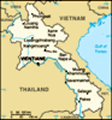
Trail, and the section from La Beng to La Hap was very important pre-1973 as it was used to supply the PAVN in a big area south of the DMZ in Vietnam. He provided us with more history on the area, including bombing data on some of the areas we had ridden (see Google Earth images). This confirmed the importance of our strict rule of not getting off worn roads or paths in the area. You can see where we traveled in relation to the Trail in the basic map I have attached to this blog.
Along the way there were quite a few junctions. The best bet seemed to try and pick the biggest track/road rather than the one heading south (towards Ta Oi). We took one road that deteriorated over the course of 30mins as it headed into the jungle. It must have been a logging road. We decided to turn around after 30 minutes (which is hard when it has been hard work getting there) and check out the other fork. This was a good decision as we were back on the deep rut type road which was easier.
It was nice and dry when
The area near the bombed village, bamboo track, jungle track, and descent to Ban Hap.
I found an old US military map that a Vietnam veteran had scanned and posted on the internet and overlaid it on the Google Earth map of the area by scaling it and matching up the rivers on both maps. The white roads are the HCMT late 1960s, you can see how our GPS tracks (yellow) follow it. we were there, but with a little bit of rain it would be a nightmare. As it was I hit a slightly wet spot on the rim of one of the giant ruts and my back wheel flicked down into the rut and I broke my clutch lever. It was a bit of a pain to not have a clutch on a road like this. Over the course of the day we would have done 15 water crossings. The track was consistently difficult, but the biggest thing was that we were a long way from anywhere of note in Laos, and Laos is itself very third world. This fact can play on your mind when you have been battling for hours into the unknown. I do not consider the other stuff we have done as particularly adventurous, but this day was.
We finally started to see a few people and then arrived in Ban Hap where we managed to find some little bottles of sweet drink. We were very thirsty as both our spare water bottles had been punctured with the vibrations of the road, and we had not been able to buy water since Nong. One guy had
Same map as previous, but tilted and rotated clockwise. This is the bombing frequency in the area. It does not include cluster bombs.
Every dot represents one bombing run by any number of planes and normally represents 20-40 bombs. The big stack represents over 2500 bombing runs. Their location just represents where they planned to drop, so its safe to say the whole area is totally saturated with bombs. The 'interdiction point' (where the photo of my broken clutch lever was taken) was hammered as it was where the main west to east section of the HCMT funnelled through a gorge. a stepthrough loaded with what looked like pieces of plane, I should have pulled out the camera but I was too intent on getting a drink. I rummaged around in a scrap metal pile and found a cluster bomb half as a souvenir, then we left. It was not the most friendly village. I later found out that 5%!o(MISSING)f the deaths due to UXO that occur in Laos happen around these scrap metal areas. I had asked the locals if it was OK to look in the pile and it was right next to a house, but it was a stupid thing to do in hindsight.
After the trip I also found out the following information on the road from Nong to La Hap: It was an important part of the Trail as it led from La Hap up to A Loui valley in Vietnam where Hamburger Hill was, and was hence used to supply all operations against US forces from Hue to Danang. Very close to La Hap there was a nasty battle involving US special forces which was a complete nightmare for the US (have a look at this link:
www.valorremembered.org/SWP_RaidOnGiap.htm). For the most part however
Nong to Ta Oi - testing
This was hard core. The track was consistently difficult, but the biggest thing was that we were a long way from anywhere of note in Laos, and Laos is itself very third world. This fact can play on your mind when you have been battling for hours into the unknown. the Vietnamese preferred to cross the river at Nong (the one with no boat) as the route from there down to Ta Oi was much easier.
The bamboo/sapling part of the road we tackled was the exact area of an” interdiction point” targeted by the US bombers, and right where it is thousands of bombs and tens of thousands of cluster bombs were dropped. There were AAA guns right there and a depot and base. The area was heavily fought over and is still dangerous. The stretch further on, after where we took the wrong logging track, was even hotter as there were some important bases in there that the US threw the B52s at. Now we are talking about tens of thousands of bombs and loads more cluster bombs. See the image included in this blog. Every dot represents one bombing run by any number of planes and normally represents 20-40 bombs. The big stack represents around 2500 bombing runs. Their location just represents where they planned to drop, so its safe to say the whole area was simply sprayed with bombs.
Around La Hap was an area code-named “Oscar Eight” by the US. It was defended
Ban Hap
Would you believe it, two Minsks in the middle of nowhere! by consecutive belts of AAA guns of all sizes that were not only stationed on the ground, but also mounted on platforms in the trees and expertly camouflaged. More American aircraft were downed in that area than any other place in Laos (100+).
Oscar Eight also favoured the PAVN because the only suitable landing zones were located in a wide bowl surrounded by jungle-covered high ground containing AAA guns and bunkered infantry. There was a base in there responsible for maintenance of the Ho Chi Minh Trail network, traffic management, road security, and the correct routing of men and supplies. The area was heavily bombed by US fighter bombers and B-52s. US AC-130 Spectre gunships also conducted night time missions there (blowing up an average of 9 trucks a mission compared to the B52s average of just over 2 trucks). US special forces made frequent insertions into the area in attempts to interdict traffic, either directly via “Hatchet Force” missions, or indirectly by calling in air strikes. The Vietnamese detected practically every special forces insertion into this area and the teams fought many vicious battles with Vietnamese security regiments in this area, taking many casualties (as in the link
mentioned above).
From La Hap the road became easier and after asking directions as usual we arrived in Ta Oi. Probably due to our poor pronunciation it was hard getting directions. You would think “La Hap”, “Ta Oi” or “Salavan” would be hard to get wrong, but it seemed as if every person we asked would point in the opposite direction of the person before them. One thing is for sure, when away from the main roads you have to ask for places close to where you are otherwise you are likely to draw blank stares (even when asking for a provincial capital).
In Ta Oi we bought out a small shop of its food and drink, and I filed a scooter clutch lever so it would fit the Baja. We probably should have stayed in Ta Oi as it was 4.30pm, but we decided to push on to Salavan, 85km or so away.
The road from Ta Oi to Salavan was a lot of fun, apart from some areas where the road was made up of ridiculously chunky rocks laid in HCM trail days.
I plunged into a deep mud-filled hole at one stage but
was helped out by a team of Laos boys as Jeremy laughed and took photos.
About 20km from Salavan Jeremy’s bike started to handle poorly. Through a combination of our mechanical knowledge we figured the most likely reason was a 4-inch nail which was likely threatening the integrity of his inner tube.
As hypothesized the nail had indeed compromised the inner tube.
In VTE I had been about to ask Fuark if we could take a spare inner, but got distracted and didn’t. Stupid. So we set about trying to fashion a patch from another tube that a local found for us. There were another 4 holes as well as the big one, so it was a bit of a mission. It seemed OK when we pumped it up outside the tyre, but when push came to shove and we pumped it up in the tyre it did not hold. So we trusted a family (that had been bemusedly watching us fix it) with the newest Baja in Laos and I doubled Jeremy to Salavan. Two km from where he ran over the nail the road turned into flat, hard, wide, about-to-be-sealed road. Murphy’s law.
So
we limped into Salavan at 9pm on one bike after 15 hours on the road and had a beer. Then we tried to find accommodation (well I did while Jeremy had another beer). But the four guesthouses I found were all full. Seriously, when does that happen in a place like Salavan? Eventually a nice lawyer who owned one of the guesthouses called the “Saise Hotel” and drove me round there to show me where it was. It was very good to have a place to crash. There were no restaurants open by then so Jeremy found a shop and we had strange bags of chippies for dinner.
The next day we started the difficult task of finding a tube big enough for the Baja’s rear tyre. Every tyre shop in Salavan pointed us to Pakse 110km away, but after some perseverance we found a tube that was too small but near enough. We then headed back to the bike hoping it was still there (which it was) and replaced the inner tube. We then rode to Tadlo waterfall and ate a lot of food and drank a number of beerlao in front of the waterfall. Lovely.
After
our day off we were ready to get back into it, and headed west briefly from Salavan before turning north onto a section of the HCMT upgraded after the US stopped bombing in 1973 (a mix of rock from the 70s and and packed dirt and sand that has accumulated since). We hit a river that we had to walk the bikes across as the riverbed was smooth slippery rocks. The bike slipped once with me and I broke the scooter clutch as I tried to hold it up. It was usable, but I had to hold it the whole time with my left fingers to save it falling out.
An hour or so later the road started to become more hectic. It would only have been possible on a good motorbike. At one stage during an easier section I got my back tyre caught in a rut hidden under some sand and went down going about 50km/hr. No problem but broke most of my brake lever off.
We got to a second river with a big destroyed bridge. It was very low, but not low enough to cross, so we loaded the bikes on to a boat
that was too small and ferried them one by one across the river. We should have laid the bikes down rather than listening to the boatman, because my one just about capsized the boat at one point. A stressful river crossing!
From the river it was a fast dirt road through the Dong Phou Vieng NBCA jungle towards Phin. I must have killed 30 butterflies, they were everywhere. Even a butterfly hurts if one hits you in the neck at 100km.
From Phin we headed back to highway 13 and stayed the night in the large town of Thakhek. Our final day of the Man Mission included a side trip to an old French tin mine that is still operating. We were back in Khammoune province, which is so stunning. The contrast between the surrounding karst and jungle and the barren polluted area of the tin mine was nauseating.
On arrival back in Vientiane we dropped the bikes back, and prepared ourselves for “Pi Mai” (the Lao new year) and the onslaught of water-throwing. The week had been challenging, adrenaline-inducing, breath-taking, stressful, incredibly rewarding, funny, physically demanding, fascinating, and unforgettable. If you have read this far, thanks
for taking part.
Mat
Advertisement
Tot: 0.155s; Tpl: 0.064s; cc: 8; qc: 24; dbt: 0.0267s; 1; m:domysql w:travelblog (10.17.0.13); sld: 1;
; mem: 1.2mb