Advertisement
Published: January 25th 2006

 Nohkalikai falls
The view from the top of the 'path'Summary: I've been scrambling down a cliff cutting my way through dense forest, trying not to get lost, to get to the base of the a stunning waterfall, met a great Khasi family and had my picture taken a lot.
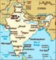
I made only three trips to this region sadly but what trips! Just a little background first. This is the wettest place on earth, Cherapunjee (the local name is Sohra - Cherapunjee is the British name) town itself held the record until a couple of years ago when the nextdoor town of Mawsynram snatched the title. They have an average rainfall of over 11m/year and mawsynram once recieved over 20m! On top of this ridiculously large figure they get it all concentrated over one relatively short period in summer! When I was there however it was the driest month of the year so the place was bone dry and had clear sunny skies. The region is home to spectacular scenery and numerous waterfalls including Nohkalikai falls supposedly the 4th highest in the world. The place also has lots of caves that are up to 6km long and some that are over 100m deep - many not fully explored I think.

 Nohkalikai falls
They don't look all that big here but trust me it is a big drop. Coming in the wet season must be a spectacular and very wet affair as relatively it's just a trickle now.First trip:
The first in the area was an organised tour where they take you to all the sights - waterfalls, caves, stunning viewpoints etc. There were about 9 of us in the group and I made good friends with two of them. A doctor who lives in Guwahati and a guy that works in a call centre in Delhi taking calls from americans - strange to actually meet someone who works in one having been put through to them so many times! The others were OK but a little rude. As is normal out there for any Indian people with a camera they wanted to have me in every possible photo they took. This I don't mind and happily oblige for people but these guys didn't speak to me or even use polite gestures and literally just pulled me across to take a photo of me in different places with them. At one point while I was showing my book to my two friends one of them just snatched it out of my hands to have a look - so I snatched it back. It just goes to show you get arseholes everywhere.
Anyway I met

 The way back
Following the dry riverbed on the way back upa lot of good people and also posed for a lot of photos that day. The only problem was the weather was misty all day so I couldn't really make the most of the views. I knew I had to come back to see things but didn't want to waste a day doing the same thing...
Second trip:
The thing I wanted to see most was Nohkalikai falls so I blagged my way onto the tourist coach and got them to drop me at the falls for a small fee. By the way the name of the falls is supposed to mean "Jump Kalikai". Legend says that after a wicked husband fed her her daughter for lunch when she found out she committed suicide.
The weather when I arrived was perfect and the photos will show the views were (in my opinion) stunning. I asked around and found out that there was a path down to them so went to see if I could find it. There was a path allright. For about the first 100m. After that you descend down what is essentially a cliff following a dry river bed (clearly not possible in the wet

 Exploring around the falls
If you took a tent and a few supplies you could easily spend a few days exploring the areaseason) and then hack your way through thick forest making your own path. Several times I considered turning back but two Indian tourists were following me so I figured if I slipped and broke something they could get help... At one point I was literally abseiling down a 12ft drop using some sort of creeper as a rope!
Near the bottom of the stream as there was no obvious path myself and the two Indian guys disagreed with me about which way was the correct route and went seperate ways. To stop me from loosing my way I had already been scratching a cross on various rocks with the walking stick I picked up on the way down. Now I was going into the 'jungle' by myself I started breaking twigs and stuff to help me find my way back - I felt like Indiana Jones but in reality of course couldn't be further from it!
I'm pleased to say that using my improvised tracking skills I found an old path from at least a year ago where the vegetation had been cut back and regrown and followed it right to the base of the falls. The two

 My Khasi friends
I met this incredibly friendly and hospitable family while exploring Cherapunjee.Indian guys never appeared and I had the place to myself for an hour or so while I had lunch and relaxed. I say I had the place to myself but in reality about 1.5km (educated guess) away people are watching the falls from the viewpoint built for tourists but it's too far away to make out anything. I considered going for a swim but the water was pretty cold and there was nobody to try and impress so I spent the time sitting in the sun.
The walk took me 2hrs down and 1hr up. It's the first time a journey has ever been quicker going up and is due to the steepness. I met the Indian guys on the way back up who made it to the stream downriver with only a partial view of the falls - much to my satisfaction. They were moving slowly so I didn't hang around and walked passed them to the top. My legs have still not forgiven for the days walking though which was in hindsight pretty bloody tough.
After I made it to the top I went 'exploring' for a while and started the 5km walk back to

 Coal mine shaft
The entrance to one of the mines - barely big enough to crawl on your belly down. God knows how long they spend down here every dayCherrapunjee where I was going to catch a share jeep (sumo) back to Shillong. After about 45mins the two indian guys passed me on their motorbike and offered me a lift. I was running a little late so accepted and jumped on the back. It turned out they were from somewhere near the border with Bhutan and were riding 600km back home the same day!
Just as a side point. I've finally had some time since I've been here to read my 'Earth' book as preperation for my masters course. Yes I realise this is reaching new levels of geekness and is even worse than the posh English guy I met but I don't care. Anyway I suddenly found myself looking down at a rock I was stood on, on the edge of a cliff, thinking to myself - 'hhmmm, looks like an extrusive igneous to me, seems to be highly mafic so probably basalt but might be andesite'. I quickly snapped out of it and went back to more rational thoughts like 'this rock i'm standing on is hanging over the edge of a really big cliff and I don't know how stable it is!'.
Trip 3:

 The muscle behind Indias industrial transport
These lorries are always highly decorated - often more so than this - and frequently have large British flags painted on them.Knowing that there was stunning scenery around Cherrapunjee and wanting to have a look around I headed back the next day taking a local sumo out to Cherrapunjee early in the morning. I spent the first part of the day having tea and biscuits with a family that invited me up (see photo). They were all Khasi people (all people in this area of Meghalaya are from the Khasi tribe) and extremely friendly. Some of them spoke a few words of english and kept telling me how beautiful my eyes and hair were. They got their cameras out and all took photos for a while - the girls (all around 19) took turns to give me their babies and have my pic taken with them! Bizarre. Eventually I said goodbye to them and headed off to explore the area. I found amongst other things lots of monoliths (essentially gravestones/tombs) scattered around the area. The biggest I saw this day was around 6ft high but have driven passed some that are about 20ft high. They are erected by the Khasi people when somebody important dies. I also came across several coal mines where you would see a small shack built

 Visibility on the way back
Believe it or not the visibility here was starting to improve as you can actually vaguely make out somethin in the road. For ages you literally couldn't see a think and he still went round corners with no lights on at a speed where you needed to hold onto your seat! And there was normally a cliff on at least one side of the car!!of stones just outside it. One of them I passed had a very young mother in it looking after the baby while the husband was loading his cane basket with coal to carry down to the road. Its a really sad situation because the mine shafts they crawl down are tiny and they probably spend all day down there working for peanuts while someone gets rich off the coal they sell. It's not a renewable source of income so will run out sooner or later and they will probably die of nasty diseases like black lung. Not that I'm an expert by any means but that is my guess.
Advertisement
Tot: 0.06s; Tpl: 0.012s; cc: 12; qc: 31; dbt: 0.0297s; 1; m:domysql w:travelblog (10.17.0.13); sld: 1;
; mem: 1.1mb


