Bangladeshi Geography, Bangladesh Geography
Advertisement
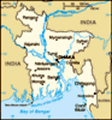
Location: Southern Asia, bordering the Bay of Bengal, between Burma and India
Geographic coordinates: 24 00 N, 90 00 E
Map references: Asia
Area: Total: 144,000 sq km land: 133,910 sq km water: 10,090 sq km
Area - comparative: Slightly smaller than Iowa
Land boundaries: Total: 4,246 km border countries: Burma 193 km, India 4,053 km
Coastline: 580 km
Maritime claims: Territorial sea: 12 nm contiguous zone: 18 nm exclusive economic zone: 200 nm continental shelf: up to the outer limits of the continental margin
Climate: Tropical; mild winter (October to March); hot, humid summer (March to June); humid, warm rainy monsoon (June to October)
Terrain: Mostly flat alluvial plain; hilly in southeast
Elevation extremes: Lowest point: Indian Ocean 0 m highest point: Keokradong 1,230 m
Natural resources: Natural gas, arable land, timber, coal
Land use: Arable land: 62.11% permanent crops: 3.07% other: 34.82% (2001)
Irrigated land: 38,440 sq km (1998 est.)
Natural hazards: Droughts, cyclones; much of the country routinely inundated during the summer monsoon season
Environment - current issues: Many people are landless and forced to live on and cultivate flood-prone land; water-borne diseases prevalent in surface water; water pollution, especially of fishing areas, results from the use of commercial pesticides; ground water contaminated by naturally occurring arsenic; intermittent water shortages because of falling water tables in the northern and central parts of the country; soil degradation and erosion; deforestation; severe overpopulation
Environment - international agreements: Party to: Biodiversity, Climate Change, Climate Change-Kyoto Protocol, Desertification, Endangered Species, Environmental Modification, Hazardous Wastes, Law of the Sea, Ozone Layer Protection, Wetlands signed, but not ratified: none of the selected agreements
Geography - note: Most of the country is situated on deltas of large rivers flowing from the Himalayas: the Ganges unites with the Jamuna (main channel of the Brahmaputra) and later joins the Meghna to eventually empty into the Bay of Bengal
Advertisement
The information here has been derived from Public Domain Sources such as the CIA World Factbook. No liability can be taken for any inaccuracies.
Tot: 0.045s; Tpl: 0.007s; cc: 5; qc: 8; dbt: 0.0116s; 1; m:domysql w:travelblog (10.17.0.13); sld: 1;
; mem: 1.1mb
 Bangladesh came into existence in 1971 when Bengali East Pakistan seceded from its union with West Pakistan. About a third of this extremely poor country floods annually during the monsoon rainy season, hampering economic development....