Liberian Government, Liberia Government
Advertisement
Country name: Conventional long form: Republic of Liberia conventional short form: Liberia
Government type: Republic
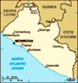
Capital: Monrovia
Administrative divisions: 15 counties; Bomi, Bong, Gbarpolu, Grand Bassa, Grand Cape Mount, Grand Gedeh, Grand Kru, Lofa, Margibi, Maryland, Montserrado, Nimba, River Cess, River Gee, Sinoe
Independence: 26 July 1847
National holiday: Independence Day, 26 July (1847)
Constitution: 6 January 1986
Legal system: Dual system of statutory law based on Anglo-American common law for the modern sector and customary law based on unwritten tribal practices for indigenous sector
Suffrage: 18 years of age; universal
Executive branch: Chief of state: Chairman Gyude BRYANT (since 14 October 2003); note - this is an interim position until presidential elections in 2005; the chairman is both the chief of state and head of government head of government: Chairman Gyude BRYANT (since 14 October 2003); note - this is an interim position until presidential elections in 2005; the chairman is both the chief of state and head of government cabinet: Cabinet appointed by the president and confirmed by the Senate; note - current cabinet positions are divided among groups participating in the Liberian peace process elections: president elected by popular vote for a six-year term (renewable); election last held 19 July 1997 (next to be held 11 October 2005) election results: Charles Ghankay TAYLOR elected president; percent of vote - Charles Ghankay TAYLOR (NPP) 75.3%, Ellen Johnson SIRLEAF (UP) 9.6%, Alhaji KROMAH (ALCOP) 4%, other 11.1%; note - TAYLOR stepped down in August 2003 note: a UN-brokered cease-fire among warring factions and the Liberian government resulted in the August 2003 resignation of former president Charles TAYLOR; a jointly agreed upon replacement, Chairman Gyude BRYANT, assumed office as head of the National Transitional Government on 14 October 2003
Legislative branch: Bicameral National Assembly consists of the Senate (26 seats; members elected by popular vote to serve nine-year terms) and the House of Representatives (64 seats; members elected by popular vote to serve six-year terms) elections: Senate - last held 19 July 1997 (next to be held 11 October 2005); House of Representatives - last held 19 July 1997 (next to be held 11 October 2005) election results: Senate - percent of vote by party - NA%; seats by party - NPP 21, UP 3, ALCOP 2; House of Representatives - percent of vote by party - NA%; seats by party - NPP 49, UP 7, ALCOP 3, Alliance of Political Parties 2, UPP 2, LPP 1
Judicial branch: Supreme Court
Political parties and leaders: Alliance of Political Parties (a coalition of LAP and LUP) [leader NA]; All Liberia Coalition Party or ALCOP [Peter KERBAY]; Liberian Action Party or LAP [C. Gyude BRYANT]; Liberian People's Party or LPP [Koffa NAGBE]; Liberia Unification Party or LUP [leader NA]; National Patriotic Party or NPP [Cyril ALLEN] - governing party; United People's Party or UPP [Wesley JOHNSON]; Unity Party or UP [Charles CLARKE]
Political pressure groups and leaders: NA
International organization participation: ACP, AfDB, AU, ECOWAS, FAO, G-77, IAEA, IBRD, ICAO, ICCt, ICFTU, ICRM, IDA, IFAD, IFC, IFRCS, ILO, IMF, IMO, Interpol, IOC, IOM, ITU, NAM, OPCW (signatory), UN, UNCTAD, UNESCO, UNIDO, UPU, WCL, WCO, WFTU, WHO, WIPO, WMO
Diplomatic representation in the US: Chief of mission: Ambassador (vacant); Charge d'Affaires Aaron B. KOLLIE chancery: 5201 16th Street NW, Washington, DC 20011 telephone: [1] (202) 723-0437 FAX: [1] (202) 723-0436 consulate(s) general: New York
Diplomatic representation from the US: Chief of mission: Ambassador John William BLANEY III embassy: 111 United Nations Drive, P. O. Box 10-0098, Mamba Point, 1000 Monrovia, 10 Liberia mailing address: use embassy street address telephone: [231] 226-370 through 226-380 FAX: [231] 226-148
Flag description: 11 equal horizontal stripes of red (top and bottom) alternating with white; there is a white five-pointed star on a blue square in the upper hoist-side corner; the design was based on the US flag
Advertisement
The information here has been derived from Public Domain Sources such as the CIA World Factbook. No liability can be taken for any inaccuracies.
Tot: 0.032s; Tpl: 0.007s; cc: 5; qc: 8; dbt: 0.0077s; 1; m:domysql w:travelblog (10.17.0.13); sld: 1;
; mem: 1.1mb
 In August 2003, a comprehensive peace agreement ended 14 years of civil war and prompted the resignation of former president Charles TAYLOR, who was exiled to Nigeria. The National Transitional Government of Liberia (NTGL) - composed of rebel, govern...