Beninese Geography, Benin Geography
Advertisement
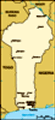
Location: Western Africa, bordering the Bight of Benin, between Nigeria and Togo
Geographic coordinates: 9 30 N, 2 15 E
Map references: Africa
Area: Total: 112,620 sq km land: 110,620 sq km water: 2,000 sq km
Area - comparative: Slightly smaller than Pennsylvania
Land boundaries: Total: 1,989 km border countries: Burkina Faso 306 km, Niger 266 km, Nigeria 773 km, Togo 644 km
Coastline: 121 km
Maritime claims: Territorial sea: 200 nm
Climate: Tropical; hot, humid in south; semiarid in north
Terrain: Mostly flat to undulating plain; some hills and low mountains
Elevation extremes: Lowest point: Atlantic Ocean 0 m highest point: Mont Sokbaro 658 m
Natural resources: Small offshore oil deposits, limestone, marble, timber
Land use: Arable land: 18.08% permanent crops: 2.4% other: 79.52% (2001)
Irrigated land: 120 sq km (1998 est.)
Natural hazards: Hot, dry, dusty harmattan wind may affect north from December to March
Environment - current issues: Inadequate supplies of potable water; poaching threatens wildlife populations; deforestation; desertification
Environment - international agreements: Party to: Biodiversity, Climate Change, Climate Change-Kyoto Protocol, Desertification, Endangered Species, Environmental Modification, Hazardous Wastes, Law of the Sea, Ozone Layer Protection, Ship Pollution, Wetlands signed, but not ratified: none of the selected agreements
Geography - note: Sandbanks create difficult access to a coast with no natural harbors, river mouths, or islands
Advertisement
The information here has been derived from Public Domain Sources such as the CIA World Factbook. No liability can be taken for any inaccuracies.
Tot: 0.023s; Tpl: 0.007s; cc: 2; qc: 3; dbt: 0.0058s; 1; m:domysql w:travelblog (10.17.0.13); sld: 1;
; mem: 1.1mb
 Present day Benin was the site of Dahomey, a prominent West African kingdom that rose in the 15th century. The territory became a French Colony in 1872 and achieved independence on 1 August 1960, as the Republic of Benin. A succession of military gov...