Advertisement
Published: July 22nd 2011
Hello everyone,
it's July which means the "big vacation" in Curaçao and time to hit the road again! As long as I'm healthy enough and have the funds to travel, I will keep doing so!
This time I chose to spend two weeks across Ecuador! It's the first time too that I went with a friend from Curacao, Giancarlo, who I know since we were teenagers. We lived in the same neighbourhood and went to school (St. Martinus Mavo) together. I think that after this trip, other friends would love to join. Actually, some are already asking what's next because they want to join and will start saving!
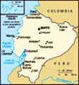
ECUADOR The country borders Colombia to the north and Peru to the west and south. It has an total area of 256.000 square km and has more than 14 million people. Compared to the rest of South America it's a small country but it offers a big variety of landscapes.
Ecuador is a so called "medium-income country" with a GDP of approx. US$ 8.000 per capita. The currency they use is the US Dollar. The country used to have it's own currency, the Sucre, until 2000. People here are very friendly,
always greeting and saying "gracias señor, buenos dias señor, a la orden señor". People told us that the minimum wage is US$ 260 per month. The impression I got because of what I've seen and heard when talking to locals, especially those working in the markets, is that they are hard working people. Women selling food at the markets usually open at 6:30 - 7:00 am and close early evening! Many times people thought we were from Esmeraldas, a coastal city where most Afro-Ecuadorians live. Others were always guessing where we're from and they mentioned countries such as Colombia, Panama, Nigeria, Cuba, Puerto Rico and Brazil, hahahaha!
Like in most Latin American countries, here you'll be confronted with poverty too: kids sleeping on the street and begging for money. It's the hard reality, you feel and actually are totally powerless to really help these people out. That's why I say and will always say: be happy with what you have!!
Why I chose Ecuador? Because it was on my list of countries I want to visit, because of the variety of landscapes and also because KLM is going to stop the direct flights between Bonaire and Ecuador later this
year! So I wanted to go before they do so.
We flew to Bonaire one afternoon and boarded KLM MD-11 in the night, at 4:30am. We flew non-stop to Guayaquil.
Guayaquil With almost 4 million people, Guayaquil is the largest and commercially most important city of Ecuador. It lies on the shores of the Guayas River. It has a warm and humid climate. July is one of the less warm months though and at night temperatures could drop to 16°C. After a very long queue to go through the immigration, we got our baggage and grabbed a taxi to our accommodation. Once we arrived we went to explore the area around the place and also bought something to eat. Then we slept because obviously we were tired of that night flight.
Once we woke up we grabbed our map and went into the city. We took the Avenida 9 de Octubre, which leads you straight to the Parque Centenario and then further to the
Malecón 2000 on the shores of the Guayas River. The Malecón 2000 is a long promenade or sidewalk, whatever you call it, along the river. It's a very beautiful place to hang out and
there is a lot to do: playground for kids, cinema, restaurants, shops etc. We got to the Malecón at the Simon Bolivar monument, then headed right. We walked all the way to the Mercado Artesanal where we bought some souveniers. From here we continued to
La Bahia. This is an area full of stands where you can buy almost anything you can imagine! No wonder we spent a long time here, we went twice! We bought a lot of stuff, especially Giancarlo went crazy, hahaha. Here we met a couple of friendly locals working at a mobile phone stand where Giancarlo had to fix something on his Blackberry. They told us about the nightlife of the city and that we should go to a place in Las Peñas.
Las Peñas and
Zona Rosa are the two nightlife areas of Guayaquil. Zona Rosa has one long street, with clubs and pubs on both sides if the street. Las Peñas is a historical neighbourhood with colonial houses and it's located along the Cerro Santa Ana (a hill). It takes you 444 steps to reach the top of Cerro Santa Ana and 56 more to reach the top of the lighthouse located on
top of the hill. Each of the 444 stairs has the number written on the stair itself. At night I couldn't believe how busy it was on the stairs of Las Peñas! We met with the guys from La Bahia here, at stair 288. Their names were Alexis, Miguel and Erwin. They treated us very well, we can't complain. We returned to Las Peñas during the day too and from here you can enjoy views of all around Guayaquil. We also visited
Malecón del Salado which is also a promenade but much smaller than the Malecón 2000. The bridge located here, the Puente El Velero, looks gorgeous at night!
Cuenca & area After Guayaquil we took a 3-hour bus to Cuenca. Driving to Cuenca, you enter the Andes mountains and at a certain point the road reached an altitude of 4.100m. Cuenca itself lies at approx. 2500m. It has almost half a million people and is a historical, colonial city. You'll notice that everywhere, on the buildings with their balconies and the streets are made with bricks which helps keeping the city's colonial look. The climate is cool, at night it reached 8°C while we were here. Many foreigners
who get here, fall in love with the place and it's people and end up staying here (starting a business or retire). Honestly, I didn't find the city to have much to do and see. We went twice outside the city. First we visited the
Ingapirca ruins, which is used to be a sacred site for the Cañari people first, and then for the Inca's. The most important building here is the Temple of the Sun, built on the highest point of the site. It was a very interesting visit and guide from a local woman. The ride to the place was too long though (2,5 hours)! The next day we visited
Cajas National Park. Here we made one photo-stop at an altitude of more than 4.100 m and we made two walks in the park. The second walk was very long and at the end, when we went for lunch, I got some altitude-sickness but I recoverd quickly after. It reminded me of the tremendous headache I got last year in Chile after descending from Cerro Toco of 5.600m. Cajas N.P was very beautiful and I'm happy I visited! Stunning views of what mother nature created. We also saw
llamas on the road. It was a cold and windy walk at times. We also walked through some woods with a lot of trees called "arboles de papel" (paper trees) because the skin of the trees come off all the time and it looks like paper. The long walk started at an altitude of 4.000m and finished at around 3.700m.....2,5 hours later!
After all Cuenca has it's own charm and I'm not disappointed that I came here. Now we're heading north to Baños and after this it'll be Quito, from where we'll fly back to Bonaire and then Curaçao.
There will be a Ecuador blog part 2 soon. Take care all!!!
Elton
Advertisement
Tot: 0.114s; Tpl: 0.014s; cc: 9; qc: 23; dbt: 0.0495s; 1; m:domysql w:travelblog (10.17.0.13); sld: 1;
; mem: 1.1mb


Andy
non-member comment
ecuador
Great pics mate! Hope you're doing fine!!!!! Big hugs from rainy Switzerland!