Advertisement
Published: February 12th 2009
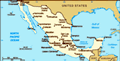
Crossing the US-Mexico border at Tijuana is a truly bizarre experience. San Diego to the north and Tijuana to the south effectively form one huge urban area but the border is centreplace to several major political issues facing both countries. The crossing into the US is one of the most stringent in the world, in an attempt to stem the flow of illegal immigrants and halt the trafficking of narcotics. In contrast, when I arrived at the border on the trolley from San Diego city centre, I simply walked through and before I knew it I had entered Mexico without encountering a single customs official or border guard, US or Mexican. The ease of passage allows Americans to use Tijuana as a party town for college students (escaping the strict American drinking laws) and to purchase cheap pharmaceuticals from the dozens of chemists in town, a controversial market-based solution to high American drug prices.
Not in need of an easy-going barman or cheap pills, Tijuana didn’t have much to offer. Luckily I was there for just one night and fortunately it was a Monday and free of partying students. There was just time to have a walk around town and
to begin using my phrasebook to augment the few Spanish words I knew, most importantly for interpreting restaurant menus. After a night in a “basic” hotel, I made my way the next day to the northern city of Chihuahua. As the journey would have taken 24 hours by bus (and I’d be spending more than enough time on buses over the next month), I opted to take a cheap internal flight.
Chihuahua is best known for cowboy boot shopping and for being the former residence of revolutionary Pancho Villa. Most importantly for me though, it was the starting point of the Copper Canyon train journey, one of my main reasons for visiting Mexico. I spent a day in Chihuahua, staying at the excellent Casa Chihuahua hostel just opposite the train station, enjoying a quiet but pleasant town blissfully free of tourists and of course purchasing my train ticket. The following morning I arose pre-dawn getting to the station in time for the 6am departure.
El Chepe
The Ferrocarril Chihuahua al Pacifico, or El Chepe for short, bills itself as the most spectacular train ride in the world. Known in English as the Copper Canyon Railway, it runs
for 655km between Chihuahua and Los Mochis on the Pacific coast, cutting through the Sierra Madre Mountains and skirting the breathtaking Copper Canyon (Barranca del Cobre), a series of canyons much larger and sometimes deeper than Arizona’s Grand Canyon.
Two trains run daily each way on El Chepe, the primera express and the clase economica - the latter leaves an hour later and makes more stops. Although the primera express is twice as expensive, it’s worth the extra cost when heading westward as you’re more likely to see the best scenery before dark. We set off in the pre-sunrise darkness and slowly made or way westwards, gradually increasing altitude and passing through several villages, including Mennonite settlements developed when members of this religious group migrated here in the 1920s. Just after passing Creel, the centre of the indigenous Tarahumara group and a popular base for exploring the canyons, the train reached its high point at 2460m and soon reached the small town of Divisadero.
The station (well, the tracks where the train stops) at Divisadero is only about 100 metres from a viewpoint overlooking Urique Canyon. The train stops here for 15 minutes to allow passengers to disembark
and absorb the close-up of the Cooper Canyon. The view is quite simply breathtaking - the canyons can be seen all the way to the horizon and 1200 metres down the tree covered slopes to the river beds of Rio Urique below. So spectacular is the view that it’s quite easy to get carried away and lose all track of time and when I made my way back up to the tracks something was missing - the train.
With the train now heading down the mountains with all my belongings (except my camera) and me stuck in a tiny mountain village, panic started to set in. The local traders gathered around, clearly amused at my predicament, and my elementary knowledge of Spanish deserted me. Luckily one of the traders spoke some English and told me a local could drive me to the next station for a small fee of 150 pesos which I immediately accepted. Fortunately El Chepe chugs along at a leisurely pace so we made it to the station, San Rafael, with minutes to spare and I re-boarded to the puzzlement of the conductor.
Relieved that my train chase had ended successfully, the next 100km or
so were the most exciting part of the journey as El Chepe gradually descended in altitude on its way to the coast. Although the train compartments offer good views, the place to best experience the trip is at the end of the carriages where you can open the upper part of the doors, lean out and soak up the vistas. In this section the train passes over and through the majority of the 39 bridges and 87 tunnels constructed for the track, travels along cliff edges and provides spectacular wind-swept mountain views. Perhaps the most impressive part is where the track makes a 180 degree turn within a mountain tunnel whilst dropping 100 feet before it descends around a stunning valley allowing you to see the track on three levels.
Eventually, the train descended to sea level and it was after dark before we arrived in El Fuerte, where I had planned to disembark. The station is some way from the town but I was offered a lift by some fellow passengers, so I squeezed into an old banger with my backpack, along with two doctors and a Mexican singer complete with cowboy hat, who dropped me off at
a hotel in town. El Fuerte is a small, sleepy but very attractive old colonial town and I spent a further day there before heading south again.
Mexico City
El Chepe is the only surviving passenger train in Mexico so buses are the primary mode of transport for the rest of the country. Fortunately there is an extensive network of coaches with several companies providing a competitive and comfortable service. The only downside is the lack of a central website to compare routes and fares which makes finding the best option difficult in the larger stations. From El Fuerte the journey south to Guadalajara via Los Mochis involved a day long bus trip. Seeing I was reading an English language book, one of the other passengers struck up a conversation with me. He had just arrived in Mexico having been deported from the US where he had lived since he was five months old. His illegal status meant that one brush with the law saw him exiled from the only country he ever knew and now he was beginning a new life in Mexico, as much of a stranger to the country as I was. It was another
reminder of the political and economic tensions that straddled the border and the lives these affected.
After spending a few days in Guadalajara and chilling out on the beach at Melaque, I headed back inland to a complete contrast - the huge metropolis of Mexico City. Known as Distrito Federal (DF), the city covers a vast area and is home to over 18 million people. Only having a few days to spend there, I concentrated on the Centro Historico, a UNESCO World Heritage site built around the Zocalo - the main central plaza which contains the Catedral Metropolitana and quite possibly the world’s biggest flag. The area around the Zocalo boasts numerous sites of historic and cultural interest, from the Aztec ruins of the Templo Mayor to the National Palace, as well as being a commercial centre with countless shops and restaurants.
I stayed in the Mexico City Hostel just off the Zocalo, an excellent and very stylish hostel. Here I was able to book a tour to the unmissable ancient site of Teotihuacan. This pre-Aztec city was built in the early centuries AD and was capital of Mexico’s largest pre-Hispanic empire. Having been abandoned and used only
as a pilgrimage site by the Aztecs at the time of the Spanish invasion, it was saved from the destruction suffered by other Aztec cities. The site’s main features are the Pyramids of the Sun and the Moon (Piramides del Sol y de la Luna), two huge and remarkably well preserved structures. Indeed the Piramide del Sol is the third largest pyramid in the world after Cheops in Egypt and the overgrown Cholula also near Mexico City.
You can ascend only part of the way up Piramide de la Luna, but this does give a great vantage point down the eerily named Avenue of the Dead, lined by several smaller structures though the view is dominated by the Piramide del Sol. Luckily it’s permitted to climb fully the 250 steep steps of the Pyramid of the Sun and appreciate the spectacular panoramic views across the whole site and surrounding countryside. It’s an awe-inspiring spectacle which only hints at what life was like in this ancient empire. Back in Mexico City, the people from the tour group hit the cantinas for some cerevezas and tequilas before heading to Plaza Garibaldi. This square is filled with mariachi bands who play songs
on request (for a little donation of 100 pesetas!), a little touristy but good fun.
The Mayan Peninsula
The southern states of Mexico, in particular Oaxaca, Chiapas and the Yucatan peninsula contain some of the country’s best attractions. Looking beyond the tourist masses at the beach resorts of Cancun and Acapulco (I steered well clear), Mexico’s history reveals itself through fascinating and very well preserved historical ruins, particularly from the Mayan civilisation, and more recent beautiful colonial towns.
Oaxaca is a charming colonial town, 6 hours by bus to the south-east of Mexico City. Like the capital, the Zocalo is the centre point of the town, but the pace and ambience here are polar opposites to DF. Oaxaca is built on a grid of narrow streets, with its colonial style buildings housing numerous restaurants, galleries and bars. It’s a great town for exploring and to hang out and relax. A short bus ride takes you to the ancient site of Monte Alban, built by the Zapotec civilisation and inhabited for over 1000 years. The location of Monte Alban is spectacular - on a flattened hilltop overlooking Oaxaca, with the heat and sunshine giving the area a dusty,
parched effect that adds to the atmosphere. Though the structures themselves aren’t as well preserved or imposing as at Teotihuacan, it is a very unique site that’s well worth the visit.
Another colonial town, Merida, the capital of Yucatan State, is the base for exploring the Mayan ruins at Chichen Itza and Uxmal. The pyramid at Chichen Itza (El Castillo) was recently named as one of the New Seven Wonders of the World and that has certainly helped to increase the visitors to the site, which was packed when I visited. This only partly detracts from the experience as the pyramid is certainly one of the most impressive single structures in Mexico, both physically are by the fact that its design represents the Mayan calendar. In addition to El Castillo, the site also boasts the ball court (Gran Juego de Pelota) where losing captains were decapitated, the somewhat crumbling Observatory and the eerie Group of the Thousand Columns.
South of Merida, the ruins at Uxmal offer a very different experience from Chichen Itza. Set in a hilly, forested region and with much fewer visitors, Uxmal is a quiet, peaceful site where you can wander around the buildings in
relative solitude and appreciate its historic nature. Highlights include the oval-shaped temple Casa del Adivino, the Governor’s Palace and the Great Pyramid, which offers superb panoramic views of the whole site. There was also a light and sound show in the Nun’s Quadrangle after dark, with a story explaining the decline of the area due to drought and the residents appeal to Chac-Mool, the rain god, to save them.
I headed further south to Palenque in the state of Chiapas and what was easily the most spectacular and beautiful Mayan site. This is largely due to its setting in dense jungle, where several buildings have been excavated and renovated in some compact clearings, but there are also some very impressive structures including the famous Temple of the Inscriptions. This contains inscriptions detailing Palenque’s history but currently visitors are prohibited from climbing it to aid its preservation. You can however climb to the top of the Temple of the Cross to see great views of the whole area, including the Palace and its renovated tower. Remarkably it’s estimated that only 4% of the ancient city has been renovated and the rest is still buried in the jungle. We went on
a short trail through the jungle, where you walk over ancient stone blocks protruding from the ground suggesting there are many more buildings to be unearthed and mysteries revealed.
Five hours by bus south of Palenque lies San Christobal de las Casas, my final stop and the jewel of Mexico’s southern colonial towns. San Christobal is surrounded by tree-lined hills and its plazas and cobbled streets are filled with great restaurants and bars. Particularly recommended is Kinoki, a small independent cinema and restaurant where you can hire a small and very comfortable screening room and play a film of your choice. The film we viewed was a documentary on the Zapatista indigenous movement, which became famous in 1994 when it occupied San Christobal on the day NAFTA came into force. San Christobal and the state of Chiapas in general have a very strong presence of indigenous peoples, seen in the wonderful markets in the north of the town where you can buy native textiles and artworks, as well as the ubiquitous Zapatista dolls and t-shirts.
I took a tour to the nearby village of Chamula which is inhabited by the Mayan Tzotzil people. We arrived early in the
morning and noticed a funeral was taking place in the village graveyard. This didn’t deter an old man who approached our group to greet us and offer us some of the local moonshine. Tasted like rocket fuel but it would have been rude to decline. We then headed down to the market in the main square before visiting the church, Templo de San Juan. The Tzotzil practice a fascinating faith which fuses Catholicism with indigenous beliefs. The church floor is laid with pine needles and the worshippers light hundreds of candles and pray to the statues of saints that line the sides of the church. Their ceremonies also involve chicken sacrifice and the use of carbonated cola drinks in the belief that burping expels evil spirits.
On my last day in Mexico I took a boat trip through the Sumidero Canyon, which provided a neat symmetry after beginning my trip in the Copper Canyon in the north of the country. This time I was seeing the canyon from below as it had been flooded by the construction of a hydroelectric dam at its northern end allowing boats to sail through the narrow fissure. The scenery along the route is
spectacular, with the vertical cliff faces rising to almost 1km at one point. There are stories that natives who refused to convert to Christianity during the Spanish conquest were thrown off the cliffs into the canyon. Several crocodiles kept a watchful eye along the canyon’s edge during our boat trip.
My journey through Mexico had been an unexpected highlight of my travels, revealing a country of spectacular landscapes and one possessing a long and complex history, which reverberates into the present day as a society with a rich, diverse culture but facing many issues as it adapts to a globalised world.
Frontiers of Travel - Inspiration and Information for the Adventure Traveller
Advertisement
Tot: 0.278s; Tpl: 0.014s; cc: 9; qc: 57; dbt: 0.0624s; 1; m:domysql w:travelblog (10.17.0.13); sld: 1;
; mem: 1.2mb