Advertisement

 D400 en route to Kas from Dalyan
heading towards the sea along the Esen Cay River valley with snow still on the peaks of the adjacent Dumanli Dag mountains.
Note: by double-clicking on any of the photos you will be transferred to the photo gallery which provides bigger images of the photos.
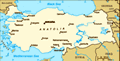
Wednesday 29th May: the big transfer to Kas. After a leisurely packing up session in the morning we headed off down the road to say goodbye and thanks to Pete and Margaret for making our stay in Dalyan so enjoyable and memorable. Then it was back to Dalyan and the 100 mile journey east to Kas, a small and scenic port that we had enjoyed visiting twice previously, in 2008 and 2010. The journey was quite easy as all we had to do was to join the D400 main coastal highway just outside Dalyan and follow it all the way to Kas and admire the scenery en route. We stopped twice, once for a picnic lunch at Xanthos (see Turkey Tour 2010 Blog 3) and again at Patara to see the amazing 2,500 year old siphonic aqueduct happily still intact (also Turkey Tour 2010 Blog 3). We arrived in Kas at 5pm and went to our hotel where the man in charge, Cercan, not only looked familiar but he claimed to have remembered
us from our stay at the hotel in 2008 (we stayed at another hotel in 2010). Having been shown to our room I noticed Cercan standing outside the hotel opposite which had an unobstructed sea view; so I went downstairs and asked him if that hotel was owned by the same people as our hotel. He confirmed that it was and that we could have a top floor room which had a magnificent view out over Kas Bay. He also politely refused my offer of help and casually carried both our suitcases (combined weight 80 pounds) down three floors and back up another three floors to our new room. What a star. After settling in we had a stroll around the town to see if there had been any changes, which there hadn’t, and then returned to our hotel for an excellent dinner.
Thursday 30th May: after breakfast in the hotel's lovely garden restaurant next to the sea we decided to take a ferry/launch to Liman Agzi an almost landlocked beach directly across the bay from Kas that we had not previously visited and which looked very inviting. So it proved. Very picturesque, no road access just a pebble
Veranda of Andifli Hotel
Wait till you see the view beach with a restaurant on it. We took a walk along a section of the Lycian Way hiking trail back towards Kas to a scenic point marked on our map. This involved negotiating a steep narrow path including a fixed rope on a potentially dangerous section. The view from the top of the path however was truly spectacular. After a look at another beachfront restaurant further round the bay where we had lunch we took the ferry back to Kas. An interesting trip as there was a considerable swell, 4/5 feet, which was causing the ferry to roll about 45-50 degrees. But the captain seemed unconcerned (the Turkish stiff upper lip?) and we made it back safely to Kas. We had a truly excellent dinner at our hotel that evening, having arranged with the maitre d’/head waiter at breakfast that we would like stuffed aubergines followed by mushrooms & spinach for Jane and shrimp casserole for Jenks: magnificent.
Friday 31st May: in the morning we departed for our next destination, Cirali (pronounced Chi-ra-lee) via an inland, scenic route to have a look at some Lycian/Roman era ruins at Arykanda in the mountains; a detour of around 40 miles This
The view
From left: Kas Harbour, Liman Agzi across the bay and Meis Island offshore involved following the D400 highway up the mountain behind Kas then turning off inland on to a very scenic country road down a steep descent with lots of hairpin bends into the valley of the Kasaba River. We followed this narrow but good quality country road along the valley and up and over the watershed at the head of the valley then down into the valley of the Basgoz River where we joined a major highway leading inland from the coast. The turn-off for Arykanda proved a little difficult to find as it wasn’t where it was shown on our map but a least 2 miles further along the highway than indicated on the map. Nevertheless we found the site and were properly impressed by its excellent state of preservation and its magnificent setting up in the mountains, well over 2,000 feet above sea level and in many ways similar to the ruins at Termessos near Antalya (see Turkey Tour 2010 Blog 1) though in better shape. We had a good look around then called in at a pension/restaurant just round the corner from the site for lunch. Good call. The proprietor was a very nice German lady who spoke
Room with a view.
Morning view of Meis Island no English, but we managed well enough by pointing to the items we wanted on the menu. The food was excellent as was the setting: outdoors in warm sunlight overlooking the valley below and the mountains beyond.
Then back to the car and the final run down the valley to Finike on the coast, back on to the D400 coast highway through Komluca (the tomato capital of the world), and finally down the narrow mountain road to Cirali and the Odile Hotel; where we had also stayed previously in 2008). Although we arrived at the hotel at 5.15pm we were told that our room wasn’t quite ready as the occupants had checked out late and they needed to prepare the room for us – only half an hour. One and a quarter hours later we finally moved in. Not a good start but the room was very nice and the location of the hotel is wonderful.
Of which more to come in Blog 4.
Advertisement
Tot: 0.334s; Tpl: 0.014s; cc: 9; qc: 57; dbt: 0.0705s; 1; m:domysql w:travelblog (10.17.0.13); sld: 1;
; mem: 1.2mb


Darren
non-member comment
Fantastic
Oh wow, your trip just looks so incredible!!! Will have to try and get there one day soon. Enjoy yourselves!! :-)