Advertisement
Published: March 7th 2017
The first of my many Maya city visits was a smashing success! I got to meet a few people on my tour, and then in the evening I met even more new people! I hadn't expected really to make new friends, but then I hadn't exactly expected to go to Caracol today.
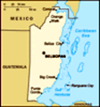
First off, Caracol is truly in the middle of nowhere. When I purchased this tour Saturday afternoon (right when I got to San Ignacio), the tour people said it was quite an adventure and worth the trip. As I've said before, I planned this trip so I could see ruined Maya cities. So this fool and his money were soon parted. Most of my time in Belize has been full of surprises because I haven't really be fully prepared for any of it. When the tour guide came to the company office (a loose use of the term, but nevertheless where business is transacted) this morning to pick me up, I was just standing there in front; no one was in the open office, and I had been there for at least 20 minutes without seeing any employees. Such is Belize. It turns out that my tour was
very small indeed - only 4 tourists and our guide. So we crammed into the SUV and set off for Caracol. Only at this point did I find out that it was a 2.5-hour drive to the site, which we would be doing post haste. It was also only 50 miles, give or take, but the road quality was abysmal for probably 80% or more of the voyage.
I hadn't eaten breakfast (TJ and I had set out for our respective tours too late to do that), so when we stopped at a convenience store about 30 minutes outside of town, I took the opportunity to buy a drink. That was a life saver. I was riding shotgun in this SUV, which meant that our tour guide - Leo - was almost constantly having a conversation with me. My other 3 travelers - Mike, a retired environmental engineer of about 70; Jill (from Colorado) and Ann (from Norwich, England), both in their mid 40s, had been friends since university and were having one of their many reunion trips - were in the back seat. Often, the two women would start a conversation of their own, so that was a
bit distracting since they were right behind me. And then they all frequently asked to go to the bathroom along the way. We made two stops after the convenience store, one of which was required. Why was it required? Because this area of Belize is susceptible to Guatemalan incursions (not military, just ordinary people). It turns out that Guatemala doesn't recognize Belize as a separate country, because Belize gained its independence from Britain, and Guatemala never recognized the legitimacy of the British claim to begin with. So Guatemalans come into Belize thinking they have a right to be here and do what they want, and they don't care too much for Belize telling them to go away without some force to back it up. The required stop, then, is around 9:30AM, at a military checkpoint. They have toilets, too. But the military vehicle with armed soldiers and a large gun on the back leads the way to the park every day at this time. So we ventured with the military escort for the remainder of the way, for about 1 hour. They also leave the park at 2PM, so if you’re not ready to go by that time, they just
leave you.
I rode shotgun on the way to the ruins, which was quite nice. I could see all the potholes and anticipate them; plus, there wasn’t much room for motion sickness. On the way back, though, I switched places with Mike at his behest – he complained about his back, so I obliged. That was a mistake for me; I hadn’t thought that Dramamine would come in handy on this trip until that ride back to San Ignacio.
Leo was a chatty fellow, and as the person riding up front, I got an earful. He was very informative, though, and he gave a good bit of information about Caracol and the Maya world while we were driving, for those who chose to hear. Needless to say, however, that the arrival at Caracol was a welcomed experience, for many reasons.
The place is called Caracol because the road up to the site is very winding, like the shell of a snail. “Caracol” means “snail” in Spanish. They were not lying about that road. But when we arrived, we had time for a bathroom break before Leo wrangled us together and began his tour. Again, it turns out
that he was our guide for the whole day, not just our driver. And it also turns out that he worked on some of the archaeological digs at the site, so he knew what he was talking about.
Our first stop was a middle-class residence near the entrance to the park. It wasn’t particularly spectacular, but I could appreciate the theater of the whole experience – building up to the grand finale, which was very spectacular. We had the occasional rain cloud, but even though I hadn’t brought an umbrella or poncho, I was never fearful of becoming soaked. We heard a great many howler monkeys in the trees, and that was dreadful the first time you hear it. But then you get used to it and it becomes part of the background noise. Jill did often want to stop and find the monkeys or birds that we heard along the trip.
Our second stop at Caracol was a semi-elite area with its own burial pyramid. Apparently one of the new fads at the end of Caracol’s existence was the cult of the one-footed god, so two guys were buried in this pyramid after their right feet had
been cut off. Post mortem, thankfully. But it was to convince the gods of Xibalba, the underworld, to accept them.
Incidentally, Leo told us that Caracol was huge, but that we would only be seeing 1% of the entire site. I thought that was going to be small, but if we only saw 1%, then this site truly is massive.
On our way to the first elite residential area of the day, we passed by a very florid area that Leo told us had been a man-made reservoir during Maya times. Apparently Leo and his friends had used it has a swimming hole during their time on the archaeological site, before the researchers determined that it might have historical significance. Fun!
We passed through a ball court next, though the hoops that one expects to see there were missing. And next was a great plaza with pyramids on all 4 sides. I thought that we had reached the end of the tour, so I decided it was time to climb some pyramids. I climbed two of them that seemed sturdy; one was in disrepair and the other had no way to climb up anyway. It was fantastic
to see the remains of walls on the upper levels. I was a bit disappointed not to find any carvings or inscriptions here. The one promising façade, I learned, was actually a reproduction that had been placed over the original to protect it from weathering.
Speaking of weathering – Leo let us know that most of the archaeology that now goes on at Caracol was of the uncover-then-cover-up variety. The pyramids that we climbed had been unearthed in the 1920s and 1930s, but now when archaeologists uncover a building, they study it and then cover it back up to avoid exposure to the elements. Erosion can be a big problem for buildings that are over 1300 years old.
Our final stop before heading back to the entrance was the Caana pyramid. Huge. It’s the one you see on all the brochures, and it was frankly a bit disappointing in those brochures. It didn’t look so big, and the brochures almost give the feel that there’s only this one building to see at Caracol. As you can read, you know that’s not the case. But their pictures didn’t do it justice. It’s so big. Three main levels, and just
when you think you’re done, there’s more steps to climb. At the top, I found my first true Maya inscription! It was quite by accident, and I asked Leo about it when we were coming down from the tippy-top of the pyramid. I told him it said “7” something, but I wasn’t sure about the other symbol. He seemed impressed that I could read that much, but the Maya numeral system is really quite easy. It turns out that the hieroglyph reads “7 Ajaw,” which is a date in the Maya calendar. It’s a cyclical calendar, as most people know, but the people apparently thought that the “Ajaw” dates were of special significance, so they dedicated most of the buildings with respect to those dates. Pretty cool stuff.
Before we left the park, we had lunch. It was a “traditional Belizean meal,” and it turns out that it’s standard fare for most of these day trips out of San Ignacio. TJ and the others were telling me that they had the same meal on the ATM Cave trip that day as well. Rice and beans mixed together, with some type of spiced chicken (most still on the bone), some
mixed vegetables, watermelon, and tortilla chips with salsa. Everything but the salsa was homemade, Leo said. I enjoyed the rice, beans, and chicken, and the tortilla chips were quite good. I don’t really like watermelon, so I passed on that, and I’m still not sure about the safety of fresh vegetables (or ice or water) in Belize, so I skipped all that, too.
We left the park around 2:30, which meant our earliest return time would be 5PM. As I mentioned earlier, I had switched places with Mike for the return trip and was rather nauseated at several points on that trip. Our armed escort left about 15 minutes before we did, but Leo said that was pretty standard (who were we to question that?). Of course, my travel companions needed a pit stop about 45 minutes into the trip, so we pulled over and let one go. About 15 minutes later, we all stopped at the military checkpoint again, and the rest of us used the very unimpressive facilities. Within 10 minutes, we were at the Rio Frio Cave. It’s more of a tunnel, really, since it has two open ends. But it’s pretty large, with stalactites and
stalagmites protruding. It’s mainly of limestone, but some granite shows up in places. I was pretty adventurous compared to the others, almost making it to the bottom of the cave itself. You start up pretty high, following the established path from the parking lot, and that path leads along the upper ridge of the interior of the cave. It does look like something out of Fraggle Rock. But there’s not really enough water to go for a full swim. Maybe some wading. Anyway, we were there for about 20 minutes before we loaded back into the SUV and made it to the Rio On pools.
I will confess that by this time, I was willing to forgo any further activity if I could get home sooner, and be off that infernal road. And get a good shower. It only took about 10 minutes to reach the pool destination, but Mike and I both said we were fine without swimming. I hadn’t even brought a swim suit on this trip (remember that this particular tour was a last-minute decision, after I got to Belize). The two ladies, however, had brought a change of clothes. Damn. We walked another path to
find a place that looked a lot like the area around Watson Mill Bridge near Athens, GA. The water wasn’t too cold, so I’m sure it felt nice for those who took the plunge. Again, I led the way to the waterfall area, out into the middle of the “river” and across the connecting rocks. We were probably there for 25-30 minutes, and the ladies never changed out of their clothes. They both sat for a little while, and Jill dipped her feet into the water for a few minutes. But that was it. I didn’t want to be rude, but suffice it to say I was happy when they came to the decision that it was time to return home. Finally.
There’s not much else to tell about that trip. We made the final hour or so back home, arriving about 6:20PM, or about 80 minutes later than expected. I was the last to be dropped off, and even Leo remarked how it was later than normal. Not for my lack of trying, I might add. It really was a good tour, and Leo was an excellent guide, but I don’t know if I would’ve signed up for
it if I had been made aware of how long it would take to get there. I’m glad I did it – don’t get me wrong. But I don’t know if I would ever go back with the road in such a state of disrepair.
Back at the Guest House, I walked up the steps to find none other than TJ sitting there, staring at his phone. It wasn’t because he loved me that he kept hanging around that area. As it happens, he couldn’t get the wi-fi in his room! So he was coming out to the front porch area to get some internet time. I just laughed when I saw him, thinking he must’ve been there for hours. But he hadn’t gotten back too long before me. And we were both quite hungry and wanting showers. So after we got cleaned up, we went looking for food. I had been recommended to try Crave, so we set off with the GPS in hand. That was a waste of time. We couldn’t find it, and I’m convinced that Belize is actively plotting against the success of Google maps. So we walked back to the main tourist road –
it’s pedestrian, so it’s easy to find. The thought did arise that since it was Sunday night, many places might not be open.
We did find a place called Eva’s – TJ had eaten a breakfast burrito there this morning before leaving for his tour. Dave, one of the guys from TJ’s tour, was sitting at a table out front with another fellow, so we stopped to talk to them. A waiter came by, so we inquired about the location of Crave – he told us it was basically where we had been looking, but that it probably was closed. Oh well. We were invited to join these two guys at Eva’s, so we did. The food was okay – I got a chicken steak with Dijon potato – and the conversation went back and forth between politics, sports, and our respective tours of the day. We were there so long. The food took probably an hour to get there. I think we didn’t get back to the Guest House until after 10PM, almost 3 hours after we left. I suppose a good time was had by all. Before we went to our bedrooms, TJ and I decided to
meet up around 8:15AM and get some breakfast before heading over to the nearby Maya ruins of Xunantunich.
Advertisement
Tot: 0.087s; Tpl: 0.023s; cc: 12; qc: 27; dbt: 0.0478s; 1; m:domysql w:travelblog (10.17.0.13); sld: 1;
; mem: 1.1mb


")


