Puerto Rican Geography, Puerto Rico Geography
Advertisement
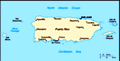
Location: Caribbean, island between the Caribbean Sea and the North Atlantic Ocean, east of the Dominican Republic
Geographic coordinates: 18 15 N, 66 30 W
Map references: Central America and the Caribbean
Area: Total: 9,104 sq km land: 8,959 sq km water: 145 sq km
Area - comparative: Slightly less than three times the size of Rhode Island
Land boundaries: 0 km
Coastline: 501 km
Maritime claims: Territorial sea: 12 nm exclusive economic zone: 200 nm
Climate: Tropical marine, mild; little seasonal temperature variation
Terrain: Mostly mountains with coastal plain belt in north; mountains precipitous to sea on west coast; sandy beaches along most coastal areas
Elevation extremes: Lowest point: Caribbean Sea 0 m highest point: Cerro de Punta 1,338 m
Natural resources: Some copper and nickel; potential for onshore and offshore oil
Land use: Arable land: 3.95% permanent crops: 5.52% other: 90.53% (2001)
Irrigated land: 400 sq km (1998 est.)
Natural hazards: Periodic droughts; hurricanes
Environment - current issues: Erosion; occasional drought causing water shortages
Environment - international agreements:
Geography - note: Important location along the Mona Passage - a key shipping lane to the Panama Canal; San Juan is one of the biggest and best natural harbors in the Caribbean; many small rivers and high central mountains ensure land is well watered; south coast relatively dry; fertile coastal plain belt in north
Advertisement
The information here has been derived from Public Domain Sources such as the CIA World Factbook. No liability can be taken for any inaccuracies.
Tot: 0.021s; Tpl: 0.008s; cc: 3; qc: 2; dbt: 0.0022s; 1; m:domysql w:travelblog (10.17.0.13); sld: 1;
; mem: 1.1mb
 Populated for centuries by aboriginal peoples, the island was claimed by the Spanish Crown in 1493 following Columbus' second voyage to the Americas. In 1898, after 400 years of colonial rule that saw the indigenous population nearly exterminated and...