Advertisement

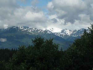
 Seven Sisters
Seven SistersGeo: 58.4387, -129.989
For those of you just joining our travelogue, here's the link for our Spot GPS tracking device to see our location real-time: http://share.findmespot.com/shared/faces/viewspots.jsp?glId=07vjbVTduHMWhprc04JGBEuC6AyXsumvk
It started raining pretty hard as we ate breakfast in the motel dining room in Smithers. The storm passed long enough for us to pack up and head out of town around the Seven Sisters. Ominous clouds threatened all day, with rain squalls and heavy black clouds all around us. Temps stayed in the upper 50's.
We stopped in Kitwanga at the base of the Seven Sisters mountains, the start of the Stewart-Cassiar Hwy 37 north. From this point on it was a spectacular ride through the wilderness of British Columbia. The mountains, rivers, and valleys were a visual feast, in spite of the ominous black clouds the covered most of the sky.
At Meziadin Junction, where 37A, the road to Hyder, AK, splits from 37, we were expecting to find gas (according to Google), but there was none there. Fortunately we had enough to continue another 60 miles to Bell 2 Lodge. After being swarmed by mosquitoes at the gas pump, we decided to make it our lunch stop, warming up on soup and
coffee.
Even with several layers, we were starting to feel the effects of the cool temps. We stopped in Iskut, 60 miles south of Dease Lake for coffee and put on our rain suit jackets for the remaining ride, with the dark clouds growing heavier to the north. Surprisingly, for the length of the entire day's ride, we never had more than of few minutes of light rain hit us! As we finished unloading our gear from the bike at our motel, a downpour mixed with hail lasted for about an hour.
Until recently there were long stretches of gravel roadways along Hwy 37. We enjoyed pavement and chip-seal for the entire route except for a few short stretches of gravel (and mud) just south of Dease Lake. Overall, the route was a wonderful motorcycle odyssey - decent roads, virtually no traffic, with amazing scenery and vistas.
Dease Lake is not the resort community we were expecting. It's pretty much a stopover along the highway with a few eating establishments, general store and gas station. We enjoyed our "day off" from the road, relaxing and hiking to the nearby lake. In retrospect, we would have been better served to stay

 The start of Hwy 37
Kitwanga intersection of Hwy16 and 37the extra night in Smithers.
So far, we've logged 2,145 miles for the trip.
Advertisement
Tot: 0.233s; Tpl: 0.011s; cc: 10; qc: 49; dbt: 0.0454s; 1; m:domysql w:travelblog (10.17.0.13); sld: 1;
; mem: 1.2mb

 Seven Sisters
 Dark clouds throughout the day
 The start of Hwy 37


Steve McK
non-member comment
Looks like some beautiful country. Canada is a good place for you to be this week. Sacramento has had 6 days over 105. Is the Alaska Highway a different route?