Advertisement
Published: September 5th 2016
At 2599 m Grauspitz is Liechtenstein’s highest mountain and one of the most arduous and sketchiest peaks I’ve tackled. What you might just be able to make out on the summit photos are my violently shaking legs knowing that I have to get down again. A sheerer than sheer ridge followed by pathless seemingly vertical scree dropping into oblivion. Spoiler alert: I made it down alive. Though for a few days texting was painful due to the thistle spines in my fingertips as grabbing the spiky beasties was often all that prevented certain doom.
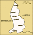
Why visit Liechtenstein? Well my train passed within sight of it so it seemed rude not to get off and have a look. As for why I was in Switzerland; see the previous blog. Unlike everyone else on the bus to Vaduz, Liechtenstein’s capital, from Sargans railway station in Switzerland who were planning on being there for an hour or so, I had my bags with me and intended to stay for a whole two nights – perhaps a record for a visitor to this little land.
The other people I met in the hostel (I only met
three – an American and two Australians if that matters – but 100 % of them had this view) admitted that they were purely in Liechtenstein as a country counting exercise. Though they also all now admitted that they unexpectedly rather liked it. It’s a lovely place which is easy to just wander around in. So easy in fact, that the day I left, I wandered into Vaduz from the hostel location closer to Schaan. Then kept wandering out of the other side because I was enjoying wandering (I was only away a week so was travelling pretty light with a small-ish rucksack). I soon found myself on the banks of the Rhine and kept wandering all the way to Balzers. A quick glance at a map indicated I had walked more than half the length of the country in a morning in my flip flops.
Other than strolling about, which was thoroughly pleasant, my aim in visiting Liechtenstein was to climb Grauspitz, its highest mountain. Though not as high as the mountains in neighbouring Austria or Switzerland (both of which are themselves landlocked, making Liechtenstein one of the only two “doubly-landlocked” countries in the world –
surely reason enough to visit!), Grauspitz was still high enough and tricky enough to make it quite a challenge. In fact, far more of a challenge than I expected. I nearly gave up several times!
I have a book called “Europe’s High Points – Reaching the summit of every country in Europe” which describes a “ludicrously exposed ridge, very loose rock and sheer drops” and suggests climbing it from the Swiss side, as do all the other internet references I found which also recommend not doing it alone, except one which climbed up from Liechtenstein and down into Switzerland over two days. Given time restraints and the unsubstantiated feeling that “David knows best”, I was going to attempt it in one day, on my own, up and down from the Liechtenstein side. How hard could it be?
It started well, the bus was punctual to the minute, getting me from Vaduz to Malbun and dropping me off at 1600 m at 08:42, it then took me an hour and a quarter to get to the Pfalzer Hut at 2108 m which was half the time the yellow sign indicated. I reached the Barthumeljoch Pass
 Chamois
That ridge he/she is on is about a foot wide. They seemed to be mocking my nervous ridge-clinging.at 2305 m in not too much time first crossing into Austria then into Switzerland, with fantastic views all the way, and was thinking this climb would be easy and I’d be back in Vaduz in the early afternoon. Then I realised it was quite a big descent to Ijes farm at 1940 m before climbing all the way back up the other side to higher than I currently stood. This seemed unavoidable though the route description I was following said they had managed to skirt around the valley side then around the back maintaining altitude. Such a traverse not only looked like adding significant distance but was also across occasionally very steep pathless slopes. I didn’t fancy it – which was a bit worrying because the author of the route description passed over it in a sentence, saving the warnings for what was to come later.
I took the direct route preferring to stick to the path which was initially a steep loose descent then flat and through the farm. Here the path ended. I jumped electric fences to get to the bottom of a grassy ridge I knew I had to climb. It started ok
as I zig-zagged up the ever steepening slope though I had to stop often for a breather. Nearer the top of the first section I occasionally had to use my hands to grab clumps of turf to haul myself up. This is when I first started having doubts. It wasn’t too bad to ascend but how was I going to get back down this? I was having an argument with myself saying it was currently ok to continue so why not continue, I hadn’t gone far enough to turn back, while another voice said this wasn’t a rocky slope that I could turn around and down climb, it was slippery grass with little to hold on to. Halfway up there was a little plateau with a heart-shaped pond where I stopped for a bite to eat. Running down from this pond was a mostly dry stream that looked like a much easier way to get up or down to or from this point. That settled it; I could later descend the stream and wouldn’t have to go down that grassy slope, therefore, I would carry on!
The next part of the ridge had a trace of a
path which I followed as it steepened and narrowed. It actually narrowed rather a lot to the point where you really didn’t want to look over the edge to the right but occasionally had to as the only way past some of the rocks was to get very close to that edge. Again this was slightly worrying as the route descriptions only describe this ridge as a tough prolonged climb, not that there is the risk of dropping 75 m vertically one way or 100 m bouncing down the rocks on the other – again all the warnings are for the final summit section.
At the top of this ridge there is a T-junction with another ridge that climbs to Hintergrauspitz, which is a bit lower than Grauspitz though is still a healthy 2570 m. It looked a much more extreme ridge than the one I’d been on and apparently that is easier than getting to Grauspitz hence it is apparently much more frequently climbed. This point gave me the first proper view of my target summit and this time I decided there was no way I was climbing it. From where I was standing the peak
Descent to Ijes Farm
The grassy ridge I talk about is the one up and right of the farm. Grauspitz summit is the left of the two peaks at the right hand end of the horizon ridge. seemed to be at the top of a vertical face of more than a hundred metres (see photo). There is no path, you have to find your own. The book recommends climbing Hintergrauspitz then making your way along the knife-edge ridge. The internet route I was following says this is suicidal, just go diagonally right up the face. The arguments again started in my head: “Just go down, it’s been a nice walk so far and sufficiently strenuous, be content just to have spent time high in the mountains.” “But you haven’t achieved anything yet, you have to get to the top of something.” “Forget it, that idea to climb the highest mountain in every country in the world has long since been forgotten.” “When will you have chance to climb Liechtenstein’s highest mountain again?” “You haven’t seen anyone for hours, nobody knows you are up here, it’s your sister’s wedding on Friday, you’re halfway through a PhD, and you have someone at home who you’d like to safely get back to.” “OK, you’re right, but I don’t want to have lunch in this precarious position so I’ll just go onwards a bit to the bottom of the slope by
Route to Grauspitz summit (the peak in the middle):
Drop from this t-junction down to the snow then where the snow reachest highest up the slope head diagonally up towards the summit aiming to hit the ridge where the solid rock reaches down the furthest (for something to cling to rather than scree). It seemed impossible from this view and only a bit better when up close. that snowy patch (maybe the slope won’t be so steep when I get close up to it).”
And it wasn’t. After dropping down to the snow I started diagonally up the scree which was quite blocky so didn’t slide too much – though I still had no intention of going to the top. Soon I was quite a long way up and started wondering if it was actually possible. Unlike the earlier grassy slope, I thought I could just slide and jump down this scree if necessary. To be more safety-conscious though quite pessimistic I put on my red rain jacket thinking at least if I did fall I would be easier to spot amongst the limestone than in my white t-shirt. The concave slope got much steeper as it got higher and soon I was picking out the solid outcrops to give something to hold on to. I got to the top of the ridge too early then had to get along it. The drop on the other side was ludicrously dizzying and the top of the ridge actually overhung it. But I couldn’t edge away from it because that would put me back onto the
Final scree ascent to the summit
Not quite as steep as it looks from afar but getting steeper as you get higher. scree which was now too steep to traverse without something to hold on to. Legs were shaking, arms were shaking, but I was now convinced I would get to the top while still repeating out loud “what are you doing you shouldn’t be here, what are you doing you shouldn’t be here”.
And somehow I did get to the top! Though I didn’t linger, even though the view in all directions was incredible. The summit was long and thin, about the width of a table, so I had to sit down lengthways and daren’t let go of my bag. I had two bites of lunch but couldn’t eat anymore knowing I still had to get down.
The descent was divided into stages and I just kept telling myself; “go slowly, the last bus isn’t until 11pm, it’s not going to rain till 5pm, so there’s no rush”. Stage one was just getting back to the top of the slope; “don’t look left, don’t look left”. Stage two was going backwards down the rocky bit to the top of the scree. Stage three was sliding down the scree. Done! The grassy ridge which had made
Vaduz Castle
Home of Liechtenstein's royal family me tremble on the way up seemed like nothing after that top part. Lunch was scoffed and I was soon negotiating the electric fences with a massive smug grin on my face ready for the climb through the screeching marmots back up Barthumeljoch Pass.
Here I met a Swiss chap who looked as old as the mountains armed with a big stick, a pipe, an ancient rucksack, and some pre-war looking boots. I told him I had just been up Grauspitz and it had been quite an ordeal. His response; “No not Grauspitz – it is easy!” They make them tough around here.
It started raining on the way down at precisely 5pm and I soon realised it would be touch and go to make the hourly bus. Therefore, I ran quite a bit of the descent towards Steg. I missed the bus by 6 minutes – if only everything here wasn’t so punctual! Thus I had to wait in a shelter in the rain for nearly hour. The whole walk took 10 hours and was hugely rewarding. Would I recommend it to others? Perhaps not.
Unwittingly, I have now stood
Grauspitz summit
Proof it was me up there. on the highest point of many of the world’s tiniest countries; Monaco, San Marino, Malta, Andorra, and now Liechtenstein. Continuing this trend is one day going to see me marooned on top of St Peter’s Basilica in the Vatican!
Advertisement
Tot: 0.092s; Tpl: 0.023s; cc: 14; qc: 28; dbt: 0.0595s; 1; m:domysql w:travelblog (10.17.0.13); sld: 1;
; mem: 1.2mb


michelleandkev
Michelle & Kevin Cavanagh
Big mountain in a tiny country - well done!
Such beautiful photos - thanks for sharing. And congratulations on a climbing job well done! It certainly would be too much for the likes of me but then again I'm a lot older than you I guess. Cheers, Michelle