Advertisement
Our very first time on the African Continent! Only Australia and Antarctica left to go.
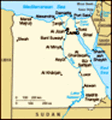
Pulled into this dry, dry desert port early this morning and we were ready to hit the bus by 8:00am for an expected long (12 hour+) tour day. We were driving 140 miles to the city of Luxor (known as Thebes in ancient times) to see the Valley of the Kings and Temples of Karnak located on the opposite banks of the Nile River.
Until we reached about 30-50 miles from the Nile, the landscape was bleak. Very little vegetation, not even cactus nor tumbleweed type plants, could be seen. Really no communities could be spotted for over 2 hours of riding. Here and there were a few shanties that the guide said were built by the Bedouins who wandered the area. I can’t imagine anyone crossing this land on foot, or horse/donkey, or even camel.
Besides the boring scenery, all along the way, the bus was forced to slow down for speed bumps on what you would think, by looking at the width of the road, are major highways. The speed bumps also slowed you down for police check points. After being
in Egypt for the last 6 days, and having gone through a great number of these check points, we still don’t understand their purpose. When we asked the tour guide, she responding by saying they take down your license plate numbers, which makes no sense. They are really an annoying condition of driving the Egyptian roads---major, what we would call 4 lane highways are squeezed into one lane each side to go over speed bumps and through check points that have a half dozen police standing around, but don’t seem to “check” anything that we could see.
Finally, we came close enough to the Nile that irrigation can take place, so the land now has communities and farms with truck garden size plots. Both sugar cane and wheat are being harvested now. The wheat was being cut and then tied in small bundles and left in the fields to dry. Stacks of sugar cane are piled high onto small cart and trucks. The ends of the cane look like they are pulled from the ground and not cut as we do. Of course, we now use huge harvesters in the cane fields and it is not cut by hand
at all.
The houses are made of brick (some a mud-wattle type brick) and concrete with rebar sticking out of the roof. Apparently, there is a hefty tax that is paid on your house if you finish building it, so no homes are ever “finished.” You also add floors to the house as your family size increases; one floor for the male children and one floor for the female children. So, village after village has these multiple rebar “antenna” sticking out of the top of brick columns on all the buildings. Animals are everywhere now—donkeys, small horse carts, sheep, and long haired goats loose with a shepherd watching.
Drove into the city of Luxor and crossed to the west bank of the Nile River. As we crossed over on the bridge, we looked down on all of the boats docked ready for tourists to take a cruise down to the Aswan Dam.
Culture, religion, and life in Thebes (Luxor) reached its peak in the 15
th century BC. It is here that the dynasties of Pharaonic Egypt for over 400 years had their center of power and where they were buried. The west bank of the Nile is
where the mortuary complexes and the Valley of the Kings were carved/built.
We first came to the ruins of the massive Temple of Amenphis III and the Clossi of Memnon which are two large faceless remaining statues. We then drove to, and then along, the Theban Mountains and looked from the bus windows at the Temple of Queen Hatshesut carved from the limestone cliffs.
We then drove into the mountains, past the home English Egyptologist Howard Carter, used while excavating the tomb of King Tut, to look at the tombs of all the kings that are dug, into the hillsides of a narrow limestone canyon. Of course, we were forced to walk through all of the sales stalls to get to the main entrance where we caught a rather dilapidated elephant train to take us uphill to the tomb cluster.
Not what we envisioned at all, with the use of the word “Valley”! All the tombs are clustered along an area no more than a half mile long and from where we stood, no more than 150 feet wide from King Tut’s tomb to Ramses III’s tomb. The elaborately painted walls and ceilings covered in hieroglyphics in
the tombs themselves did not disappoint.
Before we were given free time to explore the caves, the tour guide told us the history and said that she recommended visiting at least three of the tombs. I went into both the recommended tombs of Ramses the II and III, and Valerie also walked into one further on up the hill.
The three tombs were generally the same with a long hall from the entrance of about 5-6 feet across and 30-50 feet deep. It was so bleeping hot that that was all I could manage—even if it was cooler inside the tombs. The high walls of the canyon stopped any air movement and it was like you were being baked. We were required to leave our cameras on the bus so no pictures were taken of the site.
After evading the hordes of vendors, we got back on the bus and then rode to a restaurant for a buffet lunch. Although Valerie recognized the hotel chain as one that had fancy branches in Germany, the buffet was not the quality you would expect from a 5 star hotel.
Everyone piled back into the bus and we rode
along the eastern bank of the Nile and then did a very quick drive-by of the Luxor Temple. With luck and a move into the stairwell, Valerie was able to get some pictures that did not have our seatmates’ heads in them.
We then drove about a mile to the huge Temples of Karnak which were built over a period of 1500 years (1539-1186 BC). Every pharaoh added something to this temple and it was the most important symbol of the Empire during this time. We were very impressed with its massive high carved pillars, carved statues, and vast size of the complex. Valerie was able to get lots of pictures here and if you are interested you can go to this site for a virtual tour:
http://www.360cities.net/image/temple-of-karnak-luxor-karnak#10.70,-11.70,70.0 or
http://dlib.etc.ucla.edu/projects/Karnak/experience for a little more detail.
I was able to walk through more of this temple complex than I expected, as by the time we got there, the sun’s position was such that there was lots of shade inside and a bit of a breeze kept it cooler.
Tired now, but feeling good about the day and what we saw, and thankful we had an air conditioned bus
to ride in back toward port. We traveled a different route back that followed a canal out of Luxor, but still had police checks and speed bumps every so often.
It was really interesting to watch the people and observe their life along the way. We did spot a few black and white kingfishers on wires over the canal and lots of animals being ridden or driven. The harvesting continued even as dusk fell. When some of the side “roads” intersected the road we were on, there were often “mini-markets, “mini” coffee shops, and “mini-mosques” complete with washing facilities necessary to cleanse themselves before prayer.
Unfortunately, we had to leave the interesting life we saw along the canal and head back into the desert that stretched mile after mile until we finally arrived back at the ship at 10:00 pm. Ate a quick dinner and then hit the bed.
Advertisement
Tot: 0.083s; Tpl: 0.013s; cc: 13; qc: 27; dbt: 0.0447s; 1; m:domysql w:travelblog (10.17.0.13); sld: 1;
; mem: 1.1mb


")


Jon
non-member comment
Memories
Brought back memories of our trip there in November last year. Check out our blog at http://www.teachorbeach.com/