Advertisement
Published: August 12th 2008
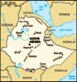
From Bahir Dar where we are based we took a chartered van to Lalibela an arduous 10 plus hours of driving on bad roads, along the way we hit a hailstorm that lasted a good 10 minutes. We finally made it to town of Lalibela and checked in at the Green Olives hotel. We made a deal at reception since it is not peak time, 3 of us shared a room, me Craig and Sam. We talked to some people about hiring guides that will not over charge and Bod found one for the group. Dinner at the horel then off to bed after a few St.Georges.
The next morning we strated our tour of the rock hewn churches, I should have listed all the names now can't remember them in sequence so just enjoy the photos as I havent a clue which is which. 5 churches during the morning and another 5 or 6 in the aftrenoon, quite funny, you are allowed to use flash indoors but the priests have to wear sunnies to protect their eyes. Lots of very old manuscript not well protected, a shame as these are more than 500 years old, hopefully the government will
 GONDER
FASILIDAS CASTLEdo something about it in the future.
Early departure to get back to Bahir Dar. Rained constantly when we arrived back, 4 in a room once again, me chris, jack and Craig. The next morning left earlish again to head to Gonder, we are staying at Tarara Hotel which is a dump, we pitched our tents in the back, toilets are abyssimal and staff rude and annoying. We toured the Dashen beer factory in the afternoon, free beer one each though and no free shirt as promised!!! Jackie and Chrissie spent the day looking for the best trip to Axum for the group, Di once again failed us here, we are left to our own devices, I wonder how much worse she could be until Egypt!
The next day we finalized our trip for Axum and then did some food shopping with Jo and Jackie, a young kid lead us to the market and helped us carry our groceries, we gave him a tip as he was helpful rather than a nuisance as we are discovering that most kids that approach you wants something. This country is stunningly beautiful unfortunately the touts are relentless, probably the worst in
AXUM
NORTHERN STELAE FIELD Africa in my opinion, you, you, you, you, give me something.....I wonder if all the UN help had spoiled them, before we came there were news of Famine here but we did not see any, the country is green and full of pastureland, maybe we did not go to the affected areas??? In the afternoon, Craig and I visited the Fasilidas Castle, quite impressive, even Craig from Scotland (lots of castles)was amazed. Then hired a tuk tuk to go to the Bath. There was a guide but he talked too fast, so we gave him a meager tip. Spent the night packing for our trip to Axum, Me Craig and Jack will do the Simien trek as well so I gave specific instructions to Jack what to remind the hired chef, bring the tent etc... hopefully he remembers them all...
Next morning early departure, 12 hour trip on bad roads, once we got past Debark the mountain scenery was mind blowing, zig zagging through the Simien range it was breathtaking but made me nauseous cause of the constant turns up and down hills. It seems to take forever then we arrived finally, and booked ourselves at the Africa hotel,
once again Gary and Jackie handled the room price negotiations, and we got discount again as it it not peak time. We hired a guide and toured the attractions, the most intriguing of course is the chapel dedicated to the Ark of the Covenant where supposedly it is being kept here, we are not allowed inside, but we saw the priest guarding it. After the tor was finished we all met up for dinner with Ross and Bod our friends from Addis, then checked out the local bar scene later that night, half of the town was without power including our own hostel so when power came back on we went to this bar, had a few drinks but then decided to leave when the local guys dancing in the dance floor started asking us to join them, I have never been asked by a guy to dance with them so all felt homophobic and made a quick exit leaving Gary who was still trying to finish his drink.
Nine hour drive back to Debark, where we all stay to do the Simien Mountain trek, most of the group will do a half day trek the next day while
me and Craig and Jack will do the 3 days 2 nights. We drove to the registration office of the Park and saw Jack walking having just signed us in. I wasnt feeling very well having the shits since Axum, must be that bin bread(local sour dough tripe looking thing)that is served in local cuisines. A bit worried that it might ruin my trek so was careful not to eat too much. We me tour cook and guide and ranger guide(with gun). We were told we leave at 8am tomorrow, and JP a Frenchman asked Jack if he could join our trek since he was alone, he seem to be a nice guy so we said yes.
Next morning the half day trekkers left on time while we sottd witing for transport for the Sankebar camp til 11am, mix up made by the guy in Gonder we booked it with, i was so pissed I started yelling at the cook as he was given instructions to organize all for us, anyway we eventually left, picked up by the same van that took our friends for the half day trek. Drove into the park, again spectacular views, more than half
hour later we are at the park entrance and we got fropped of halfway throught the 1st camp and took a walk along the road where baboons are feeding, it was bright and sunny then 15 minutes later clouds and fog came in and started to drizzle, we arrived at the Sankebar camp, quite chilly we set up our tent quickly and had lunch, rain started pouring down, we have to wait in the hut, along with us is 3 ladies from Spain who invited us for a game of pictionary to kill time. When the weather cleared up Jack and Craig and I started to trek to various viewpoints, and our lazy guide stayed in the hut, The view was breathtaking, a tad bit windy but as it clears up you can see the mountain ranges. Had an early dinner then called it a night, we werent really that sleepy so the 3 of us in the tent just having nonsense conversations, Jack entertaining us to no end.
Bright sunny morning woke us and after breakfast started our long trek up to Geich campsite, before then we visited a beautiful waterfall that flows all the way down to
the town of Debark. Spectacular scenery again, then up and down hills we went Jack struggling mightily carrying his rucksack rather than a poor donkey do it for him, we crossed a river, well a creek at that time it was freezing cold water, we collected some water for we were running low on supplies, JP had tablets to make the water drinkable. Eventually we made it near the camp, we stop for lunch, we were given sandwiches, unfortunately for Jack who is a veggie it was tuna but he decided to eat it anyway as he was starving. An hour later we got to the Geich camp, we are the only ones there, the clouds started rolling in and getting cooler, we set up tent right away amidst windy conditions. After a good lunch we had a nap, then the rains came. Jack woke up and decided to start celebration for harriet's birthday,he brought a bottle of whiskey with him, JP joined him then we eventually joined in the fun, we all sat in the smoky hut as the rain started puring down, after dinner at 530pm! we hung out a bit and had whiskeys for Harriet then off
LALIBELA
PRIEST WITH SHADES to bed, good timing as just as we made it inside, hailstorm started, it was to go for maybe 1/2 hour, we feared the tent might collapse on us but luckily not, JP was soaked the next morning poor lad did not sleep well all his things wet as his rented tent soaked through from the bottom. After breakfast off we go again.
We try to get to the top of a viewpoint about 3900 plus meter above sea level, very misty cloudy day quite difficult trek for me as my heavy pack is slowing me down, eventually we made it to the top only to have no clear visibility at all, it was as our guide said supposed to be a magnificent 360 degree view of the valleys below. Today is our last day hiking so we slowly made our way back to Sankebar, it started pissing really hard and the tracks got muddy, we were struggling not to slip, My waterproof jacket wasnt so and i was soaked to the bone when we arrived back at Sankebar. we got picked up by a van to go back to Debark then off to Gonder. We dropped of JP
at Debark then on to Gonder about 3 hours drive. Relieved to be back, as we almost did not make it, on the way down the mountain on a very foggy road, suddenly a big blue truck suddenly appeared in front of us on a head on collision, our driver did not see it coming and he was only alerted says JP when i suddenly yelled out oh my god, at the last minute he was able to swerve to the right but cautiously enough as to not make us drop on to the edge of the ravine. We stopped and the drivers were arguing who's fault it was, I can tell in our ranger face he was shaken by it. Anyway, good to be alive...
Back at Gonder we tried to get cleaned up, shower, tent set up, put away dirty smelly clothes etc. We were instructed by Tony to finish all the beers we have before we crossed into Sudan which will be the next day. Craig and I have a 24 pack heineken in cans for harry's bday that we have not started yet so all night we tried to finish it, whatever was left we
finished it the next day as we drive out of Gonder and as close to the Sudanese border as possible.
WIKI INFOS:
AXUM:
Axum, or Aksum, is a city in northern Ethiopia named after the Kingdom of Aksum, a naval and trading power that ruled from the region ca. 400 BC into the 10th century. The kingdom was occasionally referred to in medieval writings as "Ethiopia".
Located in the Mehakelegnaw Zone of the Tigray Region near the base of the Adwa mountains, the city has an elevation of 2,130 metres. It was the centre of the (eventual) Christian marine trading power the Aksumite Kingdom, which predated the earliest mentions in Roman era writings (around the time of the birth of Jesus) in good correlation to the expansion of Rome into northern Africa, and later when it developed into the Christian kingdom, was a quasi-ally of Byzantium against the day's Persian Empire. The historical record is unclear, primary sources being in the main limited to ancient church records.
It is believed it began a long slow decline after the 7th century due partly to Islamic groups contesting trade routes. Eventually Aksum was cut off
from its principal markets in Alexandria, Byzantium and Southern Europe and its trade share was captured by Arab traders of the era. The Kingdom of Aksum also quarreled with Islamic groups over religion. Eventually the people of Aksum were forced south and their civilization declined. As the kingdom's power declined so did the influence of the city, which is believed to have lost population in the decline similar to Rome and other cities thrust away from the flow of world events. The last known (nominal) king to reign was crowned ca. 10th century, but the kingdom's influence and power ended long before that.
Its decline in population and trade then contributed to the shift of the power centre of the Ethiopian Empire so that it moved further inland and bequeathed its alternative place name (Ethiopia) to the region, and eventually, the modern state.
Based on figures from the Central Statistical Agency in 2005, Axum has an estimated total population of 47,320 of whom 20,774 were males and 21,898 were females. Seventy-five percent of the people in the city are members of the Ethiopian Orthodox Church. The remainder of the population is Sunni Muslim and P'ent'ay (Protestant and other
non-Orthodox Christians).
Aksum is served by an airport (ICAO code HAAX, IATA AXU).
Due to their historical value, in 1980 UNESCO added Aksum's archaeological sites to its list of World Heritage Sites.
The Aksumite kingdom and the Ethiopian Church
The Chapel of the TabletThe kingdom of Aksum had its own written language called Ge'ez, and also developed a distinctive architecture exemplified by giant obelisks, the oldest of which (though much smaller) date from 5,000-2,000 BC. This kingdom was at its height under king Ezana, baptized as Abreha, in the 300s (which was also when it officially embraced Christianity).
The Ethiopian Orthodox Church claims that the Church of Our Lady Mary of Zion in Aksum houses the Biblical Ark of the Covenant in which lies the Tablets of Law upon which the Ten Commandments are inscribed. This same church was the site Ethiopian emperors were crowned for centuries until the reign of Fasilides, then again beginning with Yohannes IV until the end of the empire. Axum is considered to be the holiest city in Ethiopia and is an important destination of pilgrimages. Significant religious festivals are the T'imk'et Festival (known as the Epiphany in
western Christianity) on 7 January and the Festival of Maryam Zion in late November.
In 1937, a 24-metre tall, 1700-year-old obelisk standing in Axum was cut into three parts by Italian soldiers and shipped to Rome to be re-erected. The obelisk is widely regarded as one of the finest examples of engineering from the height of the Axumite empire. Despite a 1947 United Nations agreement that the obelisk would be shipped back, Italy balked, resulting in a long-standing diplomatic dispute with the Ethiopian government, which views the obelisk as a symbol of national identity. In April 2005, Italy finally returned the obelisk pieces to Axum amidst much official and public rejoicing, Italy also covered the $4 million costs of the transfer. UNESCO has assumed responsibility for the re-installation of this stele in Axum, and as of July 2008 the lower section has been reinstalled.
The major Aksumite monuments in the town are stelae; the largest number lie in the Northern Stelae Park, ranging up to the 33-metre Great Stele, believed to have fallen during construction. The tallest standing is the 24-metre King Ezana's Stele. Another stele looted by the Italian army was only returned to Ethiopia in 2005
and is in the process of reinstallation as of July 2008. The stelae are believed to mark graves and would have had cast metal discs affixed to their sides, which are also carved with architectural designs. The Gudit Stelae to the west of town, unlike the northern area, are interspersed with mostly fourth-century tombs.
Other features of the town include St Mary of Zion church, built in 1665 and said to contain the Ark of the Covenant (a prominent twentieth-century church of the same name neighbours it), archaeological and ethnographic museums, the Ezana Stone written in Sabaean, Ge'ez and Ancient Greek in a similar manner to the Rosetta Stone, King Bazen's Tomb (a megalith considered to be one of the earliest structures), the so-called Queen of Sheba's Bath (actually a reservoir), the fourth-century Ta'akha Maryam and sixth-century Dungur palaces, the monasteries of Abba Pentalewon and Abba Liqanos and the Lioness of Gobedra rock art.
Local legend claims the Queen of Sheba lived in the town.
LALIBELA:
Lalibela is a town in northern Ethiopia. Lalibela is one of Ethiopia's holiest cities, second only to Aksum, and is a center of pilgrimage for much
of the country. Unlike Aksum, the population of Lalibela is almost completely Ethiopian Orthodox Christian. Lalibela was intended to be a New Jerusalem in response to the capture of Jerusalem by Muslims, and many of its historic buildings take their name and layout from buildings in Jerusalem.
Located in the Semien Wollo Zone of the Amhara ethnic division, or kilil at 2,500 meters above sea level, Lalibela has a latitude and longitude of 12°02′N 39°02′E / 12.033, 39.033Coordinates: 12°02′N 39°02′E / 12.033, 39.033. Based on figures from the Central Statistical Agency in 2005, the town has an estimated total population of 14,668 of whom 7,049 were males and 7,619 were females. The 1994 national census recorded its population to be 8,484 of whom 3,709 were males and 4,775 were females.
This rural town is known around the world for its monolithic churches which play an important part in the history of rock-cut architecture. Though the dating of the churches is not well established, most are thought to have been built during the reign of Lalibela, namely during the 12th and 13th centuries. There are 13 churches, assembled in four groups:
The Northern Group: Bete Medhane Alem, home
LALIBELA
CRAIG GOING THROUGH NARROW ENTRYWAYS to the Lalibela Cross and believed to be the largest monolithic church in the world, probably a copy of St Mary of Zion in Aksum. It is linked to Bete Maryam (possibly the oldest of the churches), Bete Golgotha (known for its arts and said to contain the tomb of King Lalibela), the Selassie Chapel and the Tomb of Adam.
The Western Group: Bete Giyorgis, said to be the most finely executed and best preserved church.
The Eastern Group: Bete Amanuel (possibly the former royal chapel), Bete Merkorios (which may be a former prison), Bete Abba Libanos and Bete Gabriel-Rufael (possibly a former royal palace), linked to a holy bakery.
Farther afield lie the monastery of Ashetan Maryam and Yimrehane Kristos church (possibly eleventh century, built in the Aksumite fashion but within a cave).
There is some controversy as to when some of the churches were constructed. David Buxton established the generally-accepted chronology, noting that "two of them follow, with great fidelity of detail, the tradition represented by Debra Damo as modified at Yemrahana Kristos." Since the time spent to carve these structures from the living rock must have taken longer than the few decades of
King Lalibela's reign, Buxton assumes that the work extended into the 14th century. However, David Phillipson, professor of African archeology at Cambridge University, has proposed that the churches of Merkorios, Gabriel-Rufael, and Danagel were initially carved out of the rock half a millennium earlier, as fortifications or other palace structures in the waning days of the Axumite Kingdom, and that Lalibela's name simply came to be associated with them after his death. On the other hand, local historian Getachew Mekonnen credits Masqal Kibra, Lalibela's queen, with having one of the rock-hewn churches (Abba Libanos) built as a memorial for her husband after his death.
Contrary to theories advocated by writers like Graham Hancock, the great rock-hewn churches of Lalibela were not built with the help of the Knights Templar; abundant evidence exists to show that they were produced solely by medieval Ethiopian civilization. For example, while Buxton notes the existence of a tradition that "Abyssinians invoked the aid of foreigners" to construct these monolithic churches, and admits that "there are clearly signs of Coptic influence in some decorative details", he is adamant about the native origins of these creations: "But the significant fact is remains that the rock-churches continue
to follow the style of the local built-up prototypes, which themselves retain clear evidence of their basically Axumite origin."
The churches are also a significant engineering feat, given that they are all associated with water (which fills the wells next to many of the churches) exploiting an artesian geological system that brings the water up to the top of the mountain ridge on which the city res
GONDER:
Gondar or Gonder (Ge'ez: ጎንደር Gōnder, older ጐንደር Gʷandar, modern pronunciation Gʷender) is a city in Ethiopia, which was once the old imperial capital and capital of the historic Begemder province. As a result, the old province of Begemder is sometimes referred to as Gondar. Located in the Semien Gondar Zone of the Amhara Region, Gondar is north of Lake Tana on the Lesser Angereb River and southwest of the Simien Mountains. The city has a latitude and longitude of 12°36′N, 37°28′E with an elevation of 2133 meters above sea level.
Gondar traditionally was divided into several neighborhoods or quarters: Addis Alem, where the Moslem inhabitants dwelled (as mentioned above); Kayla Meda, where the adherents of Beta Israel lived; Abun Bet, centered on the residence
of the Abuna, or nominal head of the Ethiopian Church; and Qagn Bet, home to the nobility. Gondar is also a noted center of ecclesiastical learning of the Ethiopian Orthodox Tewahedo Church, and known for having 44 churches, for many years more than any other settlement in Ethiopia.
Crowds gather at the Fasilides' Bath in Gondar to celebrate Timket - the Epiphany for the Ethiopian Orthodox Tewahedo Church.The modern city of Gondar is popular as a tourist attraction for its many picturesque ruins in the Royal Enclosure, from which the Emperors once reigned. The most famous buildings in the city lie in the Royal Enclosure, which include Fasilides castle, Iyasu's Palace, Dawit's Hall, a banqueting hall, stables, Mentewab's Castle, a chancellery, library and three churches. Near the city lie Fasiladas' Bath, home to an annual ceremony where it is blessed and then opened for bathing; the Qusquam complex, built by Empress Mentewab; the eighteenth century Ras Mikael Sehul's Palace and the Debre Berhan Selassie Church.
Downtown Gondar shows the influence of the Italian occupation of the late 1930s. The main piazza features shops, a cinema, and other public buildings in a simplified Italian Moderne style still distinctively
of the period despite later changes and, frequently, neglect. Villas and flats in the nearby quarter that once housed occupation officials and colonists are also of interest.
SIMIEN MOUNTAINS:
The Semien Mountains lie in northern Ethiopia, north east of Gondar. They are a World Heritage Site and include the Semien Mountains National Park. The mountains consist of plateaux separated by valleys and rising to pinnacles. The tallest peak is Ras Dashen (4,543 m); other notable heights include Mounts Biuat (4,437 m) and Abba Yared (4,460 m).
Notable animals in the mountains include the Walia Ibex, Gelada Baboons and a few Ethiopian wolves.
Although the word Semien means "north" in Amharic, according to Richard Pankhurst the ancestral form of the word actually meant "south" in Ge'ez, because the mountains lay to the south of Aksum, which was at the time the center of Ethiopian civilization. But as over the following centuries the center of as Ethiopian civilization itself moved to the south, these mountains came to be thought of as lying to the north, and the meaning of the word likewise changed.
The Semiens are remarkable as being one of the few spots in Africa
where snow regularly falls. First mentioned in the Monumentum Adulitanum of the 4th century AD (which described them as "inaccessible mountains covered with snow" and where soldiers walked up to their knees in snow), the presence of snow was undeniably witnessed by the 17th century Jesuit priest Jerónimo Lobo. Although the later traveler James Bruce claims that he had never witnessed snow in the Semien Mountains, the 19th century explorer Henry Salt not only recorded that he saw snow there (on 9 April 1814), but explained the reason for Bruce's failure to see snow in these mountains -- Bruce had ventured no further than the foothills into the Semiens.
Waterfall in Semien Mountains, falling into the Gishe Abbai, near Debarq.Despite their ruggedness and altitude, the mountains are dotted with villages linked by tracks. Historically they were inhabited by Ethiopian Jews (the Beta Israel), who after repeated attacks by the zealous Christian Emperors in the 15th century withdrew from the province of Dembiya into the more defensible Semien mountains
Advertisement
Tot: 0.156s; Tpl: 0.03s; cc: 13; qc: 29; dbt: 0.0558s; 1; m:domysql w:travelblog (10.17.0.13); sld: 1;
; mem: 1.2mb


Zan
non-member comment
Into Sudan?
Hi Gil....joe and i are enjoying your blog and your photo's are AMAZING! He and our daughter will be leaving the states on Jan 1, heading to Cairo, then into Sudan and on to Ethiopia....I am anxiously awaiting your comments on Sudan as I worry about them already!