Advertisement

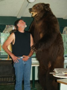
 Dave and a Grizzly
He towers over DavePrince Rupert sits on the Hecate Strait on the Pacific Ocean. Thick fog hung in the air this morning and the visibility was severely limited. We arose around 6 am and after having breakfast out again, we were on the road and heading home by 7am. We didn’t wake Bill and Nadine to say goodbye - Have a wonderful trip you two! We would liked to have seen Prince Rupert and would have if it was visible through the pea soup fog..
The scenery, I am sure, was beautiful along the first 40 miles of Route 16, the Yellowhead Highway, but we will never know. The Milepost, our bible for traveling these many thousand of miles, described the beauty of scenic overlooks along the way, which we can only imagine. When the fog finally burned off, we were rewarded with scenes that would knock your socks off. The Yellowhead Highway follows the Skeena River from Rainbow Lake, through the mountains to The Hazletons and then follows the Buckley River down to Buckley Lake. Steep mountains climbed out of the canyons that we drove through, waterfalls cascaded down the rocky cliffs and the snow capped peaks loomed above the rivers and

 Pea Soup Fog in morning
We could not see the beautiful scenery along the Yellowhead Highway for about an hourlakes.
As we listened to Canadian’s Public Radio, we hear that Route 16 before Jasper was closed indefinitely due to a mudslide. This news was very disturbing to us, as this was the route we intended to take through the beautiful Canadian Rocky Mountains. There was also mudslides and a huge fire on Jackass Mountain, the alternate route we needed to take if we unable to get through on the Yellowhead. We stopped in Prince George at the RCMP (Mounties) and they had not even heard about the closure, but called dispatch and were told that they expected one lane to be open later that night and it would remain open unless there was another heavy thunderstorm. The forecast did call for heavy thunderstorms, so we were in a tough spot.
While traveling the Yellowhead, east of Prince George, looking for a campsite, we saw a cute little black bear on the side of the road. Dave stopped and I took pictures of him, but in another mile when we saw another one, Dave kept driving. And when we saw a third about 15 minutes later, he again kept driving, saying he was all beared-out. We have seen
dozens of black bears, but I still like stopping and taking pictures of each one.
We took our chances that the road would open so we traveled to within a hundred miles from the Park and camped in McBride at the Beaverview Campground. The campground was great and reasonably priced and the staff was very accommodating and friendly. It was a great stay for us. There is free wi-fi here so we will check www.drivebc.ca in the morning for the status on the road.
Advertisement
Tot: 0.2s; Tpl: 0.011s; cc: 21; qc: 92; dbt: 0.1092s; 1; m:domysql w:travelblog (10.17.0.13); sld: 1;
; mem: 1.3mb

 Dave and a Grizzly
 Pea Soup Fog in morning

Dianne
non-member comment
Homesick?
Hi Carolyn and Dave, Since I left BC when I was 19, now you've seen firsthand why I've been homesick my whole life :) Thank goodness I get to go back every once in a while to the place I consider one step away from Heaven. Hope you've really enjoyed your trip. I've enjoyed it through your great blog. Love, Dianne