Advertisement
Published: August 7th 2007

 Sunrise, Sehonhong, Lesotho
It is a man standing on the ridgeI have returned to Khotso Backpackers in Underberg in the Southern Drakensberg Mountains. I first arrived here on March 21. In between now and then, good times have been had.
Readers Digest Version
I left Khotso on horseback and rode into Lesotho. Two days were spent riding to or around Sehlabathebe National Park in Lesotho. After that a few days were spent in the capital Maseru. From Molumong Lodge I did another two days of pony trekking. After Molumong Lodge we hiked down the famous Sani Pass back into S. Africa. So I arrived in Lesotho on the back of a horse and left on foot. How cool is that? From the base of Sani Lodge I took the opportunity to hike three days on the Giant Cup trail. The trail is intended as a five-day hike. Though on day four instead of continuing on the trail I hiked over the mountain to Splashy Fen. I spent Easter Sunday listening to live music at the Splashy Fen Music Festival. Today I returned to Khotso backpackers. Those are the facts of my last three weeks and they can’t be disputed.
Unabridged Version
Well if you have
the time and inclination to read on I will fill you in on all the details, sights, and sounds of the last three weeks. I have been very busy that is for sure. Even though this story starts and ends with horses, it isn’t all about horses. It even has a brief bit about Nalgene bottles binered to the belt.
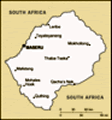
This adventure takes place mostly in the southern Drakensberg Mountains, that form the border between S. Africa and Lesotho. It starts at the base of the escarpment, moves to the top of the mountains, down into the “lowlands”, back to the top and finally back to the base again. At Khotso the elevation is 1500 meters, at the top of the escarpment the elevation is 2500+ meters, and the “lowlands” sit at a paltry 1000+ meters.
The plan is to enter Lesotho through the Bushman’s Nek border post on horseback. Spend a couple of days there and then head towards Maseru, the capital. After a few days of exploring the western lowlands of Lesotho head back to the mountains and Sani Pass. Here I can do some more hiking and either take transport down Sani Pass and back
to Underberg or hike back to Bushman’s Nek. In any case the final goal is Splashy Fen Music Festival over Easter weekend. Well this was the plan when I left Khotso with the horses.
Lesotho The Bushman’s Nek border post is unique in that once through, you can only proceed by foot or horseback. I picked horseback since I wasn’t sure I really wanted to hike all the way up the escarpment with my full pack. By definition an escarpment should be pretty steep and I had no idea how high it would be. Of course since I wasn’t coming back with the horses, I was required to carry my pack filled with whatever didn’t fit in the saddlebags. This made for an interesting look along the trail.
The Lesotho border was quite interesting here. We climbed/rode on the horses for several hours before we reached it. The only way we knew we were there was because Wade the guide pointed it out. “That group of white buildings in the distance is the Lesotho Border Post.” Of course it is unmanned because it really is in the middle of nowhere. Within another 10 minutes of riding we
crossed a broken down barbed wire fence and were in Lesotho. We then had another several hours of riding before we reached the nearest village, Sehlabathebe.
The second day was just a local ride. We road out of Sehlabathebe and up Bushman’s Valley. Really we just went exploring. We met shepherds, saw San rock art, explored shepherds caves and just enjoyed the scenery. Wade and Phillip managed to find the way to this massive shepherds cave that you can see from the bottom Bushman’s Valley but that Wade hadn’t been to before. Actually during both days of riding we saw lots of shepherds caves. These caves are often nothing more than overhanging rocks in the highlands. The shepherds that use them have usually built up some kind of rock walls around the openings to protect them from the weather and to keep the sheep close.
I was happy on the third day to not be riding. My backside was pretty sore and raw. It would later be described as rug burn like. This is a testament to how sore I was. I would rather ride in a combi (mini-bus) over the mountains on gravel roads for 6 hours
than get back on a horse. And that is exactly what I did. At 6:30AM, I boarded my taxi (mini-bus) and around 11:30 or so I arrived in Sehonghong. From here I had a “short” walk to Mashai Lodge, my stop for the day. Of course Mashai Lodge is only a few Ks away as the crow flies, as the road goes, up and down and around and around, it seemed forever away.
The ride to Sehonghong wasn’t too bad. The only had to get out and help the bus up in one spot. I count that a success. I spent my afternoon entertaining the local school kids with my camera. They all wanted to pose for their picture, it was good fun. At 6AM the next day I continued my journey by bus to Maseru, the capital of Lesotho.
The landscape in this area of Lesotho reminded me of so many places in the U.S. Sometimes WY, sometimes AZ, sometimes I don’t know where. It seemed like there was always up and always down. You could look up and see the top of the mountain and climb up there. Only then you would find out that behind
it was another mountain. Or maybe you go down onto the valley floor, go over a small rise and wouldn’t you know it, there is another valley even lower, and then you have to go up again.
There is hardly a tree around anywhere. The mountainsides are covered in grass and are very steep. They all seem cut and dissected by stream beds with no water. I didn’t see hardly any rivers to kayak. It seems like it is too steep for the water to stay in the river bed. The major rivers that hold water all seemed very flat and along way down from where I was.
And that brings up an interesting observation about the roads. They don’t like to build bridges. If you have to cross a river, the road will follow it upstream until the river is shallow enough and the banks low enough to cross or build a simple culvert bridge. No such thing as a large suspension bridge. After the river crossing you then begin to wind your way back up away from the river and along your way. This is why what may really be a close village takes all day
to get to by road.
But don’t try and shortcut the road because it is probably too steep.
Maseru is in the western “lowlands” of Lesotho. “Lowlands” being still 1000+ meters. However it is much flatter than the eastern section of the country. The maize seems to grow better here as well. But don’t get the idea that the west is flat, oh no. Now think of Utah or something like that. Just more space between mountains, peaks, and plateaus.
The city itself is nothing too special. Not a bad little town. It had some life but nothing special. Which is why I didn’t spend much time here, just 2 nights and then I caught a 6:00AM bus to Mohotlong. I’m not sure why all my bus trips in this town start at such an early time, but I will be happy to sleep in, or at least not have to get up for a few days. Oh yeah, they put a sheep in a burlap sack and put him in the luggage compartment of the bus. I found that interesting.
Mokhotlong reminded me of an old west town. I don’t know why, that just is what
it seemed like. It was a town, not a village. Heck it even had internet. But I think there were more people riding around town on horses than in cars. There were also horses tied up outside the local pub.
However, I couldn’t stay. My plan was to head out to Molumong Lodge (pronounced moo-doo-mong), about 17kms away and spend a few days. Boy did this lodge feel remote. When I first got there I wasn’t even sure it was open, but I was staying there regardless. I had no place else to go. Luckily it was open. I spent two nights camping here before I decided that I had proven myself enough in the cold that I could move inside. The nights here in Lesotho got down to about 5, it was cold.
At Modomong, I met Nicole. She is a peace corp. volunteer on holiday. Her and Lalo showed up the day after I did. But she was keen to join me in some horse trekking and Jacob (horse guide) and I managed to talk her into a 2 day horse trek. Yes, I am a glutton for punishment and I wasn’t sure how my backside
would hold up. But I figured I was in Lesotho. This is how the locals get around, I can toughen up and ride horses for 2 more days.
This pony ride was more comfortable for me. Maybe it was not having to carry the pack, maybe because we did less trotting and running, or maybe the saddles were more comfortable. One thing Nicole and I made sure we got was blankets. The Besotho people walk around wrapped up in wool blankets, once again Old West style. The wear the blankets wrapped around them and pinned shut at the neck with a giant safety pin. Well since we were going into the villages and it was cold at night we wanted blankets as well. For most of the day it was too hot to wear the blankets so we just sat on them, that might have helped the comfort as well. During the first day it did start to rain lightly so we put our blankets on. These things are great, not only did they keep us dry but the breathed and we didn’t get too hot. And they are just fun to wear.
The two days were really
amazing. We rode through I don’t know how many villages. Spent the night in one village in a little rondavel. (Lesotho rondavels are almost all made of stone, unlike S. African ones that are mud and sticks. Maybe because there are no trees and more rocks in Lesotho) The next day we just walked around the village. I watched a lady dancing with here baby as she got water from the spring. We watched a man thatching a roof and playing an accordian type instrument. Nicole and I spent our time debating western cultural influences in developing worlds and the merits of corrugated tin for roofing.
On the ride back to Modomong, we sat and hung out with a family that was harvesting wheat. Nicole was a huge hit to the tune of she now has a 15 year old Besotho husband. We also came across old ladies thatching already harvested wheat. And still the scenery continued. Up one ridge, down another valley, up another impossibly steep climb.
The next day we hiked out of Lesotho. Literally. It started with a simple 7Km hike for Nicole and I up to Sani Rd. We didn’t really intend to hike
that far but every taxi that went by was full. Luckily we didn’t have to wait long at Sani Rd before we got a ride to the pass. Once again Nicole’s charms helped. I can’t remember if she has another husband now or not. Anyway we managed to get a ride to Sani Top Lodge. This is advertised as the “Highest Pub in Africa.” We stopped and had a beer and lunch. Then we decided that since it was only 8km’s to the S.A. Border Post that we could hike down the famous Sani Pass. This is by far the steepest road I’ve ever seen. You are only allowed to drive up it if you have a 4x4.
Before hiking out of Lesotho though, I wanted a Lesotho stamp in my passport. So we shuffled over to the customs building and presented our passports. The guard asked how long we were staying, and was shocked when we said we were leaving. He started flipping through Nicole’s passport. She didn’t have a stamp she explained because when she came up Sani Pass nobody stopped her or made or show her passport on the Lesotho side of the border. The border
guard was not “happy” about this and started reading the riot act… sort of. Anyway I jumped in and said I didn’t have a stamp because I came in Bushman’s Nek and there wasn’t a Lesotho post at that border. I was told, “Good answer.” He handed back our passports and said “You can leave.” This wouldn’t work, and I explained that we wanted Lesotho stamps in our passports. I think the border guard was shocked by this request but he stamped them anyway.
The hike down the pass road was quite fun. We made it in about 2 hours, a full hour before the S. A. border closed. I think in this area the escarpment is a bit more pronounced and steeper than Bushman’s Nek area. Both are quite impressive though.
So now I’m back in SA. My thoughts on Lesotho. Well words really can’t describe the beauty of the Drakensberg Mountains, Lesotho or the Besotho people. Really the pictures don’t do it justice either, but I hope they help. While in Lesotho I was reminded of so many mountain places out west. The weather in the mountains is tough. The hills are steep and there are
all kinds of amazing river canyons. It is such a strange landscape, and it seems so easy to get lost. It always seemed like we could hike up two different routes on the same hill and end up in two completely different villages. Probably not far apart yet unable to see the other all because the terrain is so steep and cut.
I really like the way the Besotho people say goodbye. They don't just say goodbye, they have two sayings. If you are leaving you say Tsamea Hantle, which translates into "Stay Well." The person staying says what translates into "Go Well." This type of salutation is not limited just to Lesotho. It is said all throughout the region. I find that is sounds very respectful and makes one feel good to hear it.
[Pictures from Lesotho Giant’s Cup We had to leave Lesotho when we did because Nicole was schedule to start the Giant’s Cup trail in a couple of days. This is a five day trail that runs along the bottom of the Drakensberg from Sani Lodge to Bushman’s Nek, 60kms. Upon arriving we found that Lalo wasn’t feeling well and was bailing on the
hike. This meant they had an extra space and would I like to go.
Now, I was excited about the opportunity to do another great hike, but I had planned on spending Friday and Saturday at Splashy Fen and then hopefully beating tracks to Swaziland. Nobody really seemed like they could give me good advice. Splashy Fen is a 4 day music festival on a farm in Underberg. Everyone claims it is the S. African Woodstock. I think it is more like Banaroo. But I don’t know the music so it might not be much fun or could be great. Oh yeah, there is camping on site. Finally I worked out that I could hike 3 days on the trail and then instead of starting the 4 day on the trail I could bundu (bush) bash my way over and around the mountain for about 8 kms and be at Splashy Fest. Well that seemed the best answer.
The hiking committee was Nicole, and Emily another PCV and myself. It was a great three days with the girls. It was also nice staying in the huts every night as it rained every night. The only truly nice weather
My camp Splashy fen
I hiked down the steepest part of the hill in the background. Didn't seem the steepest when I was above it. day was the first day and we managed I hiked down the steepest part of the hill in the background. Didn't seem the steepest when I was above it.to get some swimming in. For the most part though the rain held off until we made camp.
Not much of true excitement happened on the trail but it was a real adventure. There was some concern that afternoon tea might have to be skipped to save fuel for dinners. On the 2nd night my t-shirt had a run in with a mouse and lost. I now have holes in my wool Ice-breaker t-shirt from the mouse. But I guess at least he didn’t get the food. And to top off the adventure, the huts for the 3rd night were locked. I trekked back out to the road and found a resort that could call the ranger to come and unlock them for me.
Splashy Fen On the morning of the 4th day I had to make a decision. Should I got to Splashy or continue hiking. It has been raining for the last 2 days and today is foggy. In the end I decide I want to see Splashy. If it is a muddy mess I can always catch a ride and go hang out at the backpackers.
For the most part the hike isn’t too bad. After getting off the trail I have to continue to climb for awhile. The worst part of this was being knee to hip deep in wet grass. About the time I reached the top and the short grass I started thinking about snakes in the grass. Nothing to do but keep going. I was soaked by the time I made it to the top of the ridge. But once there it was easy to follow the nature reserve fence around until…there it was. The tent city and music, just below me. It was like the sirens song. I started down what must have been the steepest part of the mountain. It didn’t look that way when I started but as I descended I was sure I was hiking double black diamonds. But I didn’t care, I could see the tents. Once I was “down,” I realized that it still wasn’t flat and I was still a long ways up. I had originally intended to hike around the forest that was between me and the festival because I figured it would be thick with undergrowth. But now I saw a trail through the woods. Boy was I fooled. The trail went just far enough to make me want to bundu bash throught he undergrowth instead of hiking back out. I did finally make it inside the trees and it was like I was in the enchanted forest. I could no longer hear the music. When I came out of the forest I was close but now between me and tents was brambles. I could either hike back up the hill and maybe get around the brambles or straight through. Well they weren’t that thick and only would come up to my knee. Ok they came up to my thigh and they really hurt…. But I arrived!!!!!
So I wandered around a bit and checked out the scene. Not as muddy and messy as I thought, this was going to be fun. I went to information to see about paying admission (silly cricket in my head). I told the man “I just got here. I hiked down from the mountain. How much do I owe?” He turned around and repeated what I said to the guy behind him who responded “Cool.” Well that was the head hongo and “Cool” means I don’t pay. Melisa, the girl in the information line next to me asked if I had a place to camp yet. She said I could camp by her group. They were taking in wayward Americans anyway. And that is how I became the Mountain Man. Everyone was amazed that I hiked in off the mountains and well the name stuck. Someone staying at Khotso had even heard a story of this mysterious Mountain Man that was at Splashy Fen… yup it was me. Oh yeah, in another random act, I ran into a girl I had met in Nature’s Valley several months ago. How random.
The festival was lots of fun. It was really pretty calm and great music. I loved the bands Foxfyre and Jump Never Sink. At one point Jump Never Sink were playing Ukalele and Slide Guitar. Foxfyre is two chicks that sort of reminded me of Indigo Girls. The stage areas were all dry as well. The put up tents to cover the stage and the audience. So when it starts raining everyone heads for cover of the music. I was also amazed at the porto-johns for men. I took a picture but they have outdoor urinals that just have too walls round and no lines and no doors. They also have beer can holders.
Well after setting up camp and getting some food it was time to really take in the festival. Since the beer tent was starting to run out of beer I stocked up. What the heck, I had a Nalgene just for this purpose. I guess that is why I found myself going to bed at 4AM. It was a great fun festival. I somehow found myself hanging out with the girls from Foxfyre all night. We just danced, drank, and they sang. Luckily they didn’t make me sing.
As the rain came down during the day I found myself wishing for my Lesotho blanket to wrap up in. It would have been a nice addition. I also wanted gum boots. I just had Chacos and soaking wet socks. Everyone else had gum boots, even the ladies. This struck me as funny. Girls would be dressed in all kinds of ways: jeans, punk, grunge, dresses, hippy dresses. Yet they were all wearing gum boats. Actually I was just jealous.
The next day it was back to Khotso backpackers. But my work wasn’t done yet. Khotso came once and got half of their horses and all of our stuff. They were giving horseback rides at the festival, hence the getting of their horses. It was deteremined that the horse trailer really couldn’t come back to the festival the 2nd time, not sure why, but we would have to take the horses out to the main road. I got roped into helping by riding out Moonlight bareback. Moonlight was the horse I rode to Lesotho.
So my random, adventures in the Drakensberg came to an end. I rode a horse into Lesotho, and walked out. I walked into Splashy Fen Music Festival off a mountain top and rode out bareback.
I’m pretty happy about how it all turned out. Oh yeah, and I have lots of knew friends.
And one other thing. I have introduced sweet tea to South Africa. The South African’s are notoriously for putting gobs of sugar in their tea. Back at Khotso I showed them how good it can taste if you cool the tea before drinking it. Who knows it might take off.
[Giants Cup and Splashy Fen Pictures Question: What are marshmallows made of?
Answer: (said in unison)….. CHEMICALS!!
PS: A belated Happy Easter and Good Passover (sorry, I don’t know the proper salutation for Passover if there is one)
Advertisement
Tot: 0.263s; Tpl: 0.015s; cc: 17; qc: 85; dbt: 0.1093s; 1; m:domysql w:travelblog (10.17.0.13); sld: 1;
; mem: 1.4mb


Tracy
non-member comment
Looks like Wyoming!
I've never seen the west look that green ever!!!!