Advertisement
One of my objectives in heading to Ecuador was to find a relatively cheap package to the Galapagos Islands. However, finding a package, within the price range I wanted, and within the time frame I wanted to be there, was next to impossible. You can simply fly to the Galapagos for about $350 roundtrip but you risk either not finding a package within your budget or you end up having to wait several days before being able to explore the islands. It is virtually impossible to tour the Galapagos without being on a guided tour (usually by a small boat with cabins and all meals included) and I wasnÔÇÖt willing to sit in some town on the islands with all the wildlife so close, yet so far!
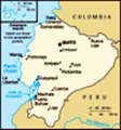
So, I sat in my hotel room in Guayaquil, figuring out my next move. I had already toured Guayaquil, there was not much else to see, and I had three days before my flight back to Lima. While in my room I saw a map/brochure that described the ÔÇťRuta del Sol,ÔÇŁ a drive along EcuadorÔÇÖs Pacific coast. So, now I suddenly had my new objective: drive from Guayaquil west to the coast and
 Heading towards the coast
Pretty much flat land and no service stations!then head north until I reached the town of Jama, which sits on the equator, so I could put one foot in the northern hemisphere and one foot in the southern hemisphere.
Pondering a drive along the Pacific coast of EcuadorÔÇŽ.
It would be a challenge doing this drive for a number of reasons. First, IÔÇÖd have to figure out how to get out of the complex city of Guayaquil, in which road signs are few and far between. Second, IÔÇÖd have to figure out how much time it would take to get to the equator and which towns I would need to stop in overnight. And finally, I would need to do all this in less than three days, and with only a modicum of Spanish language skills. On top of all this, I had no idea what the roads were like along the coast, whether they were paved and/or well-marked and most importantly, if there was any risk in being stopped by roadside bandits who would steal my car and all of my luggage, money, credit cards, camera, laptop computer, and perhaps even slash my throat just for the fun of it!
With my trepidation
Finally reaching the "Ruta del Sol"
Not many tourists, let alone locals. Perfect! at its height, on Monday morning I caught the hotelÔÇÖs shuttle bus to the airport where the car rental office was located and surprisingly quickly got into my 4-wheel drive SUV. While it was a fairly new car, it had tons of scratches and dents so at least it didnÔÇÖt look like rental car which is a good thing. The gas gauge read nearly empty; apparently car rental agencies in Ecuador donÔÇÖt give you a full tank to start with so getting gas would be my goal. Fortunately, the clerk at the car rental agency spoke some English and she was able to point me in the direction of the gas station and the road that heads out to the coast.
I found the gas station easily enough and the on-ramp to the highway that supposedly led to the coast was right next to the gas station. I did notice that gasoline is less expensive in Ecuador, only about $2/gallon compared to around $3/gallon in Costa Rica, so it never cost me more than around $20 to fill my tank and I think I filled it four times on this road trip.
The other thing I should have
Map of the Ruta del Sol
The red line indicates my not so straight route! mentioned in my previous blog entry but didnÔÇÖt, is that EcuadorÔÇÖs official currency is the U.S. dollar. Up until this trip, I donÔÇÖt believe IÔÇÖve visited another country where the currency was the dollar. IÔÇÖve visited many countries where the dollar is widely accepted and used, but never the only currency. EcuadorÔÇÖs coins, however, are an odd mix of one-dollar, U.S. government-issued coins and 10 through 50 centavo coins which were equivalent to U.S. coins of these denominations. IÔÇÖd not sure how it all works, but it was nice for a change to not convert the cost of products and services from the local currency to dollars all the time.
Getting lost then finding my wayÔÇŽ.
Finding the correct road to the coast was more of a challenge than finding the gasoline station. I was told to look for signs that said, ÔÇťSalinas.ÔÇŁ Salinas is the farthest town west of Guayaquil and sits on the edge of the Guayas Peninsula, overlooking the Pacific Ocean. I would be driving towards Salinas but turn north about 20 kilometers before actually reaching it (my guide book didnÔÇÖt seem make it seem it would be worth my while so I skipped it).
Headed inland several times
Sometimes the road hugged the coast. At other times it went into the mountains. Several of the signs on the highway that encircles Guayaquil read ÔÇťAv. SalinasÔÇŁ which means ÔÇťAvenue Salinas,ÔÇŁ which I assumed was in Guayaquil. Other signs that read just Salinas appeared to go off somewhere I wasnÔÇÖt sure I wanted to go, such as an industrial facility, or in one case, a military base.
I ended up spending about 45 minutes on GuayaquilÔÇÖs maze of highways and in at least three instances ended up on the same road not sure if I was heading north, south, east or west of Guayaquil. Finally, I turned onto a new road that I hadnÔÇÖt been on three times and followed it for about three kilometers. Luckily, as I was on the on-ramp to this new road a bus in front of me read ÔÇťGuayaquil-SalinasÔÇŁ on the back, so I assumed it was heading west towards Salinas. I took that road and several minutes later I finally saw a road sign saying, ÔÇťSalinas y Ruta del Sol.ÔÇŁ I was on my way to the PacificÔÇönot sure how long it would take to hit the coastÔÇöbut on my way nonetheless! New rule: follow buses if you arenÔÇÖt sure you are on the right road (and
Seaside town
This definitely isn't Cape Cod! pray they are actually heading to the destination listed on them)!
Heading across the Guayas PeninsulaÔÇŽ.
To get to the coast and to the real start of the ÔÇťRuta del Sol,ÔÇŁ you have to cut through a two-hour, flat, dull, totally uninteresting stretch of highway. The terrain the road cuts through is mostly brown with little vegetation and there is not much in the way of services along the route. In fact, there are no rest stops, gas stations or even emergency stopping lanes until you hit the coast. Luckily, there is hard-packed dirt on either side of the highway so I was able to pull off and take a ÔÇťbiology break,ÔÇŁ hoping no one would see me (there werenÔÇÖt any trees either).
As an aside, I should mention that there were several stretches of road between Guayaquil and the coast, and then, during the drive up the coast in which there were no gas stations, stores and in some cases even people. I can remember driving one stretch of road that jutted inland from the coast for about 50 miles through semi-tropical rainforest with trees encroaching on the road, in which there was nothing: no signs,
no people, or any other drivers on the roadÔÇöand my gas tank indicator was reading between ┬╝ of tank and empty. I kept an eye on the tank and prayed IÔÇÖd hit a town with a gas station soon. It would be a bad place for a mechanical failure! New rule: get gas the first chance you get and always try keep the tank near ÔÇťfull!ÔÇŁ
Reaching the ÔÇťRuta del SolÔÇŁÔÇŽ.
Getting to the Pacific coast about two hours after I finally figured out how to get out of Guayaquil, was a tremendous experience. After leaving a mountainous area and spending an half hour in fog so thick I could barely see five feet in front of me, the fog clears and IÔÇÖm now down at sea level with a long expanse of ocean on my left side, with nothing but beaches and small, thatch huts dotting the coast, apparently constructed for the tourist trade during the high season (I was on the coast in the low season). There was no one around except a few shopkeepers trying to make a few dollars during these intervening months.
It wasnÔÇÖt cold; my guess is that it was about
70 to 75 degrees, but it certainly wasnÔÇÖt warm enough for swimming, and during this time of year on the coast, it is generally overcast. However, I did have one day with bright sunshine which almost made some of the very poor towns along the coast almost look inhabitable. Whatever the weather, there is certainly something relaxing about being the only car on long stretches of road right on the coast, with no particular destination or objective in mind, only to find a decent town with decent hotels and restaurants, before nightfall.
Overnight in MontanitaÔÇŽ.
I had read in my guide book that Montanita, about one-third up the coast, was a surfer town filled with hotels and restaurants and would be a good stopping point for the night. Montanita wasnÔÇÖt more than an half-dozen small streets with tourist stands, cheap hotels, surf shops and restaurants but it had a fun, ÔÇťbohemianÔÇŁ feel to it. So, I drove through town to assess its appeal and the possibility of finding decent accomodations for the night. I decided it would work just fine but decided to head up the road a few more miles to find this eco-lodge on the hills
overlooking the Pacific. ÔÇťThe Centro Samai,ÔÇŁ eco-lodge/resort/spa was beautiful and had stunning views of the Pacific. It also had individual cabins dotting the rainforest and its manager was nice enough to show me several cabins. Each cabin had terrific views and the price was good but there was no one else there, and for lunch and dinner, IÔÇÖd have to drive into Montanita anyways so I decided to head back there.
CharoÔÇÖs Hostal in MontanitaÔÇŽ.
I usually spend some time evaluating hotels, B&B or hostels to stay at because the older I get the more finicky I am becoming in terms of what I want in a room. However, in this case, I was tired, hungry and just wanted to find a room and have lunch. CharoÔÇÖs Hostal, just off the ÔÇťmain squareÔÇŁ in grubby but quaint Montanita, fit the bill. For $10, I got a quiet room facing the oceanÔÇöso close to the ocean that when the tide came in so of the water spit on my window of my roomÔÇöand the basic necessities: bathroom with hot water in the shower, a comfortable bed and clean sheets. It fit the bill for the night. Charo and her
Yet another parade
I think I hit some type of national holiday, celebrated in every small town. husband David were very nice hosts and they ran a restaurant within the hostal so I ate ÔÇťal frescoÔÇŁ in front of the hostal with a view of the dirt street, tourist hawkers and the handful of gringos making their way through town. Charo made an excellent fish ceviche, rivaling the most famous ceviches of Peru. Her hamburgers were quite good too and for $3, including a beer, it was a great deal.
Just down the road from CharoÔÇÖs Hostal I found a terrific coffee house with several different types of coffee, friendly people, good music, and a pretty expansive menu. In fact, one of the staff played his guitarÔÇöand quite wellÔÇöin between serving guests. I knew IÔÇÖd be back for dinner.
Montanita is known as a ÔÇťsurferÔÇÖs townÔÇŁ due a long-breaking wave that hits the coast at just the right height and length (in fact it is the longest right-breaking wave in Ecuador) very close to town. Besides the various residents, others on bicycles selling eggs, milk and produce to the hotels and restaurants, you find many surfer going back and forward on the main street head to or from the beach, surfboards in tow. There isnÔÇÖt
much of a beach here, however, itÔÇÖs more pebbles and rocks from the road jutting down to the ocean. The 1997-1998 El Nino wiped out most of the beach here. However, the town survives and it remains a tourist-surfer haven, even hosting a surfing competition and bikini contest each April. Unless you are a surfer, it isnÔÇÖt worth spending more than a night or two here but just wanting the townsfolk going about their daily activities and watching the tourists come and go, makes for relaxing stay.
I did end up back at the coffee shop for dinner as I really liked the atmosphere and people there. Being a coastal town, seafood is the main choice on Montanita. I had the dinner special, some kind of white fish drenched in a creamy, spice sauce with avocados, potatoes and vegetables. While I like seafood well enough, I donÔÇÖt crave it or eat it that often. However, this fish dish was one of the best IÔÇÖve ever had. I almost ordered a second plate of it. And, at $6.50 for the entire meal, I could have!
Racing Towards the EquatorÔÇŽ.
It is now Tuesday and I have to be
back in Guayaquil to catch my flight back to Lima by Wednesday afternoon. I decided one night in Montanita was enough so IÔÇÖd head north, hoping to reach the town of Jama, and the equator, before nightfall. My next big destination would be the town of Bahia de Caraquez, supposedly a town with a look and feel similar to that of Miami Beach. From Bahia, I could evaluate if I had the time to head farther north to the equator.
The road from Montanita to Bahia remained fairly nice, only some stretches filled with potholes. However, the road was no longer a straight shot. Once I left the town of Manta, the largest port town on the coast and the banana capital of the country (but quite an ugly town and the ÔÇťofficialÔÇŁ end of the ÔÇťRuta del SolÔÇŁ), I had to watch the road much more closely to find connecting roads to the next biggest town going north, and eventually, Bahia.
I was definitely heading north along the coast but when I hit the fairly ugly coastal town of San Jacinto, the road just seemed to end, in the center of town, along a dirt road following
the ocean. Given it was almost 1:30pm at this time, I found the only open restaurant, parked the car right in front and had a decent beef and rice meal for $2, including a soda. The owner, a nice woman in her late 20s with two adorable kids, was able to point me in the right direction to get to the road for Bahia, however, by the time I left San Jacinto, it was almost 3pm and Bahia was still two hours north. It appeared I wouldnÔÇÖt be finding the equator today as it was another two hours north of Bahia.
A night in BahiaÔÇŽ.
Bahia, which lies on a small stretch of narrow land between the Pacific and the Bay of Bahia, was one of the cleanest and most well kept coastal towns in Ecuador that I had seen, and yes, it did remind a bit of Miami Beach. The town (more a small city, really) had a combination of newer, high-rise condominium buildings and smaller, colonial-style buildings. The first thing one will notice about Bahia is how clean it is, and unlike other towns along the coast, is fairly free of pollution from automobiles and trucks.
Like Montanita, the town was hit by six months of punishing rains and wind during the 1997-1998 El Nino and then in August of 1998, a major earthquake damaged many of the townÔÇÖs buildings leaving some 2500 of BahiaÔÇÖs 20,000 residents living in the streets for several months. In fact, the town didnÔÇÖt have water or electricity for almost six months. Since then, the town has been completely restored to its original grandeur and town officials declared it an ÔÇťeco-cityÔÇŁ in 1999, recycling waste, implementing strict pollution control laws and encouraging all residents to do their part to protect the environment, particularly its large bay. It also helped that a former President of Ecuador was raised in Bahia and still maintains a home there. He was instrumental in helping to rebuild the town, providing some money and sweat equity.
Driving through Bahia to find a hotel was quite easy as traffic, unlike other parts of Ecuador, was light and moved a leisurely place. I took the main route which follows the outer edge of town, starting on the bay side and routing through the other side of this small land mass to the Pacific side, where I found a
hotel, the Hotel La Piedra, the most posh hotel in town. During the off season, however, the rates where very reasonable and I was given a large room with a balcony facing the Pacific Ocean.
When I arrived at the hotel, it didnÔÇÖt appear to have a parking lot and frankly, I was a bit nervous throughout the coast, worrying about having the car stolen. A staff member told me just to leave the car on the road in front of the hotel. Apparently, he was there all night watching it while I slept.
There wasnÔÇÖt all that much to do in town, particularly in the off season, not to mention that by the time I checked in and made my way to the center of town it was nearly 4pm. However, I wandered BahiaÔÇÖs very pleasant streets, poking my head into shops and sitting in the town square, watching the car ferry let of assorted trucks and automobiles coming over from San Vincente.
By nightfall and dinnertime, I found a quaint Italian restaurant, a short walk from my hotel, attached, not surprisingly, to the Hotel Italia. The restaurant had an eclectic mix of furnishings and wall
fixtures, some walls had paintings of small Italian towns, then another wall had pictures of various motorcycles and biker-type guys. However, by 7:30pm, on a Tuesday night in the off season, this restaurant of eight or ten tables was nearly full, mostly with residents but a few gringos as well. I had chosen well and had another outstanding three-course meal with two beers for $6.50. IÔÇÖm really getting to like Ecuador!
The equator is out of reach for this tripÔÇŽ.
After dinner, I had to face facts. I was now about seven-hours north/northwest of Guayaquil and the next afternoon I had to catch my flight back to Lima. I actually didnÔÇÖt have to do anything; I was on vacation. So, I could get up the next morning, head the two or so hours north to hit the equator, stick my foot in the northern hemisphere, and then drive nearly nine hours back to Guayaquil, hopefully arriving back by 4pm to check in for a 6pm flight. I decided against going north for a number of reasons, mostly that the road continuing north deteriorated significantly from Bahia and the weather, I was told, would be turning colder and possibly
rainy. The towns north of Bahia, particularly the closer one gets to the Columbian border also deteriorate fairly quickly. I decided, therefore, it was not my best interest to not end up in a bad town close to the Columbian border (Ecuador and Columbia have had border issues and skirmishes in the past). So, instead, I decided to leave at 6am to get back to the airport in Guayaquil with plenty of time to spare, treating myself to breakfast at CharoÔÇÖs Hostal in Montanita, along the way.
I did make it back to the airport, with two hours to spare. While I didnÔÇÖt get to see the Galapagos or the Equator, driving the ÔÇťRuta del Sol,ÔÇŁ was a terrific adventure. I saw mile after mile of pristine coastline, white-sand beaches, and cute (if a bit grungy) fishing communities, had terrific meals and relaxed along the way. It is not a bad way to spend a few days.
More adventures soon. Thanks for reading!
Pura Vida!
Andrew
andrew4cr@gmail.com
http://www.AngelValleyFarmBandB.com
Advertisement
Tot: 0.086s; Tpl: 0.04s; cc: 10; qc: 27; dbt: 0.0346s; 1; m:domysql w:travelblog (10.17.0.13); sld: 1;
; mem: 1.1mb