Advertisement
Published: October 13th 2011
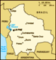
So after marvellous Machu Picchu it was time for the last sight of Peru, and the first of Bolivia, being lake Titicaca.
For those of you who don't know, Titicaca is considered to be the highest navigable lake(meaning boats can sail, or whatever it is boats do, on it) and people say the skies are brighter and bluer there than anywhere else in the world.
But first... I had to get there.
From Cusco to Puno, at the shores of Titicaca(3.800m), it was a fairly easy ride, despite passing at 4.500m.
And well, I found it to be quite funny that when I stopped while climbing to this highest point(if I may add, it was snowing gently) the zipper of my only jacket died on me.
So now the only thing protecting me(this is actually quite the overstatement as it didn't do anything of the sort) from the close to freezing winds bashing on to my manly chest ;D was my little thin summer sweater.
But then, as if there was someone watching over me, at this 4.500m point, there was a artisan market.
So there I bought an alpaca-scarf, and got the ingenious idea to wear an extra t-shirt over my jacket, keeping it closed and thus keeping the wind out.
Besides looking a bit like a clown on a bike, the rest of the ride went smooth enough and I was plenty warm all the way to Puno.
The next day I went on a ferry that first took me to one of the floating islands of the Uros, a people that has been living on these types of self-made islands from before the time of the Incas.
There the president of the island, on which only one family lived, together with tree of his five wives explained how they built the islands using since recently modern technology.
At this point I instantly thought it to be less impressive that they built these islands themselves.. until he showed what he meant with 'modern technology'.
What he meant was a big rusty saw(the kind that my grandparents had) instead of wooden pins and nylon rope instead of rope made of natural resources.
After we went to a regular island on the lake, where everything was still pretty traditional and stuff, making it an amusing stop-over.
On this trip I met yet another nice girl, from the Dominican Republic this time... who would have thought there were this many nice girls out there ;D
With the last Peruvian stop fresh in my memory I started heading for... Copacabana!!
Nooo, not the one in Brazil, I was not intending to cross half a continent in one go.
There is also a Copacabana by Titicaca, 10km in to Bolivia.
And so there I spent my first night in the continents poorest nation(no, it's not one big ghetto, not everyone is actually poor and so far it's been a lotta fun actually).
From Copacabana I drove to La Paz, the world's highest capital(the world's highest sky-scrapers are also told to be there, but that's just a way of looking at things I guess 😉 ).
La Paz turned out to be a fun city to be in and walk around in(for as long as you can manage though, the altitude does get to you).
My first day there was Domingo, Sunday, and thus market-day.
And boy I figured I would go and check it out quickly, but 2hours later I still hadn't reached the other end of it and well, decided it was a good idea to turn around and start heading back to familiar ground.
You can guess since La Paz is huge and it was my first day, obviously I got lost and ended up asking for directions another 3hours later.
So I walked about 6 straight hours, all over the place, without having much clue where I was most of the time, but I don't think there are better ways to explore a city, right ;P
On the way back I had a surprisingly good 0€70 dinner(with drink off course) and got to the conclusion that I was finally adapting to the altitude as I did not feel like dying after every step.
One of the things I planned on doing when I got to La Paz was riding a mountainbike down the world's most infamous road, the old connection from La Paz to Coroico, labelled 'the world's most dangerous road'.
Until 2006, when a new asphalted road was finished between these two cities, the old 50km patch had an average annual death-toll of over 200(as it turns out the new road is just as dangerous as people tend to simply drive faster now).
There was plenty of choice, but in the end I opted to go with the company with the better bikes, since I did intend to make it out alive.
Starting out at 4.700m and finishing at 1.500 it doesn't take much to figure out that most of it was downhill.
For those of you thinking 'and was it actually dangerous'... since you are riding the bike yourself, it is as dangerous as you make it, not forgetting that the road is gravel all the way, ranging from little peddles to fist-size rocks which you really do not want to hit at the wrong moment.
And that if you do end up next to the road, the drops range from 50m to 600m, meaning one and the same thing.
But besides all of that it was great fun, first 22km on asphalt as a warm-up and then the actual death-road as locals like to call it.
And at every stop the guide had multiple stories of people and vehicles plunging over the edge, some he had even seen happen himself, as means of encouragement I guess.
Despite some minor hick-ups which made me end up closer to the edge than one would want to be everything went smooth all the way down to our final stop, a rescued-animal-shelter.
There they had besides beer, our lunch, lots of monkeys, parrots , big ant-eaters, a bear, jungle-cats and a cayman.
After being man-handled by a some of the less timid monkeys we took the bus back up the worlds most dangerous road all the way to La Paz.
Next on the to do list was get to Uyuni, some 350km south of the capital.
Most people whom I talked to told me the better part of the road to Uyuni was in bad condition, gravel or worse, so I decided to go there by train since it was cheap, comfortable and a nice change of pace certainly since the entire way to Uyuni is over the Altiplano(which made me believe that it would also be a cold and windy ride, the kind of which I have had already more than enough I think ;p)
You all can probably guess why I went to Uyuni, but for those of you who don't; I went there primarily to visit the world's biggest salt-plane.
There are several ways to visit the salar, the most common being a tree day trip which takes you to most of the areas noticeable sights and as turns out, there are a lot of those.
The first day the six of us plus guide/driver left by ,a supposedly 4x4, jeep.
After passing by a train-graveyard and a salt-processing plant(a little shack with some basic tools) the ground under our feet(wheels) started to turn white, this led me to believe that we had reached the Salar de Uyuni.
First stop on the salar was at a(I don't really know how to call it) place where they scrape the salt from the ground in order to transport it to the processing-plant.
Next was the “Isla Pescado”(called that way because it has the shape of a fish) which is actually a hill(made of earth, not salt) in the middle of the otherwise next-to-perfectly-flat salar, filled with cacti, where we had our lunch.
After lunch and some camera-fun we started heading for our hotel(entirely made of salt) at the edge of the salar for some food, showers and rest … the quiet before the storm ;D
Day two we set out at seven for a day of lagoon and semi-active volcano watching.
At least that was the plan, but what we hadn't counted on was the combination of the jeep and driver...
OK, picture this a dessert where the soil is as hard as concrete, so you can easily drive trough it, plus at both sides actual roads.
But, I guess since this is a sort of adventure ride, the guide opted for going straight trough the dessert which seemed, as there were many tracks, quite common.
Now while most of the tracks went more to the left, our guide followed a singular track down the middle.
Imagine about 20km by 30km of drive-able surface and arriving at a place which is pretty clearly a clay-pool(of about 5 by 10m), one track going trough which only made it more obvious that it was a place where you don't want to be driving unless you are sure of making it trough, the guide stops in front of it for like 2seconds and then drives in...
After getting out it was quite clear to everyone that we weren't gonna push it out as I had sunk in all the way so that the bottom of the vehicle was touching the ground.
And when I remarked to the guide that it seemed strange to me that a 4x4 Land Cruiser with off-road tires didn't manage this pool he added, with a straight face, that the 4x4 hadn't been working for some time already.
So basically what he did was drive a 2ton car loaded with seven people, luggage and gear in the 1% of a concrete dessert where he shouldn't have driven it...
What he did then was basically tell us to collect rocks and wood while he would go and get help at a nearby village, and then started to run around in this dessert to a town and some other places.
In the meanwhile a couple of other jeeps stopped and tried to help us, but since we didn't have any kind of equipment it was hopeless to get it out without some experts or something.
After a while some local guy showed up with a plan(and some experience apparently).
So pretty much four and a half hours after arriving at the place, thanks to this guy and his “equipment” we got the jeep out.
Once assured that we were going to do and see everything we were supposed to but just at a slightly higher pace, we were ready and eager to get going.
First we had lunch next to a semi-active volcano (which is semi-cool I guess) and then moved on to a series of lagunas of which two had a colony of flamingos(the normal kind, although one of them was looking at me strange).
On the way to the last lagoon, laguna colorado which has actual red water, we passed trough a dessert with some ice deposits(we were after at close to 5.000m altitude) and the arbol de piedra, a 5m high rock, in the middle of the dessert, in the shape of a tree.
'Slightly' tarted we arrived at our second-night stop, where we again had dinner... but no showers this time.
The third and final day we left at 5h30 with as our first destination a place with steam-spewing geysers and boiling mud-pools.
The next, and very welcome, stop were some thermal pools.
Imagine: 9am in the morning, in the midst of snow-capped mountains, temperature next to freezing, slightly snowing, sitting in a 30°C thermal pool at the side of some huge laguna waiting for your pancakes XD good-times!
Sadly we could not stay here forever and thus after being urged by our guide that it was really time to move on we got out(this part was less fun 😉 ) and left for the laguna verde y blanca, two lagoons next to each other and being of clear green and white colour.
Along the way we also passed the dessert of Dali, which hosts a quite surreal landscape.
And that pretty much marked the end of the tour, on the way back to Uyuni we only stopped for lunch.
From Uyuni I would take the train back to La Paz, where I would go pick up my bike and spend one night before leaving for Sucre, the nation's original capital and mid-way point to el Chaco...
Advertisement
Tot: 0.052s; Tpl: 0.011s; cc: 8; qc: 24; dbt: 0.0319s; 1; m:domysql w:travelblog (10.17.0.13); sld: 1;
; mem: 1mb