Solomon Islander Geography, Solomon Islands Geography
Advertisement
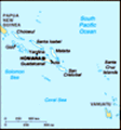
Location: Oceania, group of islands in the South Pacific Ocean, east of Papua New Guinea
Geographic coordinates: 8 00 S, 159 00 E
Map references: Oceania
Area: Total: 28,450 sq km land: 27,540 sq km water: 910 sq km
Area - comparative: Slightly smaller than Maryland
Land boundaries: 0 km
Coastline: 5,313 km
Maritime claims: Measured from claimed archipelagic baselines territorial sea: 12 nm exclusive economic zone: 200 nm continental shelf: 200 nm
Climate: Tropical monsoon; few extremes of temperature and weather
Terrain: Mostly rugged mountains with some low coral atolls
Elevation extremes: Lowest point: Pacific Ocean 0 m highest point: Mount Makarakomburu 2,447 m
Natural resources: Fish, forests, gold, bauxite, phosphates, lead, zinc, nickel
Land use: Arable land: 0.64% permanent crops: 2% other: 97.36% (2001)
Irrigated land: NA
Natural hazards: Typhoons, but rarely destructive; geologically active region with frequent earth tremors; volcanic activity
Environment - current issues: Deforestation; soil erosion; many of the surrounding coral reefs are dead or dying
Environment - international agreements: Party to: Biodiversity, Climate Change, Climate Change-Kyoto Protocol, Desertification, Environmental Modification, Law of the Sea, Marine Dumping, Marine Life Conservation, Ozone Layer Protection, Whaling signed, but not ratified: none of the selected agreements
Geography - note: Strategic location on sea routes between the South Pacific Ocean, the Solomon Sea, and the Coral Sea
Advertisement
The information here has been derived from Public Domain Sources such as the CIA World Factbook. No liability can be taken for any inaccuracies.
Tot: 0.038s; Tpl: 0.011s; cc: 3; qc: 8; dbt: 0.0105s; 1; m:domysql w:travelblog (10.17.0.13); sld: 1;
; mem: 1mb
 The UK established a protectorate over the Solomon Islands in the 1890s. Some of the bitterest fighting of World War II occurred on these islands. Self-government was achieved in 1976 and independence two years later. Ethnic violence, government malf...