Advertisement
Published: January 19th 2008

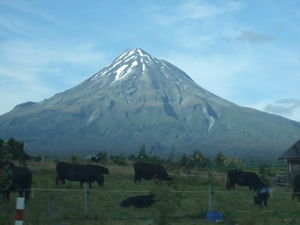
 Mt Taranaki
We climbed nearly two thirds of this - a traveller we met told us the top was still full of snow so am glad we didn't proceed!DATE VISITED: 13TH/14TH JANUARY
We hit the 'Forgotten Highway' - a road where you really DON'T want to break down or run out of petrol as there is nothing for miles and miles and miles. This route was prettier than the coastal option which took us from the caves to the western bulge of the North Island near New Plymouth. We didn't see this city but instead called in at the Taranaki National Park where the mighty Mt Taranaki (2nd highest mountain in the north island ) sits at over 2500 metres.
The route to Taranaki was along a heritage trail and was quite scenic but just went on and on and on!
We arrived at our querky accommodation called the Missing Leg Backpackers. I don't usually write on here abour each stop but this place warranted a mention! Your greeted by hundreds of bicycles all lined up on the front wall of the property - but then there are more in the hostel. A log fire, rustic piano and a cosy mountain hut type lounge add to the atmosphere. We saw even more bikes inside - I even had to unhook a pan hanging precariously off a

 Lord of the Rings wood
(well it wasn't - but the moss and type of trees on this walk made us think we were on the screen set)!bike pedal on the kitchen ceiling!
Our tent for the first time ever was in a beautiful rose garden - no one else was there so it was a real treat.
We came to this area to originally climb the dorment volcano but since I read up on the perilous scree on the higher slopes I changed my mind. Instead, we still tackled parts of the mountain but just climbed the lower slopes (these were still bloody high mind!). We did a mountain circuit which incorporated deep bush, a rocky open path and a steep climb up a track to one of the mountain huts. The climb was a good work out with rewarding views at the top. The walk was about the right length (about 5 hrs) - considering we had a sleepless night in the tent this was probably a good move (the experts estimate the Mountain summit climb takes about 10 hrs).
Forget that.
Our stay at the Missing Leg enabled us to check out another corner of New Zealand many backpackers don't have time to visit. The tent pitch was only 4 quid a night and the walk was fab too. Taranaki

 View from the lodge (mountain hut)
(this was as high as we went - though we still felt a massive sense of achievement as it is the 2nd highest mountain on the island!)is an impressive classic cone shaped mountain no doubt about it but with more walks and hikes to come I had to pull the brakes on this one giving the terraine (volcanic!). I will remember this backpackers - not least for the above but to meet the owner Dave- a Kiwi pirate type character - what a nice bloke!
Advertisement
Tot: 0.204s; Tpl: 0.009s; cc: 11; qc: 64; dbt: 0.1001s; 1; m:domysql w:travelblog (10.17.0.13); sld: 1;
; mem: 1.1mb

 Mt Taranaki
 Lord of the Rings wood
 View from the lodge (mountain hut)
