Heading to the Oregon Coast


Advertisement
United States' flag
North America » United States » Oregon » Coos Bay
April 15th 2008
Published: April 15th 2008
Edit Blog Post

Highway 66 to Valley of the RogueHighway 66 to Valley of the RogueHighway 66 to Valley of the Rogue

Our journey on Highway 66 followed the Applegate Trail. This was a southern route of the Oregon trail that was considered a safer path to the Willamette Valley of Oregon by the early settlers, since it avoided the Columbia River.
This entry covers our trip from Fort Bidwell, CA to Valley of the Rogue, OR, where we spent three days, and the five days we stayed in Coos Bay, on the south Oregon coast.


Our last night in Fort Bidwell saw snow and wind. We had planned to take a shortcut over Fandango Pass, but decided given the snow, that we had better take a longer, but less elevated route to our next stop at Valley of the Rogue (named for the wild and scenic Rogue River), in southwest Oregon. Although it snowed on the higher passes, the road remained dry and safe and we arrived mid-afternoon at the Valley of the Rogue State Park and settled in for a three day stay.


On 9 April, we left Valley of the Rogue and traveled north on Interstate 5 to Winston, OR where we headed west, crossing the coastal range to arrive at Coos Bay. We had made reservations at the Charleston Marina and RV Park located at the south end of the bay because the cities of Coos Bay and North Bend seemed too developed for us. This turned out to be true and we very much
Highway 66 to Valley of the RogueHighway 66 to Valley of the RogueHighway 66 to Valley of the Rogue

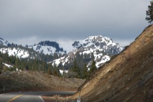
There were essentially no services on this 60+ mile section of Highway 66.
enjoyed our stay in Charleston, which reminded us of a small New England fishing village. The other fortuitous part of our stay was that it occured during the first warm, sunny period that had been seen in this part of Oregon since previous the fall.

The following photos and captions show some of the experiences we had during this part of our trip.


Additional photos below
Photos: 33, Displayed: 23


Advertisement

Valley of the Rogue (River)Valley of the Rogue (River)
Valley of the Rogue (River)

Situated along the river, the state park we stayed at was quite nice, but a bit too close to the interstate. The smoke stack in the distance is associated with a plywood factory.
The Rogue River--a  Wild and Scenic RiverThe Rogue River--a  Wild and Scenic River
The Rogue River--a Wild and Scenic River

The snow-melt in the mountains had begun and the river was quite high, so our flat-water kayaks remained on top of the truck.
The Rogue River--a  Wild and Scenic RiverThe Rogue River--a  Wild and Scenic River
The Rogue River--a Wild and Scenic River

We did a lot of walking on a very nice trail along the river and at several county parks in the area.
The Rogue River--a  Wild and Scenic RiverThe Rogue River--a  Wild and Scenic River
The Rogue River--a Wild and Scenic River

Jon saw a group of 4-5 river otters one morning and common mergansers and kingfishers were everywhere setting up territories on the river. We watched yellow-rump wabblers and ruby-crowned kinglets "flycatch" emerging insects along the Rogue.
The Rogue River--a  Wild and Scenic RiverThe Rogue River--a  Wild and Scenic River
The Rogue River--a Wild and Scenic River

It was a bit early for the Steelhead run on the river, but these fisherman seemed to be having a good time.
Typical Western ClearcuttingTypical Western Clearcutting
Typical Western Clearcutting

We never got use to seeing the result of clearcutting, a practice that is uncommon in the east. It causes increased erosion, creates a monoculture of future saw-timber where once a diverse forest had existed, and certainly decreases the aesthetics of the landscape.
Replanted Clearcut  AreaReplanted Clearcut  Area
Replanted Clearcut Area

This type of clearcutting, called a silvicultural clearcut, harvests all trees, and replants only the (typically single) species deemed best by the logging company. This drastically reduces the original diversity of the forest.
Entrance to the Charleston Marina and RV ParkEntrance to the Charleston Marina and RV Park
Entrance to the Charleston Marina and RV Park

The RV Park is located between a series of docks where most of the fishing fleet is located and a marina with pleasure boats.
Cooperative Western GullsCooperative Western Gulls
Cooperative Western Gulls

Adult and second winter individuals.
View of the Coos Bay EntranceView of the Coos Bay Entrance
View of the Coos Bay Entrance

Two large breakwalls guard the entrance to the bay. The "bar" or sandbar typically found beyond the entrance to many seaports is a major obstacle to navigation when the sea conditions are rough. "Crossing the bar" can be a very dangerous feat.
Coast Guard Bar Observation PostCoast Guard Bar Observation Post
Coast Guard Bar Observation Post

This observation post looks out on the bay entrance and bar. The Coast Guard monitors the sea conditions at the bar and determines when conditions are too dangerous to allow passage into or out of the bay.
Beach-side on the North SpitBeach-side on the North Spit
Beach-side on the North Spit

Moxie contemplates the Pacific Ocean.
Wreck of the New MarissaWreck of the New Marissa
Wreck of the New Marissa

The New Marissa, a 650' bulk tanker, came ashore in February 1999. It was burned and blown apart by the Navy and all but the the stern section that remains was hauled into deeper water and sunk. Plans exist to remove the stern section.
Charleston Fishing FleetCharleston Fishing Fleet
Charleston Fishing Fleet

Commercial fishing in this area is still profitable but it was also apparent to us that economic depression was having a real effect on the community.
Charleston Fishing FleetCharleston Fishing Fleet
Charleston Fishing Fleet

Just prior to our arrival, the US Fish and Wildlife Service announced that salmon fishing may be suspended again this year based on low numbers of spawning salmon ascending the Sacramento River. If this happens, it will be the second suspension in the past three years, but is the only way to protect salmon stocks.
Memorial to Fishermen Lost at SeaMemorial to Fishermen Lost at Sea
Memorial to Fishermen Lost at Sea

Next to lumberjacking and firefighting, commercial fishing is a very hazardous occupation. The most recent fatality was in 2003.
American Bald EagleAmerican Bald Eagle
American Bald Eagle

Bald eagles were commonly seen soaring along the coastal bluffs in this area.
EquisetumEquisetum
Equisetum

Abundant rainfall and humidity create ideal conditions along the coast for moss, fern, and lichen growth both in the soil and as epiphytes on trees.
Seascape Along the Road to Cape AragoSeascape Along the Road to Cape Arago
Seascape Along the Road to Cape Arago

This 20-mile road follows the coast past three state parks and a county park to the south of Charleston.


Tot: 0.096s; Tpl: 0.013s; cc: 14; qc: 54; dbt: 0.0559s; 1; m:domysql w:travelblog (10.17.0.13); sld: 1; ; mem: 1.1mb