Advertisement

 114F0F63-6EF8-4BFA-947E-5034F00C3F9B.
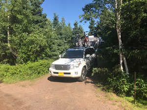
Campsite at Gooseberry Falls State ParkGooseberry Falls State Park, Two Harbors, Minnesota
As the crow flies, or the fish swims, we only moved 41 miles northwest of Bayfield, Wisconsin. But because my LandCruiser neither flies nor swims, we had to drive around the western edge of Lake Superior almost 130 miles. It wasn’t a particularly difficult drive, although Wisconsin doesn’t maintain its highways along this part of the lake very well, and, so that portion was pretty bumpy. We basically took route 13, which parallels the lakeshore all the way down to Superior, which is the twin city to Duluth, right at the tip of Superior. There we we caught US 53 which took us up and through the cities and onto US 61, which rides up the north shore of the lake. In addition to being bumpy, the Wisconsin portion was mostly shielded from the lakes by stands of forests, so lake views weren’t very frequent.
The whole drive took us less than three hours, so we stopped for a leisurely lunch in Superior at a funky place called Gronk’s. Mostly, it is a beer, pizza, and burger place, but their decor is a tad weird and the menu is a riot to
read. (Did you know that the proper name for ketchup is ‘Irish Gravy’?). I ordered the Gronk Burger which comes with layers of fried provolone cheese and onion rings - it was tasty and very filling. Washed it down with a glass of hard pear cider, which I really enjoyed. Joan was less than thrilled with her meal.
Back on the road, we immediately began confronting the industrial complex that forms, or at least used to form, the economic base for these two cities. Iron ore mining was the dominant industry a century or so ago, nowadays I think they concentrate mostly on grain shipments out of the port here, down through the Great Lakes, and out to the rest of the world. Changes in shipping technology have probably hit the area pretty hard - it doesn’t look like it is exactly a boom town anymore - there are lots of smokestacks, but they look mostly idle.
Moving out of Duluth, we drove maybe 30 miles up the coast. This was a pretty ride with great views of the lake and the shore. Gooseberry Falls State Park was not our first choice as a campground - we had wanted to be further up the shoreline in order to minimize travel times to our planned destinations. But Joan found most everything else booked up when making reservations (back in January). Not sure why things are so busy, but I suspect that when summer finally happens up here in the North Country, the locals are more than anxious to get out and enjoy it. When we arrived here at the park, the ‘Campground Full’ sign was on display and there were cars parked everywhere for people trying to get to the beach.
This park sits on the mouth of Gooseberry River which, just before emptying into the Lake spills over two thirty-foot waterfalls. We will try to get down there with the girls to see what we can see. We will be dry-camping here (no that doesn’t mean no alcohol), so we will be relying on the solar panel to recharge the batteries every day. We will also have to watch our water consumption and the sewage tanks. We are planning on being here just five nights, so I think we will be just fine. But when dry-camping, we have to pay a bit more attention to our resources.
Woke up this morning to see an interesting phenomena which tells a lot, I think, about the North Shore. There was a solid bank of clouds to the southeast of us while nothing but blue skies above us. I suspect that happens frequently here. Since prevailing winds are from the west and north, they are probably pretty dry right here on land. But once they get out above the Lake, they pick up all kinds of moisture and energy. All those storms that the Keweenaw Peninsula has been getting come from this direction, but proabably don’t pick up their intensity until over the Lake. That means that this side of the lake gets less rainfall, and the result is a different ecology. Based on my ecoregion maps, that seems to be the case. We are still in the main North Woods eco-zone, but there are distinctive differences in vegetation.
We have one park and two rebellion items on this stop. But we have a pile of laundry that is starting to spill out of the trailer, so I think we will be taking a down-day today to do laundry, grocery shopping, and maybe a nap or two!
Advertisement
Tot: 0.242s; Tpl: 0.016s; cc: 15; qc: 46; dbt: 0.1211s; 1; m:domysql w:travelblog (10.17.0.13); sld: 1;
; mem: 1.2mb


