Advertisement
Published: February 14th 2012

 Issaqueena Falls
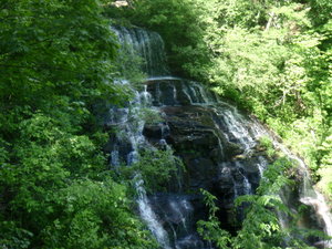
The upper portion of Issaqueena Falls (the lower half was hidden by trees)When researching this trip, everyone I talked to discussed the need for contingency planning.
On a long trip, something will go wrong at some point.
It’s not a matter of ‘if’, only ‘when’ and how much time and money it will suck up.
On the trip so far, I’d been pretty fortunate.
I’d had to rearrange things on occasion, and drop an attraction here and there, but there had been nothing major.
Today, that changed.
My plan was to raft the
Chattooga section IV, the one where much of Deliverance was filmed.
I’d had a taste of it the previous day.
I got the sense that things were not going to go as planned at four AM, when I found myself in the cabin bathroom rather than resting for the trip the next day.
I had a stomach virus.
I’m pretty sure the cold water yesterday made me more vulnerable to it.
By the time I had to depart for the rafting base, things were clear that I wasn’t going anywhere.
For better or worse, I have experience with rafting sick, and it’s never pretty.
I

 Oconee State Park Cabin
Wilderness Travel at its most luxuriousreluctantly called and pulled out of the trip.
I then spent most of this day popping pills from my medical supply and staying in bed.
By the late afternoon, I had recovered enough to travel a bit.
Not much, mind you, but a bit.
I asked the park rangers what there was to see in the area.
They recommended a trio of attractions located near the park.
Issaqueena Falls
The first of these was called
Issaqueena Falls.
It’s named for a Cherokee woman who fell in love with an English settler, warned him of an impending attach by the tribe, and then hid near the falls to escape their revenge.
The waterfall is located at the end of a narrow dirt road that is steep and scary.
The parking lot is surprisingly large given how difficult it is to get here.
Apparently, the waterfall is a favorite local spot (to picnic and other things…).
The waterfall itself is seen from an overlook, at the end of a short trail.
A small stream falls a long way off a mountainside.
It’s technically a

 Oconee State Park porch
Settle in and stay a whilevery steep cascade.
I was more impressed with the amount of blooming mountain laurel along the trail than the waterfall.
Stumphouse Tunnel
The next site was located about a five minute walk from the waterfall.
It’s called the
Stumphouse Tunnel.
In the 1830s, the South Carolina legislature provided money to a group of railroad builders to create a line from Columbia to Knoxville in Tennessee.
It would be the first railroad in this part of the state.
Things went really well, until the builders got to the mountains in western South Carolina.
They had to build three tunnels to get through.
Even with a crew of Irish laborers working around the clock, they made very slow progress through the granite, often only inches a day.
The legislature cancelled the project after a decade.
The unfinished tunnel is still on the mountainside.
It’s locally known as the mountain that defeated the railroad.
The tunnel has been attracting tourists since the 1890s.
One odd note about the place is that it has a constant temperature of 55 degrees, so a professor from Clemson set

 South Carolina Mountain Laurel
Huge mountail laurel bushes along the waterfall trail.up a laboratory there for a decade to find new ways of curing cheese.
Yellow Branch Falls
The final site was just down the road from these two,
Yellow Branch Falls.
It requires a hike of about an hour to reach.
The first part of the trail goes along a stream.
I found it rather interesting that the stream itself is surrounded by mountain laurel while the surrounding forest is mostly deciduous.
There are three separate stream crossings.
This stream is the one with the waterfall, but the trail does not follow it all the way.
Instead, it goes over a small ridge into a ravine.
This ravine had only a trickle of water in it.
The ravine gets deeper and deeper, until a large gorge appears through the trees.
The trail now follows the wall of the gorge.
It goes up and down.
In places, the trail is narrow and the drop-off is pretty steep.
Eventually, it heads into the next ravine off the gorge and reaches the waterfall.
The trail ends right at the base.
The waterfall is a tiered cascade.
I normally do not like this type of waterfall, because the stream breaks into multiple little pieces, each of which then drips off each ledge.
Here, thanks to the rain the previous day, it worked properly.
Water fell in wide curtains from each ledge, with lots of bigger streams falling down the rocks.
It reminded me quite a bit of the circular falling fountains I had seen at Swan House (see
History, for a City that Doesn’t Like Any).
Advertisement
Tot: 0.326s; Tpl: 0.011s; cc: 30; qc: 104; dbt: 0.1929s; 1; m:domysql w:travelblog (10.17.0.13); sld: 1;
; mem: 1.4mb


