Advertisement
Published: October 9th 2007

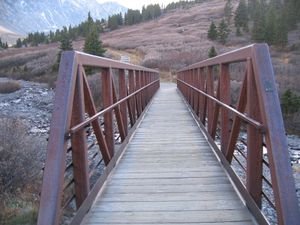
 Bridge Trailhead the next time
See anything different this time?After a couple of days of relaxing at Tony & Diana’s where I didn’t nothing but watch TV and movies Seaver and I were determined to try Grey’s and Torrey’s peaks again. This time we left two hours later and had much better snow gear.
On the drive up Seaver said that the weather said it might have snowed up there the night before so we were ready for more snow. However, there was no snow and the peaks could easily be seen from the trailhead. At the point where we originally turned around most of the snow had melted in the past two days and there was maybe 3-4 inches in the deepest spots.
The lack of snow didn’t make it easier however. Once we reached the spot we had turned around at before it became much steeper. Every step we took was a step up into thinner air. By the time we were about 400 feet from the top I had to stop about every twenty paces to catch my breath. When I say 400 feet, I mean directly up, which means about 4 times that far walking up switchbacks along the trail. As soon as
I would start hiking it felt like my leg muscles were out of energy, but I pressed on. By the time I was 100 feet from the top it literally felt like my muscles were going to refuse to go any farther. Seaver was already up there and I was determined to make it.
I finally made it and the wind was blowing like crazy at the top. We sat up there for a while and were able to lean against the wind at an angle it was blowing so strong. There were two blackbirds drifting on the winds directly overhead of us. I devoured a sandwich Ihad and rested while I took in the view. The top of Grey’s peak is 14,270 feet high. The trailhead was at 12,000. It was about 5 miles and 2,200 feet of elevation gain. Definitely the highest point I’ve been on the ground. It’s also the highest point along the continental divide.
The view from the top was superb. We could see the tree cut areas that would be Breckenridge and Copper ski resorts when more snow fell in a couple of weeks. Mountains as far as we could see to
the North, South, and West and we could just make out Denver to the East.
In the last image if you look right at the center, toward the bottom of where the trees stop is where the trailhead is.
After sufficiently taking in the views we headed down toward Torrey’s peak. Once in the saddle of the two giant peaks I decided that the 600 foot climb to Torrey’s was too much for me. My legs were tired from coming down Grey’s 600 feet. Seaver decided he was going to do it, so I sat by a large rock cairn and took a nap.
Advertisement
Tot: 0.167s; Tpl: 0.01s; cc: 9; qc: 50; dbt: 0.0432s; 1; m:domysql w:travelblog (10.17.0.13); sld: 1;
; mem: 1.2mb

 Bridge Trailhead the next time