Twin Peaks


Advertisement
Published: April 25th 2009
Edit Blog Post

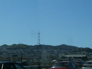
From US 101 NorthboundFrom US 101 NorthboundFrom US 101 Northbound

The twin peaks are those two to the left most of the picture, but I have always located the area by the red and white tower there in the center.
I was over at the Albany Bulb in the East Bay prior to this and noticed how clear the Twin Peaks area was. So, I drove back into the city, took a left on Market, drove past Castro street, then up Portola and then eventually Twin Peaks to get to the top to bring you these very windblown pictures.

I was able to hold the camera steady enough for these, but it was very windy and chilly on top of each of the peaks, as it often must be. I have only been here twice, once about five years prior, and yep, it was windy then too.


Additional photos below
Photos: 12, Displayed: 12


Advertisement

TowerTower
Tower

Up close.
Now up on topNow up on top
Now up on top

That is Market street you see there just right of center.
AlcatrazAlcatraz
Alcatraz

Just to the left and behind Alcatraz is of course Angel Island.
Zoom in on Market StreetZoom in on Market Street
Zoom in on Market Street

The top of the Transamerica Pyramid building can be seen at the far left of the photo. The tall building to the right of center, far away by where the Bay bridge makes landfall is One Rincon Hill. You can see that building all around the area. Must have great views on the upper floors there, but I wouldn't want to be anywhere around the building during a major earthquake.
Golden Gate Bridge in the distanceGolden Gate Bridge in the distance
Golden Gate Bridge in the distance

All the trees and greenery just before the Golden Gate Bridge is The Presidio area.
Hike up one of the peaksHike up one of the peaks
Hike up one of the peaks

Not much of a climb really, not by Colorado hiking standards. People didn't hang around the tops of those hills very long today though, way too windy!
Looking South toward the other peakLooking South toward the other peak
Looking South toward the other peak

You can see Daly City there beyond the other peak, and beyond it, the communications poles that sit on the peaks in the distance that are in South San Francisco.
Looking SE across The Mission DistrictLooking SE across The Mission District
Looking SE across The Mission District

San Francisco International Airport (SFO) sits on that piece of land barely visible against the right most side of the Bay.
Pacific Surf in the distancePacific Surf in the distance
Pacific Surf in the distance

That is either Daly City or Pacifica shore there.
Outbound Ocean FreighterOutbound Ocean Freighter
Outbound Ocean Freighter

Looks like Tiburon is the area directly beyond the Freighter in this photo. You can also see the reservoir used by the SFFD and the Twin Peaks area residents, in the left foreground.


Tot: 0.172s; Tpl: 0.012s; cc: 10; qc: 28; dbt: 0.0604s; 1; m:domysql w:travelblog (10.17.0.13); sld: 1; ; mem: 1mb