Advertisement
Published: March 31st 2015

 JAEGER'S STATION
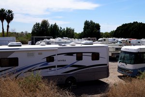
Jaeger's Station was located just at the east end of the River's Edge RV Park.Southern states coveted a transcontinental railroad link to California that could operate year around. It was proposed to Congress by Senator Gadsden of South Carolina but the route passed through Northern Mexico and that was not acceptable. In 1853 Gadsden was made Ambassador to Mexico with extraordinary powers to negotiate the purchase of lands needed for the railroad. The treaty was ratified in 1854 and the international boundary was shifted from the Gila River to the town of Mesilla and on to the southern border of California. The survey of that land acquisition was completed by 1856 but by then Congress was reluctant to allocate funds for construction of the railroad because of concerns about the expansion of slavery to the Territory of New Mexico. A compromise was reached for the funding of a stage coach route connecting St Louis to San Francisco through Arkansas, Texas, and the Territory of New Mexico and into Southern California. It was called “The Oxbow Route” because of its shape on a map. The northern states favored the Overland route up the Platte River to Denver and Salt Lake City and on across Nevada. What became the Butterfield Trail for

 PAYDIRT
The placer gold deposit originated in this wash. There is probably still some gold up there, but advancing civilization has disturbed the original ground surface. mail and passenger service to California along the Oxbow Route was 16 hundred miles further than the Overland Route. Congress allowed a mail subsidy of 170 thousand dollars to the Overland, but the appropriations committee was dominated by Southerners and the Butterfield got a subsidy of 600 thousand dollars. Both routes sprang into competition at about the same time and both lines were expected to keep the same tight delivery schedule for the mail. The Oxbow was too much further and the Butterfield fell behind even in winter. In the 1858 federal election Republicans gained control of the appropriations committee and they cut the Butterfield subsidy. After the 1860 election Butterfield went broke and the line was abandoned to the dust and coyotes. A mule drawn line connecting San Antonio to San Diego took its place and operated along the same route. It was called the “Jackass Mail”. The mules pulled smaller and lighter coaches. Few things aside from irrigation, the riverboats and the army had a larger impact on Yuma than the Butterfield Trail did. The Southern Pacific Railroad, when it came to town, followed the Butterfield route because stations already existed and there was generally water not far

 SNIVELY'S
Gila City was situated in this area.away. Between Gila Bend and Yuma the route followed the Gila River. The station at Yuma was operated by man named Jaeger and was called Jaeger’s Station. It was situated on the California side of the river about a mile east of Fort Yuma. Jaeger also operated a ferry in conjunction with the stage station. As Yuma grew the stage stop was eventually moved into town and the ferry docked at the end of Madison Street. There were several different ferries operating at various times. Twenty miles upriver to the east was the next station. It was located near the north end of the Gila Mountains and called Snively’s. Jacob Snively spooked around and found some placer gold in a dry wash nearby and the little boom town that sprang up around the gold diggings was called Gila City. Jacob was a colonel at age 21 in Sam Houston’s army during the War for Texas Independence. In order to be closer to his gold claim Snively moved the stage station to Gila City. The gold soon played out and Snively moved on to other ventures. Most of them included his pal, Jack Swilling, as a partner. For more information on

 BUTTERFIELD STATION
When I lived in Yuma old timers there assured me that this adobe structure was a remnant of the Butterfield Stage Station. I never had reason to doubt it until I realized that this site on Araz Road is only about 3.5 miles east of Jaeger's and not even on the Butterfield route. The next station west of Yuma would have been at Ogilby. Most likely these adobes are the remnant of some farmer's barn. the Butterfield Trail Gerald T. Ahnert has written an excellent book called, of all things,
“The Butterfield Trail and Overland Mail Company in Arizona: 1858 -1861”.
Advertisement
Tot: 0.075s; Tpl: 0.009s; cc: 9; qc: 34; dbt: 0.0376s; 1; m:domysql w:travelblog (10.17.0.13); sld: 1;
; mem: 1mb

 JAEGER'S STATION
 PAYDIRT
 SNIVELY'S
 BUTTERFIELD STATION