Advertisement
Published: July 26th 2012

 8 AM Greeting in Chihuahua
And HOT already. Our tour operator transported us to our hotelJune 4th, 2012 4AM and Fran, Maurice and Linda are up and off to the airport for their trip to Copper Canyon (Barrancas del Cobre), in the State of Chihuahua, in the north of Mexico. Linda and Fran spoke often of doing this tour and finally, it was happening. When we stepped off the plane and onto the tarmac in Chihuahua, we were immediately struck by intense heat. Though only 8AM, it must have been over 30 degrees Celsius. We were greeted by our tour operator and driven to the the City Express Hotel some 30 minutes away.
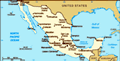
Chihuahua, the largest state in all of Mexico, has a very diverse landscape including a large desert, many different mountain ranges, very arable farm land and also significant ranching country. The state borders the US states of New Mexico and Texas, and includes the city of Cuidad Juarez, one of the most dangerous of the border areas. The capital city of Chihuahua, population close to 1 million, is located about 4 hours, or 400 kilometers south of the border, and as such is heavily influenced by the Americans and is also designed as a maquiladora, or part of the free trade zone.
Desert City
Situated where two rivers intersect. They have been suffering from 2 years of drought Therefore, there is a lot of manufacturing occurring in the city. Most of the people we spoke with could speak English, and the city had a Southwestern US feel to it. It also was obvious that its' local economy was doing very well because of the many large infrastructure improvements being constructed as well as new hotels and large apartment projects. The state is the leading producer of apples, nuts, cattle and sheep raising, and has a very active mining industry as well. Because of it's proximity to the US, it is also the most industrial, with manufacturing being the leading economic activity. We found the city busy, and its' people reasonably content.
Upon arriving at the hotel, we were treated to a courtesy breakfast and we then took the hotel shuttle to the centro. We strolled and shopped, taking note of the road construction on almost every street in the Centro. We ambled along in the 37 degree heat and finally decided that lunch and cervesa were in order. Afterwards, we shuttled back to the hotel and took a nap. Free Happy Hour, a first for us, began at 6PM so we took advantage of the various selection
Free Happy Hour
Free drinks and snacks from 6 to 8PM or longer if needed. of food snacks and free drinks, including a variety of beers, wines, rum and tequila. We added in a few games of cards and called it a night.
We were once again up early, this time at 4:40AM. We grabbed coffee and were driven by our tour operator to the Chepe train. The Chihuahua al Pacifico, or Chepe railroad, is an engineering marvel that took almost 90 years and 90 million dollars to complete. Opened after decades of construction in 1961, the railway was designed as a major freight connection between the Pacific Ocean and Mexico’s central desert territory and the city of Chihuahua. The Copper Canyon line is over 390 miles in length and crosses 39 bridges and 86 tunnels. The track starts in the ocean port city of Las Mochis and rises to an altitude of around 8000 feet above sea level before descending into Chihuahua at about 2500 feet above sea level. The line crosses some of Mexico’s most rugged terrain, hugging the edges of mountains, and crossing deep ravines on its many bridges. The scenery is truly breathtaking and the journey is spectacular.
We boarded the train. Later a leisurely breakfast was had while
Chepe Train Station
Passenger service from Chihuahua to Las Mochis on the coast of Mexico. enjoying the scenery as we rolled along the tracks. We climbed the hills of the Sierra Tarahumaras, a small mountain range. We marveled at the scenery, the tunnels and the bridges on this rail line. We then dropped a bit into a large and fertile valley and the first main center, the city of Cuauhtemoc. This is the largest Mennonite community in Mexico and they arrived in 1922. The former Canadians arrived there with a dream and have become famous for their production of cheese and apples. We napped, read, and wandered between the cars and were even able to ride outside the rearmost car watching the scenery recede.
The train finally stopped around noon at the village of Divisadero on the edge of Copper Canyon. We were greeted by vendors offering local foods and children selling artifacts and crafts. We were able to walk just a short way to the edge of the cliff and enjoy our first view of this amazing geographical phenomena. We simply stood in awe at the panorama before us, the canyons yawning before us, and the Urique River meandering slowly about 4260 feet below us.
Copper Canyon is a generic name for
Passenger and Dining Car
Colorful and comfortable cars for our 8 hour journey to Posada Barrancas, 6 kilometers past Divisadero the entire system of 8 different canyons that intersect and join in this region. At Divisadero, we were actually gazing at the Urique Canyon, the largest and deepest of the whole system. Copper Canyon actually has a length of 932 miles making it 4 times larger than the famous Grand Canyon. After a half hour or so, we were herded back on board to continue our journey to Barrancas, the next stop only a few miles further on. At the Posada Barrancas station, we were once again greeted, this time by our host from the hotel Masion Tarahuamara, our lodging for the night. What a gorgeous palace, set right on the edge of the gorge! After checking in and arranging for the next morning's tour, we were guided to the rim of the canyon and down along the canyon wall. There, we encountered an old rock dwelling which centuries ago housed a Tarahuamaran family. Then, further along the path, we came upon a cluster of Tarahuamaran families that still lived there. Led by the children, we were shown their gardens, their chicken coops, the pigpens, and their water supply, a spring flowing out of the rock. They sourced firstly their
On our way
Scene of the city as we pull out at 6AM drinking water, then clean wash water for dishes and clothes, then their bathwater and finally water for plants. The children walked up over the rim and down into the town on a daily basis to attend school. They showed us how they used lumber to extend natural rock depressions in order to create larger living areas as well as the blackened areas they used to cook. It was very informative, and very primitive, it made us wonder why anyone would want to live there, but that was all they have ever known. When we returned to the hotel, we decided to hike up yet another trail to another vantage lookout. We were able to scramble to the very top edge of the canyon, and gaze in wonder at the length, depth and complexity of the canyon system. Here, there was another breathtaking view with the Urique River meandering along the bottom. We were able to take some spectacular photos and test our nerve as we climbed out onto tipsy rocks at the top of the canyon! Once back at the hotel, we chose to take advantage of the pool, however, we found that the water was too cool for comfort,
Drought
Sad seeing the cattle trying to survive with little food and very limited water. and ended up soaking in the hot-tub instead. We enjoyed a tasty supper in the restaurant while being serenaded by a talented musician and singer.
Next morning, after breakfast in the hotel, we were taken by van a few kilometers to a lookout point directly where three canyons join together. Then it was off to the "teleferico" a large cable car that traveled across the Urique Canyon to the point on the other side where the three canyons joined. What an incredible experience!! The vistas were spectacular, and the camera kept busy. Amazingly, members of the local indigenous people still live along the canyons, and in villages along the bottom as well, following traditional lifestyles. Once back at the teleferico base, we hiked just a short ways over to "Piedra Volada", without doubt Barrancas del Cobre, or Copper Canyon's most famous viewpoint. Here, you could step out 20 to 30 yards along a jutting cliff maybe 10 to 15 feet wide, and at the very edge, there is a rock about 16 feet across that you can stand on and cause it to rock back and forth. Fran and Linda managed to bumscoot along the jut and got close
Agriculture
Apple trees under nets designed to protect the apples from birds and sun enough to actually touch the huge rock. Just as they were leaving, a young man was brave enough, or maybe stupid enough to actually jump onto the rock and make it move back and forth. WOW!
We then hiked another kilometer or so along the canyon rim to the village of Divisadero, and caught the van back to our hotel. We grabbed a quick lunch, then were taken back to the train station where we met the train that took us to the town of Creel.
Arriving in Creel in the late afternoon, we were met by our hotel's staff and again taken to our lodging for the night, a very cozy and comfortable cabin. We wandered along the streets in the area, found a small abarrote (privately owned convenience store) where we were able to buy snacks and of course, the obligatory cervesas. We then went for a stroll along the main drag to the zocalo, where we wandered through a small museum and enjoyed the warm and friendly atmosphere of the town square. We found a restaurant, had supper and returned to our cabin for cards, cervesa, and bed. Being the beginning of June, we found
Mennnonite Community
Irrigated farm land on the plateaus in the region the daytime temperatures to be very warm, maybe 34 to 35 degrees, however, because of the altitude, it would cool off drastically in the evening. There was no need for any air conditioning, and in fact, it was very comfortable simply by opening the windows. We found out however, that by early morning, we would be scrambling to cover up with the extra blankets provided. During the winter months, it is often below freezing at night, and they usually experience snow here 3 or 4 times a year here.
Thursday morning, we were once again up early, had breakfast at the hotel restaurant, then, along with 6 others, climbed into the van for the tour to visit some of the highlights in this area. First stop was to visit another Tarahuamaran family farm. We toured through their home and yard and viewed how they survived. Their home was mostly a large cave, with wooden partitions segregating the kitchen and the bedrooms from the main living area. Other stone and wood structures provided shelter for chickens, tools and whatever. Any arable land available was planted to corn. When planted, each individual seed location was watered. Water was carried to each
Dining Car
Shortly after leaving Chihuahua, we enjoyed a leisurely breakfast while admiring the scenery. seedling after it sprouted. The corn struggled to survive in the intense heat. Afterwards, we were driven to view and photograph unusual rock formations as well as balancing rocks on tiny fulcrums. Our next stop was at a picturesque little lake. We returned to Creel, and once again boarded the train heading back to Chihuahua. We were once again greeted by our tour operator and returned to our City Express hotel.
Friday morning, after a lovely breakfast, we headed out on a city tour hosted by the tour operator. We visited several museums, while being told of the colorful history of this area. We visited the Pancho Villa Museum, formerly the home of his legal widow, Luz Corral.
Pancho Villa, sometime outlaw and sometime folk hero, so the saying goes, was "hated by thousands and loved by millions." The mere mention of his name conjures up tales of daring and kindness, treachery and lawlessness. Like Robin Hood, who stole from the rich and gave to the poor, Villa helped northern Mexico’s less fortunate, and they repaid him by keeping his name alive in legends. It is rumored that he had 25 different wives and fathered over 75 children,
Desert, Farm Land, Pine Forest
Amazingly diverse ecosystems as we travel westward, climbing slightly as we went however, it was his second wife, Luz Corral who eventually came to be his legal wife and lived with him until his death. Born in 1878, he was involved in the Mexican revolution, leading troops into battles against the government, even becoming the provisional governor of the state of Chihuahua in 1913-14. He was known as a flamboyant womanizer, leader, actor, rustler, miner, rancher, politician and was involved in various other pursuits. On the morning of July 20th, 1923, Villa had picked up a load of gold to pay his ranch staff and was driving his black Dodge roadster when 7 riflemen fired 150 shots into his car. To this day it is not known who ordered the killing, however they gave the assassins very light sentences, leading many people to believe that the government was involved. Today, songs are sung in his memory, streets are named after him, and he is still much beloved throughout the nation.
We then wandered a bit more, did some shopping, but quickly gave that up in favour of cervesa, mostly because of the 38 degree heat. We returned to the hotel, collected our bags and were driven back to the airport for
Clean Train!
Spectacular views everywhere, this was a wall leading to a tunnel. our evening flight back to DF. What a fantastic 5 day trip!
famous flamboyant womanizing bandit turned politician then governor
Advertisement
Tot: 0.079s; Tpl: 0.014s; cc: 15; qc: 35; dbt: 0.0471s; 1; m:domysql w:travelblog (10.17.0.13); sld: 1;
; mem: 1.1mb


mallory Hamre
non-member comment
Looks like a great adventure!!