Advertisement
Published: August 14th 2011

 Midland 00
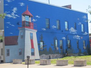
Wall MuralBiking Midland’s Rotary Waterfront Trail
The Basics: Number of times we have biked this trail: 2 to 4 times a year since 2008 Location: Midland’s waterfront
Distance: 8.5 km + extensions of 4-5 km
Trail Surface: asphalt and concrete
Access & Parking: parks and in town
Trail Head: Pete Peterson Park
Washrooms: parks and in town
Water: in town
Signage: There are a few but not needed
Garbage disposal: Excellent
Rest Areas: Excellent
Points of Interest: Many
Other: Waterfront Trail is part of the Trans Canada Trail
We have been on many waterfront trails (Belleville, Orillia, Barrie, Toronto etc) and Midland’s is one of the best. It is concrete and asphalt and some sections are wide enough to drive a vehicle (if they were permitted.) The Waterfront Trail is 8 km long with the first portion in the town and along the waterfront.
Going towards Midland (from the Tay Shore Trail – see blog) you will pass a gazebo and Veteran’s Park with an arboretum that includes trees from all parts of

 Arboreteum
Midland Waterfront TrailCanada. From the town dock, you can view the
largest mural in North America painted on a silo. When you reach King Street it is worth a short detour to see some of the many large historic wall murals (see photos). It is claimed to have the
largest outdoor historic mural display in North America with 30 other murals. By going from the waterfront to the library and back you can see many of these murals on the side streets (some photos included here)
As you head towards
Pete Peterson park, there are beaches, more parkland and parking.
The trail ends at the marina where it connects to the
Mid Pen Link which continues to Penetang. There are no signs to show the connection to the Mid-Pen Link, so leave via the gravel driveway and when you come to a stop sign at Sunnyside Drive you will see a TransCanada sign. Stay on the sidewalk for about 100 metres. Just before the next set of stoplights on Sunnyside Drive, cross the road (no crosswalk here) and you will see a small sign for the trail. This trail is freshly paved
asphalt passing through a dense, mostly maple tree, canopy. It is 1-1.5 km to the exit where there is a small parking lot at the end of Murray Street in Penetanguishene. From here you can follow the street into town and when you see the water, head for it and you can hook up with Penetanguishene waterfront trail which in turn connects with the Tiny Township trail (see separate blog)
There is also another extension that you can take from Pete Peterson Park. As above, leave via the gravel parking lot and proceed to Sunnyside Drive. Almost immediately on your right is another trail that follows the waterfront for 1 to 1.5 km. The first section is a wide (5 metres!) concrete path, which changes to packed limestone. This trail comes out a small park with a porta potty and beach. Continuing past the park will take you into a sub division.
More Photos below .....
Advertisement
Tot: 0.088s; Tpl: 0.011s; cc: 14; qc: 33; dbt: 0.035s; 1; m:domysql w:travelblog (10.17.0.13); sld: 1;
; mem: 1.1mb

 Midland 00
 Arboreteum