Advertisement
Published: January 6th 2014

 Katha in strong wind
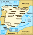
I almost got blown off the cliffs on my first day on Lanzarote.The island of Lanzarote is probably the windiest place I have ever been to. Initially the plan for my wee there had been to do some cycling and some hiking, but when I almost got blown away by the extremely strong wind on my first day there, I changed my plans, rented a car for the rest of my stay, and drove to different spots on the island to go hiking there.
But let me start at the beginning. I arrived on Lanzarote in the afternoon of the last Saturday of the year. It was very windy and drizzling. However, the drizzle and the sun created some beautiful rainbows. Some of them were even close to the bus that took me to the village of Playa Blanca in the south of the island, where I was going to stay for a week. This holiday would be great. I checked into my hotel that was only a ten minute walk from Playa Dorada, one of Playa Blanca’s beaches, and then walked to the Marina Rubicón, one of Playa Blanca’s harbours. There I had my first Lanzarote dinner: papas arrugadas (potatoes cooked in very salty water so that they obtain a salty
Playas de Papagayo
However, no parrots around. The beaches were named after a pirate ship that sunk close by. crust,) with two kinds of mojo (two dips, one red and spicy, the other green and with lots of garlic) and some grilled Lanzarote cheese topped with tomato confit and rocket. Very nice! After dinner, I took a walk around the port. There are lots of shops, restaurants, and cafés, all of them nicely arranged around the water and well maintained. From the quay wall, I could see the nearby island of Fuerteventura. It was a nice, warm, but also windy evening.
The next morning, I went for a run along the beach promenade that runs for many kilometres along the south coast. There are several beaches, another port, and of course hotels, restaurants, and shops. After breakfast, I walked towards the east along the beach promenade and then over to the Papagayo beaches. These are not, as the name suggests, populated by parrots (“papagayo” in Spanish) or surrounded by abundant vegetation. Rather, there is not much but black rocks, yellow sand, and a few dry brushes. However, the combination of colours (black rock, yellow beach, blue water) is beautiful, and the sea is nice and calm there so that they are the perfect place for swimming. Their name
Caldera Blanca crater
I walked up the mountain and then all the way around the huge crater. stems from a pirate ship that sunk close by. There are several beaches, each of them located in a little bay. In the very east, there is the Punta del Papagayo, the most southerly spot of the island. As mentioned before, the wind was so extremely strong that I nearly got blown away (literally, a few times I was close to simply being blown over!). I avoided getting too close to the edges of the cliffs because I did not want to get blown off and whenever I got to a sheltered spot on one of the beaches, this felt like such a relief. I was kind of exhausted when I got back to my hotel in the afternoon and spent some time relaxing and reading before I went down to the promenade again and walked towards the western end of it. I had dinner there and decided to skip my cycling plans.
The next morning, I rented a car and drove into the Parque Nacional de Timanfaya, the national park around the “Fire Mountains” that erupted in the 18
th and 19
th century and covered one fourth of the island in lava and ashes. First, I went into the
Wildlife on Caldera Blanca
Goats were climbing up and down really steep mountains. visitor centre to learn more about the volcano. Then I hiked across a lava field, up an extinct volcano, Caldera Blanca, and around its crater. It has an altitude of 458 metres at its peak. The hike was not challenging in terms of endurance. However, it required some surefootedness because the lava track consisted of only loose gravel and the track up and around the crater was always close to the edge. I took a little rest at the highest point of the crater track. However, when the wind started picking up, I hurried to get down to the bottom again. I remembered how strong the wind had been the previous day, and being on the edge of the steep crater did not appear to be a good idea. When I was back at the bottom, I made a little unwanted detour, following a path that I thought would bring me to another track I had seen on my way up, which it did not. However, finally, I got back to my car and had a late lunch in the nearby village of Tinajo. I was proud of myself that I could order my food in Spanish and understand what
Cliffs close to El Golfo
Pitch black rocks, blue ocean, and white surf... the waiter told me although I do actually not speak any Spanish... The afternoon I spent reading on my balcony and I had dinner at the Marina Rubicón again.
On Tuesday, after my morning run and breakfast, I drove to the fishing village El Golfo on the West coast of Lanzarote. From there starts a track along the coast that takes you into the Parque Nacional de Timanfaya. It is the only hike within the borders of the national park you are allowed to do on your own. For all the other tours, you have to walk with a guide or even catch a bus. The national park is a very sensitive environment that needs protection. The track I took was, like on the previous day, not challenging in terms of endurance, but as it consisted of rocks and loose gravel, again it required surefootedness and was excellent training for all the small muscles in my legs and for my body tension in general. Sometimes it was hard to even find the path. It was marked by little rock piles, however, I really needed to keep my eyes open not to lose it. On my right side, there were
More cliffs close to El Golfo
Already in the Parque National de Timanfaya. The only track one can walk unaccompanied. the volcanoes, the lava fields, rocks, some scarce vegetation, and on my left side, there was the deep blue sea, breaking against the black cliffs with white surf. Sometimes the waves hit the cliffs with such force that the surf would splash up like a fountain. There was no noise except for the waves and my own steps on the rocks, and I only met very few people. After a while, I lay down on one huge rock close to the cliffs and simply enjoyed the sun, the sound of the sea, and the quiet, before walking back to El Golfo. You can actually walk all the way from El Golfo to the Playa de la Madera. However, this would have been an 11 km tour which would have taken long because due to the characteristics of the track, it is not possible to walk fast (I guess you can make at most 3 km per hour), and there is no public transport at the other end so that I would have had to walk back. Therefore I had decided to only walk along a part of the track, which gave me a great impression of the mountains and the
Los Hervideros
The "boiling cauldrons", however, not really boiling on this day because the sea was apparently not wild enough. sea in any case.
I had another late lunch in one of the fish restaurants in El Golfo. For those who eat fish and seafood, this must be paradise. The waiters present the fresh fish to you on a plate and you can decide which one you want to eat. However, me being a vegetarian I had some papas arrugadas, garlic bread, and grilled veggies. Afterwards, I drove south again to have a look at Los Hervideros (“boiling cauldrons”), caves along the coast that collapsed. Now the waves roll into the caves and the surf splashes up through the holes so that they really look like boiling cauldrons. However, when I was there the waves were not strong enough, so not much for me to see there. After a brief stop at the Salinas de Janubio, where salt is extracted from the sea, I went back to Playa Blanca and to my books and had, once again, dinner at the Marina Rubicón (like every night except for one – I just loved the atmosphere of the port too much). It was New Year’s Eve, but I went to bed like on a normal day. There was no point for
Mirador del Rio
Designed by César Manrique. The staircase leading up to the upper terraces. me in waiting for the fireworks (have already seen so many of them), and I was glad to be able to sleep again, which had been quite a problem the weeks before. Therefore I was trying to go to bed and get up roughly at the same time every day.
On New Year’s Day, I drove north. I drove through La Geria, an area where wine is grown in a very particular way: single vines are planted in holes in the volcanic ashes so that their roots can get access to good soil and are surrounded by walls in order to protect them from the wind. Then I drove through Teguise, the former capital of Lanzarote (nowadays it is the city of Arreceife, where about 50 per cent of the island’s 140,000 inhabitants live) and then into Haria that is like a little oasis with its many palm trees. The north of Lanzarote is more green than the south (to the extent that you can call anything on this island green), with more palm trees and particularly more bushes. From there, I drove to the Mirador del Rio at the most northerly point of Lanzarote. This was my first
Playa del Risco
... at the bottom of the Famara Ride after my hike all the way down (hike up still to come). encounter with the artist César Manrique. He lived from 1919 to 1992, was born on Lanzarote and returned there after living in Madrid and New York and other places in the world. He was a strong advocate of sustainable development of the island and is well-known for his buildings that he perfectly integrated into the landscape. The Mirador del Rio is a view point at the north end of the Famara ridge that has different terraces outside and inside the cliffs. I simply loved the design and of course the stunning view, not only of Lanzarote, but also of the island of La Graciosa, which is to the north west of Lanzarote. I explored the building, enjoyed the beautiful view and had a cup of coffee with the view of the Famara ridge and La Graciosa. When leaving the Mirador del Rio, I decided that I wanted to see more of Manrique’s works while on Lanzarote.
I know that the Famara ridge is also the place where hangglider and paraglider pilots go flying. However, I only saw a few paragliders in the air the few times I drove past the ridge and could not make out where they had
Haria
... like an oasis with all its palm trees and little white houses. launched from. And I only saw three cars with hanggliders on their roofs.
Anyway. After leaving the Mirador del Rio, I drove south along the ridge and stopped a few kilometres further away to go hiking: down the mountain from 440 m above sea level down to sea level to a beautiful and almost lonely beach, the Playa del Risco. Again, I needed to mind every step on my way down because of loose gravel. However, the beach was worth all the effort and I sat there for quite a while, ate my lunch and enjoyed the view of the Famara ridge, and the island of La Graciosa. Then I climbed all of the 440 m up to the ridge again. Phew.
I stopped again in Haria to take a walk around this sleepy, calm and quiet village with its palm trees, nice Plaza de la Constitucion, and cafés and restaurants (all of which were closed due to the holiday, so no coffee stopover for me there). My next stopover was the Jardin the Cactus in Guatiza on the east coast, a garden with cacti designed by César Manrique in a former stone quarry where 1,400 different kinds
Jardin de Cactus
Cactus garden designed by César Manrique. of cacti are arranged beautifully along with some architecture. This was enough for the day, I returned to Playa Blanca and, after a short rest, went to Marina Rubicón again for dinner.
The next day, after my morning run, I drove to the Fundación César Manrique in Tahiche, his house that he integrated into some lava bubbles that nowadays is a museum. There are several rooms that are located in lava bubbles with open roofs so that they are exposed to daylight. All of the rooms are connected by alleys and once you get above “lava level” windows open up the view the whole lava field under which the house was built. The house is at the same time an exhibition for pictures of abstract art. However, I did not pay too much attention to them, I was too much attracted by the architecture of the house, truly amazing!
Afterwards, I drove to La Caleta de Famara, also an old fishing village, but now the base for all the surfers because the close by Playa de Famara has all the great waves. There are many surfing schools, of course. In my travel guide, it says that the village
Fundacion Cesar Manrique
His house that he built into a number of lava bubbles. still has the atmosphere of Wild West and that it is not as stylish as the other villages. I did not like the atmosphere there at all, I found it spoilt by the surfer tourists and did not like it. However, I took a walk along the beach, which consists of sand, but also of many rocks so that it makes sense for the surfers there to wear shoes. Swimming is almost never allowed there.
Afterwards, I had my best lunch of the holiday back up in the village of Teguise: a mixed tapas platter in a wonderful patio that used to be the Palacio del Marquéz (Count’s palace) and is now called “Patio del Vino”. After lunch, I took a walk around Lanzarote’s former capital. It has a quiet and beautiful atmosphere with its old churches and palaces. In the old days, it used to be exposed to pirate attacks. Its inhabitants tried to shelter from it in the surrounding volcanic caves, whereas there was a subterranean alley from Palacio del Marquéz to Castillo Santa Bárbara on the mountain close to the village.
As I had not been successful in finding a hiking track anywhere along the
Teguise
The former capital, a very quiet and beautiful village. Famara ridge, I changed my original plans and drove back to Timanfaya National Park to take the Ruta de los Vulcanes tour – the one that takes you along the “Fire Mountains” (32 of them) that erupted between 1730 and 1736. At first, I regretted having made the decision. First you pay a fee at the entrance, then you drive your car up the hill and park it. And then everyone is transferred in busses. All of it is kind of mass processing and I hated it. But it is worth the hassle. The bus takes you across lava fields, into lava valleys, up the mountains so that you have a stunning view of the whole area in which the volcanoes erupted and that was covered in lava and ashes. Additionally, I found our bus driver pretty amazing. He steered the big bus up and down the steep road and through narrow curves, close to the edge – wow! At the end of the tour, we got out of the bus and one of the employees showed us that the rocks are still pretty hot. He poured water into some holes, and it erupted as a geyser right away. He
shovelled dry pieces of brushes into another hole and the wood started burning right away. The coolest thing, however, was the “natural barbecue”, a grillage installed right above a hole with warm lava that is in fact warm enough that one can grill meat on it. When I got back to Playa Blanca in the evening, I was indeed glad I had taken the tour.
I wanted to do a bit more walking and so I decided to walk up Montana Roja, the volcano in Playa Blanca, for sunset. It was a nice easy walk up from its east side and then along the crater ridge to its west side. I watched a beautiful sunset before walking back around the other side and down the mountain to my car again. And guess what? Dinner at Marina Rubicón.
My last day was characterised by Manrique again. I wanted to see Jameo del Agua, another house designed by him. I took the wonderful road through the mountains, via La Geria and Teguise and then through Haria, all the way north via Yé to Orzola, and then along the east coast back to Jameo del Agua – all of it a
Montanas del Fuego de Timanfaya II
A channel that the lava flew through after the volcanoes had erupted. super scenic route. Jameo del Agua is also integrated into the volcanic landscape, but it is different from Manrique’s house. It has two smaller open areas which are connected by a grotto, and one large open space area surrounded by a kind of gallery that has some rooms along it. The special thing about the grotto is that there are little white crabs in the water. It is said that they drifted up from the deep sea due to a seaquake. Their eyes are vestigial because they did not need them in the deep sea. It is quite amazing to see these absolutely white crabs on the absolutely black rock in the water.
Just a kilometre from Jameo del Agua is Cueva de los Verdes, a tunnel created by lava from the volcano Monte Corona. It is part of a larger tunnel system that leads into the sea and of which Cueva de los Verdes is also part. The tour again started with a little hassle because you are not allowed into the cave unless you take a tour. This meant queuing again and then taking the tour with a huge group of people and at times being a
Jameo del Agua
A house designed by César Manrique and built into a lava tunnel. bit bored because the guide always explained things in Spanish first and then in English, which made the trip a bit lengthy at times. However, the hassle was worth it. What I found most stunning in the beginning was that once we were underneath the earth, the rocks around us seemed to swallow all the noise. There was no echo or anything, and although our group was quite big, the tour was rather silent. The tunnel was tall and big in some areas and narrow and small in others. In many places we even needed to bend down in order to proceed. There were different kinds of rock in various shapes, and mostly the cave was dry. In one spot, however, the surface of a little lake mirrored the ceiling in such a perfect manner that it looked as if one were looking into a deep hole. We did not notice the delusion until our guide threw a little rock into the water. However, after 50 minutes I was glad to get back into daylight.
I went to Teguise again for lunch and had another mixed tapas platter in a tiny restaurant with a nice view of Castillo Santa
Castillo Santa Barbara
... close to Teguise that was built to protect the citizens from pirate attacks. Bárbara. After lunch, I walked up to this small castle. It hosts the pirate museum, which I was not particularly interested in. But there is a wonderful view from the mountain which I enjoyed. I walked back down again and drove into the La Geria region to go for another walk there. It was not easy to find a track there because my travel guide did not give any hints here. I found one by looking at the map and walked for about half an hour, then ended up at a deserted house with a dog barking at me. I decided to better not enter the dog’s terrain, but rather turned round and walked back.
For my last dinner, I went back to the restaurant I had eaten in on my first evening, and I ate papas arrugados and Lanzarote cheese again, accompanied with lovely garlic bread. I sat outside on the terrace and enjoyed the quiet (everyone else was sitting inside), the view of the harbour, and the crescent moon. After dinner, I went for a walk along the beautifully illuminated Marina Rubicón and then back to my hotel.
My flight back home on Saturday did not
Marina Rubicon
The nice port at Playa Blanca where I had dinner almost every night. leave until the late afternoon, so I had time for a morning run and after packing my bags I went for another walk along the beach promenade to Playa Flamingo and back. The flight was delayed by half an hour and I did not like the airport because it is super hectic and there is not a single nice place to eat or stay. But apart from that, the journey home went just fine.
I must say that I have kind of fallen in love with the island of Lanzarote. How can you not? It has a pleasant and sunny climate all year through (average temperatures between 17 and 23 degrees), and it hardly ever rains (of course, this also turns the production of fresh water into a challenge, it is mostly produced by desalinating salt water, which is expensive of course). This allows you to be outside and in the sun almost all the time. With this climate, it is perfect for all kinds of sport (I think even for cycling...). There is this magic volcanic landscape. There is a wonderful combination of colours: black or red rocks, white or yellow beaches, the azure blue sea, green palm
trees, and bright white houses. I found people there super friendly, and it was a friendliness that came from the heart – at least this is what it felt like for me. As a summary, all that I can say is that I truly loved my stay there and enjoyed every single minute of it.
Advertisement
Tot: 0.422s; Tpl: 0.019s; cc: 38; qc: 142; dbt: 0.241s; 1; m:domysql w:travelblog (10.17.0.13); sld: 1;
; mem: 1.6mb