Advertisement
Published: August 6th 2019

 Sprangdalen valley
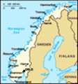
The view of the Sprangdalen valley. On the first day we pitched our tents next to the smaller lake. This picture, however, was taken on our return journey to Sota Seter, when the whether was excellent..Breheimen means home of glaciers. Despite the fact that the largest glacier in continental Europe - Jostedalsbreen - lies just outside of Breheimen to the west, the area contains a number of smaller glaciers on top of flattened mountains up to 2000m high. Furthermore, Breheimen offers very reasonable, several days long trails, in between which one can spend a night at a campsite (which means shower) and buy more food. The main reason to choose Breheimen was the fact that apart from me no one else in our team (me, Marjorie, Zeke and Stephen) had visited Norway before. The area offers a number of typically Norwegian attractions, which we planned to visit: 1. glacier, 2. fjord, 3. stave church (stavkirk), 4. mountain hut (hytta).
After picking up Stephen from the Stockholm airport (Saturday, August 20) and 12 hours in the car, we reached Lom, where we spent a night at a campsite. Apart from tent sites, Norwegian campsites offer huts of various standards. Since it was late and rainy we stayed in a small 4-persons hut. Next day we visited the Lom stave church (point 3), reached Sota Seter and started our hike. While the weather forecasts we had checked
Greinbreen glacier in the Sprangdalen valley
A view of a tongue of the small glacier Greinbreen. There is quite a few of such small glaciers in Breheimen. This picture was taken on the first day, when the weather was poor. before our departure predicted rain, the situation wasn't that bad. The sky was covered in clouds, but it rained very little, mostly in the evening. Next day we hiked through the highest and most demanding part of the trail, where one has to leap from boulder to boulder and walk on snow. However, to my surprise, there was very little snow this time and small lakes were almost ice free. Normally at the altitude of around 1500m the lakes are usually covered by ice and there is abundance of snow. Clearly, we saw the effects of the heat wave that passed through Europe in march. We ended this day by a river crossing that required taking our shoes off and wading through (not very cold) water.
The next day ended in the rain once more. At this point we were stating being fed up with the rain in the evenings, as it makes pitching up tents and cooking much less enjoyable. Nevertheless, a miracle occurred at night: the sky cleared up completely and in the morning we were welcomed by the sunshine. As there was almost no wind, it quickly became rather hot. And such a fantastic weather lasted
Greinbreen glacier in the Sprangdalen valley
And this picture, taken from the same spot, was taken on our way back, when the weather was very good. until the last day of our trip! In valleys the temperature reached unheard 34C and no more rain occurred. I was completely unprepared for such an un-Norwegian weather having a single bright t-shirt, since normally I would need to absorb every single ray of sun.
On Wednesday, after 4 days of hiking, we reached Skjolden, where we stayed in another hut at a campsite, we dried our stuff and took a shower. We marvelled at a fjord (point 2), ate tasty burgers at a local hotel and bought groceries. According to the plan we were supposed to hike back to Sota through Nørdstedalseter in a neighbouring valley. However, the plan was changed, as demands were raised for a quiet day and a decrease in difficulty. Hence, we took a bus and instead going east, went west to see Nigardsbreen: one of the most breathtaking tongues of the glacier Jostedalsbreen (point 1).
Next, we were supposed to hike for 3 days in a rather leisurely pace up the Jostedal valley and back to Sota Seter. However, it turned out that the team wanted to spend a night in a classic Norwegian mountain hut and the only one on our
Norway is the country of waterfalls.
Water in Norway is everywhere. For this reason there are many bogs, which significantly impede the hiking speed and make finding a good spot for camping difficult. Furthermore, crossing streams is time consuming and on one occasion we had to take our shoes off and wade through water. One can say it was an additional attraction: 5. wading through a river. Luckily, due to the cold climate, mosquitoes or midges are not an issue. way was right in the middle of the hike. To reach it we had to abandon the idea of taking things easy and marched for over 20km while gaining 1000m in altitude. But finally, we reached Sprongdalshytta (point 4), where we stayed for the night. Next day I described to the team how amazing are three-course dinners served in mountain hostels such as Sota Seter. Hence, we hiked for another 20km in order to reach Sota and stayed in another hut, this time with a restaurant-quality dinner.
On Sunday morning we had to decide what to do next, considering that we had two more days. We decided to sight see Norway in a more American style, driving and taking short hikes. First we drove the absolutely amazing road through Jotunheimen: from Lom via Fortun to Øvre Årdal, and next we hiked to see Vettisfossen, the tallest waterfall in Norway (275m). On Monday we made a loop by car, first driving the mountain road to Aurland while marvelling at two fjords. Next we drove the longest road tunnel in the world (24.5km) in order to reach Borgund, where we visited the famous stave church. From there we went to Eidsbugarden,
Mørkrisdalen
This was the view of the valley on Tuesday evening. It was raining, obviously. were we walked to the top of a local vista point, with breathtaking panorama of Jotunheimen: covered in glaciers highest peaks in Norway. Finally, we returned to our campsite in Øvre Årdal, while the next morning we began our drive back to Sweden.
Advertisement
Tot: 0.201s; Tpl: 0.013s; cc: 10; qc: 51; dbt: 0.0714s; 1; m:domysql w:travelblog (10.17.0.13); sld: 1;
; mem: 1.2mb