Advertisement
Published: November 15th 2009
8:20 PM
Whenever we have been off on trips to foreign parts in the past, we have always made the best use of the public transport available, mainly, across Europe, the formerly bargainous Inter Rail tickets which enable us to jump on a train anywhere in Europe and jump off anywhere we want (I say formerly bargainous because the price shoots up once you hit the age of 26, and the collapse of Sterling against the Euro in the last 12 months has now made it doubly expensive). The problem with Iceland is that there aren’t any trains; the landscape doesn’t make building them particularly easy or cheap, and given the population of the island outside of Reykjavik, it almost doesn’t seem worth the effort. The lack of trains meant that if we wanted to go out of Reykjavik and into the places that aren’t served along the main roads, we needed to get ourselves a car. We planned the trip to split it into two parts, the first where we would rely heavily on the use of buses, ferries and mostly, our feet. Today saw the start of the second half, where we would hire a car and hit
the Ring Road. Having never driven outside of Britain before, the whole driving on the right in a snowy landscape was starting to seem like less of a good idea than I originally thought, but luckily the snow didn’t get any worse overnight and the road conditions in Reykjavik didn’t look too bad.
We couldn’t pick the car up until 11.00, so we had a fairly lazy morning getting up and sitting around drinking hot chocolate in the hostel. While walking out in the snow last night we decided to have a look for the car rental shop, but after wandering around aimlessly for a while we gave up and went back to the warmth of the hostel. This morning we realised that the reason that we couldn’t find it was because it was off the city centre map that our Lonely Planet book provided, so we decided to get a taxi there, which might cost us, but it seemed worth it to save the hassle. Our friendly taxi driver (we left him a tip) dropped us off at the doors, came in with us to make sure we were in the right place, and then he waved
us off, after which we were ready to drive. Well, almost. Last night’s snow and the forecast bad weather later in the week meant that the car hire firm wanted to search through their list of cars, and instead of giving us their cheapest, most basic car as I had ordered, we ended up with a rather nice Volvo that was fitted with snow tyres for the same budget price.
Once we were on the road, our first stop was the supermarket where we picked up enough supplies to last us for the next few days, and then we were heading out of the city. Well actually, at first we headed back into the city, got lost and drove straight into the centre, but eventually we found our way out and hit Route 1.
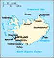
Iceland’s roads are among the least developed in the Western world, many of them being little more than gravel tracks, quite a few being only accessible to 4x4’s and some being closed outside of the summer season (summer being July and August here). The main Route 1, or the Ring Road as it is sometimes known, isn’t too bad though. It runs
right the way around the island and connects up pretty much all of the major towns in the country (all of the major towns are fairly near the coast, the Icelanders choosing to stay away from the interior of the country, which is mostly mountains, glaciers and deserts, as far as I can gather). Considering the snow and apparently dodgy driving conditions, driving along this main road actually felt like some of the easiest driving of my life. The land south-east of Reykjavik is mostly flat plains and river basins, so barring a few strong crosswinds, it was only the distractions of the spectacular views that caused any real problems.
Once out of Reykjavik, it became clear that towns were becoming few and far between. In fact, any sign of life at all only really cropped up every 20 miles or so. We stopped off in Hella around dinnertime, which is the nearest town to Mount Hekla, Iceland’s most active volcano. There was no real chance of us climbing Hekla though, this nearest village is still a good distance away and the roads to it need a 4x4 and decent weather just to get to its base. It
is also due to erupt in the near future and I didn’t fancy taking on its wrath, particularly as it only gives a couple of hours notice before it erupts, meaning if you’re at the top when it decides to let us know, it takes a speedy run down to avoid being fried. The village was completely empty, a small farming community with a cafe and a petrol station attached, and not a lot else. We had a coke in the cafe for a quick break, and then continued the journey.
Our next stop along the route was at Seljalandsfoss, a couple of waterfalls that we had been watching as we got closer to them along the road. We stopped off here and decided to trek around for an hour or so, before deciding to move on and head for Vik, mainland Iceland’s most southern point, before it got dark.
Advertisement
Tot: 0.104s; Tpl: 0.011s; cc: 11; qc: 51; dbt: 0.0763s; 1; m:domysql w:travelblog (10.17.0.13); sld: 1;
; mem: 1.2mb


chinese
non-member comment
great