Advertisement
Published: July 14th 2015
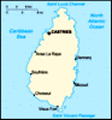
And so, to St Lucia, a sovereign island country in the West Indies in the eastern Caribbean Sea on the boundary with the Atlantic Ocean. The island was previously called Lyonola, the name given to the island by the native Amerindians and later, Hewanorra, the name given by the native Caribs. Part of the Lesser Antilles, it is located north/northeast of the island of Saint Vincent, northwest of Barbados and south of Martinique. It covers a land area of 617 square kilometres and reported a population of 165,595 in the 2010 census. It's capital is Castries.
We last visited here five years ago when we did the standard touristy things of the Pitons, Soufriere, the volcano and sulphur pools, botanic gardens and waterfalls. We felt neither the need nor the requirement to do this again and briefly toyed with the idea of doing our own thing. This can be very satisfying when all goes well, but a bit of a mistake when time is of the essence and knowledge and information at a premium. We also recalled that the cruise dock is a considerable way outside Castries and that we were arriving on a Sunday. In the Caribbean, this still
amounts to most things being closed all day, but at the very least from late morning; and so it proved to be.
We arrived early morning a full day and two nights after quitting Aruba. We had quite forgotten how beautiful the approach to Castries harbour is. Narrow, and hilly on the south side and more yielding on the north, with the lower undulations giving way to the local airport. We docked at Pointe Seraphine cruise terminal which had the merit of commercial facilities and tourist information available to us even on a Sunday, but first we had our tour to do. We had toyed briefly with the idea of doing Pigeon Point National Park, but this is at Rodney Bay in the north west of the island amidst all the very touristy traffic and we really wanted to get away from all this. In fact, we were minded to get away from the relatively tame Caribbean coast and visit the more exiting and energetic Atlantic coast to the east; at least that was our comparative experience from having visited Barbados on our previous trip to the West Indies where we witnessed the crashing of the wild Atlantic and
the meeting of the seas at North Point. So, it was off to the east coast and for a little more excitement, we chose to use some more of our credit to take a mountain bike trip - in the expectation that there would be fewer takers than average and with likely similar interests to ourselves and, if it doesn't sound too curmudgeonly, fewer folk with mobility challenges (is that the PC way to say it). This is not quite as it turned out.
There were about 20 of us on the tour and we were taken by bus to the bike centre. The journey across the island took about half an hour or so. The east coast was certainly more rugged than the west. We first arrived at Dennery, the main settlement on the Atlantic coast, after crossing the fairly high mountain pass and watershed in the middle of the island. The views for the second part of the trip were exciting without ever quite reaching the category 'stunning'. We arrived at a standalone bungalow up a metaled road a couple of miles inland from the coast road at Dennery in the garden of which were located twenty
of so mountain bikes. Being essentially a residential property, there was a long queue for the single lavatory available to guests before we selected our bikes. M & D, both availing themselves of the facilities, were at the back of the queue for choosing a bike and whilst M did OK, D did not and this was to have its toll later.
Whilst there were no walking sticks in view on this tour - we've never seen so many in one place as there are on the MSVG - there were plenty of folk making D appear quite 'snake-hipped' and plenty of others not in particularly good shape for what was to start as an undulating climb and become quite hilly before we went 'off road'. We did not even leave the grounds of the bungalow before one lady managed to steer herself into a storm drain and had to be rescued by both of our guides. Another managed about 400 yards along the road before she gave up the ghost, loaded her bike onto the bus which was following us and did the remainder of the trip on four wheels. Unsurprisingly, the group split into those who possessed a modicum of fitness, including M and even D along with one or two younger guests and the remaining dozen or so who were left a couple of hundred yards behind on each stretch. However, we did stop at regular intervals for an ecology update (rest!). The steeper sections were proving difficult for many including D who was obliged to do some walking. However, we hasten to add that this was because his bike had a broken front gear shift and when were advised to select the lowest gear for a particularly challenging section (the mountain of death!) this proved not to be an option for D who had to elevate his portly torso without the benefit of 'the lowest gear'; or at least try. No such problems for M who had quite a snazzy, fully- functional bike.
Next, to the 'off road' section of the tour which comprised a footpath track, not particularly wide, which meandered across the steep sided (by this time) river valley, crossing the stream four or five times in a stretch of about a mile or so. Biking on the metaled road was not such a problem as the highway was both smooth and wide. The path was a different matter, riddled with muddy sections; some tree roots; bamboo, side-free bridges and steep sections. We had separate instructions for this stretch which comprised, 'single file only and keep at least a bike's length gap from the person in front'. This was fine in theory, but D and M who were respectively 4 and 5 in the line were following a chap who was fine on the road and the flat, but who had real problems uphill, particularly on the path. Whereas we were minded to speed a downhill section to help take the following uphill stretch, he proceeded with caution down the hill and couldn't get up the slope. Accordingly, D would have to ram on his brakes and get of the bike, M then had to do likewise in order to avoid a crash; as did everyone behind. Whilst M & D had a debate on the relative merits of being immediately behind this guy as compared with behind each other, at least we had the benefit of getting part-way up the following hill. By about position 9 in the line (the rest were miles behind) there was a serious risk of crashes from these emergency stops, particularly as the affected cyclists had usually only just started a downhill stretch and had to break approaching full speed. Needless to say, the culprit was oblivious to this and back on the road challenged furiously anyone who tried to overtake him on a flat section. His ultimate achievement was, as we were just about to re-join a metaled section, he stopped some 5 metres from the road on a particularly steep stretch of path, leaving everyone else to have to leg it up the full length of this really steep muddy section. It was both funnier and more frustrating than narrative can describe.
Eventually, we reached the top of the ride and left our bikes to walk down to the 'waterfall'. 'Unfortunately', it was explained by our guides, 'it has not rained for a few days' so the waterfall was reduced to a trickle, 'but you should have seen it the day before yesterday'! - I guess we should. This was also where we were supposed to have taken a dip, but with the water reduced to about a metre deep in a smallish pool M & D gave it a miss. We returned to the bikes to ride downhill for a mile or so to the 'Love Shack', which turned out to be a rather rickety old shack serving food and local beer. We availed ourselves of the latter which was quite good and purchased a bottle of Banana Ketchup. The bikes were then put on a trailer and we were taken back to Castries and the ship.
We took a quick lunch and did a brief shop for the West Indies night deck party (Rasta Hats) before we took a cab to a nearby beach, The Wharf, located in the direction of Rodney Bay, but just a couple of miles past the airport. The Wharf turned out to be a rather nice beach-side cafe/bar so we had a swim in the Caribbean for an hour and another large beer at the The Wharf before our taxi whisked us back to Pointe Seraphine and the MSVG at about 5.30 pm. All in all, a good day - and we needed one. We sailed for Barbados early evening.
Advertisement
Tot: 0.052s; Tpl: 0.011s; cc: 12; qc: 30; dbt: 0.028s; 1; m:domysql w:travelblog (10.17.0.13); sld: 1;
; mem: 1.1mb