Advertisement
Published: February 26th 2013

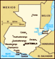
 1.Flores, Peten
Pleasant island cityOn Thursday Feb 25, Paulino picked us up in the little town of Flores, a small town that is the capital of the State of Peten in Guatemala. It is an island in Lake Peten Itzá, the last holdout of the Maya against the Spanish conquista, remaining an independent native city until 1697. (The first to fall was Q'umarkaj, 174 years earlier. The Peten was just too remote and hot to bother with, apparently.) There is little to show for it today; just a small city park with a few steles, which we did not bother to visit. It is a pretty little town; see Photo 1.
Tikal, according my own theory of Maya history, is the great Mother City of the whole civilization. Professional historians are not quite ready to say this, but on the basis of its early start (600 BC), its enormous size, and late date of abandonment (900 AD), I think it is true. The oldest dated stela ever found, 292 AD, is at Tikal. More than 3000 structures have been identified, all but a few still covered by thick jungle. Add to this the huts of the workers, and the most recent estimates are that
2.Road into Tikal
Idyllic, but we saw no animals about 120,000 peope lived here at the peak around 750 AD. It is close to Calakmul and to Palenque, daughter cities that grew to challenge the great Mother City.
The biosphere road into Calakmul in the Yucatan (last trip) was absolutely unforgettable. We even saw a jaguar, and I had hoped that the road into Tikal would be at least a little similar. So I was eager to get an early start and be the first car on the road that morning, as we were at Calakmul. Sadly we were about ten years too late. One tour lady said that if you want to see animals at Tikal today you have to stay in a jungle lodge within the park and stay up all night looking for them. You will hear the howler monkeys in the very early morning, but that is all that is guaranteed any more. Photo 2 shows the road in as it looked through our windshield, beautiful and unspoiled jungle by human standards, but perhaps not by jaguar standards.
In the parking lot we hired a sturdy young guide named Manuel who spoke good English and who had read a lot about the archeology
3.Top of temple 1
Tikal's main icom of the place. A truck picked us up and took us to the edge of the archeological area near the Great Plaza, passing several jungley ponds along the way. These ponds were very important: There is no large nearby body of water, so for the entire 1500 years of its existence Tikal had to depend on rainwater. It was stored in huge tanks formed by the quarrying of limestone for the temples, lined with fairly waterproof clay. You can still see some of the canals that collected the rain. There is some water in the tanks, but the clay lining has deteriorated and it is no longer potable.
The Main Plaza is bounded on West and East by two enormous temples (called 1 and 2). They are so tall that standing at the foot of one, I could not get the whole of other in the viewfinder of my camera. See Photos 3, 4, and 5. These are the icons used in all the advertising about Tikal, but they are quite crumbly and after some rather bad accidents no one is allowed to climb on them any more. On the South side of the Plaza is a palace for
4.Side of temple 1
Can't get iot all in one shot. royalty. On the East is a confused-looking lesser long structure of some kind called the Acropolis del Norte.
More Scandal from the University of Pennsylvania The present condition of the Acropolis del Norte is a major archeological scandal, as Manuel tells it. I have tried to authenticate his story on the web, but have been unable to. No one wants to talk about it. The University of Pennsylvania got permission to work at Tikal starting in 1956. It was a National Science Foundation project, with Profs. Wm. Coe, Edwin Shook, and George Guillemin as Principal Investigators. It went on for 13 years, demolishing the former theory that the Maya were peaceful, poetic priest-astronomers, and establishing the truth about their dynastic preoccupations and the many inter-city wars that characterize the "classic" phase of Maya history. No doubt, it was a great project, the most extensive ever funded by NSF. But here is Miguel's little addition to the story:
After clearing the Great Plaza and its two major temples on West and East, and probably also the royal residences on the South, the U. Pa. archeologists started in on the Acropolis del Norte, which originally was fronted by three
5. Temple 2 top
A little lower than #1. small pyramids on a common platform. They knew that Maya pyramids are constructed in layers, with new facades and towers covering older ones. So to speed things up, they decided to dig a tunnel directly into the center pyramid, to see what they could see. Unfortuately, the tunnel removed essential structural support, and the whole pyramid collapsed. That is why today the complex look so confused.
Tourists are allowed to climb up a few of the lower steps and look down into a pit that reveals the front of the preceding pyramid. It was fronted by a gigantic mask, still fairly well preserved (see Photo 7). Other bits of stucco scupture were also preserved by the outer pyramid, but are not worth putting into the blog.
The only structure that tourists are encouraged to climb is Temple 4, about a 15 minute walk west from the Grand Plaza. It is the highest temple in Tikal; indeed, the highest anywhere. It has a very solid wooden staircase leading up just below the ornamental comb. Los Gringos Viejos climbed it, one of us rather more slowly than the other, but indeed the view from the top is worth the climb.
6.Acropolis del Norte
Not much evidence of the collapse, except for a confused-looking facade. Photo 8 is a long-lens shot from the ground of tourists clustered on the top of Temple 4, and Photo 9 shows Los Grigos Viejos, triumphant over gravity. Temples 1 and 2 of the Great Plaza poke up the the jungle in the distance.
There is a lot more to see at Tikal, but after 4 hours and a pyramid climb, we were tired, and we left the other 2996 known structures for next time.
Advertisement
Tot: 0.112s; Tpl: 0.013s; cc: 10; qc: 46; dbt: 0.0542s; 1; m:domysql w:travelblog (10.17.0.13); sld: 1;
; mem: 1.1mb


Meredith McClain
non-member comment
Greetings from sunny Lubbock
Hello, dear Carol and Martin, I just read your latest update and am so happy you're seeing such ancient monuments. I spent the day at home yesterday (as did all of Lubbock) due to the white out of our little blizzard. You may have received my pics of the snow-scape here at the 'dobe. My wood-burning stove got a good work-out and kept me and the cats cozy. Love, Meredith