Advertisement
Published: June 21st 2010
Having been to, clambered around and written about far too many ruins in the last couple of months, I just couldn’t bear to neither write nor subject you, my patient readers, to yet another of my accounts of our visit to a pile of rocks. So I enlisted help in the shape of the boyfriend to try and “mix it up”.
Introducing Elliott the Travel Blogger: Tikal
Tikal was apparently the show stopper for ruins in Central America, and certainly the major draw for Guatemala. Although we were somewhat ruined (ha ha) by visiting what seemed like every old pile of rocks in Mexico, we had heard good things about Tikal and were excited to finally visit. Unlike other Mayan ruins we had visited, especially the manicured tourist madness of Chichén Itzá, Tikal is a different and more impressive experience as it is set deep in the jungle. Howler monkeys howl, parrots squawk, tree frogs buzz (apparently) and a million insects provide a background hum to let you know you really are out in the wild. And among all this jungle splendour towering pyramids poke their heads above the jungle canopy to catch the morning sun. Truly a
magical place.
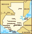
Tikal ’s ruins lie among the tropical rainforests of northern Guatemala and are one of the largest archaeological sites and urban centres of the pre-Colombian Maya civilisation. Set on a low hill above the surrounding swampy ground and covering an area of over 16 square kilometres it is thought to have been first settled around 700BC. 200 years later stone ceremonial structures were starting to appear and by 200BC complexes of buildings had sprung up. By the dawn of the early classic period, around AD250, continuous growth had created an important, heavily populated religious, cultural and commercial city. One which over the next 800 years was ruled by a single dynasty that included at least 33 rulers, most of which as well as having comedy names tried to leave their mark on the city’s architecture. As you wander around the huge site, going from towering temple to jungle-covered ruin you can marvel at the works of King Great Jaguar Paw, King Curl Nose, King Moon Double Comb and obviously my favourite - Lord Chocolate.
We had stayed in El Remate an hour down the road so we could set off early and arrive at sunrise for spectacular
views and hopefully less tourist crowds. Happily this is exactly what happened and as we grabbed our tickets (a cheeky but unavoidable $20 dollars each) and power-walked to the Gran Plaza we arrived just as the sun was cresting the trees and the whole place, apart from a yoga freak perched on top of Temple II, was still completely deserted. After chasing the wild turkeys around for a bit, we climbed some structures to the south of the plaza and enjoyed the amazing views and tranquillity of the site. As more people trickled in, including those from our minibus who we had smoked on the way in, we climbed 60 metres of rickety wooden stairs to the top of temple II, to take some photos of the postcard worthy temple I. Apparently you used to be able to climb the original stone staircase of temple I, but it is near vertical in parts, and a few years previous a tourist slipped and fell to their death, so access in now forbidden. We made sure to hold on tight when we climbed any of the temples during the day.
Having enjoyed the Gran Plaza we set off on a loop
around the site, calling at all the major temples and complexes. It was great to wander the jungle paths, ‘discovering’ a new and impressive temple around almost every corner. For the most part we had the temples to ourselves as we clambered, scampered, and trudged our way to the top of each. The amazing views from the summit of the temples made you want to keep on climbing to the top of everything you found. Having battled your way to the top you were rewarded with great panoramas of lush green jungle canopy stretching unbroken to the horizon and spotting the odd stone roof sticking up above the trees allowed you to track where you had come from and where you were headed next.
It was a great morning but after 5 hours, 12 kilometres and a thousand stone steps we had completed the loop, and felt like we had seen everything we wanted to in Tikal. We still had a couple of hours before our minibus returned to pick us up so we camped out at the visitors’ centre back near the main gates. Pre-planners that we are, we had some cheese and crackers with us, so had
a mini picnic next to a nice pond that interestingly was ringed with ‘Danger Crocodile’ signs. Sadly even with delicious Ritz crackers and ‘never-die cheese’ slices on offer we had no crocodile visitors, but instead hung out and did the traveller chat with a few of our fellow travellers. When the minibus turned up, we all piled in and then, with a brief stop in El Remate and a much needed and greatly enjoyed dip in the lake, it was off to Flores.
(And with those words Elliott passed the virtual pen to me…) Flores
On the shores of Lago Petén, three towns have grown together with Flores constituting the part that is on the small islet connected to the shore by a narrow causeway. The little island is only 1.5km in circumference with a paved path all the way around, that people run or walk on in the early morning and around sunset when the heat isn’t beating down. And it is truly hot here, with the sun shining mercilessly down on people’s heads, so most people take it slow in the shade most of the day, unless they’re finding respite from the heat by jumping
in the lake from the public jetty.
The island is criss-crossed by cute little cobblestone streets lined with low, pastel-coloured houses, most of them with lake views. And it is quite the view when the sun is setting over the calm waters, flaming up the sky, and you’re safe on shore (covered in mossie repellent) with a cold drink in your hand 😊
And that just about covers what we did in Flores…
Semuc Champey & Cobán
The most beautiful spot in Guatemala is supposedly Semuc Champey, so of course we had to go here! We took the quick option, a $20 minibus that took us through Cobán to Lanquín, a tiny village in the middle of the hills in central Guatemala. Here a pick-up truck from the place we had decided to stay, Las Marias, picked us and a few others up and took us even further into the smoky hills, up and down windy gravel roads. The views in this region must be amazing when it’s not the slash n’ burn season. This is still the agricultural method in this area and it means that it is slightly clear in the early morning, but through the
day the sky gets more and more hazy as the fires eat away at the old corn stalks and stubble on the fields dotting the otherwise lush green hills.
There are a few places to stay near Semuc Champey, but Las Marias is right on the shores of Río Cahabón, which is surprisingly cold for such a hot climate! We had a very refreshing swim here after our 8-hour journey, before a very unsatisfactory meal and a bad night’s sleep in a tiny cupboard of a room… Las Marias has a lot of atmosphere and really nice staff. People hang out in the restaurant in the evening after visiting the nearby caves and Semuc Champey itself, before the communal dinner, which unfortunately left a lot to wish for…
But it was all worth it when we got up the next morning and walked the 15 minutes up the road to Semuc Champey itself. I know I’ve mentioned it a lot without explaining what it actually is - but it’s one of those places that needs seeing rather than explaining, so have a look at the pictures first!
OK, so you see the pools of clear green and
turquoise water? This is water from Río Cahabón which splits so most of the river flows underneath a ‘bridge’ of limestone, and the rest flows through one stepped pool to another, until the waters merge again at the end of the bridge where the water comes up from under the ground again. It is remarkably cool, completely clean, and absolutely lovely to swim in. Especially if you’ve made the steep, exhausting, sweaty hike up the side of the valley the river runs through to the viewpoint at the top. I wasn’t feeling top of my game, so I was completely worn out during the climb, but the views were so worth it! And then the reward of a cool swim afterwards!!! 😊
After a day of enjoying nature in this beautiful setting, we made our way back to Cobán for a bit of urban exploring. Cobán isn’t big, but it’s the biggest town in the region, and although it’s not much of a destination in itself, unlike Rome all roads seem to lead away from here… We wanted to go to the highland lake of Atitlan next, and we’d decided on a slightly round-about route through the mountains that
is recommended as part of the best journey in the LP. So after an evening of walking around the town square and having pizza (boy were we hungry!) we got up really early (in our books at least) and found us a mini-bus to take us the first leg of our long journey. A taxi, two mini-buses, three chicken-buses and a tuk-tuk later we were in Panajachel (Pana for short) on the shores of Lago Atitlán. It really was quite the journey! Through mountains and hills, on gravel and dirt roads as well as newly built highways, we wound our way west and then south, perched on ridgelines, clinging to mountainous hillsides and through valleys on roads that are so windy you never quite know which direction you’re driving. The views were amazing which was good ‘cause we needed something to distract our attention away from our sore and later numb butts!! Not to mention our knees that were crammed into seats of child-like proportions. In Central America a seat is not your own (as it was designed) if you can in any way squeeze in another person, never mind that all four of you then have to sit on
cracks and bumps that would normally cup your bum in a loving embrace but now dig in so uncomfortably you think you’ll never feel your legs again.
Lago Atitlán
The highland lake of Atitlan is a big, smooth expanse of water in what looks like an old volcanic crater, with steep green slopes jutting out along the water’s edge, small villages clinging to their sides, and on the south side of the lake (across from Pana where we stayed) two actual volcanoes dominate the skyline, on the few mornings when the haze cleared and clouds weren’t obscuring our view. It is beautiful!
We stayed east of the ‘centre’ of town, in a quiet hotel where we were the only guests, and had a terrace in front of our room from which to enjoy views out over the roofs of the village to the green hills beyond and to one side, a little sliver of lake and volcanoes. Pana is one of those towns that has morphed into something unrecognisable as a Guatemalan town due to the intense flow of tourism. The main street is internet café after handicrafts store after restaurant after travel agent. It caters to
all kinds of tourists - even vegetarians! And when you go down to the lakefront, you understand why it became so popular in the first place. We had talked about taking a boat to one of the other small villages around the lake, but I wasn’t feeling 100% so we took it easy, enjoyed some walks around town, some good food (really cheap if you dined away from the centre) and tried to catch glimpses of the volcanoes when the weather cleared.
After a few days of indolence, we finally put on our hiking boots (or our version: running shoes) and set off on a ‘hike’ along the edge of the lake. About 5km of hills east of Pana is another tiny village, Santa Catarina, which is much more traditional than Pana. Here people still wear traditional attire. We’d noticed already on the way to Atitlan on the bus, that in this area even the men still wear local garments rather than shirts and trousers like so many others. They wear shirts made of colourful woven fabric, coarse striped woven trousers, and around their waist they have wrapped what looks like a blanket in brown and beige tartan pattern,
and most often a hat as well. The women wear a blouse in thick, blue patterned woven fabric, and a length of cloth wrapped around their waist like a long pencil skirt, also in patterned fabric with blue tones. Their hair is braided with thick ribbons and wrapped around their head. Unfortunately, we didn’t get any photos of the men’s attire, but there were plenty of women at the local festival we happened upon in Santa Catarina.
As exciting as it was to walk into town hearing the brass band from far away and realise that there was a local festival going on, and that people were thick in crowds on the streets, it was also quite disconcerting to be the only non-indigenous persons there. We felt like intruders. As the people in this region mostly speak their own languages with Spanish being their second language taught in school we didn’t manage to glean much about the festivities other than what we could make out by watching. On the church square about 30 people were dressed up with feathered headdresses, masks and gold-embroidered costumes in the style of the conquistadors. Two groups of dancers stood facing each other at
either end of the square with 4 or 6 ‘generals’ doing complicated walking/dancing patterns back and forth in the middle. The same song kept being played again and again by the brass band to one side whose main instrument is the local type of xylophone (which I’ve forgotten the name of, sorry). After a while the dancers had a small break in which a couple of helpers walked around with a bottle of ‘firewater’ which they poured for the dancers who slipped it under their masks and drank. This went on for at least the half-hour we were there, must have gone on for some time beforehand and who knows how long after we left… I wish we’d been less afraid of intrusion and learned more about the meaning of this dance - but alas, we are mere observant travellers, not participant anthropologists… Not that anyone was hostile towards us, but they didn’t look at us either, and the atmosphere didn’t invite enquiry. Not even by someone with an anthropological background. To them we were just another pair of nosy tourists from Pana!
So we walked on to the next village, San Antonio, another 5km on, through lush green
vegetation with stunning views of the calm waters of the lake and the volcanoes on the other side. From a distance this village looked exactly the same, but there was no festival going on here, and the atmosphere was one of relaxed curiosity. The children were on their way home for lunch-break and it was really cute how interested they were in us. In particular the youngest ones who don’t look more than 2 or 3, but are probably at least 5 or 6, kept running past us really fast, grinning widely and casting us surreptitious glances, or greeting us in their Maya tongue.
The village is in a beautiful setting, but boy are the houses bleak to look at! Little square cement blocks with tin roofs, everything grey, dark and crammed on the inside in the few where the doors were open. Every 5th house had been turned into some kind of store selling a few sweets and drinks, maybe a few basic groceries.
There were actually a few tourist shops, including a women’s cooperative, so maybe they make some money off tour boats, because we didn’t see anyone else there while we walked around and enjoyed a break
overlooking the lake.
A little lazily, but with the very valid excuse of blisters, we took a pick-up with a flatbed and some benches back to Pana. And it turned out to be a lucky choice, as it started pouring down just as we arrived.
Antigua
That afternoon, after watching the rain from a café for a few hours, we took a minibus to Antigua which is a couple of hours drive away via very winding roads. Too bad not everyone on the bus has as strong stomachs as us…
Antigua is an old colonial city not too far from Guatemala City, and it used to be the capital until 1776 when an earthquake razed the city. It’s different from other colonial cities in the region because, as the LP puts it: it looks as if the Scandinavians have been let loose on it for a few years, restoring old buildings and repairing the cobbled streets and there is not a phone line or electricity cable in sight! It’s quite something to walk around the old streets going from one ruined church to another. Quite a lot of them have been left in their ruined state
 Local Mayans rebuilding the temples on Plaza of the 7 temples
This seemed to consist of drying limestone and then chopping it into blocks with machetesand are spectacular in their own right, if you ask me. We also visited the cathedral and the old convent which is said to have the biggest fountain in Latin America! It definitely is a beautiful city - as it lies there nestled between 3 volcanoes that you can see on a lucky clear day (which we didn’t have many of, unfortunately)
That said, it is a Tourist town with a capital T. There’s not much Guatemala about this Guatemalan spot. There are Spanish schools and tour operators everywhere you look, and I’m sure the local to tourist ratio is close to 1:1. If you go away from the centre of town, you can still buy cheap, local meals and at the market you can buy anything from clothes, shoes, kitchen supplies, Tupperware, electrical goods, leather goods, rip-off dvd’s and cd’s to tins and packets of food, big sacks of grains, flour and maize and all manner of local fruit and veg. But Antigua is definitely in a category of its own…
We decided to embrace the tourists in ourselves and go on a tour to climb the active Pacaya volcano. This sounds more dangerous than it really
is - not that you can’t get killed if you go away from the path (in fact 2 people died a couple of weeks before by climbing an unstable side without a proper guide only to get caught in a stoneslide - very sad), but we were there with a really good, experienced guide who told us a lot about the volcano on the way up, pointed out the pacaya-plant for which it is named and so on. It was an afternoon climb and it was beautiful with the yellow light in the pre-dusk hour. We were glad we’d talked to some other travellers beforehand so we knew to bring our torches because the last hour of the down-climb was in complete pitch-black night!
We enjoyed the climb a lot, despite the mass of other groups all scrambling around to see the tiny holes in the lava where you can see a bit of red flowing lava underneath. We were really lucky to be in the first group to arrive in the afternoon so we could take pictures of the volcano with no-one in them!
Other than this tour, though, we took it pretty easy in Antigua. We can
understand how it can be so popular, as it is a definite chilled out place. But is it Guatemalan?
We didn’t stay long enough to answer that one for you - because it was time to move on. Therefore we took a chicken bus to Guatemala City, got dropped off in the middle of nowhere and eventually found a taxi to take us to the Melva bus station where we caught a bus just after lunch that would take us to El Salvador.
More about that later…
Love,
Kristine
PS: If you’ve made it this far, I’m assuming you’re one of the stubborn ones, so enjoy the abundance of photos below and on the next pages 😉 Having trouble keepin’ it short, this time… as well… haha. Kx
Advertisement
Tot: 0.231s; Tpl: 0.016s; cc: 8; qc: 54; dbt: 0.146s; 1; m:domysql w:travelblog (10.17.0.13); sld: 1;
; mem: 1.2mb