Tim Booth

travel timbooth org uk

Tim Booth

Travelling around to look at volcanoes over the last few years, but also for any other rocks and a few tourist type things on the way. Amongst other souvenirs of my trips, I seem to have picked up a wife (from the USA, although we met in the South Pacific), which has changed the style of my trips, although I still enjoy them. A regular orienteer in the UK and an active Scout Leader for at least 4 decades.

Note that due to limited times to access the Internet, this log will get weeks, or maybe months behind at times. I'll put up a few later entries and fill in the gaps when I can - Note made on 14th December 2007

Pictures from previous trips can be found on Flickr

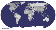
Visited Countries Map

Europe » United Kingdom » England » Hampshire November 20th 2011

A cold, foggy November morning driving through the Berkshire countryside towards the event around the old Roman town walls. Damp grassy car park with boards to stop you skidding in the mud. Forest full of minor confusing paths, covered with brown autumn leaves, meaning that it was easy to miss a path and carry on through the forest off paths (not that that is a problem - unless you're going through the wrong bit of forest). While it's all damp underfoot, being a damp,cloudy day, the land is so dry at the moment, especially for England in the autumn. Had a control on the edge of a pond, which is just a dry grassy hollow at the moment. We badly need more rain (for the countryside - I don't mind a dry run rather than a ... read more

Europe » United Kingdom » England » Surrey » Wisley November 13th 2011

A car park in the overflow of the Royal Horticultural Gardens in Wisley. A sunny day with hot November sunshine while sitting in the back of the car (and it's not often you can say that in England). The event itself is full of dead bracken, still standing tall without any frost this autumn so far. Makes for difficult navigation through the confusing lumps and bumps. and with lots of little extra paths by all the dog walkers. The event is so close to the junction of the M25 and the A3 dual carriageway that ... read more

Europe » United Kingdom » England » Hampshire » Lyndhurst November 6th 2011

The November Classic event in the autumnal New Forest - a symphony of browns, gold and yellows at this time of year make it always one of my favourite events. Very early start since I had to help - from putting the tent up before anyone arrived to taking it down again when everybody else has gone - not to mention keeping the computers going once I'd finish my run. The weather was sunny this close to the coast, very mild for November. For the aficionado, this is some of the best running in the New Forest - vague vegetation boundaries, navigation across all the paths with little to follow, herds of ponies standing sullenly in the darkest thickets they can find, roe deer bursting out of their hiding place when they think that you're getting ... read more

Oceania » New Zealand » South Island » West Coast January 6th 2008

Cloudy with occasional sunny intervals. Showers turning to rain later Packed the campsite and headed west along highway 6, without any real idea of a destination for the day (or even for the week). Perhaps inspiration will strike along the way. The road started along a broad valley, cultivated with vineyards on the valley floor and with forested sides.Gradually the valley became narrower and 'wilder' and the boulderyshallow Buller river became visible meandering about the valley floor. Reached the small town of Murchison in time for coffee - I suspect it's always really just catered for travellers - and then carried on along Highway 6, through the Buller Gorge now - a narrow valley with a river that's grown in size. When the decision point came, I headed along Highway 6 towards Westport, further north along ... read more

Oceania » New Zealand » North Island » Bay of Plenty » Tauranga December 24th 2007

Early drizzle clearing to sunny periods Wandered into town to get some replacement binoculars for Christmas, since I suspect that the originals I brought along are still in Hong Kong. Nice bright image and there's $20 off as well. Continued on to Mount Manganui and walked around the mount, an ancient volcano at the entrance to Tauranga harbour. I save the summit for a post Christmas treat. There was a circle of sunshine around the Bay of Plenty now - everywhere else remaining cloudy - and there were bright views of uninterrupted tree-backed beaches north along the coast across the harbour entrance. A 3km walk around the base, then went south to Papamoa Beach for the afternoon. Good surfing on a great beach - getting more crowded as the afternoon wore on and people stopped work ... read more


Cloudy with rain morning, brighter with sunshine afternoon and evening PADDLE LEFT! STOP! BACKPADDLE! STOP! HOLD ON! The familiar commands from Iceland and the Grand Canyon boomed over the Tongariru River. One yellow raft, a family of Texans, myself and a guide working our way through the boulders. A 13km stretch of the river with more than 60 rapids - it's more like a rock garden than a body of water. HOLD ON! The guide deliberately bounces the nose of the raft off the pumice wall on the riverside to get back into the main stream. In glimpses between giant boulders and waves, the wall shows a history of at least 6 eruptions from somewhere, ending with a single sheet of ash 20m high from the Taupo eruption 1800 years ago - you didn't want to ... read more

Oceania » New Zealand » North Island » Taupo December 13th 2007

Sunny Intervals - feeling very warm Started off the day with water. Went to Aratiatia Rapids, a few miles north of Taupo. It's an empty, narrow bouldery gorge nowadays, probably dues to the very large dam 100m upstream from the entrance. However, they open the gates and run the rapids at 10.00a.m. (and 12.00p.m.) daily, so walked to the downstream viewing point a few minutes beforehand and watched the rapids fill. Somebody does this for me and the 3 other people who were watching! It was extremely impressive as the rapids filled up - it took about 10 minutes form them to fill completely and another 10 minutes to empty when they shut the gates at 10.30. Went a little way downstream from the rapids then and went of a quick (over 50mph) trip with Rapids ... read more


Cloudy, occasional rain and drizzle It was raining all night, so it was a good decision to stay indoors and forget the tent for a few days. It continued to rain as I drove up to Whakapapa village. Good views of Mt Ruapeha, with lots of snow around the crater - some of the snow is still discoloured from the ashfall and lahars from the September eruption. Drove to the top of the road to begin with and had a quick look around. It feels very weird to be in a ski resort in December but totally out of season. Huge (1m+) boulders in the skiing areas - hope they get lots of snow to cover them. It's totally different to the only other volcanic ski area I've been to (Etna), where the small cinders make ... read more

Oceania » New Zealand » North Island » Coromandel » Thames December 6th 2007

Heavy overnight rain, continuing this morning Tent seems to be coping with the rain, had to move a couple of pegs, though. Headed out for the Gold Mining Museum in Thames - a long drive, but hopefully uneventful. Drove south down Highway 25 from Whitianga - heavy rain and spray made overtaking impossible and got stuck behind a logging truck for ages. The advantage of New Zealand summer rainstorms is that it's still warm - 20/21 degrees, rather than the cold Atlantic summer rain we get at home. I suspect that the weather systems are making their way down from the warmer northern seas. The road went along the coast for a while and then turned inland and climbed over the hills. Like the rest of Coromandel, these were volcanic, with many of the red and ... read more

Oceania » New Zealand » North Island » Northland November 30th 2007

Sunny, soon clouding over Today is the day to go and see the famous kauri trees, one of the wonders of the area that I've missed so far. They're on the west coast, so went out to Highway 1 yet again and then continued southwestwards on highway 12. The journey started through farmland, but after about 50km some high forested hills appeared. The road skirted around the hills and then continued westwards. I was relying on the GPS and hadn't really looked at the map for this trip, so it was quite a surprise when I came across a large estuary - Hokianga Harbour. Stunning views inland from the entrance and also across the estuary to the large sand dunes drowning the jungle - an extension of Ninety Mile Beach from yesterday. Continued along the road, ... read more


Tot: 0.178s; Tpl: 0.006s; cc: 19; qc: 88; dbt: 0.0841s; 1; m:domysql w:travelblog (10.17.0.13); sld: 1; ; mem: 1.2mb